| Title |
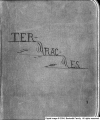
Terraces Scrapbook |
| Identifier |
terraces.xml |
| Subject |
Terraces (Geology)--Utah; Bonneville, Lake; Mountains--Utah; Rock formations |
| Description |
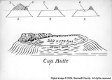
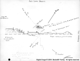
Scrapbook by Frank A. Beckwith. A set of photographs of various terraces in western Utah, with descriptive captions describing the setting and the occasions on which photos were taken. Many of these terraces were old shorelines of Lake Bonneville. Includes a road map with terraces drawn in. Terraces described include those at Leamington, Tatow Knob (House Range), Reservoir Butte, Cup Butte, Quartzite Butte, and others |
| Spatial Coverage |
Millard County (Utah); Bonneville, Lake |
| Creator |
Beckwith, Frank Asahel, 1876-1951 |
| Publisher |
Hosted by J. Willard Marriott Library, University of Utah |
| Type |
Text |
| Format |
application/pdf |
| Source |
Terraces scrapbook |
| Language |
eng |
| Relation |
Frank Asahel Beckwith Collection |
| Rights Management |
Digital image copyright 2003, Beckwith Family. All rights reserved |
| Holding Institution |
Delta City Library |
| Source Material |
Scrapbook |
| Source Physical Dimensions |
26cm x 33cm |
| ARK |
ark:/87278/s6jt2kk5 |
| Setname |
dc_bpc |
| ID |
126245 |
| Reference URL |
https://collections.lib.utah.edu/ark:/87278/s6jt2kk5 |
| Title |
Resevoir Butte |
| Identifier |
034T |
| Subject |
Terraces; Mountains; Rock formations |
| Description |
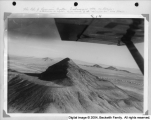
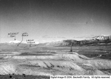
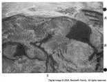
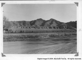
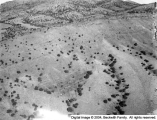
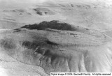
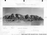
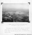
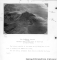
Top photograph: Resevoir Butte looking north and slightly east. South and East Reservoirs are all on same terrace level which is Bonneville level--high. "Submerged Mountains" in right middle destance. Far distant white streaks are Great Salt Lake Desert--which merge on right (hid) of Great Salt Lake. Note sharpness of top. Quartzite. Very hard hence a meager talus which has not filled any one of the reservoirs. Bottom photograph: Reservior Butte looking nearly south showing terrace levels on right--west. At middle distance one of the "Submerged Mountains" and a small front of another. Far distance white streaks are parts of Great Salt Lake Desert. Note large depression or "reservior" at left on Bonneville level, quite large, quite deep. Note rocks acting as barriers, producing cup effect. The Pony Express marker is almost directly beneath the plane. |
| Spatial Coverage |
Juab County (Utah); Great Salt Lake Desert (Utah) |
| Contributors |
Burraston, Leo Roy, 1918-1974 |
| Type |
Image |
| Format |
application/pdf |
| Format Creation |
image/tiff |
| Coverage |
Utah |
| Source Material |
Terraces Scrapbook |
| Archival Resolution |
Archival TIFF: 3000 x 4600 |
| Low Resolution |
JPEG: 800 x 600 |
| Bit Depth |
8-bit |
| Scanning Device |
Creo-Scitex Eversmart Jazz+ flatbed scanner |
| Setname |
dc_bpc |
| ID |
125495 |
| Reference URL |
https://collections.lib.utah.edu/ark:/87278/s6jt2kk5/125495 |


