Title |
Terraces Scrapbook |
Identifier |
terraces.xml |
Subject |
Terraces (Geology)--Utah; Bonneville, Lake; Mountains--Utah; Rock formations |
Description |
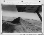
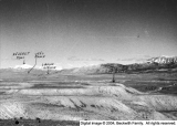
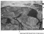
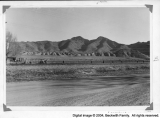
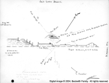
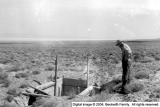
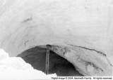
Scrapbook by Frank A. Beckwith. A set of photographs of various terraces in western Utah, with descriptive captions describing the setting and the occasions on which photos were taken. Many of these terraces were old shorelines of Lake Bonneville. Includes a road map with terraces drawn in. Terraces described include those at Leamington, Tatow Knob (House Range), Reservoir Butte, Cup Butte, Quartzite Butte, and others |
Spatial Coverage |
Millard County (Utah); Bonneville, Lake |
Creator |
Beckwith, Frank Asahel, 1876-1951 |
Publisher |
Hosted by J. Willard Marriott Library, University of Utah |
Type |
Text |
Format |
application/pdf |
Source |
Terraces scrapbook |
Language |
eng |
Relation |
Frank Asahel Beckwith Collection |
Rights Management |
Digital image copyright 2003, Beckwith Family. All rights reserved |
Holding Institution |
Delta City Library |
Source Material |
Scrapbook |
Source Physical Dimensions |
26cm x 33cm |
ARK |
ark:/87278/s6jt2kk5 |
Setname |
dc_bpc |
Date Created |
2014-07-25 |
Date Modified |
2014-07-25 |
ID |
126245 |
Reference URL |
https://collections.lib.utah.edu/ark:/87278/s6jt2kk5 |
Title |
Leamington |
Identifier |
015T |
Subject |
Terraces; Mountains; Rock formations |
Description |
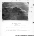
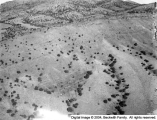
The ancient Sevier River made a large delta from Leamington far south. |
OCR Text |
Show Leanington The Shore Line at Leamington Consult your road map Take any route you wish toto Leamington If appraoched from the north the shortest and best route 15 to keep on Hirhway 91 on the pavement to Nephi the turn west on the Nephi-Leaminrton shart cut which isUtah secondary road and yovcan make 35 to 4O miles per hour without annoyance If you comef rom the south go on Hirhway No rom Delta to Lynndyl and thence east four miles to Leamington The view presented on the opposite mge is fromposition in the town close to the railroad track The share line my be seen from any point fres from buildings and trees This terrace is probably the Bomneville Level From any ground hish enough you can follow this shore line into the marrows and pick it wp again on the opposite bank of the Sevier River south bank wntil it is lst It is distinetly raver in color against the darker shade of the hills The ancient Sevier River larger than itnow mdelarpe delta from Leamincton far south the present river trenches that delta incoutherly direction and flows into Sevier Lake Oup diversion dam is built in that delta Digital image 2004 Beckwith Family Al rights reserved |
Spatial Coverage |
Leamington (Utah) |
Creator |
Beckwith, Frank Asahel, 1876-1951 |
Publisher |
Hosted by J. Willard Marriott Library, University of Utah |
Date |
1951 |
Type |
Image |
Format |
application/pdf |
Format Creation |
image/tiff |
Source |
Terraces scrapbook |
Language |
eng |
Relation |
Frank Asahel Beckwith Collection |
Coverage |
Utah |
Rights Management |
Digital image copyright 2003, Beckwith Family. All rights reserved |
Holding Institution |
Delta City Library |
Source Material |
Terraces Scrapbook |
Source Physical Dimensions |
26cm x 33cm |
Archival Resolution |
Archival TIFF: 3000 x 4600 |
Low Resolution |
JPEG: 800 x 600 |
Bit Depth |
8-bit |
Scanning Device |
Creo-Scitex Eversmart Jazz+ flatbed scanner |
Setname |
dc_bpc |
Date Created |
2004-02-24 |
Date Modified |
2004-02-24 |
ID |
125438 |
Reference URL |
https://collections.lib.utah.edu/ark:/87278/s6jt2kk5/125438 |