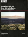
OCR Text |
Show Introduction resources throughout the basins ( Utah Department of Natural Resources, 1996). Rangeland covers about 48 percent of the Study Unit and forest and agricultural land covers 22 and 18 percent, respectively ( Hitt, 1994). Urban land accounts for 4 percent of the total land cover, and the remaining 8 percent is distributed between wetlands ( 4 percent), water ( 3 percent), and bare ground ( 1 percent) ( fig. 5). Mining occurred in several of the canyons of the Wasatch Mountains within a 30- mile radius of Salt Lake Valley. Land use and associated human activities alter the natural character of streams by changing water quality, channel shape, and flow characteristics. In headwater areas, logging, mining, and, more recently, recreation and residential construction have increased erosion and changed water quality. In the valleys, agriculture, grazing, and urbanization have removed many of the natural wetlands and riparian vegetation; channel- \ Great Salt 41 ° Lake EXPLANATION IZZl Urban 40 EH Agricultural rn Rangeland • i Forest H Water I I Wetland H Salt flats/ exposed rock CD Bare ground „ 25 50KILOMETERS Figure 5. Land- use/ land- cover information is useful in assessing human influences on water quality by providing information on the possible causal factors related to water- quality observations. EXPLANATION Direction of ground- water movement Primary f recharge f area Secondary recharge area Discharge area \ Consolidated rock Confining layer Coarse- grained deposits Basin- fill deposits Tertiary age Figure 6. Ground water in the study area generally comes from precipitation on the mountains or on valley benches, where it infiltrates into the soil and moves to the basin- fill aquifers. ized stream reaches in some areas; and contributed nutrients, sediments, and other contaminants to streams. Aquatic Habitat and Biota The composition of aquatic communities depends on stream environment. The distribution of aquatic invertebrates and algae is determined by local habitat characteristics such as substrate size and type, stream velocity, food source availability, and water temperature ( Stevenson and others, 1996). In the Study Unit, these physical factors vary considerably between small, steep mountain streams and large, low- gradient streams. The native fishery of the basin is limited in diversity and has been affected by introductions of nonnative fish. Trout are the dominant species in cold waters at higher altitudes, and introduced warm- water fishes dominate in warmer waters at lower altitudes ( Holden and others, 1996). At least 20 exotic species are common to streams in the Study Unit. Ground Water Ground water is contained within unconsolidated basin- fill deposits in the basins and in consolidated rocks in the mountains ( fig. 6). The unconfined part of the basin- fill aquifers, which is the primary recharge area, contains the water table ( or uppermost saturated zone in the subsurface) and is the most vulnerable to contamination from overlying land- use activities. The lack of confining layers near the mountain fronts results in relatively deep unconfined aquifers ( water levels generally greater than 100 feet below land surface). Mountain- front areas are becoming increasingly developed for residential and commercial uses. Where confining layers exist in the subsurface, shallow unconfined aquifers ( generally about 50 feet below land surface) overlie the confined aquifers ( Thiros, 2003a). Water from the adjacent and overlying unconfined deposits recharges confined parts of the basin- fill aquifers. Although separated from the land surface by confining layers, the confined aquifers also are susceptible to contamination from the shallow and deeper unconfined aquifers by flow reversals caused by large withdrawals of ground water. The basin- fill aquifers are a major source of water for domestic and municipal supply and for irrigated agriculture. |