| OCR Text |
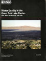
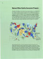
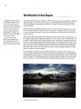
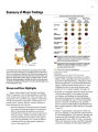
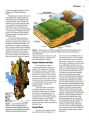
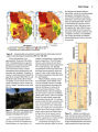
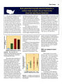
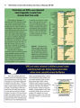
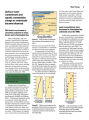
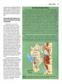
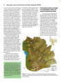
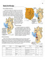
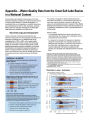
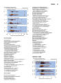
Show Introduction to the Great Salt Lake Basins Physical Setting and Climate The Great Salt Lake Basins Study Unit includes about 14,500 square miles of northeastern Utah, southeastern Idaho, and southwestern Wyoming and three major river systems that enter Great Salt Lake: the Bear, Weber, and Utah Lake- Jordan River systems ( Baskin and others, 2002). Altitude ranges from about 4,200 feet near Great Salt Lake to more than 12,000 feet in the Uinta Mountains near the eastern edge. About 1.7 million people or about 76 percent of the population in the State of Utah ( 2000 census) live along the western flanks of the Wasatch Mountains, where Utah's largest cities are located ( fig. 1). The climate in the Study Unit is typical of mountainous areas in the Western United States. Temperature generally fluctuates widely between summer and winter and between day and night. The high mountains have long, cold winters and short, cool summers. The lower valleys are more moderate, with less variance between maximum and minimum temperatures. Average monthly maximum temperature reaches 92° F in July at the Salt Lake City International Airport, and the average monthly minimum reaches - 1.5° F in January at Sage, Wyoming. Most of the annual precipitation falls as snow, which provides most of the annual runoff during the spring as snowmelt. Average annual precipitation ranges from less than 16 inches on the valley floors to greater than 70 inches in the high mountain areas. High mountain wetlands are common in headwaters along the western front of the Wasatch Mountains Historical mining activities left metal- laden tailings deposits in the upper Weber River and Utah Lake- Jordan River drainage basins 0 20 40 60 KILOMETERS Figure 1. Large changes in altitude, climate, and land use produce a wide range of hydrologic environments in the Great Salt Lake Basins. |