| OCR Text |
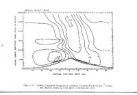
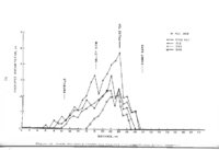
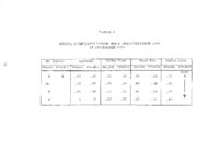
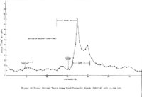
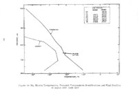
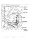
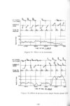
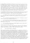
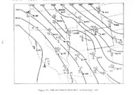
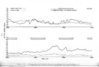
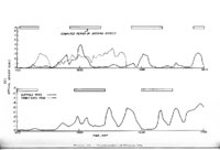
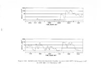
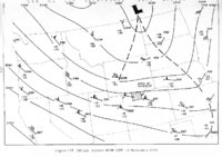
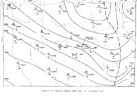
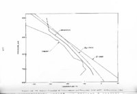
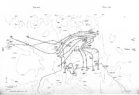
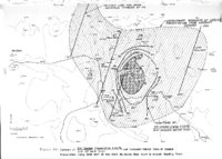
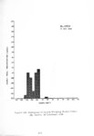
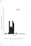
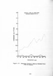
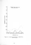
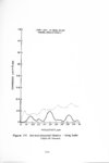
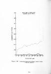
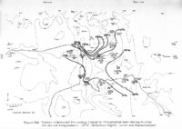
Show seeding, and during the morning ground-seeding heavy snow at Mt. Harris prevented clear PPI presentation of outlying echoes. 4. 5. 4. 1. 10 Summary and Conclusions From the data studied it is concluded that: (1) The lower level wind shift which o ccurred between 0749 ~ T and 1012 MST (probably around 0900 MST) likely accompanied the southward passage of a very slowly moving east-west band of snow, with very little precipitation following the wind shift line. (2) This east-west oriented band likely persisted over the southern portion of the experimental area (as far north and east as Rabbit Ears) into the afternoon. (3) The southward shifting morning snow-rate increase across the area correlates well both with the calculation of seeded precipitation arrival time and with the southward moving snow band. (4) The occurrence of a marked 30 minute maximum of silver-inprecipitation concentration at Rabbit Ears Pass correlates very well with the computed maximum se·e ded precipitation occurrence from Mt. Harris seeding, and is also accompanied by a precipitation rate maximum. ( 5) Lodwick vertical pointing AGC voltage readings show relative maxima at the proper times for the occurrence of seeding effect both for the ground-based and the aircraft seeding. (6) The percentage contours of 3-hour seeded period precipitation compared to 6-hour total precipitation maximized near the center of the large computed area of aircraft seeding effect. (7) The snowfall maximum occurring over the southern half of the experimental area during AP 5 correlates with the projected east-west snow band from Mt. Harris PPI radar photos. 4. 5. 4. 2 Wing Flare Release The case of wing flare burning of Agl on 16 February 19 69 was studied in detail. Findings are described below. 4. 5. 4. 2. 1 Synoptic Pattern, Moisture, and Stability A flat upper ridge was over the Great Basin with a resultant west northwest flow of moist air across the Park Range above 700 mb. 253 At and below 700 mb, |