| OCR Text |
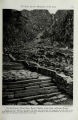
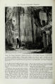
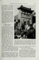
Show China Fights Erosion with U. S. Aid 657 To heal the thousands of gullies where erosion is gnawing at the good earth, we worked out a novel plan for revegetation. Clay pellets containing seeds of grasses, shrubs, and trees together with fertilizer would be dropped from airplanes like incendiary bombs after soil-soaking rains. Such broad-scale seeding calls for nurseries to grow seed in quantities large enough to make up millions of pellets with marble-making machines. One nursery for this purpose was established. Together with proposed revegetation of gully slopes, soil-saving dams are to be built by the thousands to collect silt in flat reaches of great gullies. This would build up alluvial areas suitable for farming and at the same time reduce the silt load of streams. Stream bank protection from undercutting by floods, especially in smaller streams, is also proposed on a large scale. Needed timber for bank-protecting structures must be grown in poplar and willow plantations along streams. South to Siking After getting preliminary work under way at Tienshui, we traveled to Siking, the present capital of the Province of Shensi. Siking stands in the wide alluvial plain of the Wei River on the site of ancient Chang-an, the capital of the earlier Han Dynasty some two thousand years ago. In the Tang Dynasty, A.D. 618-907, it was one of the great metropolises of the Orient. To the Tang court came embassies from the Far East and possibly from the Near East. In the Wei River Plain are hundreds of great truncated earthen pyramids, or tombs, that date from the beginning of the Chou Dynasty. I was mystified at first as to how these memorials had been built, for nowhere did I find pits from which such vast amounts of earth could have come. My good friend Li Hsieh, who was chief engineer of the King River Irrigation Project,* had died three years earlier. To do him honor, each farmer had brought a measure of soil from his own land to make up a memorial mound. The older mounds may well have been made in the same way. I placed a wreath on Li Hsieh's tomb. Representatives of the Yellow River Commission at Siking led our field party to see the diversion dam built in 1935 just above the last intake of the former defunct project (Plate VIII). Unlike the reliable Tu Kiang Irrigation Project, the King Irrigation Project has failed time after time and as often has been repaired and rebuilt. The total area of 100,000 acres now irrigated with modern works is only a fourth of that watered under ancient works. Silt is not mentioned as a problem in records of the King River Irrigation Project until A.D. 995, when the blocking of canals with silt was reported for prompt attention by officials. Prior to this time silt was regarded as an advantage. A Chinese song dating from A.D. 82 says, "In one shih [about 100 quarts! of King water there are several pecks of mud. Both irrigating and fertilizing, it makes long our growing millet, feeding and clothing the capital's vast multitudes." After A.D. 995, reports of more and more difficulty with silt appear. The records indicate that increased cultivation of slopes caused the King River waters to carry a constantly increasing burden of silt. Nowadays the water carries up to 54 per cent much of the time during summer rains, so that it cannot be used for irrigation. Another problem frequently referred to in old records was a lowering of the river below the intake canal. We examined the site of the intake cut in 246 B.C. Now the river level is fully 40 feet below, showing that the river has scoured out its channel, doubtless because of higher flashy flood stages. It was necessary from time to time to extend the intake upstream for head enough for stream water to flow into the canal system. The modern diversion dam is built just above the last intake cut into the rock. The Yellow River Commission has concluded that if floods are to be controlled in the delta plain and waters of the Yellow River and its tributaries used to the best advantage for irrigation, the enormous burden of silt must be reduced. This means a long-range program of control of soil erosion and conservation of soil and water on farmlands and revegetation of gullies throughout the vast loessal highlands. Refugee Colonists at Hwanglungshan We were invited to inspect Hwanglungshan (Yellow Dragon Mountain), where the largest colonization project of the Chinese Government is in operation. Many efforts have been made to locate refugees from Japanese-occupied China on farms. Colonization of empty areas of Free China has been a favorite scheme. We reached this project in central Shensi by traveling through Hancheng, where we were within rifle range of Japanese-controlled Shansi across the Yellow River. * See, in the NATIONAL GEOGRAPHIC MAGAZINE, "Taming 'Flood Dragons' Along China's Hwang Ho." by Oliver J. Todd, February, 1942, and "Raft Life on the Hwang Ho (Yellow River)," by W. Robert Moore, June, 1932. |