OCR Text |
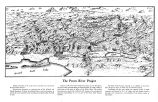
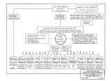
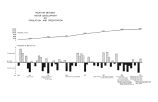
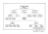
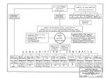
Show Table of Illustrations Provo River Project Topographic Map Cover Page 1. City and County Building grounds 1 2. Typhical Utah farm 2 3. Salt Lake City in 1853 3 4. Salt Lake City in 1860s 5 5. Main Street of Salt Lake City 4 6. Jordan and Salt Lake Canal 5 7. Salt Lake City in 1880 6 8. Suicide Rock reservoir 6 9 Ninth East Street in Salt Lake City 7 10. Creek channel of Strevcll estate 7 11. The old Salt Lake Theater 8 12. Salt Lake City in 1890 8 13. Flowing well at Thirteenth South and Seventh East Streets 9 14. Early view of Utah Lake 10 15. Big Cottonwood Creek 12 16. Typical farm land 12 17. Big Cottonwood conduit 13 18. Diversion dam in Big Cottonwood Canyon 13 19. Lake Phoebe- Mary reservoir 14 20. Twin Lakes dam 14 21. 22. 23. 24. Construction of Mt. Dell dam 15 25. Parley's high line conduit 15 26. East Jordan Canal extension 16 27. 28. Jordan and Salt Lake Canal improvements and extension work 17 29. Sixtieth South Street pumping plant 17 30. City Creek reservoir 31. Little Cottonwood conduit 19 32. The Danielson orchard 20 35. Sugar House business district 21 54. Hillsden Drive, near Salt Lake City 21 35. Feed channel for Utah Lake pumping plant.... 22 36. Harry C. Jessen, former City Engineer 23 37. The Weber River 23 38. Echo reservoir 24 59. Echo reservoir, upstream view 25 59- A. Utali Lake, comparative annual \ ields 25 40. Site of Argenta dam 26 41. Little Cottonwood conduit, nearing completion.. 26 42. Erickson artesian well 27 43. " Association" artesian well 27 44. Louis Marcus, former Mayor of Salt Lake City.. 28 45. State fish hatchery wells 28 46. Judge C. W. Morse 30 47. Utah Lake pumps -. 30 48. W. D. Beers, City Engineer 31 49. Dr. Elwood Mead 51 50. Another view of Utah Lake pumps 32 51. Utah Lake pumping plant 33 52. Effect of 1954 drouth on Big Cottonwood Creek. . 54 52- A. Dry stream bed. Big Cottonwood Creek 35 53. Emergency pump well 35 53- A. ( Photograph) Emergency well at Twenty- seventh South and Thirteenth East 36 53- A. ( Chart) Relation between water developmnt, population and precipitation - between pages 36 and 37 53- B. ( Chart) How drouth affects stream flow 57 54. William R Wallace 58 55. E. O. Larson 58 56. Finance symbol used in 1957 election 59 57. Map of Provo River Project 40 57- A. Relationships, Provo River Project 40 and 41 58. J. W. Gillman 41 59. Editorial. Salt Lake Tribune 42 61. Henry H. Blood 42 62. Pamphlet used in 1935 Metropolitan Water District election 47 65. Typical newspaper advertisement 48 64. Herbert S. Auerbach 51 65. Officers and employees of the Metropolitan Water District of Salt Lake City 52 96 97 98 99 100 101 102 103 105 106 107 108 124 125 126 126 127 128 129 130 131 132 133 134 153 136. 157 138. 139 140 141 142 143 144 Water measurement at Brighton 54 Newspaper editorial on Burdick report 56 Chas. B. Burdick 57 Map of Utah Lake Dike Project 58 Graphic comparison of financing costs 59 John C. Page 60 Cover sheet of informative pamphlet used in 1957 election 62 Governor Henry H. Blood and Director S. A. Kennedy, 1957 election 63 Window poster, 1937 election 64 76, 77, 78, 79. Display features of 1937 election.. 65 Signed copy of the Aqueduct repayment contract 66 Relief map photograph of Provo River Project.. 67 Distant view of Deer Creek dam 70 Gate chamber. Deer Creek dam 70 Upstream view. Deer Creek reservoir 71 Deer Creek reservoir showing new highway 72 Closeup view. Deer Creek dam 72 Outlet works, Deer Creek dam 75 Spillway, Deer Creek dam 75 New railroad grade, Deer Creek dam 74 91, 92, 95, 94. The Duchesne tunnel under construction 75 Weber- Provo diversion canal 76 A. Construction units of the Provo River Project, between pages 76 and 77 Provo Reservoir canal 77 Inspection of Deer Creek dam by wafer officials. 78 Board of Directors of the Provo River Water Users Association 79 Closeup view of Deer Creek dam spillway 81 Foundations of Deer Creek dam power house structure 82 Catwalk and outlet pipes, Deer Creek dam 85 Weber River station, Utah Power & Light Co... 84 104. Weber- Provo Diversion Canal 85 . Reclamation Bureau officials- E. O. Larson, John C. Page, and J. R. Alexander 86 A. V. Watkins 87 Looking through a section of aqueduct pipe 88 Official inspection of the aqueduct pipe construction 89 to 118, inclusive. Construction views of the Salt Lake Aqueduct 90 and 91 to 125, inclusive. Construction views of the Olmsted and Alpine- Draper tunnels 92 Measuring a spring in right of way negotiations.. 95 Right of way map. Aqueduct project 94 Construction progress chart, Provo Rive Project 97 A. Relationships, Provo River Project, between pages 98 and 99 Salt Lake Aqueduct as seen from Orem 99 Downstream view of Deer Creek dam 100 Vent structure, Salt Lake Aqueduct 102 Population curve of Salt Lake City 104 Leland H. Kimball 106 Salt Lake City, viewed from State Capitol 107 Vent structure and siphon, Salt Lake Aqueduct Project 108 Downstream view of Deer Creek dam spillway.. 109 Boat harbor of Great Salt Lake 110 Mirror Lake Ill Steel span section. Salt Lake Aqueduct 112 Officials and delegates, National Reclamation Association convention 115 View along top of Deer Creek dam 114 Suburban farm of Salt Lake valley 115 Salt Lake City's " White Way" 117 William M. Kasworm 118 Utah Ordnance plant 119 The Old Tree of Salt Lake Valley 121 |