Home
Browse
Ask Us
Chat
Harmful Language Statement
Log in
Institutional Repository
Advanced Search
Year
1951
1952
1953
1954
1955
1956
1957
1958
1959
1960
1961
1962
1963
1964
1965
1966
1967
1968
1969
1970
1971
1972
1973
1974
1975
1976
1977
1978
1979
1980
1981
1982
1983
1984
1985
1986
1987
1988
1989
1990
1991
1992
1993
1994
1995
1996
1997
1998
1999
2000
2001
2002
2003
2004
2005
2006
2007
2008
2009
2010
2011
2012
2013
2014
2015
2016
2017
2018
2019
TO
1951
1952
1953
1954
1955
1956
1957
1958
1959
1960
1961
1962
1963
1964
1965
1966
1967
1968
1969
1970
1971
1972
1973
1974
1975
1976
1977
1978
1979
1980
1981
1982
1983
1984
1985
1986
1987
1988
1989
1990
1991
1992
1993
1994
1995
1996
1997
1998
1999
2000
2001
2002
2003
2004
2005
2006
2007
2008
2009
2010
2011
2012
2013
2014
2015
2016
2017
2018
2019
Type
Image
312
Text
265
Format
application/pdf
312
Collection
Chicana/o Scholarship Archive
2
Electronic University Archive
15
MFA Final Projects
3
Sustainability U
12
Theses & Dissertations
85
UScholar Works
195
More
Filters:
Type:
"Image"
Collection:
ir_*
Format:
"application/pdf"
201
-
225
of
312
<
4
5
6
7
8
9
10
11
12
13
>
Gallery view
Number of results to display per page
10
25
50
100
200
Sort by Relevance
Sort by Title A-Z
Sort by Title Z-A
Sort by Date Ascending
Sort by Date Descending
Sort by Last Modified Ascending
Sort by Last Modified Descending
Title
Date
Type
Setname
201
Places: parallelism for dynamic languages
2010-02-26
Text; Image
ir_uspace
202
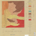
Plate 1: Geologic map and vertical cross section of the Sulphurdale sulphur deposits, Beaver and Millard Counties, Utah
1960-08
Image
ir_etd
203
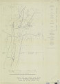
Plate 1: Geologic map of the Little Willow Series, Wasatch Mountains, Utah
1962-11
Image
ir_etd
204
Plate 1: Geologic map of the Lothidok Range, Kenya
1988-08
Image
ir_etd
205
Plate 1: Geologic map of the Paria NW quadrangle, Kane County, Utah
1970-08
Image
ir_etd
206
Plate 1: Geologic map of the Willard Peak area, North-Central Wasatch Mountains, Utah
1972-12
Image
ir_etd
207
Plate 1B: Geologic map of the Central and Southern Silver Island Mountains, Box Elder and Tooele Counties, Utah, and Elko County, Nevada
1961-06
Image
ir_etd
208
Plate 1C: Geologic cross sections of the Central and Southern Silver Island Mountains, Box Elder and Tooele Counties, Utah and Elko County, Nevada
1961-06
Image
ir_etd
209
Plate 2 Topography, resistivity, and chargeability cross-sections along dipole-dipole line 1 on Fumarole Butte
1975-08
Text; Image
ir_etd
210
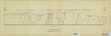
Plate 2: Cross-section A-A'
1959-06
Image
ir_etd
211
Plate 2: Detailed geologic and vertical cross sections map of the Excelsior Orebody and New York Prospect Pit, Millard County, Utah
1960-08
Image
ir_etd
212
Plate 2: Sections along line A-A' and B-B'
1962-11
Image
ir_etd
213
Plate 2: Structural sections
1970-08
Image
ir_etd
214
Plate 2: Structure sections for geologic map of the Willard Peak area
1972-12
Image
ir_etd
215
Plate 3 Topography, resistivity, and chargeability cross-sections along dipole-dipole line 2 on Fumarole Butte
1975-08
Text; Image
ir_etd
216
Plate 3: Cross-section B-B'
1959-06
Image
ir_etd
217
Plate 3: Detailed geologic and vertical cross section map of the Prince Albert Orebody, Mariposa and Queen Victoria Prospect Pits, Millard County, Utah
1960-08
Image
ir_etd
218
Plate 3: Palinspastic middle and upper Cambrian columnar sections from western and northern Utah
1972-12
Image
ir_etd
219
Plate 3: Structural map of the Little Willow Series, Wasatch Mountains, Utah
1962-11
Image
ir_etd
220
Plate 3: Structural map of the Paria NW quadrangle, Kane County, Utah
1970-08
Image
ir_etd
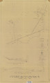
221
Plate 3: Structural sections
1970-08
Image
ir_etd
222
Plate 4: Correlation of Precambrian rocks of the lower plate and upper plate of the Willard thrust with the Huntsville and Cottonwood areas
1972-12
Image
ir_etd
223
Plate 4: Detailed map showing diamond drill hole locations and vertical cross sections of the Sulphurdale Orebody, Beaver County, Utah
1960-08
Image
ir_etd
224
Plate 4: Evolution of the eastern fault block
1959-06
Image
ir_etd
225
Plate 4: Map variations of the Little Willow Series, Wasatch Mountains, Utah
1962-11
Image
ir_etd
201
-
225
of
312
<
4
5
6
7
8
9
10
11
12
13
>