TO
Filters: Collection: "ir_eua"
| Title | Date | Subject | Description | ||
|---|---|---|---|---|---|
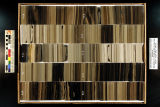
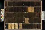
| 201 |
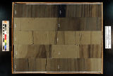 |
Skyline 16: SW SW sec. 10 11S 25E Uintah County, Utah. Box 68 Depth: 690.0 - 700.0 ft. | 2015-07 | core samples; Skyline 16; box 68; Green River Formation | Core sample photograph by the Utah Geological Survey at the University of Utah, and the Utah Core Research Center. Skyline 16: SW SW sec. 10 11S 25E Uintah County, Utah. Box 68 Depth: 690.0 - 700.0 ft. |
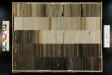
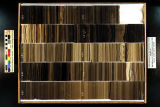
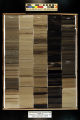
| 202 |
 |
Skyline 16: SW SW sec. 10 11S 25E Uintah County, Utah. Box 67 Depth: 680.0 - 690.0 ft. | 2015-07 | core samples; Skyline 16; box 67; Green River Formation | Core sample photograph by the Utah Geological Survey at the University of Utah, and Utah Core Research Center. Skyline 16: SW SW sec. 10 11S 25E Uintah County, Utah. Box 67 Depth: 680.0 - 690.0 ft. |
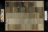
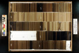
| 203 |
 |
Skyline 16: SW SW sec. 10 11S 25E Uintah County, Utah. Box 70 Depth: 710.0 - 720.0 ft. | 2015-07 | core samples; Skyline 16; box 70; Green River Formation | Core sample photograph by the Utah Geological Survey at the University of Utah, and the Utah Core Research Center. Skyline 16: SW SW sec. 10 11S 25E Uintah County, Utah. Box 70 Depth: 710.0 - 720.0 ft. |
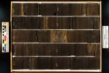
| 204 |
 |
Skyline 16: SW SW sec. 10 11S 25E Uintah County, Utah. Box 72 Depth: 730.0 - 740.0 ft. | 2015-07 | core samples; Skyline 16; box 72; Green River Formation | Core sample photograph by the Utah Geological Survey at the University of Utah, and the Utah Core Research Center. Skyline 16: SW SW sec. 10 11S 25E Uintah County, Utah. Box 72 Depth: 730.0 - 740.0 ft. |
| 205 |
 |
Skyline 16: SW SW sec. 10 11S 25E Uintah County, Utah. Box 66 Depth: 670.0 - 680.0 ft. | 2015-07 | core samples; Skyline 16; box 66; Green River Formation | Core sample photograph by the Utah Geological Survey at the University of Utah, and the Utah Core Research Center. Skyline 16: SW SW sec. 10 11S 25E Uintah County, Utah. Box 66 Depth: 670.0 - 680.0 ft. |
| 206 |
 |
Skyline 16: SW SW sec. 10 11S 25E Uintah County, Utah. Box 71 Depth: 720.0 - 730.0 ft. | 2015-07 | core samples; Skyline 16; box 71; Green River Formation | Core sample photograph by the Utah Geological Survey at the University of Utah, and the Utah Core Research Center. Skyline 16: SW SW sec. 10 11S 25E Uintah County, Utah. Box 71 Depth: 720.0 - 730.0 ft. |
| 207 |
 |
Skyline 16: SW SW sec. 10 11S 25E Uintah County, Utah. Box 65 Depth: 660.0 - 670.0 ft. | 2015-07 | core samples; Skyline 16; box 65; Green River Formation | Core sample photograph by the Utah Geological Survey at the University of Utah, and the Utah Core Research Center. Skyline 16: SW SW sec. 10 11S 25E Uintah County, Utah. Box 65 Depth: 660.0 - 670.0 ft. |
| 208 |
 |
Skyline 16: SW SW sec. 10 11S 25E Uintah County, Utah. Box 64 Depth: 650.0 - 660.0 ft. | 2015-07 | core samples; Skyline 16; box 64; Green River Formation | Core sample photograph by the Utah Geological Survey at the University of Utah, and the Utah Core Research Center. Skyline 16: SW SW sec. 10 11S 25E Uintah County, Utah. Box 64 Depth: 650.0 - 660.0 ft. |
| 209 |
 |
Skyline 16: SW SW sec. 10 11S 25E Uintah County, Utah. Box 69 Depth: 700.0 - 710.0 ft. | 2015-07 | core samples; Skyline 16; box 69; Green River Formation | Core sample photograph by the Utah Geological Survey at the University of Utah, and the Utah Core Research Center. Skyline 16: SW SW sec. 10 11S 25E Uintah County, Utah. Box 69 Depth: 700.0 - 710.0 ft. |
| 210 |
 |
Skyline 16: SW SW sec. 10 11S 25E Uintah County, Utah. Box 54 Depth: 550.0 - 560.0 ft. | 2015-07 | core samples; Skyline 16; box 54; Green River Formation | Core sample photograph by the Utah Geological Survey at the University of Utah, and the Utah Core Research Center. Skyline 16: SW SW sec. 10 11S 25E Uintah County, Utah. Box 54 Depth: 550.0 - 560.0 ft. |
| 211 |
 |
Skyline 16: SW SW sec. 10 11S 25E Uintah County, Utah. Box 40 Depth: 410.0 - 420.0 ft. | 2015-07 | core samples; Skyline 16; box 40; Green River Formation | Core sample photograph by the Utah Geological Survey at the University of Utah, and the Utah Core Research Center. Skyline 16: SW SW sec. 10 11S 25E Uintah County, Utah. Box 40 Depth: 410.0 - 420.0 ft. |
| 212 |
 |
Skyline 16: SW SW sec. 10 11S 25E Uintah County, Utah. Box 60 Depth: 610.0 - 620.0 ft. | 2015-07 | core samples; Skyline 16; box 60; Green River Formation | Core sample photograph by the Utah Geological Survey at the University of Utah, and the Utah Core Research Center. Skyline 16: SW SW sec. 10 11S 25E Uintah County, Utah. Box 60 Depth: 610.0 - 620.0 ft. |
| 213 |
 |
Skyline 16: SW SW sec. 10 11S 25E Uintah County, Utah. Box 47 Depth: 480.0 - 490.0 ft. | 2015-07 | core samples; Skyline 16; box 47; Green River Formation | Core sample photograph by the Utah Geological Survey at the University of Utah, and the Utah Core Research Center. Skyline 16: SW SW sec. 10 11S 25E Uintah County, Utah. Box 47 Depth: 480.0 - 490.0 ft. |
| 214 |
 |
Skyline 16: SW SW sec. 10 11S 25E Uintah County, Utah. Box 46 Depth: 470.0 - 480.0 ft. | 2015-07 | core samples; Skyline 16; box 46; Green River Formation | Core sample photograph by the Utah Geological Survey at the University of Utah, and the Utah Core Research Center. |
| 215 |
 |
Skyline 16: SW SW sec. 10 11S 25E Uintah County, Utah. Box 57 Depth: 580.0 - 590.0 ft. | 2015-07 | core samples; Skyline 16; box 57; Green River Formation | Core sample photograph by the Utah Geological Survey at the University of Utah, and the Utah Core Research Center. Skyline 16: SW SW sec. 10 11S 25E Uintah County, Utah. Box 57 Depth: 580.0 - 590.0 ft. |
| 216 |
 |
Skyline 16: SW SW sec. 10 11S 25E Uintah County, Utah. Box 42 Depth: 430.0 - 440.0 ft. | 2015-07 | core samples; Skyline 16; box 42; Green River Formation | Core sample photograph by the Utah Geological Survey at the University of Utah, and the Utah Core Research Center. Skyline 16: SW SW sec. 10 11S 25E Uintah County, Utah. Box 42 Depth: 430.0 - 440.0 ft. |
| 217 |
 |
Skyline 16: SW SW sec. 10 11S 25E Uintah County, Utah. Box 43 Depth: 440.0 - 450.0 ft. | 2015-07 | core samples; Skyline 16; box 43; Green River Formation | Core sample photograph by the Utah Geological Survey at the University of Utah, and the Utah Core Research Center. Skyline 16: SW SW sec. 10 11S 25E Uintah County, Utah. Box 43 Depth: 440.0 - 450.0 ft. |
| 218 |
 |
Skyline 16: SW SW sec. 10 11S 25E Uintah County, Utah. Box 48 Depth: 490.0 - 500.0 ft. | 2015-07 | core samples; Skyline 16; box 48; Green River Formation | Core sample photograph by the Utah Geological Survey at the University of Utah, and the Utah Core Research Center. Skyline 16: SW SW sec. 10 11S 25E Uintah County, Utah. Box 48 Depth: 490.0 - 500.0 ft. |
| 219 |
 |
Skyline 16: SW SW sec. 10 11S 25E Uintah County, Utah. Box 36 Depth: 370.0 - 380.0 ft. | 2015-07 | core samples; Skyline 16; box 36; Green River Formation | Core sample photograph by the Utah Geological Survey at the University of Utah, and the Utah Core Research Center. Skyline 16: SW SW sec. 10 11S 25E Uintah County, Utah. Box 36 Depth: 370.0 - 380.0 ft. |
| 220 |
 |
Skyline 16: SW SW sec. 10 11S 25E Uintah County, Utah. Box 35 Depth: 360.0 - 370.0 ft. | 2015-07 | core samples; Skyline 16; box 35; Green River Formation | Core sample photograph by the Utah Geological Survey at the University of Utah, and the Utah Core Research Center. Skyline 16: SW SW sec. 10 11S 25E Uintah County, Utah. Box 35 Depth: 360.0 - 370.0 ft. |
| 221 |
 |
Skyline 16: SW SW sec. 10 11S 25E Uintah County, Utah. Box 45 Depth: 460.0 - 470.0 ft. | 2015-07 | core samples; Skyline 16; box 45; Green River Formation | Core sample photograph by the Utah Geological Survey at the University of Utah, and the Utah Core Research Center. Skyline 16: SW SW sec. 10 11S 25E Uintah County, Utah. Box 45 Depth: 460.0 - 470.0 ft. |
| 222 |
 |
Skyline 16: SW SW sec. 10 11S 25E Uintah County, Utah. Box 61 Depth: 620.0 - 630.0 ft. | 2015-07 | core samples; Skyline 16; box 61; Green River Formation | Core sample photograph by the Utah Geological Survey at the University of Utah, and the Utah Core Research Center. Skyline 16: SW SW sec. 10 11S 25E Uintah County, Utah. Box 61 Depth: 620.0 - 630.0 ft. |
| 223 |
 |
Skyline 16: SW SW sec. 10 11S 25E Uintah County, Utah. Box 62 Depth: 630.0 - 640.0 ft. | 2015-07 | core samples; Skyline 16; box 62; Green River Formation | Core sample photograph by the Utah Geological Survey at the University of Utah, and the Utah Core Research Center. Skyline 16: SW SW sec. 10 11S 25E Uintah County, Utah. Box 62 Depth: 630.0 - 640.0 ft. |
| 224 |
 |
Skyline 16: SW SW sec. 10 11S 25E Uintah County, Utah. Box 50 Depth: 510.0 - 520.0 ft. | 2015-07 | core samples; Skyline 16; box 50; Green River Formation | Core sample photograph by the Utah Geological Survey at the University of Utah, and the Utah Core Research Center. Skyline 16: SW SW sec. 10 11S 25E Uintah County, Utah. Box 50 Depth: 510.0 - 520.0 ft. |
| 225 |
 |
Skyline 16: SW SW sec. 10 11S 25E Uintah County, Utah. Box 41 Depth: 420.0 - 430.0 ft. | 2015-07 | core samples; Skyline 16; box 41; Green River Formation | Core sample photograph by the Utah Geological Survey at the University of Utah, and the Utah Core Research Center. Skyline 16: SW SW sec. 10 11S 25E Uintah County, Utah. Box 41 Depth: 420.0 - 430.0 ft. |