TO
Filters: Collection: "ir_eua" Type: "Text"
| Title | Date | Subject | Description | ||
|---|---|---|---|---|---|
| 201 |
 |
Geology and uranium deposits of the Temple Mountain District Emery County, Utah | 1965 | geology; uranium deposits; Temple Mountain District; geologic formations; mineralogy | |
| 202 |
 |
1965-66 General Catalog | 1965 | University of Utah catalogue; (Catalog) | General Catalog 1965-1966 |
| 203 |
 |
A bibliography of thermal methods of oil recovery | 1965-03 | Thermal methods; Oil recovery; Bibliography; Bureau of Mines Petroleum Research Center; Thermal methods of oil recovery | The Oil Recovery Committee, Independent Petroleum Association of America, in response to requests and in recognition of expanded interest in the application of thermal methods of oil recovery, has sponsored the compilation of the following bibliography, with literature and patent references, and aut... |
| 204 |
 |
A growth allocation model for the Boston region | 1965-05 | The model described in this article is based on extremely simple concepts and represents the first case of a complete model covering all aspects of urban location. Basically, the future growth of each of a number of activities in a number of subareas of the Boston Metropolitan Region is projected in... | |
| 205 |
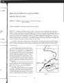 |
Green River Formation at Raven Ridge, Uintah County, Utah | 1965-07 | Green River formation; Raven Ridge; sandstone beds; shale; limestone; marlstone; oil-bearing strata | Along Raven Ridge in Uintah County, Utah, exposures of the Green River Formation contain a complex sequence of intertonguing beds of sandstone, shale, limestone, and marlstone. These strata are considered to represent deposition in an orderly sequence of environments from the flood plain through the... |
| 206 |
 |
Petroleum geology of the greater Red Wash Area, Uintah County, Utah | 1965-07 | oil and gas field; sandstone; petroleum geology | The Greater Red Wash area is the largest oil and gas field in the Uinta Basin. The Douglas Creek and Garden Gulch Members of the Green River Formation form a lacustrine delta in the area and yield hydrocarbons from a complex network of discrete sandstones. Each individual sandstone body forms its ow... |
| 207 |
 |
Program outline for the Utah State Development Plan | 1965-08 | The preparation of this report was financially aided through a Federal grant from the Urban Renewal Administration of the Housing and Home Finance Agency, under the Urban Planning Assistance Program authorized by Section 701 of the Housing Act of 1954, as amended. | |
| 208 |
 |
Campus Magazine vol.2, no.1 | 1966 | University of Utah catalogue; (Catalog) | |
| 209 |
 |
Campus Magazine vol.2, no.2 | 1966 | University of Utah catalogue; (Catalog) | |
| 210 |
 |
Campus Magazine vol.1, no.2 | 1966 | University of Utah catalogue; (Catalog) | |
| 211 |
 |
1966-67 General Catalog | 1966 | University of Utah catalogue; (Catalog) | Bulletin of the University of Utah. Volume 57, Number 5, May 15, 1966 |
| 212 |
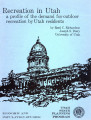 |
Recreation in Utah a profile of the demand for outdoor recreation by Utah residents | 1966-01 | Are recurring problem in planning for economic and industrial development is the lack of sufficient basic data upon which sound planning decisions may be made. One of the industry areas in which the lack of basic data for planning is conspicuous by its scarcity is outdoor recreation. Yet the outdoor... | |
| 213 |
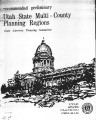 |
Recommended preliminary Utah multi-County planning regions | 1966-03 | This recommendation for Multi-County Planning Regions is preliminary to the extent that its desirability should be tested by county officials, planning groups, and other interested government and private agencies for a period of time before it is accepted as final by the State Advisory Planning Comm... | |
| 214 |
 |
A projections model for small area economies | 1966-06 | ||
| 215 |
 |
Employment, population, income and automobiles in Salt Lake, Ogden, Provo Metropolitan Area and State of Utah | 1966-12 | William C a r l i s l e and Michael A. Stoddard, graduate students in the Department of Economics, rendered v e r y valuable a s s i s t a n c e in the p r e p a r a tion of t h i s r e p o r t . Gregory M. Nielson, graduate student in Mathematics, a s s i s t e d in computer programming, and Iver... | |
| 216 |
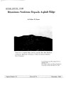 |
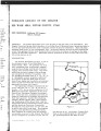
Bituminous sandstone deposits Asphalt Ridge | 1966-12 | Asphalt Ridge probably is the second largest bituminous sandstone deposit in northeastern Utah's Uinta Basin. Discontinuous concentrations of bitumen occur in the Rim Rock Sandstone of the Mesaverde Group of Cretaceous age, in the overlying Uinta Formation of Eocene age and the Duchesne River Format... | |
| 217 |
 |
Capitol Reef-Miners Mountain oil-impregnated rock occurrences | 1967 | The Capitol Reef bituminous sandstone area occurs mainly on the northern and northeastern portions of the area known as Miners Mountain. This is a dome structure of the Teasdale anticline, the axis of which parallels the Teasdale fault system. | |
| 218 |
 |
Campus Magazine vol.3, no.1 | 1967 | University of Utah catalogue; (Catalog) | |
| 219 |
 |
Campus Magazine vol.3, no.2 | 1967 | University of Utah catalogue; (Catalog) | |
| 220 |
 |
Campus Magazine vol.2, no.3 | 1967 | University of Utah catalogue; (Catalog) | |
| 221 |
 |
Impact of defense spending on the economy of Utah | 1967 | This report is a product of studies conducted at Utah State University under a contract with the Urban Renewal Administration of the Federal Housing and Home Finance Agency, under an arrangement worked out by Robert Huefner, Utah State Planning Coordinator. It builds upon The Defense Industry of Uta... | |
| 222 |
 |
1967-68 General Catalog | 1967 | University of Utah catalogue; (Catalog) | General catalog 1967-1968 |
| 223 |
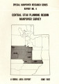 |
Central Utah planning region manpower survey: a rural area report June, 1967 | 1967-06 | ||
| 224 |
 |
Geophysical report, seismograph survey, of the Asphalt Ridge prospect Uintah County, Utah | 1967-11 | Geophysical report; seismograph survey; Asphalt Ridge prospect. | Location and general information: The area designated as Asphalt Ridge, located directly southwest of the Ashley Creek oil field, is in the northeastern part of Uintah County, Utah, in T. 5 S. , R. 22 E. , and T. 6 S. , R. 21 E. Geologically, the area is situated on the north flank, and extends to t... |
| 225 |
 |
Determination of oil shale potential Green River Formation, Uinta Basin northeast Utah | 1967-11-03 |