Home
Browse
Ask Us
Chat
Harmful Language Statement
Log in
Western Waters Electronic Resources
Advanced Search
About
Government documents and electronic resources on water issues.
Year
1991
1992
1993
1994
1995
1996
1997
1998
1999
2000
2001
2002
2003
2004
2005
2006
TO
1991
1992
1993
1994
1995
1996
1997
1998
1999
2000
2001
2002
2003
2004
2005
2006
Type
Text
243
Format
application/pdf
243
Collection
Western Waters Electronic Resources
243
Filters:
Type:
"Text"
Collection:
"wwdl_er"
Format:
"application/pdf"
176
-
200
of
243
<
1
2
3
4
5
6
7
8
9
10
>
Gallery view
Number of results to display per page
10
25
50
100
200
Sort by Relevance
Sort by Title A-Z
Sort by Title Z-A
Sort by Date Ascending
Sort by Date Descending
Sort by Last Modified Ascending
Sort by Last Modified Descending
Title
Date
Type
176
Summary of surface-water-quality data collected for the Northern Rockies Intermontane Basins National Water-Quality Assessment Program in the Clark Fork-Pend Oreille and Spokane River Basins, Montana, Idaho, and Washington, Water Years 1999-2001
2003
Text
177
Surface-Water Quality-Assurance Plan for the Washington District, U.S. Geological Survey, Water Resources Discipline
2004
Text
178
Surface-water-quality assessment of the Yakima River Basin in Washington: Overview of Major Findings, 1987-91
1999
Text
179
Surface-water-quality assessment of the Yakima River Basin, Washington: overview of major findings, 1987-91
1998
Text
180
Sustainability of Ground-Water Resources
1999
Text
181
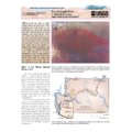
The Colorado River in Grand Canyon; how fast does it flow?
1997
Text
182
The U.S. Geological Survey recent highlights; natural resources
1997
Text
183
The effect of calcium magnesium acetate (CMA) deicing material on the water quality of Bear Creek, Clackamas County, Oregon, 1999
2000
Text
184
The effect of chamber mixing velocity on bias in measurement of sediment oxygen demand rates in the Tualatin River Basin, Oregon
2003
Text
185
The internal structure of sand bars on the Colorado River, Grand Canyon, as determined by ground-penetrating radar
2001
Text
186
Total dissolved gas and water temperature in the Lower Columbia River, Oregon and Washington, 2003: quality-assurance data and comparison to water-quality standards
2003
Text
187
Total dissolved gas, barometric pressure, and water temperature data, lower Columbia River, Oregon and Washington, 1996
1996
Text
188
Toxic contaminants survery of thelower Rio Grande, lower Arroyo Colorado, and associated coastal waters
1995
Text
189
Trace elements in streambed sediment and fish liver at selected sites in the Upper Colorado River basin, Colorado 1995-96
1998
Text
190
Transboundary Water Resources Management in the Upper Rio Grande Basin
2003
Text
191
Traveltime characteristics of Gore Creek and Black Gore Creek, upper Colorado River basin, Colorado
2002
Text
192
U. S. Geological Survey Middle Rio Grande basin study; proceedings of the Fourth annual workshop, Albuquerque, New Mexico, February 15-16, 2000
2001
Text
193
Uncertainty in annual streamflow and change in reservoir content data from selected stations in the lower Colorado River streamflow-gaging station network, 1995-99
2002
Text
194
Updating flood inundation maps efficiently: building on existing hydraulic information and modern elevation data with a GIS
1998
Text
195
Updating flood maps efficiently using existing hydraulic models, very-high-accuracy elevation data, and a geographic information system- a pilot study on the Nisqually River, Washington
2001
Text
196
Upper Klamath Basin nutrient-loading study- estimate of wind-induced resuspension of bed sediment during periods of low lake elevation
1996
Text
197
Upper Klamath Lake Basin nutrient-loading study-assessment of historic flows in the Williamson and Sprague Rivers
1999
Text
198
Use of a precipitation-runoff model to simulate natural streamflow conditions in the Methow River Basin, Washington
2001
Text
199
User's guide for the MODTOOLS: computer programs for translating data of MODFLOW and MODPATH into geographic information system files
1997
Text
200
Variations in sand storage measured at monumented cross sections in the Colorado River between Glen Canyon Dam and Lava Falls Rapid, northern Arizona, 1992-99
2003
Text
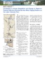
176
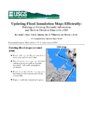
-
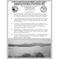
200
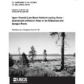
of
243
<
1
2
3
4
5
6
7
8
9
10
>