Home
Browse
Ask Us
Chat
Harmful Language Statement
Log in
Institutional Repository
Advanced Search
Year
1950
1951
1952
1953
1954
1955
1956
1957
1958
1959
1960
1961
1962
1963
1964
1965
1966
1967
1968
1969
1970
1971
1972
1973
1974
1975
1976
1977
1978
1979
1980
1981
1982
1983
1984
1985
1986
1987
1988
1989
1990
1991
1992
1993
1994
1995
1996
1997
1998
1999
2000
2001
2002
2003
2004
2005
2006
2007
2008
2009
2010
2011
2012
2013
2014
2015
2016
2017
2018
2019
TO
1950
1951
1952
1953
1954
1955
1956
1957
1958
1959
1960
1961
1962
1963
1964
1965
1966
1967
1968
1969
1970
1971
1972
1973
1974
1975
1976
1977
1978
1979
1980
1981
1982
1983
1984
1985
1986
1987
1988
1989
1990
1991
1992
1993
1994
1995
1996
1997
1998
1999
2000
2001
2002
2003
2004
2005
2006
2007
2008
2009
2010
2011
2012
2013
2014
2015
2016
2017
2018
2019
Type
Image
2,234
Text
265
Format
application/vnd.google-earth.kmz
1,727
application/pdf
312
image/jpeg
155
application/zip
40
Collection
Chicana/o Scholarship Archive
2
Electronic University Archive
17
MFA Final Projects
3
Sustainability U
12
Theses & Dissertations
169
UScholar Works
2,031
More
Filters:
Collection:
ir_*
Type:
"Image"
151
-
175
of
2,234
<
2
3
4
5
6
7
8
9
10
11
>
Gallery view
Number of results to display per page
10
25
50
100
200
Sort by Relevance
Sort by Title A-Z
Sort by Title Z-A
Sort by Date Ascending
Sort by Date Descending
Sort by Last Modified Ascending
Sort by Last Modified Descending
Title
Setname
Type
151
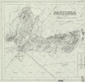
Geologic setting and origin of the Grouse Creek pluton, Box Elder County, Utah-Maps
ir_etd
Image
152
Geologic setting and origin of the Grouse Creek pluton, Box Elder County, Utah: Georeferenced map files
ir_etd
Image
153
Geology and ground-water resources of Ogden Valley, Utah
ir_etd
Text; Image
154
Geology and ore deposits of the Lucin Mining District, Box Elder County, Utah and Elko County, Nevada: Georeferenced map files
ir_etd
Image
155
Geology and ore deposits of the lucin mining district, Box Elder County, Utah, and Elko County, Nevada-Maps
ir_etd
Image
156
Geology and structure of Stansbury Island (Thesis and maps)
ir_etd
Text; Image
157
Geology and structure of Stansbury Island: Georeferenced map files
ir_etd
Image
158
Geology of the Big Piney area, Summit County, Utah
ir_etd
Text; Image
159
Geology of the Big Piney area, Summit County, Utah: Georeferenced map files
ir_etd
Image
160
Geology of the Cedar Mountains,Tooele County, Utah (Thesis and maps)
ir_etd
Text; Image
161
Geology of the Central and Southern silver Island Mountains Tooele County, Utah and Elko County, Nevada-Maps
ir_etd
Image
162
Geology of the Central and Southern Silver Island Mountains Tooele County, Utah and Elko County, Nevada: Georeferenced map files
ir_etd
Image
163
Geology of the Central Mineral Range, Beaver County, Utah
ir_etd
Text; Image
164
Geology of the Central Mineral Range, Beaver County, Utah (Google Earth map overlay KMZ file)
ir_etd
Image
165
Geology of the Central Mineral Range, Beaver County, Utah: Georeferenced map files
ir_etd
Image
166
Geology of the Cove Creek area Millard County and Beaver County, Utah
ir_etd
Text; Image
167
Geology of the Davis Knolls and northern Big Davis Mountain area, Tooele County, Utah
ir_etd
Text; Image
168
Geology of the Davis Knolls and northern Big Davis Mountain area, Tooele County, Utah (Google Earth map overlay KMZ file)
ir_etd
Image
169
Geology of the Davis Knolls and northern Big Davis Mountain area, Tooele County, Utah: Georeferenced map files
ir_etd
Image
170
Geology of the East Canyon area, Morgan County, Utah
ir_etd
Text; Image
171
Geology of the Keetley-Kamas volcanic area
ir_etd
Text; Image
172
Geology of the Keetley-Kamas volcanic area (Google Earth map overlay KMZ file)
ir_etd
Image
173
Geology of the Keetley-Kamas volcanic area: Georeferenced map files
ir_etd
Image
174
Geology of the Lost Creek-Echo Canyon Area, Morgan and Summit Counties, Utah
ir_etd
Text; Image
175
Geology of the Newfoundland Mountains, Box Elder County, Utah
ir_etd
Text; Image
151
-
175
of
2,234
<
2
3
4
5
6
7
8
9
10
11
>