Home
Browse
Ask Us
Chat
Harmful Language Statement
Log in
Institutional Repository
Advanced Search
Year
1953
1954
1955
1956
1957
1958
1959
1960
1961
1962
1963
1964
1965
1966
1967
1968
1969
1970
1971
1972
1973
1974
1975
1976
1977
1978
1979
1980
1981
1982
1983
1984
1985
1986
1987
1988
1989
1990
1991
1992
1993
1994
1995
1996
1997
1998
1999
2000
2001
2002
2003
2004
2005
2006
2007
2008
2009
2010
2011
2012
2013
2014
2015
2016
2017
2018
2019
2020
2021
2022
2023
TO
1953
1954
1955
1956
1957
1958
1959
1960
1961
1962
1963
1964
1965
1966
1967
1968
1969
1970
1971
1972
1973
1974
1975
1976
1977
1978
1979
1980
1981
1982
1983
1984
1985
1986
1987
1988
1989
1990
1991
1992
1993
1994
1995
1996
1997
1998
1999
2000
2001
2002
2003
2004
2005
2006
2007
2008
2009
2010
2011
2012
2013
2014
2015
2016
2017
2018
2019
2020
2021
2022
2023
Type
Text
158
InteractiveResource
27
Image
5
Format
application/pdf
186
application/vnd.google-earth.kmz
1
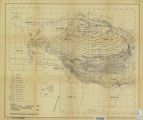
image/jpeg
1
Collection
Honors Theses Closed Archive
2
Honors Theses Open Access
3
Master of Geographic Information Scie...
20
Theses & Dissertations
131
UScholar Works
32
Filters:
Department:
"Geography"
151
-
175
of
188
<
1
2
3
4
5
6
7
8
>
Gallery view
Number of results to display per page
10
25
50
100
200
Sort by Relevance
Sort by Title A-Z
Sort by Title Z-A
Sort by Date Ascending
Sort by Date Descending
Sort by Last Modified Ascending
Sort by Last Modified Descending
Title
Date
Type
Setname
151
Snow cover trends over high Mountain asia from modis snow cover and grain size
2019
Text
ir_etd
152
South American Immigration to Utah
1972
Text
ir_etd
153
Spatial access and local demand for emergency medical services in utah
2016
Text
ir_etd
154
Spatial and aspatial residential segregation measures: Salt Lake County 1999 to 2007
2009-07-06
Text
ir_etd
155
Spatial correlation analysis of niÑo3.4 sea surface temperatures with western north america hydroclimate
2016
Text
ir_etd
156
Spatial determinants of urban growth in Chinese Cities: a case study of dongguan
2012
Text; Image
ir_uspace
157
Spatial modeling of wildland fire ignition potential in Utah
2019
Text
ir_etd
158
Spatial representation in the social interaction potential metric: an analysis of scale and parameter sensitivity
2015-05
Text
ir_etd
159
Spatial restructuring in Guangzhou city in the context of globalization and the new economy
2006
Text
ir_uspace
160
Spatial-temporal hierarchy of regional inequality of China
2010-07
Text
ir_uspace
161
Spatially calibrated model of annual accumulation rate on the Greenland ice sheet (1958-2007)
2009-01-04
Text
ir_etd
162
Spencer Roddan Master in Geographic Information Science Portfolio
2023
InteractiveResource
ir_msgis
163
Study of two vegetation-related disturbances (beetle herbivory and wildfire) in the western united states using optical remote sensing
2015
Text
ir_etd
164
Subsurface stratigraphy of the Wasatch Formation of the Uinta Basin, Utah (Google Earth map overlay KMZ file)
1963-05
Image
ir_etd
165
Subsurface stratigraphy of the Wasatch Formation of the Uinta Basin, Utah (Maps)
1963-05
Image
ir_etd
166
Summer melt regulates winter glacier flow speeds throughout Alaska
2013-01-01
Text
ir_uspace
167
Survey of earthquake preparedness actions
2016-01
Text
ir_uspace
168
Synthetic aperture radar snow conditions: seasonal and diurnal signals in the upper Indus Basin
2018
Text
ir_etd
169
Taylor Nelson Master in Geographic Information Science Portfolio
2021
InteractiveResource
ir_msgis
170
Thinking inside the black box: enhancing the social vulnerability index with an artificial neural network
2015-08
Text
ir_etd
171
Tooele Valley, Utah: A regional interpretation of the changing economies
1953-08
Text
ir_etd
172
Tracking a wildfire in areas of high relief using volunteered geographic information: a viewshed application
2014-05
Text
ir_etd
173
Tropical forcing of West Antarctic ice Sheet surface mass balance variability
2019
Text
ir_etd
174
Understanding the relationship between fire, climate, and population in Central Uganda from 1990-2010
2012-12
Text
ir_etd
175
Urban land expansion and spatial dynamics in Globalizing Shanghai
2014-01-01
Text
ir_uspace
151
-
175
of
188
<
1
2
3
4
5
6
7
8
>