Home
Browse
Ask Us
Chat
Harmful Language Statement
Log in
Institutional Repository
Advanced Search
Year
1950
1951
1952
1953
1954
1955
1956
1957
1958
1959
1960
1961
1962
1963
1964
1965
1966
1967
1968
1969
1970
1971
1972
1973
1974
1975
TO
1950
1951
1952
1953
1954
1955
1956
1957
1958
1959
1960
1961
1962
1963
1964
1965
1966
1967
1968
1969
1970
1971
1972
1973
1974
1975
Type
Image
40
Format
application/zip
40
Collection
Theses & Dissertations
38
UScholar Works
2
Filters:
Collection:
ir_*
Format:
"application/zip"
Type:
"Image"
26
-
50
of
40
<
1
2
>
Gallery view
Number of results to display per page
10
25
50
100
200
Sort by Relevance
Sort by Title A-Z
Sort by Title Z-A
Sort by Date Ascending
Sort by Date Descending
Sort by Last Modified Ascending
Sort by Last Modified Descending
Title
Setname
Type
26
Landslides in the Coal Hill area, Kane County, Utah: Georeferenced map files
ir_etd
Image
27
Mineral deposits of the Deep Creek Mountains, Tooele and Juab Counties, Utah: Georeferenced map files
ir_etd
Image
28
Mount Ogden granite: Georeferenced map files
ir_etd
Image
29
Parunuweap formation in the vicinity of Zion National Park, Utah: Georeferenced map files
ir_etd
Image
30
Petrogeneis of the Mineral Range Pluton, Southwestern Utah: Georeferenced map files
ir_etd
Image
31
Petrology and structure of the little willow series, Wasatch Mountains, Utah: Georeferenced map files
ir_etd
Image
32
Petrology of Lake Bonneville Gravels Salt Lake County, Utah: Georeferenced map files
ir_etd
Image
33
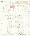
Salt Lake City, 1950: Sheet 163
ir_uspace
Image
34
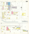
Salt Lake City, 1950: Sheet 164
ir_uspace
Image
35
Stratigraphic analysis of the Mesaverde Group, Uinta Basin, Utah: Georeferenced map files
ir_etd
Image
36
Structural geology of the Willard Peak Area, North-Central Wasatch Mountains, Utah: Georeferenced map files
ir_etd
Image
37
Subsurface geology of the Mesozoic formations overlying the Uncompahgre Uplift in Grand County, Utah: Georeferenced map files
ir_etd
Image
38
Subsurface stratigraphy of the Wasatch Formation of the Uinta Basin, Utah: Georeferenced map files
ir_etd
Image
39
Tertiary Salt Lake group in the Great Salt Lake Basin: Georeferenced map files
ir_etd
Image
40
The Thaynes formation of the Moenkopi group, North-Central Utah: Georeferenced map files
ir_etd
Image
26
-
50
of
40
<
1
2
>