In 1853 Richard Hovendon Kern was hired as topographer and artist for a government-sponsored reconnaissance led by Captain John Williams Gunnison. Kern sketched landscape panoramas as the group made its way from St. Louis toward San Francisco. When the expedition reached Sevier Lake, Utah, however, it was attacked by a band of Indians. Seven men, including Kern and Gunnison, were killed, and Kern's drawings were stolen. The sketches were soon recovered and eventually carried to Washington, D.C.
Robert Shlaer, an accomplished daguerreotypist, came across Kern's sketches many years later at the Newberry Library in Chicago. He was inspired to locate the views depicted in the drawings and to photograph them, as nearly as was possible, from the same spot where Kern had stood when he sketched them. This collection juxtaposes Kern's drawings with Shlaer's photographs, presenting 389 illustrations in geographic sequence from east to west
| Title | Alternative Title | ||
|---|---|---|---|
| 1 |
 |
Plate 331 | Garambulla Creek, composite sketch and photograph |
| 2 |
 |
Plate 298 | Desert between Grand and Green R, sketch |
| 3 |
 |
Plate 295 | Salt Creek Canon, Sept. 21st, 1853, sketch |
| 4 |
 |
Plate 297 | Salt Creek Canyon, composite sketch and photograph |
| 5 |
 |
Plate 299 | Desert between Grand and Green R, Sept. 28, sketch |
| 6 |
 |
Plate 301 | Desert between Grand and Green River, composite sketch and photograph |
| 7 |
 |
Plate 302 | Desert between Grand and Green R, Sept. 28, sketch |
| 8 |
 |
Plate 304 | Desert between Grand and Green River, composite sketch and photograph |
| 9 |
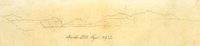 |
Plate 305 | Book (Henry) Mts Sept 29th, sketch |
| 10 |
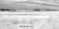 |
Plate 307 | Book Cliffs, composite sketch and photograph |
| 11 |
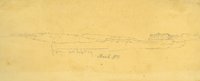 |
Plate 308 | Sketch of the San Rafael Reef on the center-left and the Beckwith Plateau on the right |
| 12 |
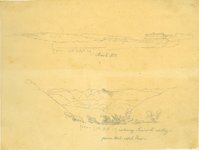 |
Plate 309 | Book Mts (San Rafael Reef and Beckwith Plateau) Sept 29th and Entering Sevier R. from Wah-satch Pass: two sketches |
| 13 |
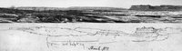 |
Plate 311 | Book Cliffs (San Rafael Reef and Beckwith Plateau), composite sketch and photograph |
| 14 |
 |
Plate 312 | Green River country, sketch |
| 15 |
 |
Plate 314 | Green River country, composite sketch and photograph |
| 16 |
 |
Plate 315 | Green River, Oct. 1, sketch |
| 17 |
 |
Plate 319 | Green River and Book Cliffs, composite sketch and photograph |
| 18 |
 |
Plate 320 | Rock Hills, Oct. 2nd, sketch |
| 19 |
 |
Plate 322 | Rock Hills, composite sketch and photograph |
| 20 |
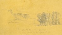 |
Plate 323 | From Camp 81 on White River at Sunset on Oct. 4, near to the Spanish Trail, sketch |
| 21 |
 |
Plate 325 | White River near the Spanish Trail, composite sketch and photograph |
| 22 |
 |
Plate 326 | On Clever Creek, Oct 5, sketch |
| 23 |
 |
Plate 328 | Clever Creek, composite sketch and photograph |
| 24 |
 |
Plate 329 | On the Garambulla Creek, Oct 10, sketch |
| 25 |
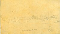 |
Plate 332 | Near Wah-satch Pass, Oct. 12, sketch |