Home
Browse
Ask Us
Chat
Harmful Language Statement
Log in
Advanced Search
Year
1849
1850
1851
1852
1853
1854
1855
1856
1857
1858
1859
1860
1861
1862
1863
1864
1865
1866
1867
1868
1869
1870
1871
1872
1873
1874
1875
1876
1877
1878
1879
1880
1881
1882
1883
1884
1885
1886
1887
1888
1889
1890
1891
1892
1893
1894
1895
1896
1897
1898
1899
1900
1901
1902
1903
1904
1905
1906
1907
1908
1909
1910
1911
1912
1913
1914
1915
1916
1917
1918
1919
1920
1921
1922
1923
1924
1925
1926
1927
1928
1929
1930
1931
1932
1933
1934
1935
1936
1937
1938
1939
1940
1941
1942
1943
1944
1945
1946
1947
1948
1949
1950
1951
1952
1953
1954
1955
1956
1957
1958
1959
1960
1961
1962
1963
1964
1965
1966
1967
1968
1969
1970
1971
1972
1973
1974
1975
1976
1977
1978
1979
1980
1981
1982
1983
1984
1985
1986
1987
1988
1989
1990
1991
1992
1993
1994
1995
1996
1997
1998
1999
2000
2001
2002
2003
2004
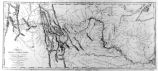
2005
2006
2007
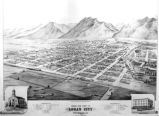
2008
2009
2010
2011
2012
2013
2014
2015
2016
2017
2018
2019
TO
1849
1850
1851
1852
1853
1854
1855
1856
1857
1858
1859
1860
1861
1862
1863
1864
1865
1866
1867
1868
1869
1870
1871
1872
1873
1874
1875
1876
1877
1878
1879
1880
1881
1882
1883
1884
1885
1886
1887
1888
1889
1890
1891
1892
1893
1894
1895
1896
1897
1898
1899
1900
1901
1902
1903
1904
1905
1906
1907
1908
1909
1910
1911
1912
1913
1914
1915
1916
1917
1918
1919
1920
1921
1922
1923
1924
1925
1926
1927
1928
1929
1930
1931
1932
1933
1934
1935
1936
1937
1938
1939
1940
1941
1942
1943
1944
1945
1946
1947
1948
1949
1950
1951
1952
1953
1954
1955
1956
1957
1958
1959
1960
1961
1962
1963
1964
1965
1966
1967
1968
1969
1970
1971
1972
1973
1974
1975
1976
1977
1978
1979
1980
1981
1982
1983
1984
1985
1986
1987
1988
1989
1990
1991
1992
1993
1994
1995
1996
1997
1998
1999
2000
2001
2002
2003
2004
2005
2006
2007
2008
2009
2010
2011
2012
2013
2014
2015
2016
2017
2018
2019
Type
Image
270
Image/StillImage
163
Text
84
Format
image/jpeg
395
application/pdf
114
application/xml
3
application/zip
3
Collection
Art and Art History
169
Aziz Suryal Atiya papers
5
Beckwith Photograph Collection
8
Classified Photographs
62
Clifton Bray Film Negatives
10
Extractions from the Land: Mining and...
2
Marriott Library Digital Stacks
1
Olympic Legacy
5
Peoples of Utah Revisited
6
Photo Archives
12
Salt Lake Tribune Negative Collection
14
Shipler Commercial Photographers
6
Ski and Snow Sports Archives
1
Theses & Dissertations
1
UAIDA Main Collection
201
Vernal Express Photographs
2
Western Waters Electronic Resources
4
Westminster University Finding Aids (...
3
Westminster University Photographs
5
More
Filters:
Subject:
"Maps"
151
-
175
of
517
<
2
3
4
5
6
7
8
9
10
11
>
Gallery view
Number of results to display per page
10
25
50
100
200
Sort by Relevance
Sort by Title A-Z
Sort by Title Z-A
Sort by Date Ascending
Sort by Date Descending
Sort by Last Modified Ascending
Sort by Last Modified Descending
Title
Date
Type
Setname
151
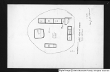
Kanosh, Black Rock, Pumice and Connor Spring scrapbook [03] : Kanosh mounds
1930
Image
dc_bpc
152
Kirtland, Ohio P.1
Image
dha_cp
153
Kirtland, Ohio P.2
Image
dha_cp
154
Lake Bonneville P.1
Image
dha_cp
155
Lake Bonneville P.2
Image
dha_cp
156
Land Added to Confederated Ute Indian Reservation 1875-76
Text
uaida_main
157
Land Allotments, White Mesa
Image/StillImage
uaida_main
158
Land Use--Map P.1
Image
dha_cp
159
Lepcis Magna, plan
Image
uu_aah_art
160
Letter from Agent Byrnes to Commissioner of Indian Affairs John D.C. Atkins dated November 28, 1887
1887-11-28
Text
uaida_main
161
Letter from Agent Robert Waugh to Commissioner of Indian Affairs T.J. Morgan dated July 30, 1892
1892-07-30
Text
uaida_main
162
Letter from Brigham Young to the Commissioner of Indian Affairs dated June 28, 1853
1853-06-28
Text
uaida_main
163
Letter to Commissioner of Indian Affairs J.T. Morgan from Agent Robert Waugh dated March 28, 1892
1892-03-28
Text
uaida_main
164
Lewis & Clark Trail P.1
Image
dha_cp
165
Lewis & Clark Trail P.2
Image
dha_cp
166
Little Cottonwood Canyon Mining District P.1
Image
dha_cp
167
Logan, Utah (Birdseye View) P.1
Image
dha_cp
168
Lucin Cut-off P.1
Image
dha_cp
169
Map based on Bunyan's "Pilgrim's Progress"
Image
uu_aah_art
170
Map of a portion of the Uncompahgre Ute Indian Reservation
1908
Image/StillImage
uaida_main
171
Map of a portion of the Uncompahgre Ute Indian Reservation, surveyed and subdivided for allotments to the Uncompahgre Ute Indians in accordance with the Act approved June 1880 by authority of Honorable N. C. McFarland, Commissioner General Land Office Daniel G. Major U.S. Surveyor 1882-1883
1882; 1883
Image/StillImage
uaida_main
172
Map of America
Image
uu_aah_art
173
Map of Chief Washakie's Hunting and Fighting Territory, prepare by Oscar Mosserly, 1930
Image/StillImage
uaida_main
174
Map of Constantinople
Image
uu_aah_art
175
Map of Dry Gulch Irrigation District, Uintah Indian Reservation, Utah
Image/StillImage
uaida_main
151
-
175
of
517
<
2
3
4
5
6
7
8
9
10
11
>