Home
Browse
Ask Us
Chat
Harmful Language Statement
Log in
Advanced Search
Year
1872
1873
1874
1875
1876
1877
1878
1879
1880
1881
1882
1883
1884
1885
1886
1887
1888
1889
1890
1891
1892
1893
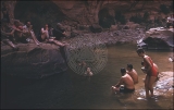
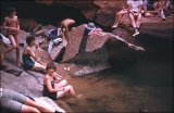
1894
1895
1896
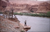
1897
1898
1899
1900
1901
1902
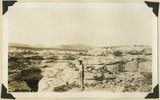
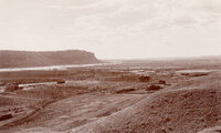
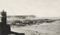
1903
1904
1905
1906
1907
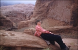
1908
1909
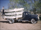
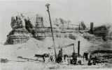
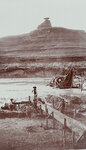
1910
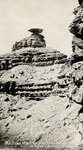
1911
1912
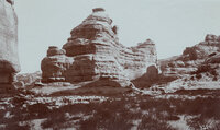
1913
1914
1915
1916
1917
1918
1919
1920
1921
1922
1923
1924
1925
1926
1927
1928
1929
1930
1931
1932
1933
1934
1935
1936
1937
1938
1939
1940
1941
1942
1943
1944
1945
1946
1947
1948
1949
1950
1951
1952
1953
1954
1955
1956
1957
1958
1959
1960
1961
1962
1963
1964
1965
1966
1967
1968
1969
1970
1971
1972
1973
1974
1975
1976
1977
1978
1979
1980
1981
1982
1983
1984
1985
1986
1987
1988
1989
1990
1991
1992
1993
1994
1995
1996
1997
1998
1999
2000
2001
2002
2003
2004
2005
2006
2007
2008
2009
2010
TO
1872
1873
1874
1875
1876
1877
1878
1879
1880
1881
1882
1883
1884
1885
1886
1887
1888
1889
1890
1891
1892
1893
1894
1895
1896
1897
1898
1899
1900
1901
1902
1903
1904
1905
1906
1907
1908
1909
1910
1911
1912
1913
1914
1915
1916
1917
1918
1919
1920
1921
1922
1923
1924
1925
1926
1927
1928
1929
1930
1931
1932
1933
1934
1935
1936
1937
1938
1939
1940
1941
1942
1943
1944
1945
1946
1947
1948
1949
1950
1951
1952
1953
1954
1955
1956
1957
1958
1959
1960
1961
1962
1963
1964
1965
1966
1967
1968
1969
1970
1971
1972
1973
1974
1975
1976
1977
1978
1979
1980
1981
1982
1983
1984
1985
1986
1987
1988
1989
1990
1991
1992
1993
1994
1995
1996
1997
1998
1999
2000
2001
2002
2003
2004
2005
2006
2007
2008
2009
2010
Type
Image
1,955
Image/StillImage
1,542
Text
286
Image/MovingImage
5
Sound
1
Format
image/jpeg
3,365
application/pdf
727
video/mp4
5
audio/mpeg
1
Collection
Beckwith Photograph Collection
2
Home Movie Collection
5
Photo Archives
1,412
Ski and Snow Sports Archives
43
UAIDA Main Collection
948
Utah Humanities Research Foundation
25
Utah Quilt Heritage Records
2
Utah River Running Photo Archives
1,665
Western Soundscape
1
Western Waters NEH
1
More
Filters:
Spatial Coverage:
"San Juan County (Utah)"
26
-
50
of
4,104
<
1
2
3
4
5
6
7
8
9
10
>
Gallery view
Number of results to display per page
10
25
50
100
200
Sort by Relevance
Sort by Title A-Z
Sort by Title Z-A
Sort by Date Ascending
Sort by Date Descending
Sort by Last Modified Ascending
Sort by Last Modified Descending
Title
Date
Type
Setname
26
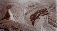
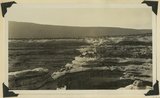
"Goose-neck Loop, San Juan River Canyon, 33 miles west of Bluff, Utah. Three miles around Loop and 1000 feet deep."
1890; 1891; 1892; 1893; 1894; 1895; 1896; 1897; 1898; 1899; 1900
Image
uum_map_rr
27
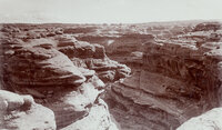
"Grand Gulch near junction with San Juan River. 600 feet deep."
1890; 1891; 1892; 1893; 1894; 1895; 1896; 1897; 1898; 1899; 1900
Image
uum_map_rr
28
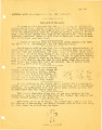
"Here and There Notes" from St. Christopher's Mission, 1946
1946
Text
uaida_main
29
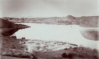
"Hermit Lake in western San Juan Co., Utah. 12 miles east of Colorado River, 1/4 mile wide and 1/2 mile long. The Henry Mountains, faintly seen, 75 miles distant." This lake was on the famous Hole-in-the-Rock trail. The natural dam failed in 1914? The lake no longer exists.
1890; 1891; 1892; 1893; 1894; 1895; 1896; 1897; 1898; 1899; 1900
Image
uum_map_rr
30
"Holding Breath"contest pool
1957; 1958; 1959; 1960; 1961; 1962
uum_map_rr
31
"Holding Breath"contest pool
1957; 1958; 1959; 1960; 1961; 1962
uum_map_rr
32
"Holding Breath"contest pool
1957; 1958; 1959; 1960; 1961; 1962
uum_map_rr
33
"Joe photographing bridge from south side."
1951-05-15
uum_map_rr
34
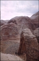
"Kachina" (Cedar Mesa) sandstone trenched 400± feet by White Canyon., just above Sipapu natural bridge, San Juan County, Utah, 1932.
1932
Image
uum_map
35
"Kachina" (Cedar Mesa) sandstone White Canyon. Sipapu natural bridge at left bottom. San Juan County, Utah, 1932.
1932
Image
uum_map
36
"Knowles Canyon mile 134. East side of river."
1951-05-12
uum_map_rr
37
"Looking down N. W. from top of Rainbow Bridge our companions 300 ft below."
1951-05-15
uum_map_rr
38
"Looking down to Barbara and Joe below."
1951-05
uum_map_rr
39
"Looking southwest from Bluff, Utah."
1890; 1891; 1892; 1893; 1894; 1895; 1896; 1897; 1898; 1899; 1900
Image
uum_map_rr
40
"Looking southwest from Bluff, Utah."
1890; 1891; 1892; 1893; 1894; 1895; 1896; 1897; 1898; 1899; 1900
Image
uum_map_rr
41
"Lovely, Lovely!"
1957; 1958; 1959; 1960; 1961; 1962
uum_map_rr
42
"Lunch time beneath Rainbow Bridge. 5-15-51"
1951-05-15
uum_map_rr
43
"Marjorie G. Paul looking over our boats prior to departure for Hite."
1951-05-10
uum_map_rr
44
"Marjorie in a relaxed pose on top of rainbow Bridge- Navajo Mt and clouds to East. 5-15-51."
1951-05-15
uum_map_rr
45
"Marjorie. on ledge of old mine site. Mile134." [Olympia Bar]
1951-05-12
uum_map_rr
46
"Members of the Bluff City Precilla Club investigating the 'Cause Why' of oil drilling machinery."
1900; 1901; 1902; 1903; 1904; 1905; 1906; 1907; 1908; 1909; 1910
Image
uum_map
47
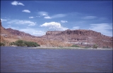
"Mexican Hat on the San Juan River at Wilson's Camp."
1890; 1891; 1892; 1893; 1894; 1895; 1896; 1897; 1898; 1899; 1900
Image
uum_map_rr
48
"Mexican Hat or Blanced Rock in the background of placer miners. View in Oil Basin, 25 miles west of Bluff, Utah."
1894
Image
uum_map_rr
49
"Mokee Castle, Grand Gulch, San Juan County, Utah. Around its base and under its sheltering cliffs were found many relics of the old cliff-dwellers."
1890; 1891; 1892; 1893; 1894; 1895; 1896; 1897; 1898; 1899; 1900
Image
uum_map_rr
50
"Moki Canyon looking up to Verona on ledge."
1951-05
uum_map_rr
26
-
50
of
4,104
<
1
2
3
4
5
6
7
8
9
10
>