Home
Browse
Ask Us
Chat
Harmful Language Statement
Log in
University of Utah Marriott Library
Advanced Search
Year
1930
1931
1932
1933
1934
1935
1936
1937
1938
1939
1940
1941
1942
1943
1944
1945
1946
1947
1948
1949
1950
1951
1952
1953
1954
1955
1956
1957
1958
1959
1960
1961
1962
1963
1964
1965
1966
1967
1968
1969
1970
1971
1972
1973
1974
1975
1976
1977
1978
1979
1980
1981
1982
1983
1984
1985
1986
1987
1988
1989
1990
1991
1992
1993
1994
1995
1996
1997
1998
1999
2000
2001
2002
2003
2004
2005
2006
TO
1930
1931
1932
1933
1934
1935
1936
1937
1938
1939
1940
1941
1942
1943
1944
1945
1946
1947
1948
1949
1950
1951
1952
1953
1954
1955
1956
1957
1958
1959
1960
1961
1962
1963
1964
1965
1966
1967
1968
1969
1970
1971
1972
1973
1974
1975
1976
1977
1978
1979
1980
1981
1982
1983
1984
1985
1986
1987
1988
1989
1990
1991
1992
1993
1994
1995
1996
1997
1998
1999
2000
2001
2002
2003
2004
2005
2006
Type
Image/StillImage
8
Format
image/jpeg
1,963
application/pdf
89
Collection
Photo Archives
2,044
Ski and Snow Sports Archives
8
Filters:
Spatial Coverage:
"Bear River Watershed (Utah-Idaho)"
776
-
800
of
2,052
<
27
28
29
30
31
32
33
34
35
36
>
Gallery view
Number of results to display per page
10
25
50
100
200
Sort by Relevance
Sort by Title A-Z
Sort by Title Z-A
Sort by Date Ascending
Sort by Date Descending
Sort by Last Modified Ascending
Sort by Last Modified Descending
Title
Date
Type
Setname
776
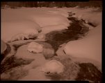
East Fork, winter [negative]
2002-03-20
uum_map
777
Emigrant burial site [negative]
2002-05-30
uum_map
778
Emigrant burial site at Soda Point (negative) [1]
2001-10-10
uum_map
779
Emigrant burial site at Soda Point (negative) [2]
2001-10-10
uum_map
780
Emigrant burial site number 13 and 14 [Contact prints]
2002-05-30
uum_map
781
Falls at Ostler Fork (negative) [1]
2002-08-24; 2002-08-25
uum_map
782
Falls at Ostler Fork (negative) [2]
2002-08-24; 2002-08-25
uum_map
783
Falls at Ostler Fork (negative) [3]
2002-08-24; 2002-08-25
uum_map
784
Falls at Ostler Fork (negative) [4]
2002-08-24; 2002-08-25
uum_map
785
Falls at Ostler Fork (negative) [5]
2003-07-16; 2003-07-17
uum_map
786
Falls at Ostler Fork (negative) [5]
2002-08-24; 2002-08-25
uum_map
787
Falls at Ostler Fork (negative) [6]
2003-07-16; 2003-07-17
uum_map
788
Falls at Ostler Fork (negative) [7]
2003-07-16; 2003-07-17
uum_map
789
Franklin County, Idaho: Battle Creek; Rifle Range view; Mound Valley oxbow, etc. [Contact prints]
2002-05
uum_map
790
Gentile Valley, Idaho [1]
2002-05-16
uum_map
791
Gentile Valley, Idaho [2]
2002-05-16
uum_map
792
Glacial moraine and Hayden Peak (negative) [1]
2001-07-23
uum_map
793
Glacial moraine and Hayden Peak (negative) [2]
2001-07-23
uum_map
794
Glacial moraine and Hayden Peak (negative) [3]
2001-07-23
uum_map
795
Grace power plant generators (negative) [1]
2002-05-31
uum_map
796
Grace power plant generators (negative) [2]
2002-05-31
uum_map
797
Grace power plant generators (negative) [3]
2002-05-31
uum_map
798
Grace power plant generators (negative) [4]
2002-05-31
uum_map
799
Grace power plant surge tower (negative) [1]
2002-05-31
uum_map
800
Grace power plant surge tower (negative) [2]
2002-05-31
uum_map
776
-
800
of
2,052
<
27
28
29
30
31
32
33
34
35
36
>