| | Title | Date | Type | Setname |
|---|
| 1151 |  | Desert View looking north, Grand Canyon National Park, Arizona | 1930; 1931; 1932; 1933; 1934; 1935; 1936; 1937; 1938; 1939; 1940; 1941; 1942; 1943; 1944; 1945 | Image | uum_map |
| 1152 | 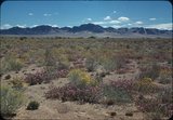 | Desert wildflowers | 1934; 1935; 1936; 1937; 1938; 1939; 1940; 1941; 1942; 1943; 1944; 1945; 1946; 1947; 1948; 1949 | Image/StillImage | uum_map_rr |
| 1153 |  | Desert wildflowers and Joshua tree [1] | 1937; 1938; 1939; 1940; 1941; 1942; 1943; 1944; 1945; 1946; 1947; 1948; 1949; 1950; 1951; 1952; 1953; 1954; 1955; 1956; 1957; 1958; 1959; 1960; 1961; 1962; 1963; 1964; 1965; 1966; 1967; 1968; 1969; 1970 | Image | uum_map_rr |
| 1154 |  | Desert wildflowers and Joshua tree [2] | 1937; 1938; 1939; 1940; 1941; 1942; 1943; 1944; 1945; 1946; 1947; 1948; 1949; 1950; 1951; 1952; 1953; 1954; 1955; 1956; 1957; 1958; 1959; 1960; 1961; 1962; 1963; 1964; 1965; 1966; 1967; 1968; 1969; 1970 | Image | uum_map_rr |
| 1155 |  | Desert wildflowers and Joshua tree [3] | 1937; 1938; 1939; 1940; 1941; 1942; 1943; 1944; 1945; 1946; 1947; 1948; 1949; 1950; 1951; 1952; 1953; 1954; 1955; 1956; 1957; 1958; 1959; 1960; 1961; 1962; 1963; 1964; 1965; 1966; 1967; 1968; 1969; 1970; 1971; 1972; 1973; 1974; 1975; 1976; 1977; 1978; 1979; 1980 | Image | uum_map_rr |
| 1156 | 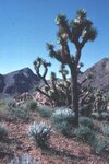 | Desert wildflowers and Joshua tree [4] | 1937; 1938; 1939; 1940; 1941; 1942; 1943; 1944; 1945; 1946; 1947; 1948; 1949; 1950; 1951; 1952; 1953; 1954; 1955; 1956; 1957; 1958; 1959; 1960; 1961; 1962; 1963; 1964; 1965; 1966; 1967; 1968; 1969; 1970; 1971; 1972; 1973; 1974; 1975; 1976; 1977; 1978; 1979; 1980 | Image | uum_map_rr |
| 1157 |  | Desert wildflowers and Joshua tree [5] | 1937; 1938; 1939; 1940; 1941; 1942; 1943; 1944; 1945; 1946; 1947; 1948; 1949; 1950; 1951; 1952; 1953; 1954; 1955; 1956; 1957; 1958; 1959; 1960; 1961; 1962; 1963; 1964; 1965; 1966; 1967; 1968; 1969; 1970 | Image | uum_map_rr |
| 1158 |  | Desert wildflowers: Ocotillo | 1937; 1938; 1939; 1940; 1941; 1942; 1943; 1944; 1945; 1946; 1947; 1948; 1949; 1950; 1951; 1952; 1953; 1954; 1955; 1956; 1957; 1958; 1959; 1960; 1961; 1962; 1963; 1964; 1965; 1966; 1967; 1968; 1969; 1970 | Image | uum_map_rr |
| 1159 |  | The Desert: exploring the Southwest | 1949 | Image/MovingImage | uum_avac |
| 1160 |  | Detail of dike 6 mi. SE of Agathla Needle, Laguna Creek valley, 1910 (Photo G149) | 1910 | Image | uum_map |
| 1161 |  | Detail of dike 6 mi. SE of Agathla Needle, Laguna Creek valley, 1910 (Photo G150) | 1910 | Image | uum_map |
| 1162 |  | Detail of dike 6 mi. SE of Agathla Needle, Laguna Creek valley, 1910 (Photo G151) | 1910 | Image | uum_map |
| 1163 |  | Detail, ash, Twin Buttes (Photo G250) | 1911 | Image | uum_map |
| 1164 |  | Detail, Dolores section, as in No. 742 (Photo G425) | 1913 | Image | uum_map |
| 1165 |  | Detail, McElmo, Blue Canyon, 1914 | 1914 | Image | uum_map |
| 1166 | 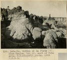 | Details, McElmo or La Plata (?), Blue Canyon, 18± mi. east of Tuba, Ariz. (M. R. Campbell photo, 1909, U.S.G.S.) | 1909 | Image | uum_map |
| 1167 | 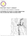 | Determining the source of water pumped from wells along the lower Colorado River | 1993 | Text | wwdl_er |
| 1168 |  | Diamond jubilee gems: Snowflake Stake of Zion | 1962 | Text | uum_msa |
| 1169 |  | Diaries of John Bushman, 1871-1923, part 1: 1871-1889 | 1871; 1872; 1873; 1874; 1875; 1876; 1877; 1878; 1879; 1880; 1881; 1882; 1883; 1884; 1885; 1886; 1887; 1888; 1889 | Text | uum_msa |
| 1170 |  | Diaries of John Bushman, 1871-1923, part 2: 1890-1923 | 1890; 1891; 1892; 1893; 1894; 1895; 1896; 1897; 1898; 1899; 1900; 1901; 1902; 1903; 1904; 1905; 1906; 1907; 1908; 1909; 1910; 1911; 1912; 1913; 1914; 1915; 1916; 1917; 1918; 1919; 1920; 1921; 1922; 1923 | Text | uum_msa |
| 1171 |  | Diary of Andrew Smith Gibbons, 1858, 1877, 1878 | 1858; 1877; 1888 | Text | uum_msa |
| 1172 |  | Diary of John McLaws, Jr., transcript | 1852; 1853; 1854; 1855; 1856; 1857; 1858; 1859; 1860; 1861; 1862; 1863; 1864; 1865; 1866; 1867; 1868; 1869; 1870; 1871; 1872; 1873; 1874; 1875; 1876; 1877; 1878; 1879; 1880; 1881; 1882; 1883; 1884; 1885; 1886; 1887; 1888; 1889; 1890; 1891; 1892; 1893; 1894; 1895 | Text | uum_msa |
| 1173 |  | Diary of William Henry Solomon, 1873 and 1874 (excerpts) | 1873; 1874 | Text | uum_msa |
| 1174 | 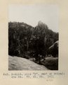 | Dike "B", east of Baigaiche Mt. VI, 45, 55. 1911 (Photo N-M114) | 1911 | Image | uum_map |
| 1175 |  | Dike "T" from south 1/2 (Photo G399) | 1913 | Image | uum_map |