Home
Browse
Ask Us
Chat
Harmful Language Statement
Log in
Western Waters Digital Library
Advanced Search
Year
1848
1849
1850
1851
1852
1853
1854
1855
1856
1857
1858
1859
1860
1861
1862
1863
1864
1865
1866
1867
1868
1869
1870
1871
1872
1873
1874
1875
1876
1877
1878
1879
1880
1881
1882
1883
1884
1885
1886
1887
1888
1889
1890
1891
1892
1893
1894
1895
1896
1897
1898
1899
1900
1901
1902
1903
1904
1905
1906
1907
1908
1909
1910
1911
1912
1913
1914
1915
1916
1917
1918
1919
1920
1921
1922
1923
1924
1925
1926
1927
1928
1929
1930
1931
1932
1933
1934
1935
1936
1937
1938
1939
1940
1941
1942
1943
1944
1945
1946
1947
1948
1949
1950
1951
1952
1953
1954
1955
1956
1957
1958
1959
1960
1961
1962
1963
1964
1965
1966
1967
1968
1969
1970
1971
1972
1973
1974
1975
1976
1977
1978
1979
1980
1981
1982
1983
1984
1985
1986
1987
1988
1989
1990
1991
1992
1993
1994
1995
1996
1997
1998
1999
2000
2001
2002
2003
2004
2005
2006
2007
2008
2009
TO
1848
1849
1850
1851
1852
1853
1854
1855
1856
1857
1858
1859
1860
1861
1862
1863
1864
1865
1866
1867
1868
1869
1870
1871
1872
1873
1874
1875
1876
1877
1878
1879
1880
1881
1882
1883
1884
1885
1886
1887
1888
1889
1890
1891
1892
1893
1894
1895
1896
1897
1898
1899
1900
1901
1902
1903
1904
1905
1906
1907
1908
1909
1910
1911
1912
1913
1914
1915
1916
1917
1918
1919
1920
1921
1922
1923
1924
1925
1926
1927
1928
1929
1930
1931
1932
1933
1934
1935
1936
1937
1938
1939
1940
1941
1942
1943
1944
1945
1946
1947
1948
1949
1950
1951
1952
1953
1954
1955
1956
1957
1958
1959
1960
1961
1962
1963
1964
1965
1966
1967
1968
1969
1970
1971
1972
1973
1974
1975
1976
1977
1978
1979
1980
1981
1982
1983
1984
1985
1986
1987
1988
1989
1990
1991
1992
1993
1994
1995
1996
1997
1998
1999
2000
2001
2002
2003
2004
2005
2006
2007
2008
2009
Type
Text
653
Sound
16
Image
12
InteractiveResource
3
Format
application/pdf
637
video/mp4
13
image/jpeg
8
Collection
Western Waters AZ. vs CA.
29
Western Waters Audio-Video
16
Western Waters Books
8
Western Waters Diaries
3
Western Waters Documents
77
Western Waters Electronic Resources
270
Western Waters Law of the Colorado River
20
Western Waters NEH
253
Western Waters Photographs
2
Western Waters Treaties and Compacts
3
More
Filters:
Collection:
wwdl_*
501
-
525
of
681
<
16
17
18
19
20
21
22
23
24
25
>
Gallery view
Number of results to display per page
10
25
50
100
200
Sort by Relevance
Sort by Title A-Z
Sort by Title Z-A
Sort by Date Ascending
Sort by Date Descending
Sort by Last Modified Ascending
Sort by Last Modified Descending
Title
Setname
Type
501
Taos trappers: the fur trade in the Far Southwest, 1540-1846 [excerpt]
wwdl_neh
Text
502
Teaching Soil and Water Conservation, A Classroom and Field Guide
wwdl_documents
Text
503
Ten rivers in America's future, from volume 2, the Report of the President's Water Resources Policy Commission
wwdl_documents
Text
504
Tenth Annual Report of the Upper Colorado River Commission
wwdl_documents
Text
505
The Thirteenth Annual report of the Upper Colorado River Commission
wwdl_documents
Text
506
Thoughts on Zuni Religion
wwdl_neh
Text
507
Thumbnail History of the Shoshone-Bannock Indians
wwdl_neh
Text
508
Total dissolved gas and water temperature in the Lower Columbia River, Oregon and Washington, 2003: quality-assurance data and comparison to water-quality standards
wwdl_er
Text
509
Total dissolved gas, barometric pressure, and water temperature data, lower Columbia River, Oregon and Washington, 1996
wwdl_er
Text
510
Toxic contaminants survery of thelower Rio Grande, lower Arroyo Colorado, and associated coastal waters
wwdl_er
Text
511
Trace elements in streambed sediment and fish liver at selected sites in the Upper Colorado River basin, Colorado 1995-96
wwdl_er
Text
512
Transboundary Water Resources Management in the Upper Rio Grande Basin
wwdl_er
Text
513
Traveltime characteristics of Gore Creek and Black Gore Creek, upper Colorado River basin, Colorado
wwdl_er
Text
514
Tube 211: Maps - Colorado River Storage Project And Participating Projects (September 1970)
wwdl_neh
Text
515
Tube 211: Maps - State of Colorado
wwdl_neh
Text
516
Tube 211: Maps - Upper Colorado Region (October 1965)
wwdl_neh
Text
517
Tube 211: Upper Colorado Region (October 1965, Revised Spetember 82)
wwdl_neh
Text
518
Tube 214 : Clay Basin, Utah (1952)
wwdl_neh
Text
519
Tube 214: Maps - Clay Basin Utah (1952)
wwdl_neh
Text
520
Tube 214: Maps - Dutch John, Utah - Wyo (1966)
wwdl_neh
Text
521
Tube 214: Maps - Goslin MTN., Utah (1952)
wwdl_neh
Text
522
Tube 214: Maps - Willow Creek Butte, Utah-Colo (1952)
wwdl_neh
Text
523
Tube 214: Maps -Swallow Canyon, Utah-Colo (1952)
wwdl_neh
Text
524
Tube 217: Maps - Delta Colorado (1980)
wwdl_neh
Text
525
Twelfth Annual report of the Upper Colorado River Commission
wwdl_documents
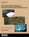
Text
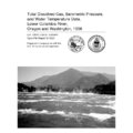
501
-
525
of
681
<
16
17
18
19
20
21
22
23
24
25
>