In 1853 Richard Hovendon Kern was hired as topographer and artist for a government-sponsored reconnaissance led by Captain John Williams Gunnison. Kern sketched landscape panoramas as the group made its way from St. Louis toward San Francisco. When the expedition reached Sevier Lake, Utah, however, it was attacked by a band of Indians. Seven men, including Kern and Gunnison, were killed, and Kern's drawings were stolen. The sketches were soon recovered and eventually carried to Washington, D.C.
Robert Shlaer, an accomplished daguerreotypist, came across Kern's sketches many years later at the Newberry Library in Chicago. He was inspired to locate the views depicted in the drawings and to photograph them, as nearly as was possible, from the same spot where Kern had stood when he sketched them. This collection juxtaposes Kern's drawings with Shlaer's photographs, presenting 389 illustrations in geographic sequence from east to west
Filters: Collection:"uu_rkfws"
| Title | Alternative Title | ||
|---|---|---|---|
| 51 | 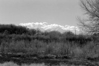 | Plate 29 | Mouth of Apishpa River at the Arkansas River, photograph |
| 52 | 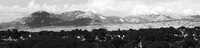 | Plate 293 | Elk Mountains, photograph |
| 53 |  | Plate 296 | Salt Creek Canyon, photograph |
| 54 |  | Plate 300 | Desert between Grand and Green River, photograph |
| 55 |  | Plate 303 | Desert between Grand and Green River, photograph |
| 56 |  | Plate 306 | Henry Mountains, photograph |
| 57 |  | Plate 310 | San Rafael Reef and Beckwith Plateau, photograph |
| 58 |  | Plate 313 | Green River country, photograph |
| 59 |  | Plate 318 | Green River and Book Cliffs, photograph |
| 60 |  | Plate 321 | Rock Hills panoramic photograph |
| 61 |  | Plate 324 | White River near the Spanish Trail, photograph |
| 62 |  | Plate 327 | Clever Creek, photograph |
| 63 | 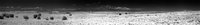 | Plate 33 | Panorama from Mount Mestas to Pikes Peak, photograph |
| 64 |  | Plate 330 | Garambulla Creek, photograph |
| 65 |  | Plate 333 | Near Wasatch Pass, photograph |
| 66 |  | Plate 336 | Little Mountains, photograph |
| 67 |  | Plate 340 | Wasatch Mountains, White Pine Creek, photograph |
| 68 |  | Plate 343 | Entering Sevier River valley from Wasatch Pass, photograph |
| 69 |  | Plate 346 | Kah-kah-nak-ah-rah-nit, Wah-satch Mts, photograph |
| 70 |  | Plate 350 | From Mormon Bridge, Sevier River, Oct. 20th, photograph |
| 71 |  | Plate 354 | Wasatch Mountains, panoramic photograph |
| 72 |  | Plate 358 | Panoramic photograph |
| 73 |  | Plate 36 | Pikes Peak from distance, photograph |
| 74 |  | Plate 361 | Jo-on-Kah-Pa-ga-mu, photograph |
| 75 | 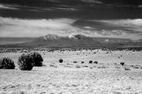 | Plate 39 | Spanish Peaks, photograph |