In 1853 Richard Hovendon Kern was hired as topographer and artist for a government-sponsored reconnaissance led by Captain John Williams Gunnison. Kern sketched landscape panoramas as the group made its way from St. Louis toward San Francisco. When the expedition reached Sevier Lake, Utah, however, it was attacked by a band of Indians. Seven men, including Kern and Gunnison, were killed, and Kern's drawings were stolen. The sketches were soon recovered and eventually carried to Washington, D.C.
Robert Shlaer, an accomplished daguerreotypist, came across Kern's sketches many years later at the Newberry Library in Chicago. He was inspired to locate the views depicted in the drawings and to photograph them, as nearly as was possible, from the same spot where Kern had stood when he sketched them. This collection juxtaposes Kern's drawings with Shlaer's photographs, presenting 389 illustrations in geographic sequence from east to west
Filters: Collection: "uu_rkfws"
| Title | Alternative Title | ||
|---|---|---|---|
| 201 |
 |
Plate 201 | Valley at the mouth of Cochetopa Pass, composite drawing and photograph. |
| 202 |
 |
Plate 202 | Razor Creek near its junction with Cochetopa Creek |
| 203 |
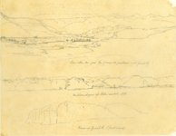 |
Plate 203 | Three sketches with minimally helpful titles drawn on one sheet by Richard Kern from near Gunnison, CO, along Cochetopa (Tomichi) Creek near its junction with the Grand (today Gunnison) River. |
| 204 |
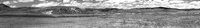 |
Plate 204 | Photograph by Robert Shlaer of lower Razor Creek |
| 205 |
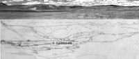 |
Plate 205 | Composite sketch and photograph of the view down Razor Creek Valley as it joins Cochetopa Creek |
| 206 |
 |
Plate 206 | Western slopes of Sah-Watch Mts, sketch |
| 207 |
 |
Plate 207 | West end of Coo-che-to-pa Pass, sketch |
| 208 |
 |
Plate 208 | Rock outcrops, sketch |
| 209 |
 |
Plate 209 | Rock outcrops, photograph |
| 210 |
 |
Plate 210 | Rock outcrops, composite sketch and photograph |
| 211 |
 |
Plate 211 | View up Grand River (first mesa), sketch |
| 212 |
 |
Plate 212 | View up Grand River (first mesa), photograph |
| 213 |
 |
Plate 213 | View up Grand River (first mesa), composite sketch and photograph |
| 214 |
 |
Plate 214 | On Grand River, sketch |
| 215 |
 |
Plate 215 | On Grand River, photograph |
| 216 |
 |
Plate 216 | On Grand River, composite sketch and photograph |
| 217 |
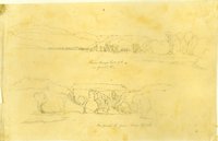 |
Plate 217 | From Camp, Sept. 7th, on Grand River (two sketches) |
| 218 |
 |
Plate 218 | From Camp, Sept. 7th, on Grand River, sketch |
| 219 |
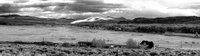 |
Plate 219 | Grand River from Sept. 7th camp, photograph |
| 220 |
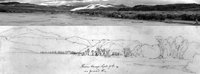 |
Plate 220 | From Camp, Sept. 7th, on Grand River, composite sketch and photograph |
| 221 |
 |
Plate 221 | On Grand River,from Camp, Sept. 7th, sketch |
| 222 |
 |
Plate 222 | On Grand River,from Camp, Sept. 7th, photograph |
| 223 |
 |
Plate 223 | On Grand River,from Camp, Sept. 7th, composite sketch and photograph |
| 224 |
 |
Plate 224 | Valley of Grand River, Sept. 8th, sketch |
| 225 |
 |
Plate 225 | Valley of Gunnison River and Blue Mesa Reservoir, photograph |
| 226 |
 |
Plate 226 | Valley of Grand River, Sept. 8th, composite sketch and photograph |
| 227 |
 |
Plate 227 | On Twin Creek, Grand River country, sketch |
| 228 |
 |
Plate 228 | On Twin Creek, Grand River country, photograph |
| 229 |
 |
Plate 229 | On Twin Creek, Grand River country, composite sketch and photograph |
| 230 |
 |
Plate 230 | Grand River, Sept. 7th, 1853, sketch |
| 231 |
 |
Plate 231 | Grand River, color photograph |
| 232 |
 |
Plate 232 | Grand River, composite sketch and photograph |
| 233 |
 |
Plate 233 | Sept 7th on Grand River, sketch |
| 234 |
 |
Plate 234 | Blue Mesa Reservoir color photograph |
| 235 |
 |
Plate 235 | Grand River, composite sketch and photograph |
| 236 |
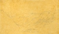 |
Plate 236 | Side valley of Grand River, sketch |
| 237 |
 |
Plate 237 | Side valley of Grand River, photograph |
| 238 |
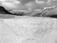 |
Plate 238 | Side valley of Grand River, composite sketch and photograph |
| 239 |
 |
Plate 239 | Affluent of Grand R, Sept 8th |
| 240 |
 |
Plate 240 | Grand River Canon, Sept 8th, 1853, sketch |
| 241 |
 |
Plate 241 | Northern slope on Grand R., Sept 8th, sketch |
| 242 |
 |
Plate 242 | View of ordinary lateral ravines on Grand River (Stanley lithograph from R. H. Kern sketch) |
| 243 |
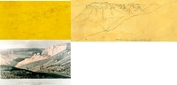 |
Plate 243 | Lateral ravines on Grand River, composite of Kern sketch and Stanley lithograph |
| 244 |
 |
Plate 244 | Grand River Canon, panoramic photograph |
| 245 |
 |
Plate 245 | Grand River canyon, composite of panoramic photograph and two sketches |
| 246 |
 |
Plate 246 | Side canyon of Grand R, sketch |
| 247 |
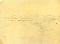 |
Plate 247 | Canon of Grand River [Lake Fork], Sept 13th [i.e. 9th], sketch |
| 248 |
 |
Plate 248 | Grand River [Lake Fork] Canon , Sept 9th, sketch |
| 249 |
 |
Plate 249 | Grand River Canon , Sept 9th; Lake Fork, Sept. 10th (two sketches) |
| 250 |
 |
Plate 250 | Grand River canyon and side canyons, Sept. 9: three sketches as a panorama |
| 251 |
 |
Plate 251 | Lake Fork of the Grand River seen from Sapinero Mesa, panoramic photograph |
| 252 |
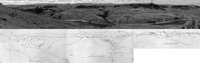 |
Plate 252 | Lake Fork of the Grand (Gunnison) River, composite of a panoramic photograph and three adjacent sketches |
| 253 |
 |
Plate 253 | Lake Fork, Sept. 10th [i.e. 9th], sketch |
| 254 |
 |
Plate 254 | Lake Fork, photograph |
| 255 |
 |
Plate 255 | View west from Lake Fork, composite sketch and photograph |
| 256 |
 |
Plate 256 | View showing the formation of the Canon of Grand River, Stanley lithograph from sketch by F. W. Egloffstein |
| 257 |
 |
Plate 257 | Upper reaches of the Black Canyon of the Gunnison |
| 258 |
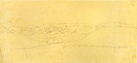 |
Plate 258 | Sketch looking northward from Pine Creek Mesa up Salt Creek Canyon |
| 259 |
 |
Plate 259 | Salt Creek Canyon photograph |
| 260 |
 |
Plate 260 | Salt Creek Canyon, composite sketch and photograph |
| 261 |
 |
Plate 261 | Grand River Canon (leaving the river), Sept. 10th, sketch |
| 262 |
 |
Plate 262 | Canon on Grand R, sketch |
| 263 |
 |
Plate 263 | Grand R. canons, sketch |
| 264 |
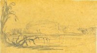 |
Plate 264 | Grand River, sketch |
| 265 |
 |
Plate 265 | Grand River, sketch |
| 266 |
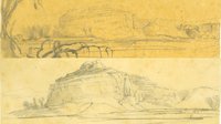 |
Plate 266 | Grand River, two sketches |
| 267 |
 |
Plate 267 | Grand River canons, sketch |
| 268 |
 |
Plate 268 | Rock hills between Green and White rivers, Stanley lithograph from Kern sketch |
| 269 |
 |
Plate 269 | Litho: "Rock hills between Green and White Rivers: drawing: ‘Grand River Canyons' composite sketch and lithograph |
| 270 |
 |
Plate 270 | Color photograph looking north from Pine Creek toward the Grand River |
| 271 |
 |
Plate 271 | Rock hills between Green and White Rivers [Grand River Canyons], composite sketch and photograph |
| 272 |
 |
Plate 272 | Stanley drawing related to his lithograph of Grand (Gunnison) River canyon |
| 273 |
 |
Plate 273 | Grand River canons, two superimposed drawings |
| 274 |
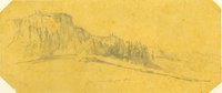 |
Plate 274 | Un-com-pah-gre Mts, sketch |
| 275 |
 |
Plate 275 | Uncompahrgre country, color photograph |
| 276 |
 |
Plate 276 | Juxtaposition of two sketches and a photograph of the slopes of Pine Creek Mesa, Uncompahgre country |
| 277 |
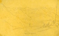 |
Plate 277 | Valley of the Cebolla Cr., sketch |
| 278 |
 |
Plate 278 | Summit of the nearest ridges south of Grand River, Stanley lithograph from Kern sketch |
| 279 |
 |
Plate 279 | Cebolla Creek (today Blue Creek drainage) and summit of ridges south of Grand River, composite sketch and lithograph |
| 280 |
 |
Plate 280 | Valley of the Blue Creek, photograph |
| 281 |
 |
Plate 281 | Valley of the Blue Creek, composite sketch and photograph |
| 282 |
 |
Plate 282 | From Camp 62, Sept. 12th, 1853, sketch |
| 283 |
 |
Plate 283 | Camp 62 along US Highway 50 and the Little Cimarron River |
| 284 |
 |
Plate 284 | Camp 62, composite sketch and photograph |
| 285 |
 |
Plate 285 | Un-com-pah-gre Mts, Sept. 18th, south of Grand River, firstsketch |
| 286 |
 |
Plate 286 | Uncompahgre Mountains, photograph |
| 287 |
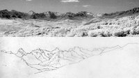 |
Plate 287 | Uncompahgre Mountains, composite of the first photograph and the first sketch |
| 288 |
 |
Plate 288 | Uncompahgre Mountains Sep. 14th [i.e. 13th], sketch |
| 289 |
 |
Plate 289 | Uncompahgre Mountains, two sketches of the same scene juxtaposed |
| 290 |
 |
Plate 290 | Uncompahgre Mountains, photograph |
| 291 |
 |
Plate 291 | Uncompahgre Mountains, composite sketch and photograph |
| 292 |
 |
Plate 292 | Elk Mts, sketch |
| 293 |
 |
Plate 293 | Elk Mountains, photograph |
| 294 |
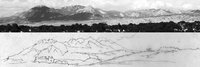 |
Plate 294 | Elk Mountains, composite sketch and photograph |
| 295 |
 |
Plate 295 | Salt Creek Canon, Sept. 21st, 1853, sketch |
| 296 |
 |
Plate 296 | Salt Creek Canyon, photograph |
| 297 |
 |
Plate 297 | Salt Creek Canyon, composite sketch and photograph |
| 298 |
 |
Plate 298 | Desert between Grand and Green R, sketch |
| 299 |
 |
Plate 299 | Desert between Grand and Green R, Sept. 28, sketch |
| 300 |
 |
Plate 300 | Desert between Grand and Green River, photograph |
| 301 |
 |
Plate 301 | Desert between Grand and Green River, composite sketch and photograph |
| 302 |
 |
Plate 302 | Desert between Grand and Green R, Sept. 28, sketch |
| 303 |
 |
Plate 303 | Desert between Grand and Green River, photograph |
| 304 |
 |
Plate 304 | Desert between Grand and Green River, composite sketch and photograph |
| 305 |
 |
Plate 305 | Book (Henry) Mts Sept 29th, sketch |
| 306 |
 |
Plate 306 | Henry Mountains, photograph |
| 307 |
 |
Plate 307 | Book Cliffs, composite sketch and photograph |
| 308 |
 |
Plate 308 | Sketch of the San Rafael Reef on the center-left and the Beckwith Plateau on the right |
| 309 |
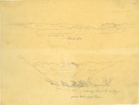 |
Plate 309 | Book Mts (San Rafael Reef and Beckwith Plateau) Sept 29th and Entering Sevier R. from Wah-satch Pass: two sketches |
| 310 |
 |
Plate 310 | San Rafael Reef and Beckwith Plateau, photograph |
| 311 |
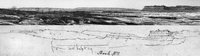 |
Plate 311 | Book Cliffs (San Rafael Reef and Beckwith Plateau), composite sketch and photograph |
| 312 |
 |
Plate 312 | Green River country, sketch |
| 313 |
 |
Plate 313 | Green River country, photograph |
| 314 |
 |
Plate 314 | Green River country, composite sketch and photograph |
| 315 |
 |
Plate 315 | Green River, Oct. 1, sketch |
| 316 |
 |
Plate 316 | View of the Roan or Book Mountains, lithograph |
| 317 |
 |
Plate 317 | Green River and Book Cliffs, composite sketch and lithograph |
| 318 |
 |
Plate 318 | Green River and Book Cliffs, photograph |
| 319 |
 |
Plate 319 | Green River and Book Cliffs, composite sketch and photograph |
| 320 |
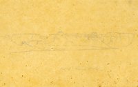 |
Plate 320 | Rock Hills, Oct. 2nd, sketch |
| 321 |
 |
Plate 321 | Rock Hills panoramic photograph |
| 322 |
 |
Plate 322 | Rock Hills, composite sketch and photograph |
| 323 |
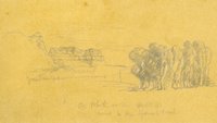 |
Plate 323 | From Camp 81 on White River at Sunset on Oct. 4, near to the Spanish Trail, sketch |
| 324 |
 |
Plate 324 | White River near the Spanish Trail, photograph |
| 325 |
 |
Plate 325 | White River near the Spanish Trail, composite sketch and photograph |
| 326 |
 |
Plate 326 | On Clever Creek, Oct 5, sketch |
| 327 |
 |
Plate 327 | Clever Creek, photograph |
| 328 |
 |
Plate 328 | Clever Creek, composite sketch and photograph |
| 329 |
 |
Plate 329 | On the Garambulla Creek, Oct 10, sketch |
| 330 |
 |
Plate 330 | Garambulla Creek, photograph |
| 331 |
 |
Plate 331 | Garambulla Creek, composite sketch and photograph |
| 332 |
 |
Plate 332 | Near Wah-satch Pass, Oct. 12, sketch |
| 333 |
 |
Plate 333 | Near Wasatch Pass, photograph |
| 334 |
 |
Plate 334 | Near Wasatch Pass, composite sketch and photograph |
| 335 |
 |
Plate 335 | Little Mountains, sketch |
| 336 |
 |
Plate 336 | Little Mountains, photograph |
| 337 |
 |
Plate 337 | Little Mountains, composite sketch and photograph |
| 338 |
 |
Plate 338 | Bluff and pictograph: two sketches |
| 339 |
 |
Plate 339 | Sierra de Wahsatch on White Pine Creek, Oct. 14, sketch |
| 340 |
 |
Plate 340 | Wasatch Mountains, White Pine Creek, photograph |
| 341 |
 |
Plate 341 | Wasatch Mountains, White Pine Creek, composite sketch and photograph |
| 342 |
 |
Plate 342 | Entering Sevier R valley from Wah-satch Pass, Oct. 17, sketch |
| 343 |
 |
Plate 343 | Entering Sevier River valley from Wasatch Pass, photograph |
| 344 |
 |
Plate 344 | Entering Sevier River valley from Wasatch Pass, composite sketch and photograph |
| 345 |
 |
Plate 345 | Kah-kah-nak-ah-rah-nit, Wah-satch Mts, Oct. 19, sketch |
| 346 |
 |
Plate 346 | Kah-kah-nak-ah-rah-nit, Wah-satch Mts, photograph |
| 347 |
 |
Plate 347 | Kah-kah-nak-ah-rah-nit, Wah-satch Mts, composite sketch and photograph |
| 348 |
 |
Plate 348 | From Mormon Bridge, Sevier River, Oct_20th, sketch in three parts |
| 349 |
 |
Plate 349 | From Mormon Bridge, Sevier River, Oct_20th, panorama sketch |
| 350 |
 |
Plate 350 | From Mormon Bridge, Sevier River, Oct. 20th, photograph |
| 351 |
 |
Plate 351 | From Mormon Bridge, Sevier River, Oct. 20th, composite sketch and photograph |
| 352 |
 |
Plate 352 | Wah-satch Mts, Oct. 21, sketch in two parts |
| 353 |
 |
Plate 353 | Wah-satch Mts, Oct. 21, panoramic sketch |
| 354 |
 |
Plate 354 | Wasatch Mountains, panoramic photograph |
| 355 |
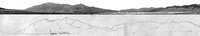 |
Plate 355 | Wasatch Mountains, composite panoramic sketch and photograph |
| 356 |
 |
Plate 356 | Great Basin, Oct 25,1854, sketch in three parts |
| 357 |
 |
Plate 357 | Great Basin, Oct 25,1854, panoramic sketch |
| 358 |
 |
Plate 358 | Panoramic photograph |
| 359 |
 |
Plate 359 | Mountains Northeast of Camp 98 |
| 360 |
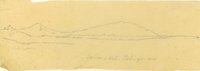 |
Plate 360 | Jo-on-Kah-Pa-ga-mu, sketch |
| 361 |
 |
Plate 361 | Jo-on-Kah-Pa-ga-mu, photograph |
| 362 |
 |
Plate 362 | Jo-on-Kah-Pa-ga-mu, composite sketch and photograph |
| 363 |
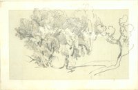 |
Plate 363 | Trees, sketch |
| 364 |
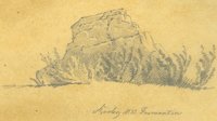 |
Plate 364 | Rocky Mts Formation, sketch |
| 365 |
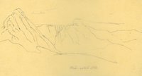 |
Plate 365 | Wah-satch Mts, sketch |
| 366 |
 |
Plate 366 | Rocky Mts, sketch |
| 367 |
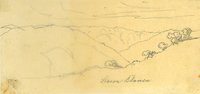 |
Plate 367 | Sierra Blanca, sketch |
| 368 |
 |
Plate 368 | Plains, sketch |
| 369 |
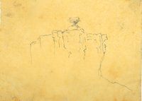 |
Plate 369 | Rock formation, sketch |
| 370 |
 |
Plate 370 | Papoose sketch |
| 371 |
 |
Plate 371 | Wooded butte, sketch |
| 372 |
 |
Plate 372 | Trees, sketch |
| 373 |
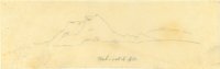 |
Plate 373 | Wah-satch Mts, sketch |
| 374 |
 |
Plate 374 | Wah-satch Mts, sketch |
| 375 |
 |
Plate 375 | Rocky Mts, sketch |
| 376 |
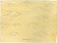 |
Plate 376 | Mount Shasta, multiple sketches |
| 377 |
 |
Plate 377 | Shasta from Mt Observation, sketch |
| 378 |
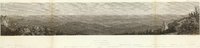 |
Plate 378 | Madelin Pass from Mount Observation, June 19th, 1854 |
| 379 |
 |
Plate 379 | Madelin Pass, Shasta segment, with Shasta drawing from Mt Observation inserted |
| 380 |
 |
Plate 380 | Shasta, 12-19_June, sketch |
| 381 |
 |
Plate 381 | Madelin Pass, Shasta segment, with Shasta drawing inserted |
| 382 |
 |
Plate 382 | Northern slopes of the Sierra Nevada, June 30th, 1854, Schumann lithograph from Eggloffstein |
| 383 |
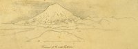 |
Plate 383 | From First Canon, sketch |
| 384 |
 |
Plate 384 | Shasta, composite of engraving, sketch, and photograph |
| 385 |
 |
Plate 385 | West end of Madelin Pass, June 26, 1854, Schumann lithograph from Eggloffstein |
| 386 |
 |
Plate 386 | Shasta, 3-26 June |
| 387 |
 |
Plate 387 | West end of Madelin Pass, composite engraving with Shasta sketch |
| 388 |
 |
Plate 388 | Portion of the main mountain passage of the upper Sacramento of Pitt River, Schumann lithograph from Eggloffstein |
| 389 |
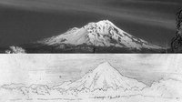 |
Plate 389 | Shasta, composite of photograph and sketch from Camp 27 and 28 |
| 390 |
 |
Map 4 25% | Explorations and surveys for a rail road route from the Mississippi River to the Pacific Ocean: route near the 41st paralle, Map no. 4, from the valley of the Mud Lakes to the Pacific Ocean, from explorations and surveys... by Capt. E. G. Beckwith, 3d Artillery |
| 391 |
 |
Map 1 25% | Explorations and surveys for a rail road route from the Mississippi River to the Pacific Ocean: route near the 41st parallel, Map no. 1, from the valley of the Green River to the Great Salt Lake, from explorations and surveys... by Capt. E. G. Beckwith, 3d Artillery (copy 1) |
| 392 |
 |
Map 4 | Explorations and surveys for a rail road route from the Mississippi River to the Pacific Ocean: route near the 41st paralle, Map no. 4, from the valley of the Mud Lakes to the Pacific Ocean, from explorations and surveys... by Capt. E. G. Beckwith, 3d Artillery |
| 393 |
 |
Full Route Map 480px h | Explorations and surveys for a rail road route from the Mississippi River to the Pacific Ocean: route near the 38th and 39th parallels: composite of maps 1 to 4 (copy 2) |
| 394 |
 |
Full Route Map 25% | Explorations and surveys for a rail road route from the Mississippi River to the Pacific Ocean: route near the 38th and 39th parallels: composite of maps 1 to 4 (copy 1) |
| 395 |
 |
Map 1 | Explorations and surveys for a rail road route from the Mississippi River to the Pacific Ocean: route near the 41st parallel, Map no. 1, from the valley of the Green River to the Great Salt Lake, from explorations and surveys... by Capt. E. G. Beckwith, 3d Artillery (copy 2) |
| 396 |
 |
Full Route Map 50% | Explorations and surveys for a rail road route from the Mississippi River to the Pacific Ocean: route near the 38th and 39th parallels: composite of maps 1 to 4 (copy 3) |