In 1853 Richard Hovendon Kern was hired as topographer and artist for a government-sponsored reconnaissance led by Captain John Williams Gunnison. Kern sketched landscape panoramas as the group made its way from St. Louis toward San Francisco. When the expedition reached Sevier Lake, Utah, however, it was attacked by a band of Indians. Seven men, including Kern and Gunnison, were killed, and Kern's drawings were stolen. The sketches were soon recovered and eventually carried to Washington, D.C.
Robert Shlaer, an accomplished daguerreotypist, came across Kern's sketches many years later at the Newberry Library in Chicago. He was inspired to locate the views depicted in the drawings and to photograph them, as nearly as was possible, from the same spot where Kern had stood when he sketched them. This collection juxtaposes Kern's drawings with Shlaer's photographs, presenting 389 illustrations in geographic sequence from east to west
Filters: Collection: "uu_rkfws" Type: "Image"
1 - 25 of 20
| Title | Alternative Title | ||
|---|---|---|---|
| 1 |
 |
Plate 251 | Lake Fork of the Grand River seen from Sapinero Mesa, panoramic photograph |
| 2 |
 |
Plate 254 | Lake Fork, photograph |
| 3 |
 |
Map 1 | Explorations and surveys for a rail road route from the Mississippi River to the Pacific Ocean: route near the 41st parallel, Map no. 1, from the valley of the Green River to the Great Salt Lake, from explorations and surveys... by Capt. E. G. Beckwith, 3d Artillery (copy 2) |
| 4 |
 |
Map 1 25% | Explorations and surveys for a rail road route from the Mississippi River to the Pacific Ocean: route near the 41st parallel, Map no. 1, from the valley of the Green River to the Great Salt Lake, from explorations and surveys... by Capt. E. G. Beckwith, 3d Artillery (copy 1) |
| 5 |
 |
Plate 248 | Grand River [Lake Fork] Canon , Sept 9th, sketch |
| 6 |
 |
Plate 253 | Lake Fork, Sept. 10th [i.e. 9th], sketch |
| 7 |
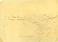 |
Plate 247 | Canon of Grand River [Lake Fork], Sept 13th [i.e. 9th], sketch |
| 8 |
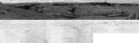 |
Plate 252 | Lake Fork of the Grand (Gunnison) River, composite of a panoramic photograph and three adjacent sketches |
| 9 |
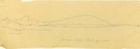 |
Plate 360 | Jo-on-Kah-Pa-ga-mu, sketch |
| 10 |
 |
Plate 249 | Grand River Canon , Sept 9th; Lake Fork, Sept. 10th (two sketches) |
| 11 |
 |
Plate 361 | Jo-on-Kah-Pa-ga-mu, photograph |
| 12 |
 |
Plate 246 | Side canyon of Grand R, sketch |
| 13 |
 |
Plate 362 | Jo-on-Kah-Pa-ga-mu, composite sketch and photograph |
| 14 |
 |
Plate 250 | Grand River canyon and side canyons, Sept. 9: three sketches as a panorama |
| 15 |
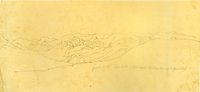 |
Plate 258 | Sketch looking northward from Pine Creek Mesa up Salt Creek Canyon |
| 16 |
 |
Plate 378 | Madelin Pass from Mount Observation, June 19th, 1854 |
| 17 |
 |
Plate 255 | View west from Lake Fork, composite sketch and photograph |
| 18 |
 |
Plate 261 | Grand River Canon (leaving the river), Sept. 10th, sketch |
| 19 |
 |
Plate 259 | Salt Creek Canyon photograph |
| 20 |
 |
Plate 260 | Salt Creek Canyon, composite sketch and photograph |
1 - 25 of 20