Home
Browse
Ask Us
Chat
Harmful Language Statement
Log in
Glen Canyon
Advanced Search
About
Glen Canyon maps and brochures
Year
1947
1948
1949
1950
1951
1952
1953
1954
1955
1956
1957
1958
1959
1960
1961
1962
1963
1964
1965
1966
1967
1968
1969
1970
1971
1972
1973
1974
1975
1976
1977
1978
TO
1947
1948
1949
1950
1951
1952
1953
1954
1955
1956
1957
1958
1959
1960
1961
1962
1963
1964
1965
1966
1967
1968
1969
1970
1971
1972
1973
1974
1975
1976
1977
1978
Type
Image/StillImage
336
Text
42
Image
1
Format
image/jpeg
337
application/pdf
42
Collection
Glen Canyon
379
Filters:
Collection:
"uu_gc"
301
-
400
of
379
<
1
2
3
4
>
Gallery view
Number of results to display per page
10
25
50
100
200
Sort by Relevance
Sort by Title A-Z
Sort by Title Z-A
Sort by Date Ascending
Sort by Date Descending
Sort by Last Modified Ascending
Sort by Last Modified Descending
Title
Date
Type
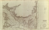
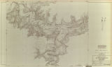
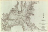
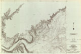
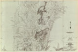
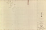
301
Glen Canyon unit, Lake Powell topography: sheet 557-414-91
1960
Image/StillImage
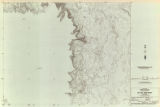
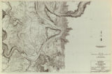
302
Glen Canyon unit, Lake Powell topography: sheet 557-414-92
1960
Image/StillImage
303
Glen Canyon unit, Lake Powell topography: sheet 557-414-93
1960
Image/StillImage
304
Glen Canyon unit, Lake Powell topography: sheet 557-414-94
1960
Image/StillImage
305
Glen Canyon unit, Lake Powell topography: sheet 557-414-95
1960
Image/StillImage
306
Glen Canyon unit, Lake Powell topography: sheet 557-414-96
1960
Image/StillImage
307
Glen Canyon unit, Lake Powell topography: sheet 557-414-97
1960
Image/StillImage
308
Glen Canyon unit, Lake Powell topography: sheet 557-414-98
1960
Image/StillImage
309
Glen Canyon unit, Lake Powell topography: sheet 557-414-99
1960
Image/StillImage
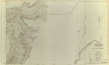
310
Glen Canyon unit, Lake Powell topography: sheet 557-414-310
1960
Image/StillImage
311
The impact of power developments on the Navajo nation
1975
Text
312
Kaiparowits handbook: Coal resources, interim report
1975-05
Text
313
Kaiparowits handbook: coal resources: interim report
1976
Text
314
Lake Powell effect on Colorado River Basin water supply and environment
1975-05
Text
315
Legal-political history of water resources development in the upper Colorado River Basin
1974
Text
316
Long-term surface-water supply and streamflow trends in the upper Colorado river basin: based on tree-ring analyses
1976
Text
317
The macroeconomic impact of energy development in the Lake Powell area
1975
Text
318
Macroinvertebrates and diatoms on submerged bottom substrates, Lake Powell
1977
Text
319
Major element geochemistry of Lake Powell
1974
Text
320
Management of scientific collaboration in the Lake Powell Research Project
1975
Text
321
Mercury in the Lake Powell ecosystem
1973
Text
322
Modeling of visibility reductions and extreme pollutant concentrations associated with southwestern coal-fired powerplants
1977
Text
323
The Navajo Environmental Protection Commission and the environmental impact statement
1976
Text
324
Navajo participation in labor unions
1975
Text
325
Overview of water requirements for electric power generation (for the Lower Colorado River Basin)
1975-05
Text
326
Predicted transport of air pollutants from the Navajo and Kaiparowits Generating Stations into Lake Powell
1976
Text
327
Prehistoric and historic steps and trails of Glen Canyon - Lake Powell
1977
Text
328
The prospects for Navajo taxation of non-Indians
1976
Text
329
The relationship of economic variations to mortality and fertility patterns on the Navajo reservation
1976
Text
330
The role of transportation of energy in the development of the Southwest
1977
Text
331
San Juan River survey, topography: San Juan River strip 518-400-12 sheet 01 out of 40
1947
Image
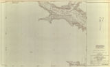
332
San Juan River survey, topography: San Juan River strip 518-400-12 sheet 02 out of 40
1947
Image/StillImage
333
San Juan River survey, topography: San Juan River strip 518-400-12 sheet 03 out of 40
1947
Image/StillImage
334
San Juan River survey, topography: San Juan River strip 518-400-12 sheet 04 out of 40
1947
Image/StillImage
335
San Juan River survey, topography: San Juan River strip 518-400-12 sheet 05 out of 40
1947
Image/StillImage
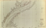
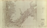
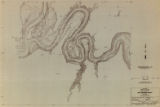
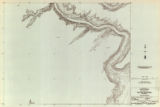
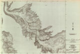
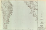
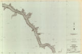
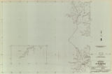
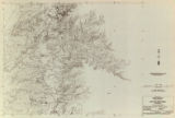
336
San Juan River survey, topography: San Juan River strip 518-400-12 sheet 06 out of 40
1947
Image/StillImage
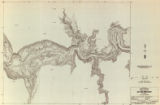
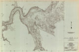
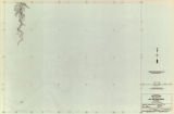
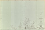
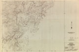
337
San Juan River survey, topography: San Juan River strip 518-400-12 sheet 07 out of 40
1947
Image/StillImage
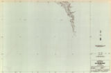
338
San Juan River survey, topography: San Juan River strip 518-400-12 sheet 08 out of 40
1947
Image/StillImage
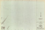
339
San Juan River survey, topography: San Juan River strip 518-400-12 sheet 09 out of 40
1947
Image/StillImage
340
San Juan River survey, topography: San Juan River strip 518-400-12 sheet 10 out of 40
1947
Image/StillImage
341
San Juan River survey, topography: San Juan River strip 518-400-12 sheet 11 out of 40
1947
Image/StillImage
342
San Juan River survey, topography: San Juan River strip 518-400-12 sheet 12 out of 40
1947
Image/StillImage
343
San Juan River survey, topography: San Juan River strip 518-400-12 sheet 13 out of 40
1947
Image/StillImage
344
San Juan River survey, topography: San Juan River strip 518-400-12 sheet 14 out of 40
1947
Image/StillImage
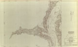
345
San Juan River survey, topography: San Juan River strip 518-400-12 sheet 15 out of 40
1947
Image/StillImage
346
San Juan River survey, topography: San Juan River strip 518-400-12 sheet 16 out of 40
1947
Image/StillImage
347
San Juan River survey, topography: San Juan River strip 518-400-12 sheet 17 out of 40
1947
Image/StillImage
348
San Juan River survey, topography: San Juan River strip 518-400-12 sheet 18 out of 40
1947
Image/StillImage
349
San Juan River survey, topography: San Juan River strip 518-400-12 sheet 19 out of 40
1947
Image/StillImage
350
San Juan River survey, topography: San Juan River strip 518-400-12 sheet 20 out of 40
1947
Image/StillImage
351
San Juan River survey, topography: San Juan River strip 518-400-12 sheet 21 out of 40
1947
Image/StillImage
352
San Juan River survey, topography: San Juan River strip 518-400-12 sheet 22 out of 40
1947
Image/StillImage
353
San Juan River survey, topography: San Juan River strip 518-400-12 sheet 23 out of 40
1947
Image/StillImage
354
San Juan River survey, topography: San Juan River strip 518-400-12 sheet 24 out of 40
1947
Image/StillImage
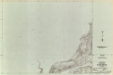
355
San Juan River survey, topography: San Juan River strip 518-400-12 sheet 25 out of 40
1947
Image/StillImage
356
San Juan River survey, topography: San Juan River strip 518-400-12 sheet 26 out of 40
1947
Image/StillImage
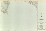
357
San Juan River survey, topography: San Juan River strip 518-400-12 sheet 27 out of 40
1947
Image/StillImage
358
San Juan River survey, topography: San Juan River strip 518-400-12 sheet 28 out of 40
1947
Image/StillImage
359
San Juan River survey, topography: San Juan River strip 518-400-12 sheet 29 out of 40
1947
Image/StillImage
360
San Juan River survey, topography: San Juan River strip 518-400-12 sheet 30 out of 40
1947
Image/StillImage
361
San Juan River survey, topography: San Juan River strip 518-400-12 sheet 31 out of 40
1947
Image/StillImage
362
San Juan River survey, topography: San Juan River strip 518-400-12 sheet 32 out of 40
1947
Image/StillImage
363
San Juan River survey, topography: San Juan River strip 518-400-12 sheet 33 out of 40
1947
Image/StillImage
364
San Juan River survey, topography: San Juan River strip 518-400-12 sheet 34 out of 40
1947
Image/StillImage
365
San Juan River survey, topography: San Juan River strip 518-400-12 sheet 35 out of 40
1947
Image/StillImage
366
San Juan River survey, topography: San Juan River strip 518-400-12 sheet 36 out of 40
1947
Image/StillImage
367
San Juan River survey, topography: San Juan River strip 518-400-12 sheet 37 out of 40
1947
Image/StillImage
368
San Juan River survey, topography: San Juan River strip 518-400-12 sheet 38 out of 40
1947
Image/StillImage
369
San Juan River survey, topography: San Juan River strip 518-400-12 sheet 39 out of 40
1947
Image/StillImage
370
San Juan River survey, topography: San Juan River strip 518-400-12 sheet 40 out of 40
1947
Image/StillImage
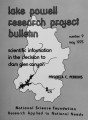
371
Scientific information in the decision to dam Glen Canyon
1975
Text
372
Sedimentation in Lake Powell
1978
Text
373
Shoreline ecology of Lake Powell
1976
Text
374
Shoreline surface materials and geological strata, Lake Powell
1977
Text
375
Some social consequences of boomtowns
1977
Text
376
Survey of Navajo community studies, 1936-1974
1975
Text
377
Theoretical analysis of air quality: impacts on the Lake Powell region
1975
Text
378
Toward a framework for evaluating the impact of procedural change upon policy: the case of the Kaiparowits environmental impact statement
1977
Text
379
Utah coal for southern California power: the general issues
1975
Text
301
-
400
of
379
<
1
2
3
4
>