11
Cowan, Derek; DuVall, Scott L. Academic podcasting:quality content delivery 2009-09-23 Our weekly department seminar has been available as streaming video for several years. Streaming video depends on a reliable, broadband connection for the entire duration of viewing for consistent video quality. Even users with faster internet connections have reported poor video quality at times. A new system for distributing the seminar was developed that takes advantage of content syndication technology. Podcasting is a form of web syndication whereby multimedia content is made available for use by other applications. By making the seminar available as a podcast, some of the problems related to streaming video broadcasts are resolved. text; image Academic Podcasting: Quality Content Delivery Jacob S Tripp BS1, Scott L DuVall BS1, Derek L Cowan2, Aaron W C Kamauu MD, MPH, MS1 1Department of Biomedical Informatics, University of Utah, Salt Lake City, Utah 2Spencer S Eccles Health Sciences Library, University of Utah, Salt Lake City, Utah Feed Reader Checks for and Downloads Attend any New Files Seminar Watch Live Broadcast Watch Streaming Video Create Downloadable Video Create Streaming Video Retrieve Downloadable Video Browse to Live Internet Streaming Video Broadcast Watch Downloaded Video Transfer to Portable Device Watch on Portable Device Record Update RSS Feed Introduction Our weekly department seminar has been available as streaming video for several years. Streaming video depends on a reliable, broadband connection for the entire duration of viewing for consistent video quality. Even users with faster internet connections have reported poor video quality at times. A new system for distributing the seminar was developed that takes advan-tage of content syndication technology. Podcasting is a form of web syndi-cation whereby multimedia content is made available for use by other appli-cations. By making the seminar available as a podcast, some of the problems related to streaming video broadcasts are resolved. In addition to be available as a live webcast, department seminars are recorded in AVI format, converted to Real Media streams, MP4 video and MP3 audio formats, and stored on the Eccles Health Science Library multimedia server. We developed a database-driven web application to input and store seminar metadata and automatically generate files that conform to Really Simple Syndication (RSS) 2.0 (http://blogs.law.harvard.edu/tech/rss), an XML schema that defines machine-readable descriptions and links to media in a web feed. These RSS files also contain specific tags that allow the feeds to be published in the iTunes Music Store Podcast Directory. End users can subscribe to video and audio feeds through web-based podcast listeners or desktop-based feed aggregators that support file enclosures. The podcast is indexed in several podcast directories including Apple Computer's (Cupertino, CA) iTunes Music Store Podcast Directory. iTunes is unique in that it combines a web-based podcast directory with the desktop-based feed reader. Discussion Podcasting is quickly gaining popularity. Podcasts can be transferred to por-table media devices allowing for viewing away from the computer. By making the seminar available in this format, viewers experience an improved viewing experience at a convenient time and place. Only a small fraction of existing podcast would be considered academic. The University of Utah Bio-medical Informatics Seminar is one of only two podcasts listed in the iTunes index on the topic of Medical or Biomedical Informatics. This seminar is an approved source of CME for live viewing, either in person or remotely. This presents the possibility of the podcast also becoming an online source for CME credit. Acknowledgements This research was supported by National Library of Medicine Training Grant T15 LM007124. 60 University of Utah Biomedical Informatics Seminar - Full Video (c) 2006 University of Utah - Biomedical Informatics Tue, 11 Apr 2006 14:06:37 MST Wed, 09 Aug 2006 08:49:47 MST A Weekly Video Podcast of the Biomedical Informatics Graduate Seminar Series from the University of Utah School of Medicine. Biomedical Informatics A Weekly Biomedical Informatics Graduate Seminar Series from the University of Utah School of Medicine en-us -
Utah Health Information Network Health Information Exchange (HIE)</a></td><td>Our weekly department seminar has been available as streaming video for several years. Streaming video depends on a reliable, broadband connection for the entire duration of viewing for consistent video quality. Even users with faster internet connections have reported poor video quality at times. A...</td><td>Academic podcasting; Content delivery; Quality; Content syndication technology; Trapeze Interactive Poster</td><td>2009-09-23</td></tr> <tr id="id713377">
<td>12</td>
<td>
<a href="/details?id=713377&facet_setname_s=%22ir_uspace%22&facet_type_t=%22Image%22&rows=200"><img alt="" class="thumb" src="/dl_thumbs/b1/cb/b1cbc5f6a689848355253b5c17cb9705983f4e16.jpg" /></a> </td>
<td>Hamasu, Claire</td><td><a href="/details?id=713377&facet_setname_s=%22ir_uspace%22&facet_type_t=%22Image%22&rows=200">Accelerating Technology Adoption by Health Sciences Librarians</a></td><td>The Rogers model for adoption and diffusion of innovation can be applied to the adoption of new technology. We know innovators need to start with the early adopters to build capacity before reaching the majority level. The National Network of Libraries of Medicine MidContinental Region (NN/LM MCR) s...</td><td>NN/LM; RML; National Network of Libraries of Medicine; MidContinental Region (MCR); Spencer S. Eccles Health Sciences Library</td><td>2009</td></tr> <tr id="id707788">
<td>13</td>
<td>
<a href="/details?id=707788&facet_setname_s=%22ir_uspace%22&facet_type_t=%22Image%22&rows=200"><img alt="" class="thumb" src="/dl_thumbs/8b/9d/8b9dbf1514eae948b1c0f010d1570502e9fa0f26.jpg" /></a> </td>
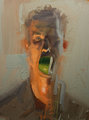
<td>Erickson, John Owen</td><td><a href="/details?id=707788&facet_setname_s=%22ir_uspace%22&facet_type_t=%22Image%22&rows=200">Adam</a></td><td>Form: painting; Medium: oil and latex; Dimensions: 18 x 24"</td><td>Painting</td><td>2008</td></tr> <tr id="id708253">
<td>14</td>
<td>
<a href="/details?id=708253&facet_setname_s=%22ir_uspace%22&facet_type_t=%22Image%22&rows=200"><img alt="" class="thumb" src="/dl_thumbs/c4/b8/c4b8f4453986474665deaf06f1950e53d51a1424.jpg" /></a> </td>
<td>Pascucci, Valerio</td><td><a href="/details?id=708253&facet_setname_s=%22ir_uspace%22&facet_type_t=%22Image%22&rows=200">Adaptive sampling with topological scores</a></td><td></td><td></td><td>2012</td></tr> <tr id="id707609">
<td>15</td>
<td>
<a href="/details?id=707609&facet_setname_s=%22ir_uspace%22&facet_type_t=%22Image%22&rows=200"><img alt="" class="thumb" src="/dl_thumbs/09/f3/09f34626eccabc90e396670fa0f7d1f732b9a6b0.jpg" /></a> </td>
<td>Mader, Emily Marie</td><td><a href="/details?id=707609&facet_setname_s=%22ir_uspace%22&facet_type_t=%22Image%22&rows=200">An analysis of foundation giving in Utah, 2007-2009</a></td><td></td><td></td><td>2011</td></tr> <tr id="id709286">
<td>16</td>
<td>
<a href="/details?id=709286&facet_setname_s=%22ir_uspace%22&facet_type_t=%22Image%22&rows=200"><img alt="" class="thumb" src="/dl_thumbs/c0/58/c058b42ae03c014b448d7ee29cb3d0325d2e3163.jpg" /></a> </td>
<td>Paiva, Marie</td><td><a href="/details?id=709286&facet_setname_s=%22ir_uspace%22&facet_type_t=%22Image%22&rows=200">An ethiopian research library evolves into the new millennium: The institute of ethiopian studies library, Addis Ababa University, Addis Ababs, Ethiopia</a></td><td></td><td></td><td>2010-05-14</td></tr> <tr id="id707893">
<td>17</td>
<td>
<a href="/details?id=707893&facet_setname_s=%22ir_uspace%22&facet_type_t=%22Image%22&rows=200"><img alt="" class="thumb" src="/dl_thumbs/5b/d5/5bd5e58a88e010f88a444dc594e7b9a6677a0c52.jpg" /></a> </td>
<td>Gopalakrishnan, Ganesh; Humphrey, Alan Parker; Derrick, Christopher Glade</td><td><a href="/details?id=707893&facet_setname_s=%22ir_uspace%22&facet_type_t=%22Image%22&rows=200">An integration of dynamic MPI formal verification within eclipse PTP</a></td><td>Our research goals were to verify practical MPI programs for deadlocks, resource leaks, and assertion violations at the push of a button and be able to easily visualize the results. We also sought to integrate these capabilities with the Eclipse IDE via an Eclipse plug-in for the Parallel Tools Plat...</td><td>Verification; Graphical User Interfaces; Dynamic Interleaving Reduction; Message Passing; MPI; Multi-core; Eclipse Parallel Tools Platform; Trapeze Interactive Poster</td><td>2010-03-15</td></tr> <tr id="id708255">
<td>18</td>
<td>
<a href="/details?id=708255&facet_setname_s=%22ir_uspace%22&facet_type_t=%22Image%22&rows=200"><img alt="" class="thumb" src="/dl_thumbs/95/5b/955bfc7bce77e304f0d35874cd23b508e25ef14a.jpg" /></a> </td>
<td>Fletcher, Thomas H.</td><td><a href="/details?id=708255&facet_setname_s=%22ir_uspace%22&facet_type_t=%22Image%22&rows=200">Analysis of human brain connectivity from multi-modal imaging</a></td><td></td><td></td><td>2012</td></tr> <tr id="id709310">
<td>19</td>
<td>
<a href="/details?id=709310&facet_setname_s=%22ir_uspace%22&facet_type_t=%22Image%22&rows=200"><img alt="" class="thumb" src="/dl_thumbs/47/22/472248ed433060020a0ed1f33f9ef243ecbf6065.jpg" /></a> </td>
<td>Fletcher, Preston Thomas</td><td><a href="/details?id=709310&facet_setname_s=%22ir_uspace%22&facet_type_t=%22Image%22&rows=200">Analysis of white matter maturation in early brain development</a></td><td></td><td></td><td>2011-11-02</td></tr> <tr id="id707644">
<td>20</td>
<td>
<a href="/details?id=707644&facet_setname_s=%22ir_uspace%22&facet_type_t=%22Image%22&rows=200"><img alt="" class="thumb" src="/dl_thumbs/19/4e/194ea2b11e0a5ed9480d8ce94724fc92736a275a.jpg" /></a> </td>
<td>Erickson, John Owen</td><td><a href="/details?id=707644&facet_setname_s=%22ir_uspace%22&facet_type_t=%22Image%22&rows=200">Apple Boy</a></td><td>Form: painting; Medium: oil and latex; Dimensions: 18 x 24"</td><td>Painting</td><td>2008</td></tr> <tr id="id707738">
<td>21</td>
<td>
<a href="/details?id=707738&facet_setname_s=%22ir_uspace%22&facet_type_t=%22Image%22&rows=200"><img alt="" class="thumb" src="/dl_thumbs/37/49/3749f8a01527c38b31540027beb65a2df41123ff.jpg" /></a> </td>
<td>Ecsedy, Kathryn Lyn; Harvey, Ian R.</td><td><a href="/details?id=707738&facet_setname_s=%22ir_uspace%22&facet_type_t=%22Image%22&rows=200">The artistic applications of M.E.M.S.: gallery on a chip</a></td><td>Our research explored the crossroads between art and science to create tiny devices known as MEMS (Micro Electrical Mechanical Systems). These artistic devices are powered by micro charge-pumped actuation of electrons in a scanning electron microscope, utilizing a phenomenon once considered an irri...</td><td>Artistic applications; MEMS; Micro Electrical Mechanical Systems; Kinetic micro sculpture; Micro charge pump actuation; Trapeze Interactive Poster</td><td>2010-03-15</td></tr> <tr id="id707774">
<td>22</td>
<td>
<a href="/details?id=707774&facet_setname_s=%22ir_uspace%22&facet_type_t=%22Image%22&rows=200"><img alt="" class="thumb" src="/dl_thumbs/36/cc/36ccc4a6c3effad3047576b0921e8a8d3c87189f.jpg" /></a> </td>
<td>Marchant, Barrie K.; Reimherr, Frederick W.</td><td><a href="/details?id=707774&facet_setname_s=%22ir_uspace%22&facet_type_t=%22Image%22&rows=200">Assessment of personality disorder in adult ADHD using data from a clinical trial of OROS Methylphenidate (OROS MPH)</a></td><td>Background: Studies have reported high comorbidity of personality disorder and adult ADHD. However, assessment of personality disorder is problematic and none have rigorously confirmed this observation with measures of concurrent validity. Methods: 47 patients entered a double-blind trial of ORO...</td><td>Trapeze Interactive Poster</td><td></td></tr> <tr id="id709308">
<td>23</td>
<td>
<a href="/details?id=709308&facet_setname_s=%22ir_uspace%22&facet_type_t=%22Image%22&rows=200"><img alt="" class="thumb" src="/dl_thumbs/80/13/801390c04860eead94a4220026a0930d81222db0.jpg" /></a> </td>
<td>Khan, Malik Murtaza</td><td><a href="/details?id=709308&facet_setname_s=%22ir_uspace%22&facet_type_t=%22Image%22&rows=200">Auto-tuning for memory hierarchy optimizations in GPUs</a></td><td></td><td></td><td>2010-02-26</td></tr> <tr id="id709274">
<td>24</td>
<td>
<a href="/details?id=709274&facet_setname_s=%22ir_uspace%22&facet_type_t=%22Image%22&rows=200"><img alt="" class="thumb" src="/dl_thumbs/75/75/7575f2647e2c34c4e8c934b08d1dddc562078748.jpg" /></a> </td>
<td>Burtsev, Anton</td><td><a href="/details?id=709274&facet_setname_s=%22ir_uspace%22&facet_type_t=%22Image%22&rows=200">Benchmarks can make sense</a></td><td></td><td></td><td>2010-02-26</td></tr> <tr id="id708715">
<td>25</td>
<td>
<a href="/details?id=708715&facet_setname_s=%22ir_uspace%22&facet_type_t=%22Image%22&rows=200"><img alt="" class="thumb" src="/dl_thumbs/b4/a8/b4a883f11be353cad16e3c2b6d86c3f60d2f5e61.jpg" /></a> </td>
<td>Snapp, Brian</td><td><a href="/details?id=708715&facet_setname_s=%22ir_uspace%22&facet_type_t=%22Image%22&rows=200">Big Drain, Little Flame, Lots of Pain</a></td><td></td><td></td><td>2007</td></tr> <tr id="id713112">
<td>26</td>
<td>
<a href="/details?id=713112&facet_setname_s=%22ir_uspace%22&facet_type_t=%22Image%22&rows=200"><img alt="" class="thumb" src="/dl_thumbs/53/14/53140decff3c29ea3105ff34e51b3a369d728cf2.jpg" /></a> </td>
<td>Yamaguchi, Ayako</td><td><a href="/details?id=713112&facet_setname_s=%22ir_uspace%22&facet_type_t=%22Image%22&rows=200">Bilateral coordination of vocal pathways in African clawed frogs, Xenopus laevis</a></td><td>This poster describes how bilateral coordination of motor programs are achieved in the central vocal pathways of African clawed frogs.</td><td>Vocalizations; Central pattern generator; Motor programs; Bilateral coordination</td><td>2014</td></tr> <tr id="id708389">
<td>27</td>
<td>
<a href="/details?id=708389&facet_setname_s=%22ir_uspace%22&facet_type_t=%22Image%22&rows=200"><img alt="" class="thumb" src="/dl_thumbs/df/d0/dfd0149a8c9efafb8c29c3a94f7786fb002ab418.jpg" /></a> </td>
<td>Horvath, Martin P.</td><td><a href="/details?id=708389&facet_setname_s=%22ir_uspace%22&facet_type_t=%22Image%22&rows=200">Biochemistry of Cone Snail toxin activation</a></td><td>Cone snails use venom to capture prey for food and for defense against predators. The venom is composed of over 100 active peptides that target specific receptors in the nervous system. Several of these peptides have the potential to become medicine for treatment of pain, depression, seizures, and n...</td><td>biochemistry; horvath; olivera; cone snail; toxin; nmda; elution; buffers; sparse matrix test; protease; protein; purification; neurotoxin; conotoxin</td><td>2013</td></tr> <tr id="id709322">
<td>28</td>
<td>
<a href="/details?id=709322&facet_setname_s=%22ir_uspace%22&facet_type_t=%22Image%22&rows=200"><img alt="" class="thumb" src="/dl_thumbs/c6/d8/c6d8ec7bbd9510d3d197734fe8a4e59037049362.jpg" /></a> </td>
<td>Aspinwall, Lisa</td><td><a href="/details?id=709322&facet_setname_s=%22ir_uspace%22&facet_type_t=%22Image%22&rows=200">Blood-based colorectal cancer screening: eliciting attitudes and determining predictors of interest in a multiethnic sample</a></td><td></td><td></td><td>2011-04-27</td></tr> <tr id="id708241">
<td>29</td>
<td>
<a href="/details?id=708241&facet_setname_s=%22ir_uspace%22&facet_type_t=%22Image%22&rows=200"><img alt="" class="thumb" src="/dl_thumbs/93/c1/93c1620dc01fa537f996520a3a3cb3bb545f235c.jpg" /></a> </td>
<td>Gerig, Guido</td><td><a href="/details?id=708241&facet_setname_s=%22ir_uspace%22&facet_type_t=%22Image%22&rows=200">Brain Changes in Traumatic Brain Injury</a></td><td></td><td></td><td>2012</td></tr> <tr id="id708226">
<td>30</td>
<td>
<a href="/details?id=708226&facet_setname_s=%22ir_uspace%22&facet_type_t=%22Image%22&rows=200"><img alt="" class="thumb" src="/dl_thumbs/25/48/25489cc5f43e737936ece05ae173a905362d33aa.jpg" /></a> </td>
<td>Gerig, Guido</td><td><a href="/details?id=708226&facet_setname_s=%22ir_uspace%22&facet_type_t=%22Image%22&rows=200">Brain imaging studies: high throughput by automatic processing pipeline</a></td><td></td><td></td><td>2012</td></tr> <tr id="id707600">
<td>31</td>
<td>
<a href="/details?id=707600&facet_setname_s=%22ir_uspace%22&facet_type_t=%22Image%22&rows=200"><img alt="" class="thumb" src="/dl_thumbs/31/bc/31bcf4b363e2477c3be450612c335ca0d36cfe59.jpg" /></a> </td>
<td>Krensky, Beth</td><td><a href="/details?id=707600&facet_setname_s=%22ir_uspace%22&facet_type_t=%22Image%22&rows=200">Bridge II</a></td><td>Form: sculpture; Medium: bronze; Dimensions: 16 x 17-1/2 x 6"</td><td></td><td>2007</td></tr> <tr id="id707659">
<td>32</td>
<td>
<a href="/details?id=707659&facet_setname_s=%22ir_uspace%22&facet_type_t=%22Image%22&rows=200"><img alt="" class="thumb" src="/dl_thumbs/88/4d/884dc0545ab82771bd0b07c1bee3dad92d182abb.jpg" /></a> </td>
<td>Krensky, Beth</td><td><a href="/details?id=707659&facet_setname_s=%22ir_uspace%22&facet_type_t=%22Image%22&rows=200">Bridge III</a></td><td>Form: sculpture; Medium: bronze; Dimensions: variable, (108) each approx. 1 x 12 x 1/4"</td><td></td><td>2007</td></tr> <tr id="id707768">
<td>33</td>
<td>
<a href="/details?id=707768&facet_setname_s=%22ir_uspace%22&facet_type_t=%22Image%22&rows=200"><img alt="" class="thumb" src="/dl_thumbs/ea/bb/eabb40a4c9d55dec40c81d46e012fd08e7547040.jpg" /></a> </td>
<td>Krensky, Beth</td><td><a href="/details?id=707768&facet_setname_s=%22ir_uspace%22&facet_type_t=%22Image%22&rows=200">Bridge III (detail)</a></td><td>Form: sculpture; Medium: bronze; Dimensions: variable, (108) each approx. 1 x 12 x 1/4"</td><td></td><td>2007</td></tr> <tr id="id712600">
<td>34</td>
<td>
<a href="/details?id=712600&facet_setname_s=%22ir_uspace%22&facet_type_t=%22Image%22&rows=200"><img alt="" class="thumb" src="/dl_thumbs/32/51/325104864f456b7342c243ef108ebfd2fd7ec2fc.jpg" /></a> </td>
<td>Gregory, Joan M.</td><td><a href="/details?id=712600&facet_setname_s=%22ir_uspace%22&facet_type_t=%22Image%22&rows=200">Building sustainable partnerships: libraries as partners in creating and supporting campus green teams</a></td><td>Libraries as Partners in Creating and Supporting Campus Green Teams</td><td>Green teams; Sustainabliity, Recycling; Waste reduction</td><td>2014-07-11</td></tr> <tr id="id712577">
<td>35</td>
<td>
<a href="/details?id=712577&facet_setname_s=%22ir_uspace%22&facet_type_t=%22Image%22&rows=200"><img alt="" class="thumb" src="/dl_thumbs/45/25/4525ca6f4f69534f4104e296c7feb530b9eaa30b.jpg" /></a> </td>
<td>Borodai, Anastasia S.</td><td><a href="/details?id=712577&facet_setname_s=%22ir_uspace%22&facet_type_t=%22Image%22&rows=200">C-F bond activation</a></td><td>Activation of Carbon-Fluorine Bonds in 2', 3', 4', 5', 6'-Pentafluoroacetophenone through a Transition Metal Complex- Manganese Pentacarbonyl</td><td>Carbon; Fluorine; Bond; Activation</td><td>2014-05-30</td></tr> <tr id="id707726">
<td>36</td>
<td>
<a href="/details?id=707726&facet_setname_s=%22ir_uspace%22&facet_type_t=%22Image%22&rows=200"><img alt="" class="thumb" src="/dl_thumbs/93/23/9323915e7de07b99bfb0c164fca1bd82932f5632.jpg" /></a> </td>
<td>Frey, Lewis J.</td><td><a href="/details?id=707726&facet_setname_s=%22ir_uspace%22&facet_type_t=%22Image%22&rows=200">ca! - emergency and disaster recovery system extensions to caBIG™</a></td><td>During Hurricane Katrina, US Federal and State Agencies had disparate data acquisition systems, separate data networks and unique incompatible applications. •System incompatibilities exist even between various Federal agencies. •Consistent data available to one agency should be available to an...</td><td>caBIG; Data acquisition systems; Data sharing; Information sharing; Trapeze Interactive Poster</td><td>2009-09-23</td></tr> <tr id="id708258">
<td>37</td>
<td>
<a href="/details?id=708258&facet_setname_s=%22ir_uspace%22&facet_type_t=%22Image%22&rows=200"><img alt="" class="thumb" src="/dl_thumbs/8e/58/8e58dc32c2243ee61efa583690586a95434c15df.jpg" /></a> </td>
<td>Rosen, Paul Andrew</td><td><a href="/details?id=708258&facet_setname_s=%22ir_uspace%22&facet_type_t=%22Image%22&rows=200">Cache ensemble analysis for understanding algorithmic memory performance</a></td><td></td><td></td><td>2012</td></tr> <tr id="id709270">
<td>38</td>
<td>
<a href="/details?id=709270&facet_setname_s=%22ir_uspace%22&facet_type_t=%22Image%22&rows=200"><img alt="" class="thumb" src="/dl_thumbs/1f/b5/1fb5fe6c8bb5085698373337eb55beb6c82fae6e.jpg" /></a> </td>
<td></td><td><a href="/details?id=709270&facet_setname_s=%22ir_uspace%22&facet_type_t=%22Image%22&rows=200">Cardiac arrhythmias</a></td><td></td><td></td><td>2011-10-15</td></tr> <tr id="id708249">
<td>39</td>
<td>
<a href="/details?id=708249&facet_setname_s=%22ir_uspace%22&facet_type_t=%22Image%22&rows=200"><img alt="" class="thumb" src="/dl_thumbs/5e/2c/5e2ce6cfae6b840c9091925bf016caa41484af82.jpg" /></a> </td>
<td>Macleod, Robert S.</td><td><a href="/details?id=708249&facet_setname_s=%22ir_uspace%22&facet_type_t=%22Image%22&rows=200">Cardiac position sensitivity using stochastic collocation</a></td><td></td><td></td><td>2012</td></tr> <tr id="id707684">
<td>40</td>
<td>
<a href="/details?id=707684&facet_setname_s=%22ir_uspace%22&facet_type_t=%22Image%22&rows=200"><img alt="" class="thumb" src="/dl_thumbs/93/f0/93f0bf3f63cf1b231bbfadd1e3ab52bdcb32f2fb.jpg" /></a> </td>
<td>Kowalski, Christopher Aaron; Deesing, Michole Ann; Deeter, Nicholas B.; Symons, John David</td><td><a href="/details?id=707684&facet_setname_s=%22ir_uspace%22&facet_type_t=%22Image%22&rows=200">Ceramide-induced disruption of endothelial nitric oxide synthase dimerization in bovine aortic endothelial cells (BAECs) is not secondary to peroxynitrite formation</a></td><td>An estimated 23.6 million individuals in the United States have diabetes and of those 90-95% have type II diabetes. Cardiovascular complications (e.g., hypertension and vascular dysfunction) are four-fold more prevalent in patients with type II diabetes. To gain insight into mechanisms responsib...</td><td>Ceramide-induced disruption; Nitric oxide synthase dimerization; Bovine aortic endothelial cells; BAEC; Peroxynitrite formation; Trapeze Interactive Poster</td><td>2010-01-20</td></tr> <tr id="id707750">
<td>41</td>
<td>
<a href="/details?id=707750&facet_setname_s=%22ir_uspace%22&facet_type_t=%22Image%22&rows=200"><img alt="" class="thumb" src="/dl_thumbs/9b/a5/9ba5ad04cf6700c110d6b1f0f7eb6168e703cc93.jpg" /></a> </td>
<td>Collins, Zachary J.; Poelzing, Steven</td><td><a href="/details?id=707750&facet_setname_s=%22ir_uspace%22&facet_type_t=%22Image%22&rows=200">Characterization of a four-camera ratiometric optical mapping system</a></td><td>Electrical activity precedes calcium mediated heart contractions. Optical mapping takes advantage of minimally invasive fluorescent molecular probes to image both electrical and calcium activity. These molecular probes allow for ratiometric imaging. We characterize a four camera system capable of...</td><td>Optical mapping; Ratiometric imaging; Di-4-ANEPPS; Indo-1; Trapeze Interactive Poster</td><td>2010-03-15</td></tr> <tr id="id712644">
<td>42</td>
<td>
<a href="/details?id=712644&facet_setname_s=%22ir_uspace%22&facet_type_t=%22Image%22&rows=200"><img alt="" class="thumb" src="/dl_thumbs/96/5e/965eca62aec29753dbac2e28e0ecc0390fabad24.jpg" /></a> </td>
<td>Paiva, Marie</td><td><a href="/details?id=712644&facet_setname_s=%22ir_uspace%22&facet_type_t=%22Image%22&rows=200">Charles Darwin Library Exhibit</a></td><td>Photograph of a display case in the Marriott Library highlighting the anniversary of Charles Darwin's 200th birthday.</td><td>Charles Darwin birthday</td><td>2009</td></tr> <tr id="id709320">
<td>43</td>
<td>
<a href="/details?id=709320&facet_setname_s=%22ir_uspace%22&facet_type_t=%22Image%22&rows=200"><img alt="" class="thumb" src="/dl_thumbs/06/f5/06f5aef9c0c6d7fef1fc79c06545af7b521ed391.jpg" /></a> </td>
<td>Kagabo, Robert</td><td><a href="/details?id=709320&facet_setname_s=%22ir_uspace%22&facet_type_t=%22Image%22&rows=200">Church attendance improves mental health, prayer alone and self-indentification as religious Do not</a></td><td></td><td></td><td>2013-10-09</td></tr> <tr id="id707989">
<td>44</td>
<td>
<a href="/details?id=707989&facet_setname_s=%22ir_uspace%22&facet_type_t=%22Image%22&rows=200"><img alt="" class="thumb" src="/dl_thumbs/0b/fa/0bfaefe655c1f2f4bca39e290a56f863c5436c04.jpg" /></a> </td>
<td>Miklavcic, Jimmy; McDermott, Colin Hull; Bross, Joshua Lee; Miklavcic, Elizabeth Ann</td><td><a href="/details?id=707989&facet_setname_s=%22ir_uspace%22&facet_type_t=%22Image%22&rows=200">Cinematic display for telematic performances</a></td><td>The InterPlay is a live telematic performance that occurs simultaneously in multiple sites across the globe, streamed over the internet through the Access Grid videoconference system, then processed, mixed and projected before an audience.</td><td>Trapeze Interactive Poster</td><td>2010-01-13</td></tr> <tr id="id709272">
<td>45</td>
<td>
<a href="/details?id=709272&facet_setname_s=%22ir_uspace%22&facet_type_t=%22Image%22&rows=200"><img alt="" class="thumb" src="/dl_thumbs/ed/6a/ed6afef8035c0bff61d713b2b58c47e4cb326c02.jpg" /></a> </td>
<td>Hoeppner, David W.</td><td><a href="/details?id=709272&facet_setname_s=%22ir_uspace%22&facet_type_t=%22Image%22&rows=200">Cold-working effects on previously damaged fasterner holes</a></td><td>Metal fatigue is microscopic damage/deformation that occurs each time a component is loaded. Metal fatigue is very common in aircraft structures, as they are often made as thin as possible for weight considerations. In order to continue flying older aircraft, cold expansion, or cold-working, was dev...</td><td></td><td>2011-05-05</td></tr> <tr id="id702309">
<td>46</td>
<td>
<a href="/details?id=702309&facet_setname_s=%22ir_uspace%22&facet_type_t=%22Image%22&rows=200"><img alt="" class="thumb" src="/dl_thumbs/ce/50/ce50efe19b7c57b6e4527d814d739cc3a5bd0273.jpg" /></a> </td>
<td>Lombardo, Nancy T.; Craigle, Valeri</td><td><a href="/details?id=702309&facet_setname_s=%22ir_uspace%22&facet_type_t=%22Image%22&rows=200">Collaborative curriculum: how the development of a virtual education library informed the pedagogical approach of a medical society</a></td><td>Poster presented at the Medical Library Association annual meeting in 2006. To address the needs of a specialized medical community, the Eccles Health Sciences Library partnered with the North American Neuro-ophthalmology Society to build a virtual library in Neuro-Ophthalmology and update and stand...</td><td>Neuro-Ophthalmology; Medical Specialty Curriculum; Digital Library</td><td>2006-05-21</td></tr> <tr id="id709290">
<td>47</td>
<td>
<a href="/details?id=709290&facet_setname_s=%22ir_uspace%22&facet_type_t=%22Image%22&rows=200"><img alt="" class="thumb" src="/dl_thumbs/23/df/23dfd4eb74ce18beac4800e01d27992b9fb0a4d4.jpg" /></a> </td>
<td>Krishnamoorthy, Vaidyanathan</td><td><a href="/details?id=709290&facet_setname_s=%22ir_uspace%22&facet_type_t=%22Image%22&rows=200">Collaborative visualization tools for the analysis of petascale combustion simulation data</a></td><td></td><td></td><td>2010-02-26</td></tr> <tr id="id708725">
<td>48</td>
<td>
<a href="/details?id=708725&facet_setname_s=%22ir_uspace%22&facet_type_t=%22Image%22&rows=200"><img alt="" class="thumb" src="/dl_thumbs/3a/94/3a94fe0c76ac5a641f90ecdb25d683fb8c39ef28.jpg" /></a> </td>
<td>Snapp, Brian</td><td><a href="/details?id=708725&facet_setname_s=%22ir_uspace%22&facet_type_t=%22Image%22&rows=200">Collapsible Chair (back)</a></td><td>Chairs -- Art</td><td></td><td>2005; 2006</td></tr> <tr id="id708736">
<td>49</td>
<td>
<a href="/details?id=708736&facet_setname_s=%22ir_uspace%22&facet_type_t=%22Image%22&rows=200"><img alt="" class="thumb" src="/dl_thumbs/63/7f/637fb0fd1bc82b5dbc64c6b8ff1009c2a1ba4eea.jpg" /></a> </td>
<td>Snapp, Brian</td><td><a href="/details?id=708736&facet_setname_s=%22ir_uspace%22&facet_type_t=%22Image%22&rows=200">Collapsible Chair (front)</a></td><td>Chairs -- Art</td><td></td><td>2005; 2006</td></tr> <tr id="id707991">
<td>50</td>
<td>
<a href="/details?id=707991&facet_setname_s=%22ir_uspace%22&facet_type_t=%22Image%22&rows=200"><img alt="" class="thumb" src="/dl_thumbs/44/ef/44ef9f2d593a0600d2df6960c29b13fdf70e5df7.jpg" /></a> </td>
<td>Zhao, Lu; Regehr, John</td><td><a href="/details?id=707991&facet_setname_s=%22ir_uspace%22&facet_type_t=%22Image%22&rows=200">Comparing program logics for reasoning about safety properties</a></td><td>To prove memory write and controls transfers do not interfere with other programs in embedded systems. Hoare Logic with Bale Predicate; Hoare Logic with Separation Conjunction.</td><td></td><td>2010-10-06</td></tr> <tr id="id709301">
<td>51</td>
<td>
<a href="/details?id=709301&facet_setname_s=%22ir_uspace%22&facet_type_t=%22Image%22&rows=200"><img alt="" class="thumb" src="/dl_thumbs/6b/f3/6bf37c5b6cd71c768d69722d125a9aecde2b5928.jpg" /></a> </td>
<td>Kendall, Katherine A.</td><td><a href="/details?id=709301&facet_setname_s=%22ir_uspace%22&facet_type_t=%22Image%22&rows=200">Comparing quality of life scores to objective measures of swallowing function after chemoradiation therapy for oropharyngeal carcinoma</a></td><td></td><td></td><td>2013-05-11</td></tr> <tr id="id707677">
<td>52</td>
<td>
<a href="/details?id=707677&facet_setname_s=%22ir_uspace%22&facet_type_t=%22Image%22&rows=200"><img alt="" class="thumb" src="/dl_thumbs/d0/f3/d0f3b655df46194d304d737e22a7fa4b1c3be35b.jpg" /></a> </td>
<td>Greene, Stephen Andrew; Golden, Kenneth M.</td><td><a href="/details?id=707677&facet_setname_s=%22ir_uspace%22&facet_type_t=%22Image%22&rows=200">Composite microstructures and climate change</a></td><td>Develop mathematical models to better understand the changes in sea ice as it pertains to global climate. Compare Diffusion Limited Aggregates (DLA) and Electrorheological (ER) fluids to sea ice microstructures.</td><td>Composite microstructures; Climate change; Effect on climate; Trapeze Interactive Poster</td><td>2010-03-15</td></tr> <tr id="id707593">
<td>53</td>
<td>
<a href="/details?id=707593&facet_setname_s=%22ir_uspace%22&facet_type_t=%22Image%22&rows=200"><img alt="" class="thumb" src="/dl_thumbs/c4/af/c4afccd3273d4fab1b26ad186b90867252e7d1eb.jpg" /></a> </td>
<td>Fletcher, Preston Thomas; Moeller, John Henry; Phillips, Jeffrey; Venkatasubramanian, Suresh</td><td><a href="/details?id=707593&facet_setname_s=%22ir_uspace%22&facet_type_t=%22Image%22&rows=200">Computing hulls in positive definite space</a></td><td>P(n): a Riemannian manifold Definition: symmetric positive-definite (n) (n) matrices Applications: Diffusion Tensor MRI (DT-MRI) Flow through voxel modeled in P(3) Elasticity Tensors Modeled by elements of P(6) Machine Learning Used in kernels Convex Hulls Data on P(n): Want to analyze...</td><td></td><td>2010-10-06</td></tr> <tr id="id708274">
<td>54</td>
<td>
<a href="/details?id=708274&facet_setname_s=%22ir_uspace%22&facet_type_t=%22Image%22&rows=200"><img alt="" class="thumb" src="/dl_thumbs/c8/ec/c8eccff0913dcdc5151ba534f1bfd12bc9608a0a.jpg" /></a> </td>
<td>Yang, Seung Ook</td><td><a href="/details?id=708274&facet_setname_s=%22ir_uspace%22&facet_type_t=%22Image%22&rows=200">Construction of a protein-based nanoreactor using charge complementarity</a></td><td></td><td></td><td>2012</td></tr> <tr id="id708236">
<td>55</td>
<td>
<a href="/details?id=708236&facet_setname_s=%22ir_uspace%22&facet_type_t=%22Image%22&rows=200"><img alt="" class="thumb" src="/dl_thumbs/23/a8/23a82ad3a5e82dcc7e5e6cdbc4993c0fdfc6b953.jpg" /></a> </td>
<td>Gerig, Guido</td><td><a href="/details?id=708236&facet_setname_s=%22ir_uspace%22&facet_type_t=%22Image%22&rows=200">Continuous Trajectories from Discrete Anatomical Shapes</a></td><td></td><td></td><td>2012</td></tr> <tr id="id707712">
<td>56</td>
<td>
<a href="/details?id=707712&facet_setname_s=%22ir_uspace%22&facet_type_t=%22Image%22&rows=200"><img alt="" class="thumb" src="/dl_thumbs/37/f3/37f3b047872558e2bc70c470c4a3a465602864f5.jpg" /></a> </td>
<td>Robison, Reid Justin; Farley, Megan A.; Cannon, Dale Sherman; Allen Brady, Kristina Lisa; Matsunami, Norisada; Stevens, Jeffery; Baird, Lisa M.; Varvil, Tena; Leppert, Mark F.; McMahon, William M.; Coon, Hilary H.</td><td><a href="/details?id=707712&facet_setname_s=%22ir_uspace%22&facet_type_t=%22Image%22&rows=200">Copy number variation in a follow-up of adults with ASD: a behavioral phenotype-genotype study</a></td><td>Autistic Spectrum Disorders (ASD) are a set of complex, early-onset neurodevelopmental disorders. Recent studies have revealed a complex genetic landscape for ASD, with many potential genes involved. Little is known about the long-term outcome of individuals with ASD who were diagnosed in childhoo...</td><td>Autistic spectrum disorders; Copy number variation; Genotyping; Trapeze Interactive Poster</td><td>2010-03-15</td></tr> <tr id="id709312">
<td>57</td>
<td>
<a href="/details?id=709312&facet_setname_s=%22ir_uspace%22&facet_type_t=%22Image%22&rows=200"><img alt="" class="thumb" src="/dl_thumbs/ae/ec/aeeca6f5ba644f2b426f4f5f11c2b18d153b9566.jpg" /></a> </td>
<td>Chyr, Anthony</td><td><a href="/details?id=709312&facet_setname_s=%22ir_uspace%22&facet_type_t=%22Image%22&rows=200">Creating hydrodynamic lubrication in metal-on-polyethylene hip joints using surface microtexture</a></td><td></td><td></td><td>2013-07-15</td></tr> <tr id="id707751">
<td>58</td>
<td>
<a href="/details?id=707751&facet_setname_s=%22ir_uspace%22&facet_type_t=%22Image%22&rows=200"><img alt="" class="thumb" src="/dl_thumbs/c4/4f/c44fb326d0bf852b5e9179b2477447b6cede2fe6.jpg" /></a> </td>
<td>DuVall, Scott L.</td><td><a href="/details?id=707751&facet_setname_s=%22ir_uspace%22&facet_type_t=%22Image%22&rows=200">Creation of an open source master person index from proprietary code: the open source "care data exchange" project</a></td><td>From 1998 to 2004 the ""Care Data Exchange"" (CDE) software was developed as a proprietary product by CareScience for the California HealthCare Foundation (CHCF). In 2005 CHCF asked Forrester Research to study the feasibility of releasing the CDE software assets under a free, open source license. Th...</td><td>Care Data Exchange; CDE; Proprietary code; Forrester report; Trapeze Interactive Poster</td><td>2009</td></tr> <tr id="id707631">
<td>59</td>
<td>
<a href="/details?id=707631&facet_setname_s=%22ir_uspace%22&facet_type_t=%22Image%22&rows=200"><img alt="" class="thumb" src="/dl_thumbs/a1/b0/a1b0f271bafce4a6486d3e4e95332c53ca48b69a.jpg" /></a> </td>
<td>Mates, Phillip Lopes; Silva, Claudio T.</td><td><a href="/details?id=707631&facet_setname_s=%22ir_uspace%22&facet_type_t=%22Image%22&rows=200">crowdLabs: a provenance enabled web repository</a></td><td>The National Science Foundation Science and Technology Center for Coastal Margin Observation and Prediction (CMPO) is a multi-institutional center dedicated to coastal margins, which are regions consisting of very productive ecosystems that play an important role in global elemental cycles. CMPO ma...</td><td>CrowdLabs; Web repository; Coastal margins; Trapeze Interactive Poster</td><td>2010-03-15</td></tr> <tr id="id707711">
<td>60</td>
<td>
<a href="/details?id=707711&facet_setname_s=%22ir_uspace%22&facet_type_t=%22Image%22&rows=200"><img alt="" class="thumb" src="/dl_thumbs/11/07/11070fdeba3137a846f0444c106d99142610ced8.jpg" /></a> </td>
<td>Snapp, Brian</td><td><a href="/details?id=707711&facet_setname_s=%22ir_uspace%22&facet_type_t=%22Image%22&rows=200">Curing, detail view</a></td><td>Form: installation; Medium: mixed media; Dimensions: variable</td><td>Painting</td><td>2006</td></tr> <tr id="id707902">
<td>61</td>
<td>
<a href="/details?id=707902&facet_setname_s=%22ir_uspace%22&facet_type_t=%22Image%22&rows=200"><img alt="" class="thumb" src="/dl_thumbs/11/07/11070fdeba3137a846f0444c106d99142610ced8.jpg" /></a> </td>
<td>Snapp, Brian</td><td><a href="/details?id=707902&facet_setname_s=%22ir_uspace%22&facet_type_t=%22Image%22&rows=200">Curing, detail view</a></td><td>Form: installation; Medium: mixed media; Dimensions: variable</td><td>Painting</td><td>2006</td></tr> <tr id="id707886">
<td>62</td>
<td>
<a href="/details?id=707886&facet_setname_s=%22ir_uspace%22&facet_type_t=%22Image%22&rows=200"><img alt="" class="thumb" src="/dl_thumbs/09/de/09de8bd0cf72cf39ee77f2663486c0989c9c66a1.jpg" /></a> </td>
<td>Snapp, Brian</td><td><a href="/details?id=707886&facet_setname_s=%22ir_uspace%22&facet_type_t=%22Image%22&rows=200">Curing, sitting view</a></td><td>Form: installation; Medium: mixed media; Dimensions: variable</td><td>Painting</td><td>2006</td></tr> <tr id="id707661">
<td>63</td>
<td>
<a href="/details?id=707661&facet_setname_s=%22ir_uspace%22&facet_type_t=%22Image%22&rows=200"><img alt="" class="thumb" src="/dl_thumbs/09/de/09de8bd0cf72cf39ee77f2663486c0989c9c66a1.jpg" /></a> </td>
<td>Snapp, Brian</td><td><a href="/details?id=707661&facet_setname_s=%22ir_uspace%22&facet_type_t=%22Image%22&rows=200">Curing, sitting view</a></td><td>Form: installation; Medium: mixed media; Dimensions: variable</td><td>Painting</td><td>2006</td></tr> <tr id="id707670">
<td>64</td>
<td>
<a href="/details?id=707670&facet_setname_s=%22ir_uspace%22&facet_type_t=%22Image%22&rows=200"><img alt="" class="thumb" src="/dl_thumbs/71/f0/71f018e2466de81593b23346fef185c694864de2.jpg" /></a> </td>
<td>Snapp, Brian</td><td><a href="/details?id=707670&facet_setname_s=%22ir_uspace%22&facet_type_t=%22Image%22&rows=200">Curing, view from the entrance</a></td><td>Form: installation; Medium: mixed media; Dimensions:variable</td><td>Painting</td><td>2006</td></tr> <tr id="id707805">
<td>65</td>
<td>
<a href="/details?id=707805&facet_setname_s=%22ir_uspace%22&facet_type_t=%22Image%22&rows=200"><img alt="" class="thumb" src="/dl_thumbs/71/f0/71f018e2466de81593b23346fef185c694864de2.jpg" /></a> </td>
<td>Snapp, Brian</td><td><a href="/details?id=707805&facet_setname_s=%22ir_uspace%22&facet_type_t=%22Image%22&rows=200">Curing, view from the entrance</a></td><td>Form: installation; Medium: mixed media; Dimensions:variable</td><td>Painting</td><td>2006</td></tr> <tr id="id707851">
<td>66</td>
<td>
<a href="/details?id=707851&facet_setname_s=%22ir_uspace%22&facet_type_t=%22Image%22&rows=200"><img alt="" class="thumb" src="/dl_thumbs/d4/86/d4861bfbcc7a3064cccdc119c2ee4118320ce25a.jpg" /></a> </td>
<td>Snapp, Brian</td><td><a href="/details?id=707851&facet_setname_s=%22ir_uspace%22&facet_type_t=%22Image%22&rows=200">Curing, view from the southeast corner</a></td><td>Form: installation; Medium: mixed media; Dimensions: variable</td><td>Painting</td><td>2006</td></tr> <tr id="id707620">
<td>67</td>
<td>
<a href="/details?id=707620&facet_setname_s=%22ir_uspace%22&facet_type_t=%22Image%22&rows=200"><img alt="" class="thumb" src="/dl_thumbs/d4/86/d4861bfbcc7a3064cccdc119c2ee4118320ce25a.jpg" /></a> </td>
<td>Snapp, Brian</td><td><a href="/details?id=707620&facet_setname_s=%22ir_uspace%22&facet_type_t=%22Image%22&rows=200">Curing, view from the southeast corner</a></td><td>Form: installation; Medium: mixed media; Dimensions: variable</td><td>Painting</td><td>2006</td></tr> <tr id="id707837">
<td>68</td>
<td>
<a href="/details?id=707837&facet_setname_s=%22ir_uspace%22&facet_type_t=%22Image%22&rows=200"><img alt="" class="thumb" src="/dl_thumbs/43/56/4356a081f721099c489eb117abc2fe1cfb2cbc08.jpg" /></a> </td>
<td>Webster, Maryann Sorensen</td><td><a href="/details?id=707837&facet_setname_s=%22ir_uspace%22&facet_type_t=%22Image%22&rows=200">Cybermuse</a></td><td>Form: object/sculpture; Medium: porcelain, china paint, circuit boards; Dimensions: 18 x 15 x 5""</td><td></td><td>2002</td></tr> <tr id="id707596">
<td>69</td>
<td>
<a href="/details?id=707596&facet_setname_s=%22ir_uspace%22&facet_type_t=%22Image%22&rows=200"><img alt="" class="thumb" src="/dl_thumbs/b9/a2/b9a2af503f91e8e3f75cdf54347766cade18e260.jpg" /></a> </td>
<td>Nguyen, Hoa Thanh; Nguyen, Thanh Hoang; Freire, Juliana</td><td><a href="/details?id=707596&facet_setname_s=%22ir_uspace%22&facet_type_t=%22Image%22&rows=200">DeepPeep: A Form Search Engine</a></td><td>We present DeepPeep (http://www.deeppeep.org), a new search engine specialized in Web forms. DeepPeep uses a scalable infrastructure for discovering, organizing and analyzing Web forms which serve as entry points to hidden-Web sites. DeepPeep provides an intuitive interface that allows users t...</td><td></td><td></td></tr> <tr id="id707900">
<td>70</td>
<td>
<a href="/details?id=707900&facet_setname_s=%22ir_uspace%22&facet_type_t=%22Image%22&rows=200"><img alt="" class="thumb" src="/dl_thumbs/99/a4/99a41f5f14d8fe0aa7047569d904b4508134d690.jpg" /></a> </td>
<td>Krensky, Beth</td><td><a href="/details?id=707900&facet_setname_s=%22ir_uspace%22&facet_type_t=%22Image%22&rows=200">Desire</a></td><td>Form: sculpture; Medium: bronze, pigment; Dimensions: 8 x 3 x 3-1/2"</td><td></td><td>2005</td></tr> <tr id="id709307">
<td>71</td>
<td>
<a href="/details?id=709307&facet_setname_s=%22ir_uspace%22&facet_type_t=%22Image%22&rows=200"><img alt="" class="thumb" src="/dl_thumbs/9f/3d/9f3dec7c154fb3dfe9652eb22224440a86bf917e.jpg" /></a> </td>
<td>Sullivan, Jake</td><td><a href="/details?id=709307&facet_setname_s=%22ir_uspace%22&facet_type_t=%22Image%22&rows=200">Development and validation od 3-D model for fluid structure interactions in blast wave loading</a></td><td></td><td></td><td>2011-05-05</td></tr> <tr id="id709302">
<td>72</td>
<td>
<a href="/details?id=709302&facet_setname_s=%22ir_uspace%22&facet_type_t=%22Image%22&rows=200"><img alt="" class="thumb" src="/dl_thumbs/58/f1/58f161c505ecbd4a339399a64e750d276efab332.jpg" /></a> </td>
<td>Reihl, Kelly D.</td><td><a href="/details?id=709302&facet_setname_s=%22ir_uspace%22&facet_type_t=%22Image%22&rows=200">Dietary reapamycin selectively improves arterial function in old mice</a></td><td></td><td></td><td>2013-05-29</td></tr> <tr id="id708251">
<td>73</td>
<td>
<a href="/details?id=708251&facet_setname_s=%22ir_uspace%22&facet_type_t=%22Image%22&rows=200"><img alt="" class="thumb" src="/dl_thumbs/a2/69/a2698e7639693aaed46e1032f5d87bef7128e551.jpg" /></a> </td>
<td>Ziegenfuss, Donna H.</td><td><a href="/details?id=708251&facet_setname_s=%22ir_uspace%22&facet_type_t=%22Image%22&rows=200">Digital habitats: a hybrid community of practice for developing 21st Century Competencies</a></td><td></td><td></td><td>2012</td></tr> <tr id="id708718">
<td>74</td>
<td>
<a href="/details?id=708718&facet_setname_s=%22ir_uspace%22&facet_type_t=%22Image%22&rows=200"><img alt="" class="thumb" src="/dl_thumbs/c3/9b/c39b153926dd9e0610949595f142c68579654da3.jpg" /></a> </td>
<td>Webster, Maryann Sorensen</td><td><a href="/details?id=708718&facet_setname_s=%22ir_uspace%22&facet_type_t=%22Image%22&rows=200">Dioxin Sea</a></td><td></td><td></td><td>2009</td></tr> <tr id="id707746">
<td>75</td>
<td>
<a href="/details?id=707746&facet_setname_s=%22ir_uspace%22&facet_type_t=%22Image%22&rows=200"><img alt="" class="thumb" src="/dl_thumbs/88/2a/882aee915e8d9202ac35bf7ac4c6de28dd9c449f.jpg" /></a> </td>
<td>Regehr, John; Pagariya, Rohit Pannalalji</td><td><a href="/details?id=707746&facet_setname_s=%22ir_uspace%22&facet_type_t=%22Image%22&rows=200">Direct equivalence testing</a></td><td>Testing embedded software is difficult. • Further complicated by presence of memory and type safety errors in software. • Compiler contain various known bugs. Developers are skeptical to upgrade the compilers. • Is your embedded software affected by memory safety and compilation erro...</td><td></td><td></td></tr> <tr id="id713113">
<td>76</td>
<td>
<a href="/details?id=713113&facet_setname_s=%22ir_uspace%22&facet_type_t=%22Image%22&rows=200"><img alt="" class="thumb" src="/dl_thumbs/98/2f/982f5a6622eca60472d3f9a2b48cfc2053b5c713.jpg" /></a> </td>
<td>Yamaguchi, Ayako</td><td><a href="/details?id=713113&facet_setname_s=%22ir_uspace%22&facet_type_t=%22Image%22&rows=200">Distinct neural control of vocal phases in frog calls</a></td><td>This poster describes how the connections within the central vocal pathways of African clawed frogs are responsible for coordinating distinct part of their calls.</td><td>Vocalizations; Central pattern generators, Motor programs</td><td>2013</td></tr> <tr id="id707654">
<td>77</td>
<td>
<a href="/details?id=707654&facet_setname_s=%22ir_uspace%22&facet_type_t=%22Image%22&rows=200"><img alt="" class="thumb" src="/dl_thumbs/fc/2e/fc2e90aa88dc34859ec09a2c391d7d09598c76a4.jpg" /></a> </td>
<td>Martinez, Valerie Kim</td><td><a href="/details?id=707654&facet_setname_s=%22ir_uspace%22&facet_type_t=%22Image%22&rows=200">Dottie</a></td><td>Oil on aluminum, 48 x 48", from the 'Mujeres de Colores' series</td><td>Painting; Woman</td><td></td></tr> <tr id="id708233">
<td>78</td>
<td>
<a href="/details?id=708233&facet_setname_s=%22ir_uspace%22&facet_type_t=%22Image%22&rows=200"><img alt="" class="thumb" src="/dl_thumbs/7d/6b/7d6b3336b7532f04ce0d5e5e46dbe4a1e002c163.jpg" /></a> </td>
<td>Gerig, Guido</td><td><a href="/details?id=708233&facet_setname_s=%22ir_uspace%22&facet_type_t=%22Image%22&rows=200">Down syndrome: Bridging Genes, Brain and Cognition</a></td><td></td><td></td><td>2012</td></tr> <tr id="id709273">
<td>79</td>
<td>
<a href="/details?id=709273&facet_setname_s=%22ir_uspace%22&facet_type_t=%22Image%22&rows=200"><img alt="" class="thumb" src="/dl_thumbs/0b/05/0b05485dd3536f5a9c5c1899d9a7282e0f3b26d0.jpg" /></a> </td>
<td>Grandin, Temple</td><td><a href="/details?id=709273&facet_setname_s=%22ir_uspace%22&facet_type_t=%22Image%22&rows=200">Dr. Temple Grandin: A neuroimaging case study</a></td><td></td><td></td><td>2011-05-12</td></tr> <tr id="id709321">
<td>80</td>
<td>
<a href="/details?id=709321&facet_setname_s=%22ir_uspace%22&facet_type_t=%22Image%22&rows=200"><img alt="" class="thumb" src="/dl_thumbs/0a/4d/0a4debccda076a1f4d49360344bccfdbd2e92650.jpg" /></a> </td>
<td>Korinek, Kim</td><td><a href="/details?id=709321&facet_setname_s=%22ir_uspace%22&facet_type_t=%22Image%22&rows=200">Dragon versus tiger baby preference: how does chinese zodiac influence fertility?</a></td><td></td><td></td><td>2013-05-01</td></tr> <tr id="id708745">
<td>81</td>
<td>
<a href="/details?id=708745&facet_setname_s=%22ir_uspace%22&facet_type_t=%22Image%22&rows=200"><img alt="" class="thumb" src="/dl_thumbs/9e/78/9e78702104f236cb3d7b6e51156797f95008d78c.jpg" /></a> </td>
<td>Webster, Maryann Sorensen</td><td><a href="/details?id=708745&facet_setname_s=%22ir_uspace%22&facet_type_t=%22Image%22&rows=200">Dream Reliquary (side A)</a></td><td></td><td></td><td>2009</td></tr> <tr id="id708749">
<td>82</td>
<td>
<a href="/details?id=708749&facet_setname_s=%22ir_uspace%22&facet_type_t=%22Image%22&rows=200"><img alt="" class="thumb" src="/dl_thumbs/df/31/df31eecc649e85e5cb45c32a918427e27538c25d.jpg" /></a> </td>
<td>Webster, Maryann Sorensen</td><td><a href="/details?id=708749&facet_setname_s=%22ir_uspace%22&facet_type_t=%22Image%22&rows=200">Dream Reliquary (side B)</a></td><td></td><td></td><td>2009</td></tr> <tr id="id709297">
<td>83</td>
<td>
<a href="/details?id=709297&facet_setname_s=%22ir_uspace%22&facet_type_t=%22Image%22&rows=200"><img alt="" class="thumb" src="/dl_thumbs/f1/c4/f1c40ea1f754adbf6a87ee56c389e04ac0d541e6.jpg" /></a> </td>
<td>Anderson, Kasey L.</td><td><a href="/details?id=709297&facet_setname_s=%22ir_uspace%22&facet_type_t=%22Image%22&rows=200">Drug release profile for an ETS-1 inhibitor in ReGel</a></td><td></td><td></td><td>2013-08-01</td></tr> <tr id="id708245">
<td>84</td>
<td>
<a href="/details?id=708245&facet_setname_s=%22ir_uspace%22&facet_type_t=%22Image%22&rows=200"><img alt="" class="thumb" src="/dl_thumbs/f9/7d/f97d89f69e66f43985345213c370d273d6433fa2.jpg" /></a> </td>
<td>Whitaker, Ross T.</td><td><a href="/details?id=708245&facet_setname_s=%22ir_uspace%22&facet_type_t=%22Image%22&rows=200">DTI Atlas Building and Statistical Analysis</a></td><td></td><td></td><td>2012</td></tr> <tr id="id708754">
<td>85</td>
<td>
<a href="/details?id=708754&facet_setname_s=%22ir_uspace%22&facet_type_t=%22Image%22&rows=200"><img alt="" class="thumb" src="/dl_thumbs/e5/6c/e56cb4aaa907315023352e0e7177a318c6e29200.jpg" /></a> </td>
<td>Webster, Maryann Sorensen</td><td><a href="/details?id=708754&facet_setname_s=%22ir_uspace%22&facet_type_t=%22Image%22&rows=200">Dying Reef</a></td><td></td><td></td><td>2005</td></tr> <tr id="id708730">
<td>86</td>
<td>
<a href="/details?id=708730&facet_setname_s=%22ir_uspace%22&facet_type_t=%22Image%22&rows=200"><img alt="" class="thumb" src="/dl_thumbs/5b/45/5b459f2efe81bb5a255061e4797d44724b02e967.jpg" /></a> </td>
<td>Webster, Maryann Sorensen</td><td><a href="/details?id=708730&facet_setname_s=%22ir_uspace%22&facet_type_t=%22Image%22&rows=200">Dying Reef II</a></td><td></td><td></td><td>2009</td></tr> <tr id="id708260">
<td>87</td>
<td>
<a href="/details?id=708260&facet_setname_s=%22ir_uspace%22&facet_type_t=%22Image%22&rows=200"><img alt="" class="thumb" src="/dl_thumbs/64/66/6466213ba429cb1a850efcb06e16984f14ff6776.jpg" /></a> </td>
<td>Hansen, Charles D.</td><td><a href="/details?id=708260&facet_setname_s=%22ir_uspace%22&facet_type_t=%22Image%22&rows=200">Dynamic particle system on the GPU</a></td><td></td><td></td><td>2012</td></tr> <tr id="id708380">
<td>88</td>
<td>
<a href="/details?id=708380&facet_setname_s=%22ir_uspace%22&facet_type_t=%22Image%22&rows=200"><img alt="" class="thumb" src="/dl_thumbs/4f/0d/4f0df774e2e0346a1d9cf07ca577351978886ce8.jpg" /></a> </td>
<td>Berbert, Amanda</td><td><a href="/details?id=708380&facet_setname_s=%22ir_uspace%22&facet_type_t=%22Image%22&rows=200">The effects of heart failure on the muscle exercise pressor reflex</a></td><td>CONCLUSIONS: HF patients and controls exhibited a similar exercise pressor reflex during both handgrip and knee extensor exercise. However, the rise in MAP was achieved primarily via a rise in SVR in the HF group versus an increase in CO in the control group. This modality-specific adaptation may co...</td><td>2013 Center on Aging poster retreat; Heart Failure; Exercise; 2013 AGS Posters</td><td>2013</td></tr> <tr id="id707973">
<td>89</td>
<td>
<a href="/details?id=707973&facet_setname_s=%22ir_uspace%22&facet_type_t=%22Image%22&rows=200"><img alt="" class="thumb" src="/dl_thumbs/be/ca/beca6b7eb01ea00b0e06d8ba9afb5bf080932c6e.jpg" /></a> </td>
<td>Martin, Jim</td><td><a href="/details?id=707973&facet_setname_s=%22ir_uspace%22&facet_type_t=%22Image%22&rows=200">Effects of temperature on maximum cycling power and optimal pedaling rate</a></td><td></td><td></td><td>2011</td></tr> <tr id="id713043">
<td>90</td>
<td>
<a href="/details?id=713043&facet_setname_s=%22ir_uspace%22&facet_type_t=%22Image%22&rows=200"><img alt="" class="thumb" src="/dl_thumbs/20/51/2051df6676d84ca657ff781c65c169c2385b68d1.jpg" /></a> </td>
<td>Borodai, Anastasia S.</td><td><a href="/details?id=713043&facet_setname_s=%22ir_uspace%22&facet_type_t=%22Image%22&rows=200">The effects of various metal ions on the folding of G-quadruplexes</a></td><td>Divalent metal cations inhibit the folding of G-Quadruplexes</td><td>G-Quadruplex; Divalent cations; Metal ions; Nucleic acids; Guanine; Tetrads</td><td>2015-03-31</td></tr> <tr id="id709294">
<td>91</td>
<td>
<a href="/details?id=709294&facet_setname_s=%22ir_uspace%22&facet_type_t=%22Image%22&rows=200"><img alt="" class="thumb" src="/dl_thumbs/82/c5/82c506cb3ef86d68845ea8264c2fc55521ad42bc.jpg" /></a> </td>
<td>Patwari, Neal</td><td><a href="/details?id=709294&facet_setname_s=%22ir_uspace%22&facet_type_t=%22Image%22&rows=200">Efficient high rate secret key extraction in sensor networks using collaboration</a></td><td></td><td></td><td>2010-02-26</td></tr> <tr id="id709275">
<td>92</td>
<td>
<a href="/details?id=709275&facet_setname_s=%22ir_uspace%22&facet_type_t=%22Image%22&rows=200"><img alt="" class="thumb" src="/dl_thumbs/64/1d/641d9915bdc7a77de87f95f85dbdc087b2db2381.jpg" /></a> </td>
<td>Poynton, Mollie Rebecca</td><td><a href="/details?id=709275&facet_setname_s=%22ir_uspace%22&facet_type_t=%22Image%22&rows=200">Electronic information exchange between emergency departments and poison control centers: consensus opinion on issues, opportunities, and barriers</a></td><td></td><td></td><td>2011-06-07</td></tr> <tr id="id707908">
<td>93</td>
<td>
<a href="/details?id=707908&facet_setname_s=%22ir_uspace%22&facet_type_t=%22Image%22&rows=200"><img alt="" class="thumb" src="/dl_thumbs/55/e6/55e6dfea4d39f7726bd25a8de23a7bb5472325c2.jpg" /></a> </td>
<td>Taylor, Linda Jo</td><td><a href="/details?id=707908&facet_setname_s=%22ir_uspace%22&facet_type_t=%22Image%22&rows=200">Emeritus alumni scholarship: enpowering refugee students to go to college</a></td><td></td><td></td><td>2011-04-27</td></tr> <tr id="id707779">
<td>94</td>
<td>
<a href="/details?id=707779&facet_setname_s=%22ir_uspace%22&facet_type_t=%22Image%22&rows=200"><img alt="" class="thumb" src="/dl_thumbs/89/2d/892d56a61eaf30b93842ff2dc1df68bc156e0280.jpg" /></a> </td>
<td>Reimherr, Frederick W.</td><td><a href="/details?id=707779&facet_setname_s=%22ir_uspace%22&facet_type_t=%22Image%22&rows=200">Emotional dysregulation in adult ADHD and response to atomoxetine</a></td><td>ABSTRACT Objective: Agreement on the symptoms of adult ADHD remains problematic. The Wender- Reimherr Adult Attention Deficit Disorder Scale (WRAADDS) contains three items which could be considered signs of emotional dysregulation: temper, affective lability and emotional over-reactivity. Previ...</td><td>Trapeze Interactive Poster</td><td></td></tr> <tr id="id708728">
<td>95</td>
<td>
<a href="/details?id=708728&facet_setname_s=%22ir_uspace%22&facet_type_t=%22Image%22&rows=200"><img alt="" class="thumb" src="/dl_thumbs/47/ea/47ea470430495a5c055f109731313b9608a477b6.jpg" /></a> </td>
<td>Webster, Maryann Sorensen</td><td><a href="/details?id=708728&facet_setname_s=%22ir_uspace%22&facet_type_t=%22Image%22&rows=200">Endangered Earth Reliquary</a></td><td></td><td></td><td>2006</td></tr> <tr id="id707921">
<td>96</td>
<td>
<a href="/details?id=707921&facet_setname_s=%22ir_uspace%22&facet_type_t=%22Image%22&rows=200"><img alt="" class="thumb" src="/dl_thumbs/12/5b/125b34d5aebddab424dc3790355fc9092648598d.jpg" /></a> </td>
<td>Narus, Scott P.; Hales, Joseph W.; Poynton, Mollie Rebecca; Evans, R. Scott</td><td><a href="/details?id=707921&facet_setname_s=%22ir_uspace%22&facet_type_t=%22Image%22&rows=200">Enhancing continuity of care through an emergency medical card at Intermountain Healthcare: using the continuity of care record standard</a></td><td>Complex and fragmented healthcare systems hamper provision of effective care where it is needed most. 1 In most instances, continuity of care is rarely considered during referral, transfer, or discharge of patients from one caregiver to another. 2,3 The dearth of pertinent current and historical hea...</td><td>Continuity of care; Emergency medical card; Trapeze Interactive Poster</td><td>2009</td></tr> <tr id="id707630">
<td>97</td>
<td>
<a href="/details?id=707630&facet_setname_s=%22ir_uspace%22&facet_type_t=%22Image%22&rows=200"><img alt="" class="thumb" src="/dl_thumbs/09/14/0914c5cb3a874301ec0958c12e21a5043941d314.jpg" /></a> </td>
<td>Kasera, Sneha K.</td><td><a href="/details?id=707630&facet_setname_s=%22ir_uspace%22&facet_type_t=%22Image%22&rows=200">Enhancing covert communications with multiple colluding receivers</a></td><td>Traditional (single receiver) system setup: ? Choose exploit field (e.g. last byte of TCP Timestamp) ? Alice: probabilistically inject parts of coded message into field ? Bob: extract symbols from field, decode to correct errors ?Warden: assume full knowledge of system and keys Can we create un...</td><td></td><td>2010-10-06</td></tr> <tr id="id707701">
<td>98</td>
<td>
<a href="/details?id=707701&facet_setname_s=%22ir_uspace%22&facet_type_t=%22Image%22&rows=200"><img alt="" class="thumb" src="/dl_thumbs/28/59/285914d9178f9891f5f1a5fa7c20caa75b873726.jpg" /></a> </td>
<td>Erickson, John Owen</td><td><a href="/details?id=707701&facet_setname_s=%22ir_uspace%22&facet_type_t=%22Image%22&rows=200">Entrance</a></td><td>Form: painting; Medium: oil and latex; Dimensions: 18 x 24"</td><td>Painting; Door; Lighted entryway</td><td>2008</td></tr> <tr id="id708229">
<td>99</td>
<td>
<a href="/details?id=708229&facet_setname_s=%22ir_uspace%22&facet_type_t=%22Image%22&rows=200"><img alt="" class="thumb" src="/dl_thumbs/42/5a/425ac0af89d76326fdfff8530ce0727de702eb79.jpg" /></a> </td>
<td>Dannhauer, Moritz</td><td><a href="/details?id=708229&facet_setname_s=%22ir_uspace%22&facet_type_t=%22Image%22&rows=200">Epilepsy investigated non-invasively using Elecroencephalography (EEG) and Magnetoencephalography (MEG)</a></td><td></td><td></td><td>2012</td></tr> <tr id="id713323">
<td>100</td>
<td>
<a href="/details?id=713323&facet_setname_s=%22ir_uspace%22&facet_type_t=%22Image%22&rows=200"><img alt="" class="thumb" src="/dl_thumbs/60/7e/607e90aa1f8434830c589876eef553d943fb8475.jpg" /></a> </td>
<td>Lucich, Stephen; Smith, Amanda</td><td><a href="/details?id=713323&facet_setname_s=%22ir_uspace%22&facet_type_t=%22Image%22&rows=200">Estimating building CO2 emissions reductions with EnergyPlus</a></td><td>The aim of this research is to investigate the potential to reduce greenhouse gas (GHG) emissions from the buildings sector in the Salt Lake Valley by altering the operational strategies of existing buildings. Air quality efforts typically focus on reducing emissions from transportation and industri...</td><td>Building energy modeling, Energy efficiency, HVAC, Greenhouse gas emissions</td><td>2014-02-07</td></tr> <tr id="id707598">
<td>101</td>
<td>
<a href="/details?id=707598&facet_setname_s=%22ir_uspace%22&facet_type_t=%22Image%22&rows=200"><img alt="" class="thumb" src="/dl_thumbs/89/44/8944593334d36bcfa53cbf5ac8f837b4e3a51ff9.jpg" /></a> </td>
<td>Gilbert, Nathan Alan; Riloff, Ellen M.</td><td><a href="/details?id=707598&facet_setname_s=%22ir_uspace%22&facet_type_t=%22Image%22&rows=200">Exploring Knowledge-Rich Solutions to Noun Phrase Coreference Resolution</a></td><td>Coreference resolution is the task of identifying coreferent expressions in text. Accurate coreference resolution can improve other tasks such as machine translation, information retrievel and document summarization. Currently, the best approaches involve some form of supervised Machine Learni...</td><td></td><td></td></tr> <tr id="id709304">
<td>102</td>
<td>
<a href="/details?id=709304&facet_setname_s=%22ir_uspace%22&facet_type_t=%22Image%22&rows=200"><img alt="" class="thumb" src="/dl_thumbs/91/84/91844155889c97b3e425a6042ad0a4c1eeea312b.jpg" /></a> </td>
<td>Flatt, Matthew</td><td><a href="/details?id=709304&facet_setname_s=%22ir_uspace%22&facet_type_t=%22Image%22&rows=200">Extensible type systems</a></td><td></td><td></td><td>2010-02-26</td></tr> <tr id="id707669">
<td>103</td>
<td>
<a href="/details?id=707669&facet_setname_s=%22ir_uspace%22&facet_type_t=%22Image%22&rows=200"><img alt="" class="thumb" src="/dl_thumbs/5f/4f/5f4f3153c0788a4c932827ad485e3e1b1e1ec487.jpg" /></a> </td>
<td>Webster, Maryann Sorensen</td><td><a href="/details?id=707669&facet_setname_s=%22ir_uspace%22&facet_type_t=%22Image%22&rows=200">False Healer</a></td><td>Form: object/sculpture; Medium: porcelain, china paint, wood frame; Dimensions: 18 x 20 x 5""</td><td></td><td>2002</td></tr> <tr id="id709309">
<td>104</td>
<td>
<a href="/details?id=709309&facet_setname_s=%22ir_uspace%22&facet_type_t=%22Image%22&rows=200"><img alt="" class="thumb" src="/dl_thumbs/39/d4/39d4a86510c3cb0efb528ba2b9d260c10cb9fda8.jpg" /></a> </td>
<td>Awate, Suyash P</td><td><a href="/details?id=709309&facet_setname_s=%22ir_uspace%22&facet_type_t=%22Image%22&rows=200">Fast shape-based nearest-neighbor search for brain MRIs using hierarchical feature matching</a></td><td></td><td></td><td>2011-09-14</td></tr> <tr id="id708227">
<td>105</td>
<td>
<a href="/details?id=708227&facet_setname_s=%22ir_uspace%22&facet_type_t=%22Image%22&rows=200"><img alt="" class="thumb" src="/dl_thumbs/38/2d/382df36927d3ed521dbcf391c7622087b33f6908.jpg" /></a> </td>
<td>Steve A. Maas</td><td><a href="/details?id=708227&facet_setname_s=%22ir_uspace%22&facet_type_t=%22Image%22&rows=200">FEBio: finite elements for biomechanics</a></td><td></td><td></td><td>2012</td></tr> <tr id="id708240">
<td>106</td>
<td>
<a href="/details?id=708240&facet_setname_s=%22ir_uspace%22&facet_type_t=%22Image%22&rows=200"><img alt="" class="thumb" src="/dl_thumbs/f7/d6/f7d6c02cd1b64dc1a0fac040036b6c37d39b064f.jpg" /></a> </td>
<td>Kirby, Robert Michael II</td><td><a href="/details?id=708240&facet_setname_s=%22ir_uspace%22&facet_type_t=%22Image%22&rows=200">Filtering for Visualization</a></td><td></td><td></td><td>2012</td></tr> <tr id="id707594">
<td>107</td>
<td>
<a href="/details?id=707594&facet_setname_s=%22ir_uspace%22&facet_type_t=%22Image%22&rows=200"><img alt="" class="thumb" src="/dl_thumbs/4f/57/4f572d7532907f4bb5eccd31f64e7ea3177554e2.jpg" /></a> </td>
<td>Yang, Xuejun; Chen, Yang; Eide, Eric; Regehr, John</td><td><a href="/details?id=707594&facet_setname_s=%22ir_uspace%22&facet_type_t=%22Image%22&rows=200">Finding compiler bugs with random testing</a></td><td>Undefined behavior (such as divide by 0) or unspecified behavior (such as order of evaluation) gives compilers freedom to diverge, causing failure to our voting mechanism Control Flow Analysis • a control flow analyzer that can handle abnormal edges created by jump statements (goto / break ...</td><td></td><td></td></tr> <tr id="id707646">
<td>108</td>
<td>
<a href="/details?id=707646&facet_setname_s=%22ir_uspace%22&facet_type_t=%22Image%22&rows=200"><img alt="" class="thumb" src="/dl_thumbs/68/45/68454f10af062fbab5a093b3c6fda1fdc4a2815b.jpg" /></a> </td>
<td>Krensky, Beth</td><td><a href="/details?id=707646&facet_setname_s=%22ir_uspace%22&facet_type_t=%22Image%22&rows=200">Finials</a></td><td>Form: sculpture; Medium: bronze, gold leaf; Dimensions: (14) each approx. 2 x 2 x 1-1/2"</td><td></td><td>2007</td></tr> <tr id="id707592">
<td>109</td>
<td>
<a href="/details?id=707592&facet_setname_s=%22ir_uspace%22&facet_type_t=%22Image%22&rows=200"><img alt="" class="thumb" src="/dl_thumbs/7e/92/7e9220723286bb6dd72747e2e8a77bae102854a3.jpg" /></a> </td>
<td>Erickson, John Owen</td><td><a href="/details?id=707592&facet_setname_s=%22ir_uspace%22&facet_type_t=%22Image%22&rows=200">Flight</a></td><td>Form: painting; Medium: oil and latex; Dimensions: 18 x 24"</td><td>Painting; Woman running away</td><td>2008</td></tr> <tr id="id708727">
<td>110</td>
<td>
<a href="/details?id=708727&facet_setname_s=%22ir_uspace%22&facet_type_t=%22Image%22&rows=200"><img alt="" class="thumb" src="/dl_thumbs/33/f6/33f6b9741b89f7ed65dd6f6549f78990c10bf67a.jpg" /></a> </td>
<td>Snapp, Brian</td><td><a href="/details?id=708727&facet_setname_s=%22ir_uspace%22&facet_type_t=%22Image%22&rows=200">Flying Chair</a></td><td>Chairs -- Art</td><td></td><td>2005; 2006</td></tr> <tr id="id707734">
<td>111</td>
<td>
<a href="/details?id=707734&facet_setname_s=%22ir_uspace%22&facet_type_t=%22Image%22&rows=200"><img alt="" class="thumb" src="/dl_thumbs/9a/b5/9ab582ee6d19e86e44e843b6290e8239d90f0e0b.jpg" /></a> </td>
<td>Krensky, Beth</td><td><a href="/details?id=707734&facet_setname_s=%22ir_uspace%22&facet_type_t=%22Image%22&rows=200">Four Worlds</a></td><td>Form: sculpture; Medium: alabaster, gold leaf; Dimensions: (4) each 13 x 7 x 8-1/2"</td><td></td><td>2005</td></tr> <tr id="id712647">
<td>112</td>
<td>
<a href="/details?id=712647&facet_setname_s=%22ir_uspace%22&facet_type_t=%22Image%22&rows=200"><img alt="" class="thumb" src="/dl_thumbs/58/99/5899965e6c608d0e93e23354349564754648806e.jpg" /></a> </td>
<td>Paiva, Marie</td><td><a href="/details?id=712647&facet_setname_s=%22ir_uspace%22&facet_type_t=%22Image%22&rows=200">From palace to treasure house: creating a new space for the Institute of Ethiopian Studies LIbrary</a></td><td>The Institute of Ethiopian Studies (IES) Library is a research library located at Addis Ababa University in Ethiopia. Hope arrived in 2009 when construction began for a new IES library.</td><td>Ethiopia; Research libraries; American Library Association annual conference</td><td>2011</td></tr> <tr id="id707997">
<td>113</td>
<td>
<a href="/details?id=707997&facet_setname_s=%22ir_uspace%22&facet_type_t=%22Image%22&rows=200"><img alt="" class="thumb" src="/dl_thumbs/dc/56/dc5698de1860f75b81486a456e4d52d5af7eb607.jpg" /></a> </td>
<td>Kieda, David B.; Binks, Joshua Thomas</td><td><a href="/details?id=707997&facet_setname_s=%22ir_uspace%22&facet_type_t=%22Image%22&rows=200">Gamma-ray emission by the BL Lac Markarian 501</a></td><td>Optical astronomy is the study of the heavens as they emit light, or the visible portion of the electromagnetic spectrum. Gamma-ray astronomy is the study of astrophysical sources that emit the most energetic form of electromagnetic radiation (ie: gamma-rays). High Energy gamma-rays are much too f...</td><td>Markarian 501; Gamma-ray emission; Trapeze Interactive Poster</td><td>2010-03-15</td></tr> <tr id="id707924">
<td>114</td>
<td>
<a href="/details?id=707924&facet_setname_s=%22ir_uspace%22&facet_type_t=%22Image%22&rows=200"><img alt="" class="thumb" src="/dl_thumbs/e6/15/e615d55e0115bf864098929a9a8d39f8cf190551.jpg" /></a> </td>
<td>Robison, Reid Justin; Marchant, Barrie K.; Reimherr, Frederick W.</td><td><a href="/details?id=707924&facet_setname_s=%22ir_uspace%22&facet_type_t=%22Image%22&rows=200">Gender differences in ADHD adults during clinical trials with atomoxetine</a></td><td>Introduction: Patients with ADHD exhibit several consistent gender differences, a male preponderance and more males with externalizing disorders (conduct and oppositional defiant disorder). Objective: To examine gender differences in a very large clinical trial of adults with ADHD. Methods: ...</td><td>Trapeze Interactive Poster</td><td></td></tr> <tr id="id707969">
<td>115</td>
<td>
<a href="/details?id=707969&facet_setname_s=%22ir_uspace%22&facet_type_t=%22Image%22&rows=200"><img alt="" class="thumb" src="/dl_thumbs/fc/09/fc0918a269aa5bb3dd0e85f7fef32e0311158206.jpg" /></a> </td>
<td>Reimherr, Frederick W.</td><td><a href="/details?id=707969&facet_setname_s=%22ir_uspace%22&facet_type_t=%22Image%22&rows=200">Gender differences in adults with ADHD, pretreatment and following treatment with atomoxetine under double-blind conditions</a></td><td>Boys more frequently have externalizing disorders (conduct and oppositional defiant disorder). Girls are more frequently inattentive type with increased internalizing disorders. NIMH-sponsored, multicenter MTA Study did not show these differences. This study explored gender differences in a clini...</td><td>Trapeze Interactive Poster</td><td></td></tr> <tr id="id707665">
<td>116</td>
<td>
<a href="/details?id=707665&facet_setname_s=%22ir_uspace%22&facet_type_t=%22Image%22&rows=200"><img alt="" class="thumb" src="/dl_thumbs/46/3b/463b2d8fb38f9ae5dcbddb2ab9c06a5ffcceb0e6.jpg" /></a> </td>
<td>Camp, Nicola J.</td><td><a href="/details?id=707665&facet_setname_s=%22ir_uspace%22&facet_type_t=%22Image%22&rows=200">Genetic susceptibility of prostate cancer: genome-wide screen of "non-aggressive" disease</a></td><td>Research has consistently shown that genetics plays a critical role in prostate cancer (CaP) development, but the identification of CaP genes has proven to be very difficult. Hereditary prostate cancer is a complex disease believed to involve numerous genes and variable penetrance. It has been propo...</td><td>CaP genes; Prostate cancer; Non-aggressive; Utah Population Database; Trapeze Interactive Poster</td><td>2009</td></tr> <tr id="id707673">
<td>117</td>
<td>
<a href="/details?id=707673&facet_setname_s=%22ir_uspace%22&facet_type_t=%22Image%22&rows=200"><img alt="" class="thumb" src="/dl_thumbs/ed/17/ed17a017dc8daf045fcf80accd126b8af4fbfba8.jpg" /></a> </td>
<td>Camp, Nicola J.</td><td><a href="/details?id=707673&facet_setname_s=%22ir_uspace%22&facet_type_t=%22Image%22&rows=200">Genome-wide linkage analysis for aggressive prostate cancer in Utah high risk pedigrees</a></td><td>Research has consistently shown that genetics plays a critical role in prostate cancer (CaP) development, but the identification of CaP genes has proven to be very difficult. Hereditary prostate cancer is a complex disease involving numerous genes and variable phenotypic expression. This heterogene...</td><td>Linkage analysis; Aggressive prostate cancer; CaP genes; ICPCG; Utah; Trapeze Interactive Poster</td><td>2009</td></tr> <tr id="id710913">
<td>118</td>
<td>
<a href="/details?id=710913&facet_setname_s=%22ir_uspace%22&facet_type_t=%22Image%22&rows=200"><img alt="" class="thumb" src="/dl_thumbs/25/eb/25eb69272358a12d819c779b2d77024170956067.jpg" /></a> </td>
<td>Sorensen, Justin Bruce</td><td><a href="/details?id=710913&facet_setname_s=%22ir_uspace%22&facet_type_t=%22Image%22&rows=200">Georeferenced Salt Lake City Sanborn, 1898: sheet 067 (.kmz file)</a></td><td>This .kmz file contains a georeferenced sheet overlay from the Sanborn Fire Insurance Maps for Salt Lake City Sanborn, 1898. The downloaded .kmz file is accessible for viewing in Google Earth and other GIS software systems. Multiple .kmz files can be loaded into a GIS software system in order to vi...</td><td>data modeling; GIS; ArcGIS; Google Earth; historic GIS</td><td>2013</td></tr> <tr id="id709335">
<td>119</td>
<td>
<a href="/details?id=709335&facet_setname_s=%22ir_uspace%22&facet_type_t=%22Image%22&rows=200"><img alt="" class="thumb" src="/dl_thumbs/25/eb/25eb69272358a12d819c779b2d77024170956067.jpg" /></a> </td>
<td>Sorensen, Justin Bruce</td><td><a href="/details?id=709335&facet_setname_s=%22ir_uspace%22&facet_type_t=%22Image%22&rows=200">Georeferenced American Fork, 1890: sheet 01 (.kmz file)</a></td><td>This .kmz file contains a georeferenced sheet overlay from the Sanborn Fire Insurance Maps for American Fork, 1890. The downloaded .kmz file is accessible for viewing in Google Earth and other GIS software systems. Multiple .kmz files can be loaded into a GIS software system in order to view a cont...</td><td>data modeling; GIS; ArcGIS; Google Earth; historic GIS</td><td>2013</td></tr> <tr id="id709333">
<td>120</td>
<td>
<a href="/details?id=709333&facet_setname_s=%22ir_uspace%22&facet_type_t=%22Image%22&rows=200"><img alt="" class="thumb" src="/dl_thumbs/25/eb/25eb69272358a12d819c779b2d77024170956067.jpg" /></a> </td>
<td>Sorensen, Justin Bruce</td><td><a href="/details?id=709333&facet_setname_s=%22ir_uspace%22&facet_type_t=%22Image%22&rows=200">Georeferenced American Fork, 1890: sheet 02 (.kmz file)</a></td><td>This .kmz file contains a georeferenced sheet overlay from the Sanborn Fire Insurance Maps for American Fork, 1890. The downloaded .kmz file is accessible for viewing in Google Earth and other GIS software systems. Multiple .kmz files can be loaded into a GIS software system in order to view a cont...</td><td>data modeling; GIS; ArcGIS; Google Earth; historic GIS</td><td>2013</td></tr> <tr id="id709330">
<td>121</td>
<td>
<a href="/details?id=709330&facet_setname_s=%22ir_uspace%22&facet_type_t=%22Image%22&rows=200"><img alt="" class="thumb" src="/dl_thumbs/25/eb/25eb69272358a12d819c779b2d77024170956067.jpg" /></a> </td>
<td>Sorensen, Justin Bruce</td><td><a href="/details?id=709330&facet_setname_s=%22ir_uspace%22&facet_type_t=%22Image%22&rows=200">Georeferenced American Fork, 1890: sheet 03 (.kmz file)</a></td><td>This .kmz file contains a georeferenced sheet overlay from the Sanborn Fire Insurance Maps for American Fork, 1890. The downloaded .kmz file is accessible for viewing in Google Earth and other GIS software systems. Multiple .kmz files can be loaded into a GIS software system in order to view a cont...</td><td>data modeling; GIS; ArcGIS; Google Earth; historic GIS</td><td>2013</td></tr> <tr id="id709334">
<td>122</td>
<td>
<a href="/details?id=709334&facet_setname_s=%22ir_uspace%22&facet_type_t=%22Image%22&rows=200"><img alt="" class="thumb" src="/dl_thumbs/25/eb/25eb69272358a12d819c779b2d77024170956067.jpg" /></a> </td>
<td>Sorensen, Justin Bruce</td><td><a href="/details?id=709334&facet_setname_s=%22ir_uspace%22&facet_type_t=%22Image%22&rows=200">Georeferenced American Fork, 1890: sheet 04 (.kmz file)</a></td><td>This .kmz file contains a georeferenced sheet overlay from the Sanborn Fire Insurance Maps for American Fork, 1890. The downloaded .kmz file is accessible for viewing in Google Earth and other GIS software systems. Multiple .kmz files can be loaded into a GIS software system in order to view a cont...</td><td>data modeling; GIS; ArcGIS; Google Earth; historic GIS</td><td>2013</td></tr> <tr id="id709332">
<td>123</td>
<td>
<a href="/details?id=709332&facet_setname_s=%22ir_uspace%22&facet_type_t=%22Image%22&rows=200"><img alt="" class="thumb" src="/dl_thumbs/25/eb/25eb69272358a12d819c779b2d77024170956067.jpg" /></a> </td>
<td>Sorensen, Justin Bruce</td><td><a href="/details?id=709332&facet_setname_s=%22ir_uspace%22&facet_type_t=%22Image%22&rows=200">Georeferenced American Fork, 1890: sheet 05 (.kmz file)</a></td><td>This .kmz file contains a georeferenced sheet overlay from the Sanborn Fire Insurance Maps for American Fork, 1890. The downloaded .kmz file is accessible for viewing in Google Earth and other GIS software systems. Multiple .kmz files can be loaded into a GIS software system in order to view a cont...</td><td>data modeling; GIS; ArcGIS; Google Earth; historic GIS</td><td>2013</td></tr> <tr id="id709325">
<td>124</td>
<td>
<a href="/details?id=709325&facet_setname_s=%22ir_uspace%22&facet_type_t=%22Image%22&rows=200"><img alt="" class="thumb" src="/dl_thumbs/25/eb/25eb69272358a12d819c779b2d77024170956067.jpg" /></a> </td>
<td>Sorensen, Justin Bruce</td><td><a href="/details?id=709325&facet_setname_s=%22ir_uspace%22&facet_type_t=%22Image%22&rows=200">Georeferenced American Fork, 1890: sheet 06 (.kmz file)</a></td><td>This .kmz file contains a georeferenced sheet overlay from the Sanborn Fire Insurance Maps for American Fork, 1890. The downloaded .kmz file is accessible for viewing in Google Earth and other GIS software systems. Multiple .kmz files can be loaded into a GIS software system in order to view a cont...</td><td>data modeling; GIS; ArcGIS; Google Earth; historic GIS</td><td>2013</td></tr> <tr id="id709341">
<td>125</td>
<td>
<a href="/details?id=709341&facet_setname_s=%22ir_uspace%22&facet_type_t=%22Image%22&rows=200"><img alt="" class="thumb" src="/dl_thumbs/25/eb/25eb69272358a12d819c779b2d77024170956067.jpg" /></a> </td>
<td>Sorensen, Justin Bruce</td><td><a href="/details?id=709341&facet_setname_s=%22ir_uspace%22&facet_type_t=%22Image%22&rows=200">Georeferenced American Fork, 1908: sheet 01 (.kmz file)</a></td><td>This .kmz file contains a georeferenced sheet overlay from the Sanborn Fire Insurance Maps for American Fork, 1908. The downloaded .kmz file is accessible for viewing in Google Earth and other GIS software systems. Multiple .kmz files can be loaded into a GIS software system in order to view a cont...</td><td>data modeling; GIS; ArcGIS; Google Earth; historic GIS</td><td>2013</td></tr> <tr id="id709342">
<td>126</td>
<td>
<a href="/details?id=709342&facet_setname_s=%22ir_uspace%22&facet_type_t=%22Image%22&rows=200"><img alt="" class="thumb" src="/dl_thumbs/25/eb/25eb69272358a12d819c779b2d77024170956067.jpg" /></a> </td>
<td>Sorensen, Justin Bruce</td><td><a href="/details?id=709342&facet_setname_s=%22ir_uspace%22&facet_type_t=%22Image%22&rows=200">Georeferenced American Fork, 1908: sheet 02 (.kmz file)</a></td><td>This .kmz file contains a georeferenced sheet overlay from the Sanborn Fire Insurance Maps for American Fork, 1908. The downloaded .kmz file is accessible for viewing in Google Earth and other GIS software systems. Multiple .kmz files can be loaded into a GIS software system in order to view a cont...</td><td>data modeling; GIS; ArcGIS; Google Earth; historic GIS</td><td>2013</td></tr> <tr id="id709338">
<td>127</td>
<td>
<a href="/details?id=709338&facet_setname_s=%22ir_uspace%22&facet_type_t=%22Image%22&rows=200"><img alt="" class="thumb" src="/dl_thumbs/25/eb/25eb69272358a12d819c779b2d77024170956067.jpg" /></a> </td>
<td>Sorensen, Justin Bruce</td><td><a href="/details?id=709338&facet_setname_s=%22ir_uspace%22&facet_type_t=%22Image%22&rows=200">Georeferenced American Fork, 1908: sheet 03 (.kmz file)</a></td><td>This .kmz file contains a georeferenced sheet overlay from the Sanborn Fire Insurance Maps for American Fork, 1908. The downloaded .kmz file is accessible for viewing in Google Earth and other GIS software systems. Multiple .kmz files can be loaded into a GIS software system in order to view a cont...</td><td>data modeling; GIS; ArcGIS; Google Earth; historic GIS</td><td>2013</td></tr> <tr id="id709343">
<td>128</td>
<td>
<a href="/details?id=709343&facet_setname_s=%22ir_uspace%22&facet_type_t=%22Image%22&rows=200"><img alt="" class="thumb" src="/dl_thumbs/25/eb/25eb69272358a12d819c779b2d77024170956067.jpg" /></a> </td>
<td>Sorensen, Justin Bruce</td><td><a href="/details?id=709343&facet_setname_s=%22ir_uspace%22&facet_type_t=%22Image%22&rows=200">Georeferenced American Fork, 1908: sheet 04 (.kmz file)</a></td><td>This .kmz file contains a georeferenced sheet overlay from the Sanborn Fire Insurance Maps for American Fork, 1908. The downloaded .kmz file is accessible for viewing in Google Earth and other GIS software systems. Multiple .kmz files can be loaded into a GIS software system in order to view a cont...</td><td>data modeling; GIS; ArcGIS; Google Earth; historic GIS</td><td>2013</td></tr> <tr id="id709339">
<td>129</td>
<td>
<a href="/details?id=709339&facet_setname_s=%22ir_uspace%22&facet_type_t=%22Image%22&rows=200"><img alt="" class="thumb" src="/dl_thumbs/25/eb/25eb69272358a12d819c779b2d77024170956067.jpg" /></a> </td>
<td>Sorensen, Justin Bruce</td><td><a href="/details?id=709339&facet_setname_s=%22ir_uspace%22&facet_type_t=%22Image%22&rows=200">Georeferenced American Fork, 1908: sheet 05 (.kmz file)</a></td><td>This .kmz file contains a georeferenced sheet overlay from the Sanborn Fire Insurance Maps for American Fork, 1908. The downloaded .kmz file is accessible for viewing in Google Earth and other GIS software systems. Multiple .kmz files can be loaded into a GIS software system in order to view a cont...</td><td>data modeling; GIS; ArcGIS; Google Earth; historic GIS</td><td>2013</td></tr> <tr id="id709336">
<td>130</td>
<td>
<a href="/details?id=709336&facet_setname_s=%22ir_uspace%22&facet_type_t=%22Image%22&rows=200"><img alt="" class="thumb" src="/dl_thumbs/25/eb/25eb69272358a12d819c779b2d77024170956067.jpg" /></a> </td>
<td>Sorensen, Justin Bruce</td><td><a href="/details?id=709336&facet_setname_s=%22ir_uspace%22&facet_type_t=%22Image%22&rows=200">Georeferenced American Fork, 1908: sheet 06 (.kmz file)</a></td><td>This .kmz file contains a georeferenced sheet overlay from the Sanborn Fire Insurance Maps for American Fork, 1908. The downloaded .kmz file is accessible for viewing in Google Earth and other GIS software systems. Multiple .kmz files can be loaded into a GIS software system in order to view a cont...</td><td>data modeling; GIS; ArcGIS; Google Earth; historic GIS</td><td>2013</td></tr> <tr id="id709337">
<td>131</td>
<td>
<a href="/details?id=709337&facet_setname_s=%22ir_uspace%22&facet_type_t=%22Image%22&rows=200"><img alt="" class="thumb" src="/dl_thumbs/25/eb/25eb69272358a12d819c779b2d77024170956067.jpg" /></a> </td>
<td>Sorensen, Justin Bruce</td><td><a href="/details?id=709337&facet_setname_s=%22ir_uspace%22&facet_type_t=%22Image%22&rows=200">Georeferenced American Fork, 1908: sheet 07 (.kmz file)</a></td><td>This .kmz file contains a georeferenced sheet overlay from the Sanborn Fire Insurance Maps for American Fork, 1908. The downloaded .kmz file is accessible for viewing in Google Earth and other GIS software systems. Multiple .kmz files can be loaded into a GIS software system in order to view a cont...</td><td>data modeling; GIS; ArcGIS; Google Earth; historic GIS</td><td>2013</td></tr> <tr id="id709340">
<td>132</td>
<td>
<a href="/details?id=709340&facet_setname_s=%22ir_uspace%22&facet_type_t=%22Image%22&rows=200"><img alt="" class="thumb" src="/dl_thumbs/25/eb/25eb69272358a12d819c779b2d77024170956067.jpg" /></a> </td>
<td>Sorensen, Justin Bruce</td><td><a href="/details?id=709340&facet_setname_s=%22ir_uspace%22&facet_type_t=%22Image%22&rows=200">Georeferenced American Fork, 1908: sheet 08 (.kmz file)</a></td><td>This .kmz file contains a georeferenced sheet overlay from the Sanborn Fire Insurance Maps for American Fork, 1908. The downloaded .kmz file is accessible for viewing in Google Earth and other GIS software systems. Multiple .kmz files can be loaded into a GIS software system in order to view a cont...</td><td>data modeling; GIS; ArcGIS; Google Earth; historic GIS</td><td>2013</td></tr> <tr id="id710757">
<td>133</td>
<td>
<a href="/details?id=710757&facet_setname_s=%22ir_uspace%22&facet_type_t=%22Image%22&rows=200"><img alt="" class="thumb" src="/dl_thumbs/25/eb/25eb69272358a12d819c779b2d77024170956067.jpg" /></a> </td>
<td>Sorensen, Justin Bruce</td><td><a href="/details?id=710757&facet_setname_s=%22ir_uspace%22&facet_type_t=%22Image%22&rows=200">Georeferenced Beaver Sanborn, 1917: sheet 01 (.kmz file)</a></td><td>This .kmz file contains a georeferenced sheet overlay from the Sanborn Fire Insurance Maps for Beaver Sanborn, 1917. The downloaded .kmz file is accessible for viewing in Google Earth and other GIS software systems. Multiple .kmz files can be loaded into a GIS software system in order to view a con...</td><td>data modeling; GIS; ArcGIS; Google Earth; historic GIS</td><td>2013</td></tr> <tr id="id710760">
<td>134</td>
<td>
<a href="/details?id=710760&facet_setname_s=%22ir_uspace%22&facet_type_t=%22Image%22&rows=200"><img alt="" class="thumb" src="/dl_thumbs/25/eb/25eb69272358a12d819c779b2d77024170956067.jpg" /></a> </td>
<td>Sorensen, Justin Bruce</td><td><a href="/details?id=710760&facet_setname_s=%22ir_uspace%22&facet_type_t=%22Image%22&rows=200">Georeferenced Beaver Sanborn, 1917: sheet 02 (.kmz file)</a></td><td>This .kmz file contains a georeferenced sheet overlay from the Sanborn Fire Insurance Maps for Beaver Sanborn, 1917. The downloaded .kmz file is accessible for viewing in Google Earth and other GIS software systems. Multiple .kmz files can be loaded into a GIS software system in order to view a con...</td><td>data modeling; GIS; ArcGIS; Google Earth; historic GIS</td><td>2013</td></tr> <tr id="id710758">
<td>135</td>
<td>
<a href="/details?id=710758&facet_setname_s=%22ir_uspace%22&facet_type_t=%22Image%22&rows=200"><img alt="" class="thumb" src="/dl_thumbs/25/eb/25eb69272358a12d819c779b2d77024170956067.jpg" /></a> </td>
<td>Sorensen, Justin Bruce</td><td><a href="/details?id=710758&facet_setname_s=%22ir_uspace%22&facet_type_t=%22Image%22&rows=200">Georeferenced Beaver Sanborn, 1917: sheet 03 (.kmz file)</a></td><td>This .kmz file contains a georeferenced sheet overlay from the Sanborn Fire Insurance Maps for Beaver Sanborn, 1917. The downloaded .kmz file is accessible for viewing in Google Earth and other GIS software systems. Multiple .kmz files can be loaded into a GIS software system in order to view a con...</td><td>data modeling; GIS; ArcGIS; Google Earth; historic GIS</td><td>2013</td></tr> <tr id="id710759">
<td>136</td>
<td>
<a href="/details?id=710759&facet_setname_s=%22ir_uspace%22&facet_type_t=%22Image%22&rows=200"><img alt="" class="thumb" src="/dl_thumbs/25/eb/25eb69272358a12d819c779b2d77024170956067.jpg" /></a> </td>
<td>Sorensen, Justin Bruce</td><td><a href="/details?id=710759&facet_setname_s=%22ir_uspace%22&facet_type_t=%22Image%22&rows=200">Georeferenced Beaver Sanborn, 1917: sheet 04 (.kmz file)</a></td><td>This .kmz file contains a georeferenced sheet overlay from the Sanborn Fire Insurance Maps for Beaver Sanborn, 1917. The downloaded .kmz file is accessible for viewing in Google Earth and other GIS software systems. Multiple .kmz files can be loaded into a GIS software system in order to view a con...</td><td>data modeling; GIS; ArcGIS; Google Earth; historic GIS</td><td>2013</td></tr> <tr id="id709355">
<td>137</td>
<td>
<a href="/details?id=709355&facet_setname_s=%22ir_uspace%22&facet_type_t=%22Image%22&rows=200"><img alt="" class="thumb" src="/dl_thumbs/25/eb/25eb69272358a12d819c779b2d77024170956067.jpg" /></a> </td>
<td>Sorensen, Justin Bruce</td><td><a href="/details?id=709355&facet_setname_s=%22ir_uspace%22&facet_type_t=%22Image%22&rows=200">Georeferenced Brigham City 1884: sheet 01 (.kmz file)</a></td><td>This .kmz file contains a georeferenced sheet overlay from the Sanborn Fire Insurance Maps for Brigham City, 1884. The downloaded .kmz file is accessible for viewing in Google Earth and other GIS software systems. Multiple .kmz files can be loaded into a GIS software system in order to view a conti...</td><td>data modeling; GIS; ArcGIS; Google Earth; historic GIS</td><td>2013</td></tr> <tr id="id709354">
<td>138</td>
<td>
<a href="/details?id=709354&facet_setname_s=%22ir_uspace%22&facet_type_t=%22Image%22&rows=200"><img alt="" class="thumb" src="/dl_thumbs/25/eb/25eb69272358a12d819c779b2d77024170956067.jpg" /></a> </td>
<td>Sorensen, Justin Bruce</td><td><a href="/details?id=709354&facet_setname_s=%22ir_uspace%22&facet_type_t=%22Image%22&rows=200">Georeferenced Brigham City, 1884: sheet 02 (.kmz file)</a></td><td>This .kmz file contains a georeferenced sheet overlay from the Sanborn Fire Insurance Maps for Brigham City, 1884. The downloaded .kmz file is accessible for viewing in Google Earth and other GIS software systems. Multiple .kmz files can be loaded into a GIS software system in order to view a conti...</td><td>data modeling; GIS; ArcGIS; Google Earth; historic GIS</td><td>2013</td></tr> <tr id="id709357">
<td>139</td>
<td>
<a href="/details?id=709357&facet_setname_s=%22ir_uspace%22&facet_type_t=%22Image%22&rows=200"><img alt="" class="thumb" src="/dl_thumbs/25/eb/25eb69272358a12d819c779b2d77024170956067.jpg" /></a> </td>
<td>Sorensen, Justin Bruce</td><td><a href="/details?id=709357&facet_setname_s=%22ir_uspace%22&facet_type_t=%22Image%22&rows=200">Georeferenced Brigham City, 1884: sheet 03 (.kmz file)</a></td><td>This .kmz file contains a georeferenced sheet overlay from the Sanborn Fire Insurance Maps for Brigham City, 1884. The downloaded .kmz file is accessible for viewing in Google Earth and other GIS software systems. Multiple .kmz files can be loaded into a GIS software system in order to view a conti...</td><td>data modeling; GIS; ArcGIS; Google Earth; historic GIS</td><td>2013</td></tr> <tr id="id709359">
<td>140</td>
<td>
<a href="/details?id=709359&facet_setname_s=%22ir_uspace%22&facet_type_t=%22Image%22&rows=200"><img alt="" class="thumb" src="/dl_thumbs/25/eb/25eb69272358a12d819c779b2d77024170956067.jpg" /></a> </td>
<td>Sorensen, Justin Bruce</td><td><a href="/details?id=709359&facet_setname_s=%22ir_uspace%22&facet_type_t=%22Image%22&rows=200">Georeferenced Brigham City, 1884: sheet 04 (.kmz file)</a></td><td>This .kmz file contains a georeferenced sheet overlay from the Sanborn Fire Insurance Maps for Brigham City, 1884. The downloaded .kmz file is accessible for viewing in Google Earth and other GIS software systems. Multiple .kmz files can be loaded into a GIS software system in order to view a conti...</td><td>data modeling; GIS; ArcGIS; Google Earth; historic GIS</td><td>2013</td></tr> <tr id="id709367">
<td>141</td>
<td>
<a href="/details?id=709367&facet_setname_s=%22ir_uspace%22&facet_type_t=%22Image%22&rows=200"><img alt="" class="thumb" src="/dl_thumbs/25/eb/25eb69272358a12d819c779b2d77024170956067.jpg" /></a> </td>
<td>Sorensen, Justin Bruce</td><td><a href="/details?id=709367&facet_setname_s=%22ir_uspace%22&facet_type_t=%22Image%22&rows=200">Georeferenced Brigham City, 1890: sheet 01 (.kmz file)</a></td><td>This .kmz file contains a georeferenced sheet overlay from the Sanborn Fire Insurance Maps for Brigham City, 1890. The downloaded .kmz file is accessible for viewing in Google Earth and other GIS software systems. Multiple .kmz files can be loaded into a GIS software system in order to view a conti...</td><td>data modeling; GIS; ArcGIS; Google Earth; historic GIS</td><td>2013</td></tr> <tr id="id709366">
<td>142</td>
<td>
<a href="/details?id=709366&facet_setname_s=%22ir_uspace%22&facet_type_t=%22Image%22&rows=200"><img alt="" class="thumb" src="/dl_thumbs/25/eb/25eb69272358a12d819c779b2d77024170956067.jpg" /></a> </td>
<td>Sorensen, Justin Bruce</td><td><a href="/details?id=709366&facet_setname_s=%22ir_uspace%22&facet_type_t=%22Image%22&rows=200">Georeferenced Brigham City, 1890: sheet 02 (.kmz file)</a></td><td>This .kmz file contains a georeferenced sheet overlay from the Sanborn Fire Insurance Maps for Brigham City, 1890. The downloaded .kmz file is accessible for viewing in Google Earth and other GIS software systems. Multiple .kmz files can be loaded into a GIS software system in order to view a conti...</td><td>data modeling; GIS; ArcGIS; Google Earth; historic GIS</td><td>2013</td></tr> <tr id="id709365">
<td>143</td>
<td>
<a href="/details?id=709365&facet_setname_s=%22ir_uspace%22&facet_type_t=%22Image%22&rows=200"><img alt="" class="thumb" src="/dl_thumbs/25/eb/25eb69272358a12d819c779b2d77024170956067.jpg" /></a> </td>
<td>Sorensen, Justin Bruce</td><td><a href="/details?id=709365&facet_setname_s=%22ir_uspace%22&facet_type_t=%22Image%22&rows=200">Georeferenced Brigham City, 1890: sheet 03 (.kmz file)</a></td><td>This .kmz file contains a georeferenced sheet overlay from the Sanborn Fire Insurance Maps for Brigham City, 1890. The downloaded .kmz file is accessible for viewing in Google Earth and other GIS software systems. Multiple .kmz files can be loaded into a GIS software system in order to view a conti...</td><td>data modeling; GIS; ArcGIS; Google Earth; historic GIS</td><td>2013</td></tr> <tr id="id709371">
<td>144</td>
<td>
<a href="/details?id=709371&facet_setname_s=%22ir_uspace%22&facet_type_t=%22Image%22&rows=200"><img alt="" class="thumb" src="/dl_thumbs/25/eb/25eb69272358a12d819c779b2d77024170956067.jpg" /></a> </td>
<td>Sorensen, Justin Bruce</td><td><a href="/details?id=709371&facet_setname_s=%22ir_uspace%22&facet_type_t=%22Image%22&rows=200">Georeferenced Brigham City, 1890: sheet 04 (.kmz file)</a></td><td>This .kmz file contains a georeferenced sheet overlay from the Sanborn Fire Insurance Maps for Brigham City, 1890. The downloaded .kmz file is accessible for viewing in Google Earth and other GIS software systems. Multiple .kmz files can be loaded into a GIS software system in order to view a conti...</td><td>data modeling; GIS; ArcGIS; Google Earth; historic GIS</td><td>2013</td></tr> <tr id="id709364">
<td>145</td>
<td>
<a href="/details?id=709364&facet_setname_s=%22ir_uspace%22&facet_type_t=%22Image%22&rows=200"><img alt="" class="thumb" src="/dl_thumbs/25/eb/25eb69272358a12d819c779b2d77024170956067.jpg" /></a> </td>
<td>Sorensen, Justin Bruce</td><td><a href="/details?id=709364&facet_setname_s=%22ir_uspace%22&facet_type_t=%22Image%22&rows=200">Georeferenced Brigham City, 1890: sheet 05 (.kmz file)</a></td><td>This .kmz file contains a georeferenced sheet overlay from the Sanborn Fire Insurance Maps for Brigham City, 1890. The downloaded .kmz file is accessible for viewing in Google Earth and other GIS software systems. Multiple .kmz files can be loaded into a GIS software system in order to view a conti...</td><td>data modeling; GIS; ArcGIS; Google Earth; historic GIS</td><td>2013</td></tr> <tr id="id709374">
<td>146</td>
<td>
<a href="/details?id=709374&facet_setname_s=%22ir_uspace%22&facet_type_t=%22Image%22&rows=200"><img alt="" class="thumb" src="/dl_thumbs/25/eb/25eb69272358a12d819c779b2d77024170956067.jpg" /></a> </td>
<td>Sorensen, Justin Bruce</td><td><a href="/details?id=709374&facet_setname_s=%22ir_uspace%22&facet_type_t=%22Image%22&rows=200">Georeferenced Brigham City, 1890: sheet 06 (.kmz file)</a></td><td>This .kmz file contains a georeferenced sheet overlay from the Sanborn Fire Insurance Maps for Brigham City, 1890. The downloaded .kmz file is accessible for viewing in Google Earth and other GIS software systems. Multiple .kmz files can be loaded into a GIS software system in order to view a conti...</td><td>data modeling; GIS; ArcGIS; Google Earth; historic GIS</td><td>2013</td></tr> <tr id="id709363">
<td>147</td>
<td>
<a href="/details?id=709363&facet_setname_s=%22ir_uspace%22&facet_type_t=%22Image%22&rows=200"><img alt="" class="thumb" src="/dl_thumbs/25/eb/25eb69272358a12d819c779b2d77024170956067.jpg" /></a> </td>
<td>Sorensen, Justin Bruce</td><td><a href="/details?id=709363&facet_setname_s=%22ir_uspace%22&facet_type_t=%22Image%22&rows=200">Georeferenced Brigham City, 1890: sheet 07 (.kmz file)</a></td><td>This .kmz file contains a georeferenced sheet overlay from the Sanborn Fire Insurance Maps for Brigham City, 1890. The downloaded .kmz file is accessible for viewing in Google Earth and other GIS software systems. Multiple .kmz files can be loaded into a GIS software system in order to view a conti...</td><td>data modeling; GIS; ArcGIS; Google Earth; historic GIS</td><td>2013</td></tr> <tr id="id709406">
<td>148</td>
<td>
<a href="/details?id=709406&facet_setname_s=%22ir_uspace%22&facet_type_t=%22Image%22&rows=200"><img alt="" class="thumb" src="/dl_thumbs/25/eb/25eb69272358a12d819c779b2d77024170956067.jpg" /></a> </td>
<td>Sorensen, Justin Bruce</td><td><a href="/details?id=709406&facet_setname_s=%22ir_uspace%22&facet_type_t=%22Image%22&rows=200">Georeferenced Brigham City, 1900: sheet 01 (.kmz file)</a></td><td>This .kmz file contains a georeferenced sheet overlay from the Sanborn Fire Insurance Maps for Brigham City, 1900. The downloaded .kmz file is accessible for viewing in Google Earth and other GIS software systems. Multiple .kmz files can be loaded into a GIS software system in order to view a conti...</td><td>data modeling; GIS; ArcGIS; Google Earth; historic GIS</td><td>2013</td></tr> <tr id="id709395">
<td>149</td>
<td>
<a href="/details?id=709395&facet_setname_s=%22ir_uspace%22&facet_type_t=%22Image%22&rows=200"><img alt="" class="thumb" src="/dl_thumbs/25/eb/25eb69272358a12d819c779b2d77024170956067.jpg" /></a> </td>
<td>Sorensen, Justin Bruce</td><td><a href="/details?id=709395&facet_setname_s=%22ir_uspace%22&facet_type_t=%22Image%22&rows=200">Georeferenced Brigham City, 1900: sheet 02 (.kmz file)</a></td><td>This .kmz file contains a georeferenced sheet overlay from the Sanborn Fire Insurance Maps for Brigham City, 1900. The downloaded .kmz file is accessible for viewing in Google Earth and other GIS software systems. Multiple .kmz files can be loaded into a GIS software system in order to view a conti...</td><td>data modeling; GIS; ArcGIS; Google Earth; historic GIS</td><td>2013</td></tr> <tr id="id709394">
<td>150</td>
<td>
<a href="/details?id=709394&facet_setname_s=%22ir_uspace%22&facet_type_t=%22Image%22&rows=200"><img alt="" class="thumb" src="/dl_thumbs/25/eb/25eb69272358a12d819c779b2d77024170956067.jpg" /></a> </td>
<td>Sorensen, Justin Bruce</td><td><a href="/details?id=709394&facet_setname_s=%22ir_uspace%22&facet_type_t=%22Image%22&rows=200">Georeferenced Brigham City, 1900: sheet 03 (.kmz file)</a></td><td>This .kmz file contains a georeferenced sheet overlay from the Sanborn Fire Insurance Maps for Brigham City, 1900. The downloaded .kmz file is accessible for viewing in Google Earth and other GIS software systems. Multiple .kmz files can be loaded into a GIS software system in order to view a conti...</td><td>data modeling; GIS; ArcGIS; Google Earth; historic GIS</td><td>2013</td></tr> <tr id="id709390">
<td>151</td>
<td>
<a href="/details?id=709390&facet_setname_s=%22ir_uspace%22&facet_type_t=%22Image%22&rows=200"><img alt="" class="thumb" src="/dl_thumbs/25/eb/25eb69272358a12d819c779b2d77024170956067.jpg" /></a> </td>
<td>Sorensen, Justin Bruce</td><td><a href="/details?id=709390&facet_setname_s=%22ir_uspace%22&facet_type_t=%22Image%22&rows=200">Georeferenced Brigham City, 1900: sheet 04 (.kmz file)</a></td><td>This .kmz file contains a georeferenced sheet overlay from the Sanborn Fire Insurance Maps for Brigham City, 1900. The downloaded .kmz file is accessible for viewing in Google Earth and other GIS software systems. Multiple .kmz files can be loaded into a GIS software system in order to view a conti...</td><td>data modeling; GIS; ArcGIS; Google Earth; historic GIS</td><td>2013</td></tr> <tr id="id709389">
<td>152</td>
<td>
<a href="/details?id=709389&facet_setname_s=%22ir_uspace%22&facet_type_t=%22Image%22&rows=200"><img alt="" class="thumb" src="/dl_thumbs/25/eb/25eb69272358a12d819c779b2d77024170956067.jpg" /></a> </td>
<td>Sorensen, Justin Bruce</td><td><a href="/details?id=709389&facet_setname_s=%22ir_uspace%22&facet_type_t=%22Image%22&rows=200">Georeferenced Brigham City, 1900: sheet 05 (.kmz file)</a></td><td>This .kmz file contains a georeferenced sheet overlay from the Sanborn Fire Insurance Maps for Brigham City, 1900. The downloaded .kmz file is accessible for viewing in Google Earth and other GIS software systems. Multiple .kmz files can be loaded into a GIS software system in order to view a conti...</td><td>data modeling; GIS; ArcGIS; Google Earth; historic GIS</td><td>2013</td></tr> <tr id="id709393">
<td>153</td>
<td>
<a href="/details?id=709393&facet_setname_s=%22ir_uspace%22&facet_type_t=%22Image%22&rows=200"><img alt="" class="thumb" src="/dl_thumbs/25/eb/25eb69272358a12d819c779b2d77024170956067.jpg" /></a> </td>
<td>Sorensen, Justin Bruce</td><td><a href="/details?id=709393&facet_setname_s=%22ir_uspace%22&facet_type_t=%22Image%22&rows=200">Georeferenced Brigham City, 1900: sheet 06 (.kmz file)</a></td><td>This .kmz file contains a georeferenced sheet overlay from the Sanborn Fire Insurance Maps for Brigham City, 1900. The downloaded .kmz file is accessible for viewing in Google Earth and other GIS software systems. Multiple .kmz files can be loaded into a GIS software system in order to view a conti...</td><td>data modeling; GIS; ArcGIS; Google Earth; historic GIS</td><td>2013</td></tr> <tr id="id709392">
<td>154</td>
<td>
<a href="/details?id=709392&facet_setname_s=%22ir_uspace%22&facet_type_t=%22Image%22&rows=200"><img alt="" class="thumb" src="/dl_thumbs/25/eb/25eb69272358a12d819c779b2d77024170956067.jpg" /></a> </td>
<td>Sorensen, Justin Bruce</td><td><a href="/details?id=709392&facet_setname_s=%22ir_uspace%22&facet_type_t=%22Image%22&rows=200">Georeferenced Brigham City, 1900: sheet 07 (.kmz file)</a></td><td>This .kmz file contains a georeferenced sheet overlay from the Sanborn Fire Insurance Maps for Brigham City, 1900. The downloaded .kmz file is accessible for viewing in Google Earth and other GIS software systems. Multiple .kmz files can be loaded into a GIS software system in order to view a conti...</td><td>data modeling; GIS; ArcGIS; Google Earth; historic GIS</td><td>2013</td></tr> <tr id="id709420">
<td>155</td>
<td>
<a href="/details?id=709420&facet_setname_s=%22ir_uspace%22&facet_type_t=%22Image%22&rows=200"><img alt="" class="thumb" src="/dl_thumbs/25/eb/25eb69272358a12d819c779b2d77024170956067.jpg" /></a> </td>
<td>Sorensen, Justin Bruce</td><td><a href="/details?id=709420&facet_setname_s=%22ir_uspace%22&facet_type_t=%22Image%22&rows=200">Georeferenced Brigham City, 1907: sheet 01 (.kmz file)</a></td><td>This .kmz file contains a georeferenced sheet overlay from the Sanborn Fire Insurance Maps for Brigham City, 1907. The downloaded .kmz file is accessible for viewing in Google Earth and other GIS software systems. Multiple .kmz files can be loaded into a GIS software system in order to view a conti...</td><td>data modeling; GIS; ArcGIS; Google Earth; historic GIS</td><td>2013</td></tr> <tr id="id709407">
<td>156</td>
<td>
<a href="/details?id=709407&facet_setname_s=%22ir_uspace%22&facet_type_t=%22Image%22&rows=200"><img alt="" class="thumb" src="/dl_thumbs/25/eb/25eb69272358a12d819c779b2d77024170956067.jpg" /></a> </td>
<td>Sorensen, Justin Bruce</td><td><a href="/details?id=709407&facet_setname_s=%22ir_uspace%22&facet_type_t=%22Image%22&rows=200">Georeferenced Brigham City, 1907: sheet 02 (.kmz file)</a></td><td>This .kmz file contains a georeferenced sheet overlay from the Sanborn Fire Insurance Maps for Brigham City, 1907. The downloaded .kmz file is accessible for viewing in Google Earth and other GIS software systems. Multiple .kmz files can be loaded into a GIS software system in order to view a conti...</td><td>data modeling; GIS; ArcGIS; Google Earth; historic GIS</td><td>2013</td></tr> <tr id="id709412">
<td>157</td>
<td>
<a href="/details?id=709412&facet_setname_s=%22ir_uspace%22&facet_type_t=%22Image%22&rows=200"><img alt="" class="thumb" src="/dl_thumbs/25/eb/25eb69272358a12d819c779b2d77024170956067.jpg" /></a> </td>
<td>Sorensen, Justin Bruce</td><td><a href="/details?id=709412&facet_setname_s=%22ir_uspace%22&facet_type_t=%22Image%22&rows=200">Georeferenced Brigham City, 1907: sheet 03 (.kmz file)</a></td><td>This .kmz file contains a georeferenced sheet overlay from the Sanborn Fire Insurance Maps for Brigham City, 1907. The downloaded .kmz file is accessible for viewing in Google Earth and other GIS software systems. Multiple .kmz files can be loaded into a GIS software system in order to view a conti...</td><td>data modeling; GIS; ArcGIS; Google Earth; historic GIS</td><td>2013</td></tr> <tr id="id709424">
<td>158</td>
<td>
<a href="/details?id=709424&facet_setname_s=%22ir_uspace%22&facet_type_t=%22Image%22&rows=200"><img alt="" class="thumb" src="/dl_thumbs/25/eb/25eb69272358a12d819c779b2d77024170956067.jpg" /></a> </td>
<td>Sorensen, Justin Bruce</td><td><a href="/details?id=709424&facet_setname_s=%22ir_uspace%22&facet_type_t=%22Image%22&rows=200">Georeferenced Brigham City, 1907: sheet 04 (.kmz file)</a></td><td>This .kmz file contains a georeferenced sheet overlay from the Sanborn Fire Insurance Maps for Brigham City, 1907. The downloaded .kmz file is accessible for viewing in Google Earth and other GIS software systems. Multiple .kmz files can be loaded into a GIS software system in order to view a conti...</td><td>data modeling; GIS; ArcGIS; Google Earth; historic GIS</td><td>2013</td></tr> <tr id="id709417">
<td>159</td>
<td>
<a href="/details?id=709417&facet_setname_s=%22ir_uspace%22&facet_type_t=%22Image%22&rows=200"><img alt="" class="thumb" src="/dl_thumbs/25/eb/25eb69272358a12d819c779b2d77024170956067.jpg" /></a> </td>
<td>Sorensen, Justin Bruce</td><td><a href="/details?id=709417&facet_setname_s=%22ir_uspace%22&facet_type_t=%22Image%22&rows=200">Georeferenced Brigham City, 1907: sheet 05 (.kmz file)</a></td><td>This .kmz file contains a georeferenced sheet overlay from the Sanborn Fire Insurance Maps for Brigham City, 1907. The downloaded .kmz file is accessible for viewing in Google Earth and other GIS software systems. Multiple .kmz files can be loaded into a GIS software system in order to view a conti...</td><td>data modeling; GIS; ArcGIS; Google Earth; historic GIS</td><td>2013</td></tr> <tr id="id709421">
<td>160</td>
<td>
<a href="/details?id=709421&facet_setname_s=%22ir_uspace%22&facet_type_t=%22Image%22&rows=200"><img alt="" class="thumb" src="/dl_thumbs/25/eb/25eb69272358a12d819c779b2d77024170956067.jpg" /></a> </td>
<td>Sorensen, Justin Bruce</td><td><a href="/details?id=709421&facet_setname_s=%22ir_uspace%22&facet_type_t=%22Image%22&rows=200">Georeferenced Brigham City, 1907: sheet 06 (.kmz file)</a></td><td>This .kmz file contains a georeferenced sheet overlay from the Sanborn Fire Insurance Maps for Brigham City, 1907. The downloaded .kmz file is accessible for viewing in Google Earth and other GIS software systems. Multiple .kmz files can be loaded into a GIS software system in order to view a conti...</td><td>data modeling; GIS; ArcGIS; Google Earth; historic GIS</td><td>2013</td></tr> <tr id="id709423">
<td>161</td>
<td>
<a href="/details?id=709423&facet_setname_s=%22ir_uspace%22&facet_type_t=%22Image%22&rows=200"><img alt="" class="thumb" src="/dl_thumbs/25/eb/25eb69272358a12d819c779b2d77024170956067.jpg" /></a> </td>
<td>Sorensen, Justin Bruce</td><td><a href="/details?id=709423&facet_setname_s=%22ir_uspace%22&facet_type_t=%22Image%22&rows=200">Georeferenced Brigham City, 1907: sheet 07 (.kmz file)</a></td><td>This .kmz file contains a georeferenced sheet overlay from the Sanborn Fire Insurance Maps for Brigham City, 1907. The downloaded .kmz file is accessible for viewing in Google Earth and other GIS software systems. Multiple .kmz files can be loaded into a GIS software system in order to view a conti...</td><td>data modeling; GIS; ArcGIS; Google Earth; historic GIS</td><td>2013</td></tr> <tr id="id709413">
<td>162</td>
<td>
<a href="/details?id=709413&facet_setname_s=%22ir_uspace%22&facet_type_t=%22Image%22&rows=200"><img alt="" class="thumb" src="/dl_thumbs/25/eb/25eb69272358a12d819c779b2d77024170956067.jpg" /></a> </td>
<td>Sorensen, Justin Bruce</td><td><a href="/details?id=709413&facet_setname_s=%22ir_uspace%22&facet_type_t=%22Image%22&rows=200">Georeferenced Brigham City, 1907: sheet 08 (.kmz file)</a></td><td>This .kmz file contains a georeferenced sheet overlay from the Sanborn Fire Insurance Maps for Brigham City, 1907. The downloaded .kmz file is accessible for viewing in Google Earth and other GIS software systems. Multiple .kmz files can be loaded into a GIS software system in order to view a conti...</td><td>data modeling; GIS; ArcGIS; Google Earth; historic GIS</td><td>2013</td></tr> <tr id="id709419">
<td>163</td>
<td>
<a href="/details?id=709419&facet_setname_s=%22ir_uspace%22&facet_type_t=%22Image%22&rows=200"><img alt="" class="thumb" src="/dl_thumbs/25/eb/25eb69272358a12d819c779b2d77024170956067.jpg" /></a> </td>
<td>Sorensen, Justin Bruce</td><td><a href="/details?id=709419&facet_setname_s=%22ir_uspace%22&facet_type_t=%22Image%22&rows=200">Georeferenced Brigham City, 1907: sheet 09 (.kmz file)</a></td><td>This .kmz file contains a georeferenced sheet overlay from the Sanborn Fire Insurance Maps for Brigham City, 1907. The downloaded .kmz file is accessible for viewing in Google Earth and other GIS software systems. Multiple .kmz files can be loaded into a GIS software system in order to view a conti...</td><td>data modeling; GIS; ArcGIS; Google Earth; historic GIS</td><td>2013</td></tr> <tr id="id709391">
<td>164</td>
<td>
<a href="/details?id=709391&facet_setname_s=%22ir_uspace%22&facet_type_t=%22Image%22&rows=200"><img alt="" class="thumb" src="/dl_thumbs/25/eb/25eb69272358a12d819c779b2d77024170956067.jpg" /></a> </td>
<td>Sorensen, Justin Bruce</td><td><a href="/details?id=709391&facet_setname_s=%22ir_uspace%22&facet_type_t=%22Image%22&rows=200">Georeferenced Briham City, 1900: sheet 01 (.kmz file)</a></td><td>This .kmz file contains a georeferenced sheet overlay from the Sanborn Fire Insurance Maps for [insert city and year]. The downloaded .kmz file is accessible for viewing in Google Earth and other GIS software systems. Multiple .kmz files can be loaded into a GIS software system in order to view a c...</td><td>data modeling; GIS; ArcGIS; Google Earth; historic GIS</td><td>2013</td></tr> <tr id="id709914">
<td>165</td>
<td>
<a href="/details?id=709914&facet_setname_s=%22ir_uspace%22&facet_type_t=%22Image%22&rows=200"><img alt="" class="thumb" src="/dl_thumbs/25/eb/25eb69272358a12d819c779b2d77024170956067.jpg" /></a> </td>
<td>Sorensen, Justin Bruce</td><td><a href="/details?id=709914&facet_setname_s=%22ir_uspace%22&facet_type_t=%22Image%22&rows=200">Georeferenced Coalville Sanborn, 1908: sheet 01 (.kmz file)</a></td><td>This .kmz file contains a georeferenced sheet overlay from the Sanborn Fire Insurance Maps for Coalville Sanborn, 1908. The downloaded .kmz file is accessible for viewing in Google Earth and other GIS software systems. Multiple .kmz files can be loaded into a GIS software system in order to view a ...</td><td>data modeling; GIS; ArcGIS; Google Earth; historic GIS</td><td>2013</td></tr> <tr id="id709915">
<td>166</td>
<td>
<a href="/details?id=709915&facet_setname_s=%22ir_uspace%22&facet_type_t=%22Image%22&rows=200"><img alt="" class="thumb" src="/dl_thumbs/25/eb/25eb69272358a12d819c779b2d77024170956067.jpg" /></a> </td>
<td>Sorensen, Justin Bruce</td><td><a href="/details?id=709915&facet_setname_s=%22ir_uspace%22&facet_type_t=%22Image%22&rows=200">Georeferenced Coalville Sanborn, 1908: sheet 02 (.kmz file)</a></td><td>This .kmz file contains a georeferenced sheet overlay from the Sanborn Fire Insurance Maps for Coalville Sanborn, 1908. The downloaded .kmz file is accessible for viewing in Google Earth and other GIS software systems. Multiple .kmz files can be loaded into a GIS software system in order to view a ...</td><td>data modeling; GIS; ArcGIS; Google Earth; historic GIS</td><td>2013</td></tr> <tr id="id709916">
<td>167</td>
<td>
<a href="/details?id=709916&facet_setname_s=%22ir_uspace%22&facet_type_t=%22Image%22&rows=200"><img alt="" class="thumb" src="/dl_thumbs/25/eb/25eb69272358a12d819c779b2d77024170956067.jpg" /></a> </td>
<td>Sorensen, Justin Bruce</td><td><a href="/details?id=709916&facet_setname_s=%22ir_uspace%22&facet_type_t=%22Image%22&rows=200">Georeferenced Coalville Sanborn, 1908: sheet 03 (.kmz file)</a></td><td>This .kmz file contains a georeferenced sheet overlay from the Sanborn Fire Insurance Maps for Coalville Sanborn, 1908. The downloaded .kmz file is accessible for viewing in Google Earth and other GIS software systems. Multiple .kmz files can be loaded into a GIS software system in order to view a ...</td><td>data modeling; GIS; ArcGIS; Google Earth; historic GIS</td><td>2013</td></tr> <tr id="id709917">
<td>168</td>
<td>
<a href="/details?id=709917&facet_setname_s=%22ir_uspace%22&facet_type_t=%22Image%22&rows=200"><img alt="" class="thumb" src="/dl_thumbs/25/eb/25eb69272358a12d819c779b2d77024170956067.jpg" /></a> </td>
<td>Sorensen, Justin Bruce</td><td><a href="/details?id=709917&facet_setname_s=%22ir_uspace%22&facet_type_t=%22Image%22&rows=200">Georeferenced Coalville Sanborn, 1908: sheet 04 (.kmz file)</a></td><td>This .kmz file contains a georeferenced sheet overlay from the Sanborn Fire Insurance Maps for Coalville Sanborn, 1908. The downloaded .kmz file is accessible for viewing in Google Earth and other GIS software systems. Multiple .kmz files can be loaded into a GIS software system in order to view a ...</td><td>data modeling; GIS; ArcGIS; Google Earth; historic GIS</td><td>2013</td></tr> <tr id="id710827">
<td>169</td>
<td>
<a href="/details?id=710827&facet_setname_s=%22ir_uspace%22&facet_type_t=%22Image%22&rows=200"><img alt="" class="thumb" src="/dl_thumbs/25/eb/25eb69272358a12d819c779b2d77024170956067.jpg" /></a> </td>
<td>Sorensen, Justin Bruce</td><td><a href="/details?id=710827&facet_setname_s=%22ir_uspace%22&facet_type_t=%22Image%22&rows=200">Georeferenced Columbia Sanborn, 1929: sheet 01 (.kmz file)</a></td><td>This .kmz file contains a georeferenced sheet overlay from the Sanborn Fire Insurance Maps for Columbia Sanborn, 1929. The downloaded .kmz file is accessible for viewing in Google Earth and other GIS software systems. Multiple .kmz files can be loaded into a GIS software system in order to view a c...</td><td>data modeling; GIS; ArcGIS; Google Earth; historic GIS</td><td>2013</td></tr> <tr id="id710766">
<td>170</td>
<td>
<a href="/details?id=710766&facet_setname_s=%22ir_uspace%22&facet_type_t=%22Image%22&rows=200"><img alt="" class="thumb" src="/dl_thumbs/25/eb/25eb69272358a12d819c779b2d77024170956067.jpg" /></a> </td>
<td>Sorensen, Justin Bruce</td><td><a href="/details?id=710766&facet_setname_s=%22ir_uspace%22&facet_type_t=%22Image%22&rows=200">Georeferenced Corinne Sanborn, 1890: sheet 01 (.kmz file)</a></td><td>This .kmz file contains a georeferenced sheet overlay from the Sanborn Fire Insurance Maps for Corinne Sanborn, 1890. The downloaded .kmz file is accessible for viewing in Google Earth and other GIS software systems. Multiple .kmz files can be loaded into a GIS software system in order to view a co...</td><td>data modeling; GIS; ArcGIS; Google Earth; historic GIS</td><td>2013</td></tr> <tr id="id710767">
<td>171</td>
<td>
<a href="/details?id=710767&facet_setname_s=%22ir_uspace%22&facet_type_t=%22Image%22&rows=200"><img alt="" class="thumb" src="/dl_thumbs/25/eb/25eb69272358a12d819c779b2d77024170956067.jpg" /></a> </td>
<td>Sorensen, Justin Bruce</td><td><a href="/details?id=710767&facet_setname_s=%22ir_uspace%22&facet_type_t=%22Image%22&rows=200">Georeferenced Corinne Sanborn, 1890: sheet 02 (.kmz file)</a></td><td>This .kmz file contains a georeferenced sheet overlay from the Sanborn Fire Insurance Maps for Corinne Sanborn, 1890. The downloaded .kmz file is accessible for viewing in Google Earth and other GIS software systems. Multiple .kmz files can be loaded into a GIS software system in order to view a co...</td><td>data modeling; GIS; ArcGIS; Google Earth; historic GIS</td><td>2013</td></tr> <tr id="id710769">
<td>172</td>
<td>
<a href="/details?id=710769&facet_setname_s=%22ir_uspace%22&facet_type_t=%22Image%22&rows=200"><img alt="" class="thumb" src="/dl_thumbs/25/eb/25eb69272358a12d819c779b2d77024170956067.jpg" /></a> </td>
<td>Sorensen, Justin Bruce</td><td><a href="/details?id=710769&facet_setname_s=%22ir_uspace%22&facet_type_t=%22Image%22&rows=200">Georeferenced Corinne Sanborn, 1890: sheet 03 (.kmz file)</a></td><td>This .kmz file contains a georeferenced sheet overlay from the Sanborn Fire Insurance Maps for Corinne Sanborn, 1890. The downloaded .kmz file is accessible for viewing in Google Earth and other GIS software systems. Multiple .kmz files can be loaded into a GIS software system in order to view a co...</td><td>data modeling; GIS; ArcGIS; Google Earth; historic GIS</td><td>2013</td></tr> <tr id="id710772">
<td>173</td>
<td>
<a href="/details?id=710772&facet_setname_s=%22ir_uspace%22&facet_type_t=%22Image%22&rows=200"><img alt="" class="thumb" src="/dl_thumbs/25/eb/25eb69272358a12d819c779b2d77024170956067.jpg" /></a> </td>
<td>Sorensen, Justin Bruce</td><td><a href="/details?id=710772&facet_setname_s=%22ir_uspace%22&facet_type_t=%22Image%22&rows=200">Georeferenced Corinne Sanborn, 1898: sheet 01 (.kmz file)</a></td><td>This .kmz file contains a georeferenced sheet overlay from the Sanborn Fire Insurance Maps for Corinne Sanborn, 1898. The downloaded .kmz file is accessible for viewing in Google Earth and other GIS software systems. Multiple .kmz files can be loaded into a GIS software system in order to view a co...</td><td>data modeling; GIS; ArcGIS; Google Earth; historic GIS</td><td>2013</td></tr> <tr id="id710773">
<td>174</td>
<td>
<a href="/details?id=710773&facet_setname_s=%22ir_uspace%22&facet_type_t=%22Image%22&rows=200"><img alt="" class="thumb" src="/dl_thumbs/25/eb/25eb69272358a12d819c779b2d77024170956067.jpg" /></a> </td>
<td>Sorensen, Justin Bruce</td><td><a href="/details?id=710773&facet_setname_s=%22ir_uspace%22&facet_type_t=%22Image%22&rows=200">Georeferenced Corinne Sanborn, 1898: sheet 02 (.kmz file)</a></td><td>This .kmz file contains a georeferenced sheet overlay from the Sanborn Fire Insurance Maps for Corinne Sanborn, 1898. The downloaded .kmz file is accessible for viewing in Google Earth and other GIS software systems. Multiple .kmz files can be loaded into a GIS software system in order to view a co...</td><td>data modeling; GIS; ArcGIS; Google Earth; historic GIS</td><td>2013</td></tr> <tr id="id710771">
<td>175</td>
<td>
<a href="/details?id=710771&facet_setname_s=%22ir_uspace%22&facet_type_t=%22Image%22&rows=200"><img alt="" class="thumb" src="/dl_thumbs/25/eb/25eb69272358a12d819c779b2d77024170956067.jpg" /></a> </td>
<td>Sorensen, Justin Bruce</td><td><a href="/details?id=710771&facet_setname_s=%22ir_uspace%22&facet_type_t=%22Image%22&rows=200">Georeferenced Corinne Sanborn, 1898: sheet 03 (.kmz file)</a></td><td>This .kmz file contains a georeferenced sheet overlay from the Sanborn Fire Insurance Maps for Corinne Sanborn, 1898. The downloaded .kmz file is accessible for viewing in Google Earth and other GIS software systems. Multiple .kmz files can be loaded into a GIS software system in order to view a co...</td><td>data modeling; GIS; ArcGIS; Google Earth; historic GIS</td><td>2013</td></tr> <tr id="id710782">
<td>176</td>
<td>
<a href="/details?id=710782&facet_setname_s=%22ir_uspace%22&facet_type_t=%22Image%22&rows=200"><img alt="" class="thumb" src="/dl_thumbs/25/eb/25eb69272358a12d819c779b2d77024170956067.jpg" /></a> </td>
<td>Sorensen, Justin Bruce</td><td><a href="/details?id=710782&facet_setname_s=%22ir_uspace%22&facet_type_t=%22Image%22&rows=200">Georeferenced Corinne Sanborn, 1907: sheet 01 (.kmz file)</a></td><td>This .kmz file contains a georeferenced sheet overlay from the Sanborn Fire Insurance Maps for Corinne Sanborn, 1907. The downloaded .kmz file is accessible for viewing in Google Earth and other GIS software systems. Multiple .kmz files can be loaded into a GIS software system in order to view a co...</td><td>data modeling; GIS; ArcGIS; Google Earth; historic GIS</td><td>2013</td></tr> <tr id="id710780">
<td>177</td>
<td>
<a href="/details?id=710780&facet_setname_s=%22ir_uspace%22&facet_type_t=%22Image%22&rows=200"><img alt="" class="thumb" src="/dl_thumbs/25/eb/25eb69272358a12d819c779b2d77024170956067.jpg" /></a> </td>
<td>Sorensen, Justin Bruce</td><td><a href="/details?id=710780&facet_setname_s=%22ir_uspace%22&facet_type_t=%22Image%22&rows=200">Georeferenced Corinne Sanborn, 1907: sheet 02 (.kmz file)</a></td><td>This .kmz file contains a georeferenced sheet overlay from the Sanborn Fire Insurance Maps for Corinne Sanborn, 1907. The downloaded .kmz file is accessible for viewing in Google Earth and other GIS software systems. Multiple .kmz files can be loaded into a GIS software system in order to view a co...</td><td>data modeling; GIS; ArcGIS; Google Earth; historic GIS</td><td>2013</td></tr> <tr id="id710777">
<td>178</td>
<td>
<a href="/details?id=710777&facet_setname_s=%22ir_uspace%22&facet_type_t=%22Image%22&rows=200"><img alt="" class="thumb" src="/dl_thumbs/25/eb/25eb69272358a12d819c779b2d77024170956067.jpg" /></a> </td>
<td>Sorensen, Justin Bruce</td><td><a href="/details?id=710777&facet_setname_s=%22ir_uspace%22&facet_type_t=%22Image%22&rows=200">Georeferenced Corinne Sanborn, 1907: sheet 03 (.kmz file)</a></td><td>This .kmz file contains a georeferenced sheet overlay from the Sanborn Fire Insurance Maps for Corinne Sanborn, 1907. The downloaded .kmz file is accessible for viewing in Google Earth and other GIS software systems. Multiple .kmz files can be loaded into a GIS software system in order to view a co...</td><td>data modeling; GIS; ArcGIS; Google Earth; historic GIS</td><td>2013</td></tr> <tr id="id710783">
<td>179</td>
<td>
<a href="/details?id=710783&facet_setname_s=%22ir_uspace%22&facet_type_t=%22Image%22&rows=200"><img alt="" class="thumb" src="/dl_thumbs/25/eb/25eb69272358a12d819c779b2d77024170956067.jpg" /></a> </td>
<td>Sorensen, Justin Bruce</td><td><a href="/details?id=710783&facet_setname_s=%22ir_uspace%22&facet_type_t=%22Image%22&rows=200">Georeferenced Duchesne Sanborn, 1917: sheet 01 (.kmz file)</a></td><td>This .kmz file contains a georeferenced sheet overlay from the Sanborn Fire Insurance Maps for Duchesne Sanborn, 1917. The downloaded .kmz file is accessible for viewing in Google Earth and other GIS software systems. Multiple .kmz files can be loaded into a GIS software system in order to view a c...</td><td>data modeling; GIS; ArcGIS; Google Earth; historic GIS</td><td>2013</td></tr> <tr id="id710785">
<td>180</td>
<td>
<a href="/details?id=710785&facet_setname_s=%22ir_uspace%22&facet_type_t=%22Image%22&rows=200"><img alt="" class="thumb" src="/dl_thumbs/25/eb/25eb69272358a12d819c779b2d77024170956067.jpg" /></a> </td>
<td>Sorensen, Justin Bruce</td><td><a href="/details?id=710785&facet_setname_s=%22ir_uspace%22&facet_type_t=%22Image%22&rows=200">Georeferenced Ephraim Sanborn, 1892: sheet 01 (.kmz file)</a></td><td>This .kmz file contains a georeferenced sheet overlay from the Sanborn Fire Insurance Maps for Ephraim Sanborn, 1892. The downloaded .kmz file is accessible for viewing in Google Earth and other GIS software systems. Multiple .kmz files can be loaded into a GIS software system in order to view a co...</td><td>data modeling; GIS; ArcGIS; Google Earth; historic GIS</td><td>2013</td></tr> <tr id="id710787">
<td>181</td>
<td>
<a href="/details?id=710787&facet_setname_s=%22ir_uspace%22&facet_type_t=%22Image%22&rows=200"><img alt="" class="thumb" src="/dl_thumbs/25/eb/25eb69272358a12d819c779b2d77024170956067.jpg" /></a> </td>
<td>Sorensen, Justin Bruce</td><td><a href="/details?id=710787&facet_setname_s=%22ir_uspace%22&facet_type_t=%22Image%22&rows=200">Georeferenced Ephraim Sanborn, 1892: sheet 02 (.kmz file)</a></td><td>This .kmz file contains a georeferenced sheet overlay from the Sanborn Fire Insurance Maps for Ephraim Sanborn, 1892. The downloaded .kmz file is accessible for viewing in Google Earth and other GIS software systems. Multiple .kmz files can be loaded into a GIS software system in order to view a co...</td><td>data modeling; GIS; ArcGIS; Google Earth; historic GIS</td><td>2013</td></tr> <tr id="id710791">
<td>182</td>
<td>
<a href="/details?id=710791&facet_setname_s=%22ir_uspace%22&facet_type_t=%22Image%22&rows=200"><img alt="" class="thumb" src="/dl_thumbs/25/eb/25eb69272358a12d819c779b2d77024170956067.jpg" /></a> </td>
<td>Sorensen, Justin Bruce</td><td><a href="/details?id=710791&facet_setname_s=%22ir_uspace%22&facet_type_t=%22Image%22&rows=200">Georeferenced Ephraim Sanborn, 1898: sheet 01 (.kmz file)</a></td><td>This .kmz file contains a georeferenced sheet overlay from the Sanborn Fire Insurance Maps for Ephraim Sanborn, 1898. The downloaded .kmz file is accessible for viewing in Google Earth and other GIS software systems. Multiple .kmz files can be loaded into a GIS software system in order to view a co...</td><td>data modeling; GIS; ArcGIS; Google Earth; historic GIS</td><td>2013</td></tr> <tr id="id710789">
<td>183</td>
<td>
<a href="/details?id=710789&facet_setname_s=%22ir_uspace%22&facet_type_t=%22Image%22&rows=200"><img alt="" class="thumb" src="/dl_thumbs/25/eb/25eb69272358a12d819c779b2d77024170956067.jpg" /></a> </td>
<td>Sorensen, Justin Bruce</td><td><a href="/details?id=710789&facet_setname_s=%22ir_uspace%22&facet_type_t=%22Image%22&rows=200">Georeferenced Ephraim Sanborn, 1898: sheet 02 (.kmz file)</a></td><td>This .kmz file contains a georeferenced sheet overlay from the Sanborn Fire Insurance Maps for Ephraim Sanborn, 1898. The downloaded .kmz file is accessible for viewing in Google Earth and other GIS software systems. Multiple .kmz files can be loaded into a GIS software system in order to view a co...</td><td>data modeling; GIS; ArcGIS; Google Earth; historic GIS</td><td>2013</td></tr> <tr id="id710795">
<td>184</td>
<td>
<a href="/details?id=710795&facet_setname_s=%22ir_uspace%22&facet_type_t=%22Image%22&rows=200"><img alt="" class="thumb" src="/dl_thumbs/25/eb/25eb69272358a12d819c779b2d77024170956067.jpg" /></a> </td>
<td>Sorensen, Justin Bruce</td><td><a href="/details?id=710795&facet_setname_s=%22ir_uspace%22&facet_type_t=%22Image%22&rows=200">Georeferenced Ephraim Sanborn, 1908: sheet 01 (.kmz file)</a></td><td>This .kmz file contains a georeferenced sheet overlay from the Sanborn Fire Insurance Maps for Ephraim Sanborn, 1908. The downloaded .kmz file is accessible for viewing in Google Earth and other GIS software systems. Multiple .kmz files can be loaded into a GIS software system in order to view a co...</td><td>data modeling; GIS; ArcGIS; Google Earth; historic GIS</td><td>2013</td></tr> <tr id="id710797">
<td>185</td>
<td>
<a href="/details?id=710797&facet_setname_s=%22ir_uspace%22&facet_type_t=%22Image%22&rows=200"><img alt="" class="thumb" src="/dl_thumbs/25/eb/25eb69272358a12d819c779b2d77024170956067.jpg" /></a> </td>
<td>Sorensen, Justin Bruce</td><td><a href="/details?id=710797&facet_setname_s=%22ir_uspace%22&facet_type_t=%22Image%22&rows=200">Georeferenced Ephraim Sanborn, 1908: sheet 02 (.kmz file)</a></td><td>This .kmz file contains a georeferenced sheet overlay from the Sanborn Fire Insurance Maps for Ephraim Sanborn, 1908. The downloaded .kmz file is accessible for viewing in Google Earth and other GIS software systems. Multiple .kmz files can be loaded into a GIS software system in order to view a co...</td><td>data modeling; GIS; ArcGIS; Google Earth; historic GIS</td><td>2013</td></tr> <tr id="id710796">
<td>186</td>
<td>
<a href="/details?id=710796&facet_setname_s=%22ir_uspace%22&facet_type_t=%22Image%22&rows=200"><img alt="" class="thumb" src="/dl_thumbs/25/eb/25eb69272358a12d819c779b2d77024170956067.jpg" /></a> </td>
<td>Sorensen, Justin Bruce</td><td><a href="/details?id=710796&facet_setname_s=%22ir_uspace%22&facet_type_t=%22Image%22&rows=200">Georeferenced Ephraim Sanborn, 1908: sheet 03 (.kmz file)</a></td><td>This .kmz file contains a georeferenced sheet overlay from the Sanborn Fire Insurance Maps for Ephraim Sanborn, 1908. The downloaded .kmz file is accessible for viewing in Google Earth and other GIS software systems. Multiple .kmz files can be loaded into a GIS software system in order to view a co...</td><td>data modeling; GIS; ArcGIS; Google Earth; historic GIS</td><td>2013</td></tr> <tr id="id709436">
<td>187</td>
<td>
<a href="/details?id=709436&facet_setname_s=%22ir_uspace%22&facet_type_t=%22Image%22&rows=200"><img alt="" class="thumb" src="/dl_thumbs/25/eb/25eb69272358a12d819c779b2d77024170956067.jpg" /></a> </td>
<td>Sorensen, Justin Bruce</td><td><a href="/details?id=709436&facet_setname_s=%22ir_uspace%22&facet_type_t=%22Image%22&rows=200">Georeferenced Garland Sanborn, 1930: sheet 01 (.kmz file)</a></td><td>This .kmz file contains a georeferenced sheet overlay from the Sanborn Fire Insurance Maps for Garland Sanborn, 1930. The downloaded .kmz file is accessible for viewing in Google Earth and other GIS software systems. Multiple .kmz files can be loaded into a GIS software system in order to view a co...</td><td>data modeling; GIS; ArcGIS; Google Earth; historic GIS</td><td>2013</td></tr> <tr id="id709426">
<td>188</td>
<td>
<a href="/details?id=709426&facet_setname_s=%22ir_uspace%22&facet_type_t=%22Image%22&rows=200"><img alt="" class="thumb" src="/dl_thumbs/25/eb/25eb69272358a12d819c779b2d77024170956067.jpg" /></a> </td>
<td>Sorensen, Justin Bruce</td><td><a href="/details?id=709426&facet_setname_s=%22ir_uspace%22&facet_type_t=%22Image%22&rows=200">Georeferenced Garland Sanborn, 1930: sheet 02 (.kmz file)</a></td><td>This .kmz file contains a georeferenced sheet overlay from the Sanborn Fire Insurance Maps for Garland Sanborn, 1930. The downloaded .kmz file is accessible for viewing in Google Earth and other GIS software systems. Multiple .kmz files can be loaded into a GIS software system in order to view a co...</td><td>data modeling; GIS; ArcGIS; Google Earth; historic GIS</td><td>2013</td></tr> <tr id="id709430">
<td>189</td>
<td>
<a href="/details?id=709430&facet_setname_s=%22ir_uspace%22&facet_type_t=%22Image%22&rows=200"><img alt="" class="thumb" src="/dl_thumbs/25/eb/25eb69272358a12d819c779b2d77024170956067.jpg" /></a> </td>
<td>Sorensen, Justin Bruce</td><td><a href="/details?id=709430&facet_setname_s=%22ir_uspace%22&facet_type_t=%22Image%22&rows=200">Georeferenced Garland Sanborn, 1930: sheet 03 (.kmz file)</a></td><td>This .kmz file contains a georeferenced sheet overlay from the Sanborn Fire Insurance Maps for Garland Sanborn, 1930. The downloaded .kmz file is accessible for viewing in Google Earth and other GIS software systems. Multiple .kmz files can be loaded into a GIS software system in order to view a co...</td><td>data modeling; GIS; ArcGIS; Google Earth; historic GIS</td><td>2013</td></tr> <tr id="id709427">
<td>190</td>
<td>
<a href="/details?id=709427&facet_setname_s=%22ir_uspace%22&facet_type_t=%22Image%22&rows=200"><img alt="" class="thumb" src="/dl_thumbs/25/eb/25eb69272358a12d819c779b2d77024170956067.jpg" /></a> </td>
<td>Sorensen, Justin Bruce</td><td><a href="/details?id=709427&facet_setname_s=%22ir_uspace%22&facet_type_t=%22Image%22&rows=200">Georeferenced Garland Sanborn, 1930: sheet 04 (.kmz file)</a></td><td>This .kmz file contains a georeferenced sheet overlay from the Sanborn Fire Insurance Maps for Garland Sanborn, 1930. The downloaded .kmz file is accessible for viewing in Google Earth and other GIS software systems. Multiple .kmz files can be loaded into a GIS software system in order to view a co...</td><td>data modeling; GIS; ArcGIS; Google Earth; historic GIS</td><td>2013</td></tr> <tr id="id709431">
<td>191</td>
<td>
<a href="/details?id=709431&facet_setname_s=%22ir_uspace%22&facet_type_t=%22Image%22&rows=200"><img alt="" class="thumb" src="/dl_thumbs/25/eb/25eb69272358a12d819c779b2d77024170956067.jpg" /></a> </td>
<td>Sorensen, Justin Bruce</td><td><a href="/details?id=709431&facet_setname_s=%22ir_uspace%22&facet_type_t=%22Image%22&rows=200">Georeferenced Green River Sanborn, 1910: sheet 01 (.kmz file)</a></td><td>This .kmz file contains a georeferenced sheet overlay from the Sanborn Fire Insurance Maps for Green River Sanborn, 1910. The downloaded .kmz file is accessible for viewing in Google Earth and other GIS software systems. Multiple .kmz files can be loaded into a GIS software system in order to view ...</td><td>data modeling; GIS; ArcGIS; Google Earth; historic GIS</td><td>2013</td></tr> <tr id="id709428">
<td>192</td>
<td>
<a href="/details?id=709428&facet_setname_s=%22ir_uspace%22&facet_type_t=%22Image%22&rows=200"><img alt="" class="thumb" src="/dl_thumbs/25/eb/25eb69272358a12d819c779b2d77024170956067.jpg" /></a> </td>
<td>Sorensen, Justin Bruce</td><td><a href="/details?id=709428&facet_setname_s=%22ir_uspace%22&facet_type_t=%22Image%22&rows=200">Georeferenced Green River Sanborn, 1917: sheet 01 (.kmz file)</a></td><td>This .kmz file contains a georeferenced sheet overlay from the Sanborn Fire Insurance Maps for Green River Sanborn, 1917. The downloaded .kmz file is accessible for viewing in Google Earth and other GIS software systems. Multiple .kmz files can be loaded into a GIS software system in order to view ...</td><td>data modeling; GIS; ArcGIS; Google Earth; historic GIS</td><td>2013</td></tr> <tr id="id709922">
<td>193</td>
<td>
<a href="/details?id=709922&facet_setname_s=%22ir_uspace%22&facet_type_t=%22Image%22&rows=200"><img alt="" class="thumb" src="/dl_thumbs/25/eb/25eb69272358a12d819c779b2d77024170956067.jpg" /></a> </td>
<td>Sorensen, Justin Bruce</td><td><a href="/details?id=709922&facet_setname_s=%22ir_uspace%22&facet_type_t=%22Image%22&rows=200">Georeferenced Helper Sanborn, 1913: sheet 01 (.kmz file)</a></td><td>This .kmz file contains a georeferenced sheet overlay from the Sanborn Fire Insurance Maps for Helper Sanborn, 1913. The downloaded .kmz file is accessible for viewing in Google Earth and other GIS software systems. Multiple .kmz files can be loaded into a GIS software system in order to view a con...</td><td>data modeling; GIS; ArcGIS; Google Earth; historic GIS</td><td>2013</td></tr> <tr id="id709923">
<td>194</td>
<td>
<a href="/details?id=709923&facet_setname_s=%22ir_uspace%22&facet_type_t=%22Image%22&rows=200"><img alt="" class="thumb" src="/dl_thumbs/25/eb/25eb69272358a12d819c779b2d77024170956067.jpg" /></a> </td>
<td>Sorensen, Justin Bruce</td><td><a href="/details?id=709923&facet_setname_s=%22ir_uspace%22&facet_type_t=%22Image%22&rows=200">Georeferenced Helper Sanborn, 1913: sheet 02 (.kmz file)</a></td><td>This .kmz file contains a georeferenced sheet overlay from the Sanborn Fire Insurance Maps for Helper Sanborn, 1913. The downloaded .kmz file is accessible for viewing in Google Earth and other GIS software systems. Multiple .kmz files can be loaded into a GIS software system in order to view a con...</td><td>data modeling; GIS; ArcGIS; Google Earth; historic GIS</td><td>2013</td></tr> <tr id="id709928">
<td>195</td>
<td>
<a href="/details?id=709928&facet_setname_s=%22ir_uspace%22&facet_type_t=%22Image%22&rows=200"><img alt="" class="thumb" src="/dl_thumbs/25/eb/25eb69272358a12d819c779b2d77024170956067.jpg" /></a> </td>
<td>Sorensen, Justin Bruce</td><td><a href="/details?id=709928&facet_setname_s=%22ir_uspace%22&facet_type_t=%22Image%22&rows=200">Georeferenced Helper Sanborn, 1931: sheet 01 (.kmz file)</a></td><td>This .kmz file contains a georeferenced sheet overlay from the Sanborn Fire Insurance Maps for Helper Sanborn, 1931. The downloaded .kmz file is accessible for viewing in Google Earth and other GIS software systems. Multiple .kmz files can be loaded into a GIS software system in order to view a con...</td><td>data modeling; GIS; ArcGIS; Google Earth; historic GIS</td><td>2013</td></tr> <tr id="id709929">
<td>196</td>
<td>
<a href="/details?id=709929&facet_setname_s=%22ir_uspace%22&facet_type_t=%22Image%22&rows=200"><img alt="" class="thumb" src="/dl_thumbs/25/eb/25eb69272358a12d819c779b2d77024170956067.jpg" /></a> </td>
<td>Sorensen, Justin Bruce</td><td><a href="/details?id=709929&facet_setname_s=%22ir_uspace%22&facet_type_t=%22Image%22&rows=200">Georeferenced Helper Sanborn, 1931: sheet 02 (.kmz file)</a></td><td>This .kmz file contains a georeferenced sheet overlay from the Sanborn Fire Insurance Maps for Helper Sanborn, 1931. The downloaded .kmz file is accessible for viewing in Google Earth and other GIS software systems. Multiple .kmz files can be loaded into a GIS software system in order to view a con...</td><td>data modeling; GIS; ArcGIS; Google Earth; historic GIS</td><td>2013</td></tr> <tr id="id709926">
<td>197</td>
<td>
<a href="/details?id=709926&facet_setname_s=%22ir_uspace%22&facet_type_t=%22Image%22&rows=200"><img alt="" class="thumb" src="/dl_thumbs/25/eb/25eb69272358a12d819c779b2d77024170956067.jpg" /></a> </td>
<td>Sorensen, Justin Bruce</td><td><a href="/details?id=709926&facet_setname_s=%22ir_uspace%22&facet_type_t=%22Image%22&rows=200">Georeferenced Helper Sanborn, 1931: sheet 03 (.kmz file)</a></td><td>This .kmz file contains a georeferenced sheet overlay from the Sanborn Fire Insurance Maps for Helper Sanborn, 1931. The downloaded .kmz file is accessible for viewing in Google Earth and other GIS software systems. Multiple .kmz files can be loaded into a GIS software system in order to view a con...</td><td>data modeling; GIS; ArcGIS; Google Earth; historic GIS</td><td>2013</td></tr> <tr id="id709932">
<td>198</td>
<td>
<a href="/details?id=709932&facet_setname_s=%22ir_uspace%22&facet_type_t=%22Image%22&rows=200"><img alt="" class="thumb" src="/dl_thumbs/25/eb/25eb69272358a12d819c779b2d77024170956067.jpg" /></a> </td>
<td>Sorensen, Justin Bruce</td><td><a href="/details?id=709932&facet_setname_s=%22ir_uspace%22&facet_type_t=%22Image%22&rows=200">Georeferenced Helper Sanborn, 1931: sheet 04 (.kmz file)</a></td><td>This .kmz file contains a georeferenced sheet overlay from the Sanborn Fire Insurance Maps for Helper Sanborn, 1931. The downloaded .kmz file is accessible for viewing in Google Earth and other GIS software systems. Multiple .kmz files can be loaded into a GIS software system in order to view a con...</td><td>data modeling; GIS; ArcGIS; Google Earth; historic GIS</td><td>2013</td></tr> <tr id="id709931">
<td>199</td>
<td>
<a href="/details?id=709931&facet_setname_s=%22ir_uspace%22&facet_type_t=%22Image%22&rows=200"><img alt="" class="thumb" src="/dl_thumbs/25/eb/25eb69272358a12d819c779b2d77024170956067.jpg" /></a> </td>
<td>Sorensen, Justin Bruce</td><td><a href="/details?id=709931&facet_setname_s=%22ir_uspace%22&facet_type_t=%22Image%22&rows=200">Georeferenced Helper Sanborn, 1931: sheet 05 (.kmz file)</a></td><td>This .kmz file contains a georeferenced sheet overlay from the Sanborn Fire Insurance Maps for Helper Sanborn, 1931. The downloaded .kmz file is accessible for viewing in Google Earth and other GIS software systems. Multiple .kmz files can be loaded into a GIS software system in order to view a con...</td><td>data modeling; GIS; ArcGIS; Google Earth; historic GIS</td><td>2013</td></tr> <tr id="id709930">
<td>200</td>
<td>
<a href="/details?id=709930&facet_setname_s=%22ir_uspace%22&facet_type_t=%22Image%22&rows=200"><img alt="" class="thumb" src="/dl_thumbs/25/eb/25eb69272358a12d819c779b2d77024170956067.jpg" /></a> </td>
<td>Sorensen, Justin Bruce</td><td><a href="/details?id=709930&facet_setname_s=%22ir_uspace%22&facet_type_t=%22Image%22&rows=200">Georeferenced Helper Sanborn, 1931: sheet 06 (.kmz file)</a></td><td>This .kmz file contains a georeferenced sheet overlay from the Sanborn Fire Insurance Maps for Helper Sanborn, 1931. The downloaded .kmz file is accessible for viewing in Google Earth and other GIS software systems. Multiple .kmz files can be loaded into a GIS software system in order to view a con...</td><td>data modeling; GIS; ArcGIS; Google Earth; historic GIS</td><td>2013</td></tr></table>
<div class="main-search-results">
<div class="sort1">
<div class="page_entries">
<strong>1</strong> - <strong>200</strong> of <strong>2,031</strong>
</div>
<div class="pagination"><ul><li><a href="/search?page=1&facet_setname_s=%22ir_uspace%22&facet_type_t=%22Image%22&rows=200"><</a></li><li class="active"><a href="/search?page=1&facet_setname_s=%22ir_uspace%22&facet_type_t=%22Image%22&rows=200">1</a></li><li><a href="/search?page=2&facet_setname_s=%22ir_uspace%22&facet_type_t=%22Image%22&rows=200">2</a></li><li><a href="/search?page=3&facet_setname_s=%22ir_uspace%22&facet_type_t=%22Image%22&rows=200">3</a></li><li><a href="/search?page=4&facet_setname_s=%22ir_uspace%22&facet_type_t=%22Image%22&rows=200">4</a></li><li><a href="/search?page=5&facet_setname_s=%22ir_uspace%22&facet_type_t=%22Image%22&rows=200">5</a></li><li><a href="/search?page=6&facet_setname_s=%22ir_uspace%22&facet_type_t=%22Image%22&rows=200">6</a></li><li><a href="/search?page=7&facet_setname_s=%22ir_uspace%22&facet_type_t=%22Image%22&rows=200">7</a></li><li><a href="/search?page=8&facet_setname_s=%22ir_uspace%22&facet_type_t=%22Image%22&rows=200">8</a></li><li><a href="/search?page=9&facet_setname_s=%22ir_uspace%22&facet_type_t=%22Image%22&rows=200">9</a></li><li><a href="/search?page=10&facet_setname_s=%22ir_uspace%22&facet_type_t=%22Image%22&rows=200">10</a></li><li><a href="/search?page=2&facet_setname_s=%22ir_uspace%22&facet_type_t=%22Image%22&rows=200">></a></li></ul></div> </div>
</div>
</div>
</div>
</div>
<footer>
<div class="container">
<div class="row">
<div class="twelve columns"><img src="/img/footer_logo_uu.png" alt="Marriott Digital Library Logo"></div>
</div>
<div class="row footer-4-col">
<div class="three columns">
<p><a href="https://lib.utah.edu">J. Willard Marriott Library</a></p>
<p class="address"><a href="https://goo.gl/maps/JeLmHFGW5Te2xVrR9"> 295 S 1500 E <br>SLC UT 84112-0860 </a></p>
<p><a href="https://forms.lib.utah.edu/dl-feedback"><i class="icon-envelope"></i> Contact Us </a></p>
<p><i class="icon-phone"></i> 801.581.8558</p>
<p>FAX: 801.585.3464</p>
</div>
<div class="three columns">
<h6>J. Willard Marriott Library</h6>
<ul>
<li><a href="https://lib.utah.edu/services/digital-library/">Digital Library Services</a></li>
<li><a href="https://lib.utah.edu/collections/special-collections/">Special Collections</a></li>
<li><a href="https://lib.utah.edu/research/copyright.php">Copyright Resources</a></li>
<li><a href="https://lib.utah.edu/services/digital-library/index.php#tab6">Terms of Use</a></li>
<li><a href="https://lib.utah.edu/services/digital-library/index.php#tab7">Harmful Language Statement</a></li>
</ul>
</div>
<div class="three columns">
<h6>University of Utah Digital Projects</h6>
<ul>
<li><a href="https://collections.lib.utah.edu">Marriott Digital Library</a></li>
<li><a href="https://digitalnewspapers.org">Utah Digital Newspapers</a></li>
<li><a href="https://exhibits.lib.utah.edu/s/home/page/home">Digital Exhibits</a></li>
<li><a href="https://github.com/marriott-library/collections-as-data">Collections as Data</a></li>
<li><a href="https://newsletter.lib.utah.edu/digital-library-news">Digital Library News</a></li>
<li><a href="https://lib.utah.edu/digital-scholarship/">USpace Institutional Repository</a></li>
<li><a href="https://hive.utah.edu">Hive Data Repository</a></li>
</ul>
</div>
<div class="three columns">
<h6>Related Digital Library Sites</h6>
<ul>
<li><a href="https://lib.utah.edu/services/digital-library/#tab5">Partner Institutions</a></li>
<li><a href="https://mwdl.org">Mountain West Digital Library</a></li>
<li><a href="https://dp.la">Digital Public Library of America</a></li>
</ul>
</div>
</div>
<div class="row sub-footer">
<div class="four columns">
<p>Copyright © J. Willard Marriott Library. All rights reserved.</p>
</div>
<div class="eight columns">
<ul class="nav justify-content-end">
<li class="nav-item"><a class="nav-link" href="http://www.utah.edu/privacy">Privacy</a>/</li>
<li class="nav-item"><a class="nav-link" href="https://www.utah.edu/nondiscrimination/">Nondiscrimination & Accessibility</a>/</li>
<li class="nav-item"><a class="nav-link" href="https://safeu.utah.edu/">Safe U</a>/</li>
<li class="nav-item"><a class="nav-link" href="http://www.utah.edu/disclaimer">Disclaimer</a>/</li>
<li class="nav-item"><a class="nav-link" href="https://lib.utah.edu/info/policies.php">Policies</a></li>
</ul>
</div>
</div>
</div>
</footer>
</body>
</html>