TO
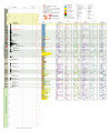
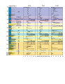
Filters: Collection: "ir_eua" Year Start: 2014
| Title | Date | Subject | Description | ||
|---|---|---|---|---|---|
| 1 |
 |
"Regulatory and analyzer update for USEPA's new formaldehyde emissions limit for combustion turbines" | 2019 | Spectrum's technical team has demonstrated a <27 ppbvd Formaldehyde detection limit (DL) on its extractive FTIR equipped using a 5-meter cell pathlength. This formaldehyde detection is well below USEPA's 91 ppbvd emission threshold for Combustion Turbines now subject to regulation under NESHAP Subpa... | |
| 2 |
 |
2014-2015 General Catalog | 2014 | University of Utah catalogue; (Catalog) | Course descriptions, majors & minors, colleges & schools |
| 3 |
 |
2015-2016 General Catalog | 2015 | University of Utah catalogue; (Catalog) | Course descriptions, majors & minors, colleges & schools |
| 4 |
 |
2016-2017 General Catalog | 2016 | University of Utah catalogue; (Catalog) | Course descriptions, majors & minors, colleges & schools |
| 5 |
 |
2017-2018 General Catalog | 2017 | University of Utah catalogue; (Catalog) | Course descriptions, majors & minors, colleges & schools |
| 6 |
 |
2018-2019 General Catalog | 2018 | University of Utah catalogue; (Catalog) | Course descriptions, majors & minors, colleges & schools |
| 7 |
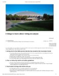 |
8 things to know about voting on campus | 2020-10-23 | COVID-19; elections; voting | Information for voting on campus for Election Day 2020 |
| 8 |
 |
A bayesian decision-theory-based digital twin for methane flares | 2022 | Ground flares operate in a high-turndown, standby configuration for a significant portion of their operating life, being fully utilized only under process upset scenarios or emergencies. The low-momentum flow results in poor fuel-air mixing near the flare tip, leading to decreased overall combustion... | |
| 9 |
 |
A chemical kinetics approach for heavy fuel oils gasification modelling | 2022 | surrogate; HFOs; pyrolysis; chemical kinetics modeling; Gassification | Refinery oil residue commonly considered the bottom of the barrel, can no longer be a waste. The increasing energy demand and the constant depletion of light oil supply make it crucial to find a suitable way to convert residual oils into valuable fuels. The gasification process represents a possible... |
| 10 |
 |
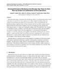
A smart combustion approach to quantify and evaluate leakage air effects in fired heaters | 2019 | The information contained in these materials is for informational purposes only and is provided "AS IS", without warranties of any kind. Your use of the information contained herein is at your sole risk. We expressly disclaim any express or implied representations, warranties or guaranties, includin... | |
| 11 |
 |
A volume of fluid approach to model injection of highly viscous fluids | 2022 | Despite the transition to renewable energy sources, fossil fuels will still play a significant role in satisfying the world's energy needs shortly. In addition, the rise in the demand for light distillates and the depletion of light crude oil reservoirs are shifting the interest toward the conversio... | |
| 12 |
 |
AAU, associations, and members file amicus brief to support lawsuits against administration's H1-B visa restrictions | 2020-10-30 | The brief supports the complaint filed by Purdue University, the University of Michigan, and Indiana University and 14 other plaintiffs against the Labor Department's rule that would make it more difficult for high-skilled foreign workers with college degrees to acquire H-1B visas. | |
| 13 |
 |
Advanced emissions monitoring from elevated gas flares for early warning system and optimization of plant operations | 2019 | Real-time monitoring of emissions from elevated gas flares is very difficult and expensive due to the relative location of the source and the cost to collect samples for analysis. Elevated Analytics has developed and applied a UAV based sensor system to accomplish this task. Besides providing a snap... | |
| 14 |
 |
The advantages of monitoring flare pilots with instantaneous response | 2020 | This paper will discuss applications for and details of a fiber optic pilot monitoring system that addresses known, specific challenges in the market. For decades, thermocouples have been the most widely accepted device for determining flare pilot status. However, there is a growing desire in the in... | |
| 15 |
 |
An air-assisted flare for biomass gasifiers | 2019 | Computational fluid dynamics (CFD) was used to simulate the combustion practice of the gases that produce from gasification process. In this simulation a new air-assisted flare design which capable to handle low flowrates of these gases with high performance was used. The simulated cases were perfor... | |
| 16 |
 |
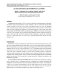
Analysis of burner operation inside an enclosed ground flare | 2022 | Thermo-Acoustic Coupling; Enclosed Flare; LES CFD Model; Noise; Premixed Burner | An industrial enclosed ground flare used as part of a large refinery project has been analyzed to assess combustion stability and performance under low and high flow conditions. This flare includes a large combustion chamber directly above the burner deck with Low Flow (LF) burners that fire up to 9... |
| 17 |
 |
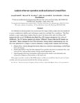
Analysis of design and operation of multi-point ground flares | 2022 | Multi-point ground flares (MPGF) are used to process large quantities of hydrocarbon gases generated in chemical processing or petrochemical refining. These flares use hundreds of flare burners arranged and fired in a staged fashion. A wind fence surrounds the MPGF to shield the flames from plant op... | |
| 18 |
 |
Annual Report: University of Utah Staff Advisory Committee (UUSAC), 2013-2014 | 2014 | Annual report | Annual report of the University of Utah Staff Advisory Committee for the 2013-2014 fiscal year. The contents include the Development Committee, Legislative Committee, Events Committee, Communications & Selections Committee and the Executive Board & Committee Chairs. |
| 19 |
 |
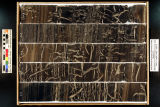
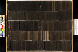
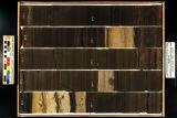
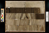
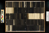
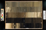
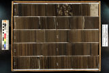
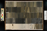
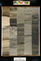
Asphalt Wash 1 (U086) - Plate 9 | 2014 | Green River Formation; well log; core log; Asphalt Wash 1; plate 9 | |
| 20 |
 |
Asphalt Wash 1 XRF depth plots | 2014 | Asphalt Wash; depth plots | |
| 21 |
 |
Budget (UUSAC 2014-09) | 2014-09 | Operating budget; Scholarship account | Budget and expenditures for operating and scholarship accounts. |
| 22 |
 |
Capturing the effect of near-and far-field dynamics on the combustion efficiency of multi-point ground flares | 2022 | Multi-point ground flares are frequently used in scenarios where flare gas flow rates can be high and pollution (noise, light, smoke) needs to be minimized. We have applied Arches, a large eddy simulation (LES) tool that we have developed for capturing the dynamics of flares (turbulent mixing, local... | |
| 23 |
 |
CFD development for fired heater applications | 2022 | Industry values the ability to ‘virtually' verify and optimize burner performance through CFD simulation and to evaluate the suitability of burner and furnace designs. Inaccurate results may lead us to falsely reject good burner designs or accept a poor design. Field problems can be far more expen... | |
| 24 |
 |
Chemical looping combustion reactions and systems: task 5 topical report, Utah Clean Coal Program | 2014-03 | ICSE; Chemical looping combustion; CLC; Chemical looping with oxygen uncoupling; CLOU; Fuel-combustion technology; Economic CO2 capture; Oxygen Carriers; Simulation of dense-phase flows; Electric power; Solid fuel combustion | Chemical Looping Combustion (CLC) is one promising fuel-combustion technology, which can facilitate economic CO2 capture in coal-fired power plants. It employs the oxidation/reduction characteristics of a metal, or oxygen carrier, and its oxide, the oxidizing gas (typically air) and the fuel source ... |
| 25 |
 |
Clean and Secure Energy from Coal - Final report, Utah Clean Coal Program | 2015-02 | coal; Utah Clean Coal Program; domestic coal resources; CO2 capture; CO2 combustion; stationary power generation; V/UQ; oxy-coal combustion; high-pressure, entrained-flow coal gasification; chemical looping combustion; underground coal thermal treatment; mercury control; environmental issues; legal ... | The University of Utah, through their Institute for Clean and Secure Energy (ICSE), performed research to utilize the vast energy stored in our domestic coal resources and to do so in a manner that will capture CO2 from combustion from stationary power generation. The research was organized around t... |
| 26 |
 |
Clean and secure energy from domestic oil sands and oil shale resources: Quarterly progress report - January 2014-March 2014 | 2014 | domestic oil shale; domestic oil sands; ICSE; CO2 management; liquid fuel production; in-situ thermal processing of oil shale; oil production | The Clean and Secure Energy from Domestic Oil Shale and Oil Sands Resources program, part of the research agenda of the Institute for Clean and Secure Energy (ICSE) at the University of Utah, is focused on engineering, scientific, and legal research surrounding the development of these resources in ... |
| 27 |
 |
Clean and secure energy from domestic oil shale and oil sands resources: Quarterly progress report - April 2014-June 2014 | 2014 | domestic oil shale resources; domestic oil sands resources; ICSE; developing oil resources; CO2 management; utilization of oil shale and oil sands; liquid fuel production; in-situ thermal processing of oil shale | The Clean and Secure Energy from Domestic Oil Shale and Oil Sands Resources program, part of the research agenda of the Institute for Clean and Secure Energy (ICSE) at the University of Utah, is focused on engineering, scientific, and legal research surrounding the development of these resources in ... |
| 28 |
 |
Clean and Secure Energy from Domestic Oil Shale and Oil Sands Resources: Quarterly progress report - January 2015 to March 2015 | 2015 | quarterly report; domestic oil shale resources; domestic oil sands resources; unconventional fuels; oil shale; oil sands | The Clean and Secure Energy from Domestic Oil Shale and Oil Sands Resources program, part of the research agenda of the Institute for Clean and Secure Energy (ICSE) at the University of Utah, is focused on engineering, scientific, and legal research surrounding the development of these resources in ... |
| 29 |
 |
Clean and secure energy from domestic oil shale and oil sands resources: Quarterly progress report - July 2014-September 2014 | 2014 | domestic oil shale; domestic oil sands; ICSE; utilization of oil shale and oil sands resources with CO2 management; liquid fuel production; in-situ thermal processing of oil shale; shale oil and pyrolysis products | The Clean and Secure Energy from Domestic Oil Shale and Oil Sands Resources program, part of the research agenda of the Institute for Clean and Secure Energy (ICSE) at the University of Utah, is focused on engineering, scientific, and legal research surrounding the development of these resources in ... |
| 30 |
 |
Clean and secure energy from domestic oil shale and oil sands resources: Quarterly progress report - October 2014-December 2014 | 2014 | domestic oil shale; domestic oil sands; ICSE; CO2 management; clean energy; oil and gas production; liquid fuel production; thermal processing of oil shale/sands | The Clean and Secure Energy from Domestic Oil Shale and Oil Sands Resources program, part of the research agenda of the Institute for Clean and Secure Energy (ICSE) at the University of Utah, is focused on engineering, scientific, and legal research surrounding the development of these resources in ... |
| 31 |
 |
Clean and secure energy from domestic oil shale and oil sands resources: Quarterly progress report: October 2013 to December 2013 | 2014 | ICSE; Quarterly report; Clean and secure energy; Oil shale; Oil sands; Uinta Basin; CO2 management; AMSO; Greenhouse gas control; Shale formation; In situ; Ex situ; TEA-C | EXECUTIVE SUMMARY The Clean and Secure Energy from Domestic Oil Shale and Oil Sands Resources program, part of the research agenda of the Institute for Clean and Secure Energy (ICSE) at the University of Utah, is focused on engineering, scientific, and legal research surrounding the development of t... |
| 32 |
 |
Clearing the Path | 2018-01 | Student success; University of Utah | A strategic student success agenda. |
| 33 |
 |
Clearsign core process burners and boiler burners - burner scaling and field results | 2022 | During previous AFRC Industrial Combustion Symposia, ClearSign Technologies Corporation introduced its ClearSign Core technology currently used in our Ultra Low NOx burner products. These ClearSign Core products have now been developed for different types of equipment applications to meet stringent ... | |
| 34 |
 |
COVID-19 is a frightening factor this Halloween | 2020-10-23 | COVID-19; Halloween | Planning for trick-or-treating during COVID-19 |
| 35 |
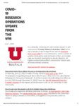 |
COVID-19 research operations update from the VPR | 2020-07-07 | COVID-19; research | Announcement on research operations during COVID-19 pandemic |
| 36 |
 |
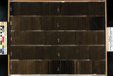
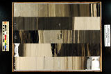
Coyote Wash 1 Plate 5 | 2014 | Coyote Wash; plate 5; well log; core log; Green River formation | |
| 37 |
 |
Effect of operating parameters on fired heater tube skin temperature measurement accuracy & the development of new improved tube skin thermocouple | 2022 | Refineries are often faced with challenges to meet production target, improve efficiency, process opportunity crudes with limited information on fouling characteristics etc. The common parameter that often becomes constraining are the tube skin temperatures which are critical in maintaining the inte... | |
| 38 |
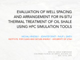 |
Evaluation of well spacing and arrangement for in-situ thermal treatment of oil shale using HPC simulation tools | 2014-10 | well spacing; in-situ thermal treatment; oil shale; HPC simulation tools; oil shale resources; oil sands resources; basin scale simulation; liquid fuel production | The mission of this presentation is to pursue research that improves industry's ability to utilize the vast energy stored in oil shale and oil sands resources with minimal environmental impact. Three main research areas looked at are: 1. Basin scale simulation of environmental and economic impacts o... |
| 39 |
 |
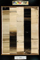
EX-1 Plate 3 | 2014 | plate 3; well log; Green River Formation; core log | |
| 40 |
 |
Experimental investigation for the development of burners for low scale reheating of semi-finished metal products | 2019 | recuperative burner; fuel rich combustion; direct fired furnace; scale reduction; radiant tube | Industrial furnaces for the reheating of semi-finished metal products are often direct fired with natural gas and air. Oxidation of the metals exposed to the furnace atmosphere causes significant material losses and additional work during furnace operation and in further processing. A reheating conc... |
| 41 |
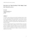 |
Explaining the "three inch rule": why model flares don't match full-scale | 2022 | It was Pohl and co-workers who discovered the so-called "Three Inch Rule" in their work on flares in the 1980s. They found that model flares with pipe diameter less than three inches do not have the same Combustion Efficiency (CE) and stability behaviour as full-scale flares, at least when wind is n... | |
| 42 |
 |
Fall 2020 Instructional Guidelines | 2020-07 | COVID-19; instruction; campus | Fall 2020 Instructional Guidelines |
| 43 |
 |
Final report of the joint NSF-NSFC workshop on combustion related to sustainable energy | 2014-03-10 | Jinxi hotel; NSF-NSFC workshop; combustion; sustainable energy | A workshop on Combustion Related to Sustainable Energy was held in Hangzhou, China on March 10-12, 2014. The workshop was jointly sponsored by the U.S. National Science Foundation (NSF) and by the National Science Foundation in China (NSFC). The purpose of the workshop was to bring together a limite... |
| 44 |
 |
Flare combustion index in lieu of combustion zone net heating value | 2020 | Flares are commonly used at industrial facilities (e.g., oil and gas extraction and production sites, gas processing plants, oil refineries, and petrochemical manufacturing plants) to safely dispose of process waste gases. Waste gases may be produced due to process upset or because they are unrecove... | |
| 45 |
 |
Flare regulatory update | 2019 | The United States Environmental Protection Agency (USEPA) revised the regulations for the refinery through the Refinery Sector Rule (RSR) revisions to NESHAP CC and UUU (aka MACT CC and MACT UUU). The USEPA is expected to propose revisions to the Ethylene MACT and the Hazardous Organic NESHAP (HON) ... | |
| 46 |
 |
Gasification studies: Task 4 topical report, Utah Clean Coal Program | 2014-02-06 | ICSE; Gasification; Large-eddy simulation; One-dimensional turbulence: Radiation; Soot formation; Entrained-flow coal gasification; Gasification kinetics; Slag formation | A key objective of the Task 4 activities has been to develop simulation tools to support development, troubleshooting and optimization of pressurized entrained-flow coal gasifiers. The overall gasifier models (Subtask 4.1) combine submodels for fluid flow (Subtask 4.2) and heat transfer (Subtask 4.3... |
| 47 |
 |
General Catalog 2019-2020 | 2020 | Course catalog; classes | University of Utah catalog of course descriptions, majors, minors, colleges, and schools |
| 48 |
|
General Catalog 2020-2021 | 2021 | Course catalog; classes | University of Utah catalog of course descriptions, majors, minors, colleges, and schools |
| 49 |
|
General Catalog 2021-2022 | 2022 | Course catalog; classes | University of Utah catalog of course descriptions, majors, minors, colleges, and schools |
| 50 |
|
General Catalog 2022-2023 | 2023 | Course catalog; classes | University of Utah catalog of course descriptions, majors, minors, colleges, and schools |
| 51 |
|
General Catalog 2023-2024 | 2024 | Course catalog; classes | University of Utah catalog of course descriptions, majors, minors, colleges, and schools |
| 52 |
|
General_Catalog_2018_2019 | 2019 | Course catalog; classes | University of Utah catalog of course descriptions, majors, minors, colleges, and schools |
| 53 |
 |
Guidelines for library space partnerships | 2014 | Guidelines for library space partnerships | |
| 54 |
 |
Installation of lean premix and remote fuel staging system in industrial process heater for next generation nox emissions control | 2022 | John Zink Hamworthy Combustion (JZHC) has completed the first installation and startup of the SOLEX combustion system in the Vacuum Tower Feed Furnace at a GS Caltex refinery in South Korea. The patented SOLEX™ burner compromises a lean premix zone of combustion, where the air-to-fuel ratio (AFR) ... | |
| 55 |
 |
Investigative approach to address thermoacoustic vibration in gas-fired heaters and boilers | 2022 | Industrial gas-fired boilers, furnaces and heaters occasionally encounter low-frequency vibrations generated by dynamic feedback between the burner (or burners) and acoustic modes in adjacent cavities in the main combustion chamber or ductwork. Feedback occurs when pressure pulses associated with ac... | |
| 56 |
 |
Letter from the Senior Vice President for Academic Affairs to Deans and Department chairs | 2020-07 | Racism; Systemic racism; Research | Letter from the Senior Vice President for Academic Affairs to Deans and Department chairs addressing U.S. Department of Homeland Security's announcement of modifications to exemptions for non-immigrant students enrolled at high education institutions during the COVID-19 pandemic. |
| 57 |
 |
Letter from the Senior Vice President for Academic Affairs to Students | 2020-07 | Racism; Systemic racism; Research | Letter from the Senior Vice President for Academic Affairs to students addressing U.S. Department of Homeland Security's announcement of modifications to exemptions for non-immigrant students enrolled at high education institutions during the COVID-19 pandemic. |
| 58 |
 |
Marriott library circulation statistics 2011-2013 | 2014-07-28 | Circulation statistics; University Press | Circulation statistics for the Marriott Library and University of Utah Press for the years 2011-2013 |
| 59 |
 |
Multistage flameless oxidation | 2019 | Flameless Oxidation (FLOX®) is a well established low thermal NOx combustion method since the early 1990s. Flameless Oxidation can be applied for processes above self ignition temperature. Typically, switching between flame- and FLOX-mode occurs at a temperature of 850°C. This restriction can be o... | |
| 60 |
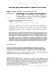 |
Neutron imaging of heterogeneous solid fuels under heating | 2019 | Solid-fuel pyrolysis, gasification, and combustion continue to play an important role in the industrial and utility sectors. Behavior of heterogeneous fuels such as biomass (e.g., wood and grasses), municipal solid waste (MSW), and coal is less understood on the micro than the macro scales, particul... | |
| 61 |
 |
New developments in flaring liquid natural gas without vaporization of the waste stream | 2020 | This paper will explore best practices and lessons learned during the development, testing, and implementation of a mechanically atomized multi-jet liquid flare for liquified natural gas (LNG). Liquefaction facilities convert natural gas into LNG by cooling it to a liquid state at -259⁰F (- 162⁰... | |
| 62 |
 |
New Member Orientation | 2014-07-14 | UUSAC new members | Agenda for the UUSAC new member orientation, with description of each agenda item. |
| 63 |
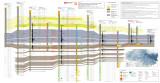 |
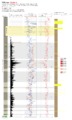
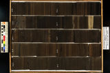
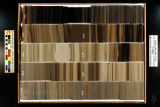
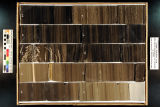
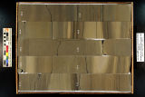
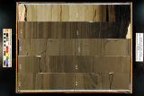
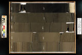
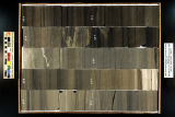
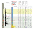
North-South core-based cross section through the middle to upper Green River Formation, Uinta Basin, Utah - Plate 2 | 2014 | oil shale; economic oil shale; oil shale zone; cross section; Green River Formation; well log; core log | The top of economic oil shale was picked at the top of the lower R-8 zone (top of the Big Three rich oil shale beds). This zone was selected to avoid the abundant saline minerals found in the overlaying saline zone, which often contains high-TDS water. If saline minerals (and high-TDS water) do not ... |
| 64 |
 |
Numberical and experimental investigations on an innovative, regeneratively heated radiant tube with compact dimensions | 2019 | heat treatment; radiant tube; regenerative heating; staged combustion | The presented, public funded research cooperation project of the Department for Industrial Furnaces and Heat Engineering at the RWTH Aachen University and the WS Wärmeprozesstechnik GmbH main aim is the development of an innovative, regeneratively heated radiant tube with compact dimensions. The ma... |
| 65 |
 |
Numerical investigations of tailored heating of a round bar for partial hot forming using Direct Flame Impingement (DFI) | 2019 | Tailored Heating; Direct Flame Impingement (DFI); Massive Forming | Hot massive forming is performed using uniform heating of the materials to avoid wrinkle formation. A new approach, which is investigated within a research project, is presented in this paper, using a tailored heating with different temperature zones to conduct hot massive forming and semi-hot formi... |
| 66 |
 |
On the front lines of COVID-19 | 2020-10-30 | COVID-19; healthcare; icu; hospital | COVID-19 health crisis impacting hospital intensive care units |
| 67 |
 |
Oxy-coal combustion studies - Task 3 topical report, Utah Clean Coal Program. | 2014-08 | oxy-coal combustion; Utah Clean Coal Program; oxy-coal; large eddy simulations; near-flame aerodynamics; pilot-scale oxy-CFB; single-particle oxy char oxidation; ash partitioning; carbon capture; pulverized coal-fired power plants | The objective of this task is to move toward the development of a predictive capability with quantified uncertainty bounds for pilot-scale, single-burner, oxy-coal operation. This validation research brings together multi-scale experimental measurements and computer simulations. The combination of s... |
| 68 |
 |
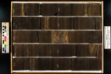
P4 Plate 6 | 2014 | well log; core log; plate 6; P4; White River Shale Project; Green River Formation | |
| 69 |
 |
PERF Project 2014-10 Results and Analysis of the VISR Method for Remote Flare Monitoring | 2019 | The Petroleum Environmental Research Forum (PERF) is a non-profit organization created to provide a stimulus to and a forum for the collection, exchange, and analysis of research information relating to the development of technology for health, environment and safety; waste reduction; and system sec... | |
| 70 |
 |
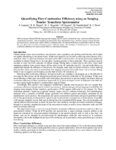
Policy issues associated with using simulation to assess environmental impacts | 2014-11 | oil and natural gas technology; policy issues with using simulation; environmental impacts; simulation-based science; judicial assessments and models; environmental policymaking | This report examines the relationship between simulation-based science and judicial assessments of simulations or models supporting evaluations of environmental harms or risks, considering both how it exists currently and how it might be shaped in the future. This report considers the legal standard... |
| 71 |
 |
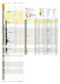
QEMSCAN analysis of Green River Formation oil shale samples, Skyline 16 core, eastern Uinta basin, UT | 2014 | QEMSCAN; oil shale; Green River Formation; Skyline 16 core; minerology | Conclusions in the presentations: 1. QEMscan analysis reveals mineralogic textures dominated by dolomite, illite, and calcite. 2. A few interpretations are made in regards to the documented compositional results generated automatically by the QEMscan: "Background" is assumed to reflect organic matt... |
| 72 |
 |
Quantifying flare combustion efficiency using an imaging fourier transform spectrometer | 2022 | Mid-wavelength infrared (MWIR) hyperspectral imaging may be used to calculate the flare combustion efficiency from standoff measurements, without requiring any information about the fuel flow rate to the flare. Species column densities are found using a spectroscopic model, which is combined with a ... | |
| 73 |
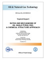 |
Rates and mechanisms of oil shale pyrolysis: A chemical structure approach | 2014-11 | Green River oil shale; oil and natural gas technology; oil shale pyrolysis; chemical structure of oil shale | Three pristine Utah Green River oil shale samples were obtained and used for analysis by the combined research groups at the University of Utah and Brigham Young University. Oil shale samples were first demineralized and the separated kerogen and extracted bitumen samples were then studied by a host... |
| 74 |
 |
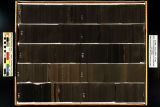
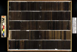
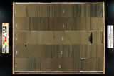
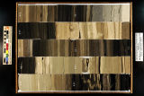
Red Wash 1 (U045) - Plate 8 | 2014 | plate 8; Red Wash 1; well log; core log; Green River Formation | |
| 75 |
 |
Redwash 1 XRF depth plots | 2014 | depth plots; Green River Formation; XRF | |
| 76 |
 |
Regulatory promotion of emergent CCS technology - Topical report | 2014-01 | CCS technology; climate change; mitigation strategies; carbon capture and sequestration | Despite the growing inevitability of climate change and the attendant need for mitigation strategies, carbon capture and sequestration (CCS) has yet to gain much traction in the United States. Recent regulatory proposals by the U.S. Environmental Protection Agency (EPA), limited in scope to new-buil... |
| 77 |
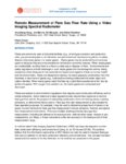 |
Remote measurement of Flare gas flow rate using a video imaging spectral radiometer | 2019 | Flares are commonly used at industrial facilities (e.g., oil and gas extraction and production sites, gas processing plants, oil refineries, and petrochemical manufacturing plants) to safely dispose of process gases (i.e. waste gases). Waste gases may be produced due to process upset or because they... | |
| 78 |
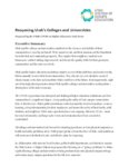 |
Reopening Utah's Colleges and Universities | 2020-05 | COVID-19; USHE; higher ed | Executive summary |
| 79 |
 |
Retreat notes: 2014 (UUSAC) | 2014 | University of Utah staff | Communication and selection. |
| 80 |
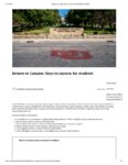 |
Return to Campus: Keys to success for students | 2020-08-20 | COVID-19; Fall Semester; 2020 | Announcement following the fifth Return to Campus webinar |
| 81 |
 |
Sabbatical report (July 2015 - December 2015) | 2015-12 | Sabbitical; Oxford university; St. Stephen's House; Pusey House | Report of sabbatical leave for Peter Kraus, Marriott Library, University of Utah |
| 82 |
 |
Simplified analysis and practical mitigation techniques for induestrial boiler thermoacoustic vibration | 2019 | Industrial boiler systems are prone to mechanical vibration which can lead to premature component failures, emission non-compliance, and greatly increased ambient noise generation. Driving mechanisms, thermoacoustic phenomena, and system geometrical interactions are complex. General methods for accu... | |
| 83 |
|
Skyline 12 Fisher Assay Data | 2015-07 | Skyline 12; Fisher Assay; Drill hole | Fisher Assay drill hole info on Skyline 12. |
| 84 |
 |
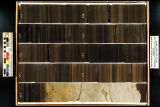
Skyline 16 - Plate 7 | 2014 | well log; core log; Skyline 16; plate 7; Green River Formation | |
| 85 |
 |
Skyline 16 information | 2015-07 | Skyline 16; preliminary stratigraphy of Skyline 16; Green River Formation; Protecore samples | |
| 86 |
|
Skyline 16 sampling | 2015-07 | Skyline 16; sampling summary | Skyline 16 sampling summary. |
| 87 |
 |
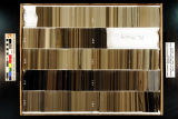
Skyline 16 Stratigraphic Column | 2015-07 | Skyline 16; stratigraphic column; well core; core log | Well log of Skyline 16. |
| 88 |
|
Skyline 16 XRF | 2015-07 | Skyline 16; Skyline 16 samples | |
| 89 |
 |
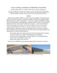
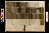
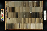
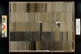
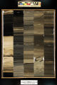
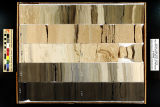
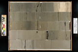
Skyline 16: SW SW sec. 10 11S 25E Uintah County, Utah. Box 1 Depth: 20.0 - 30.0 ft. | 2015-07 | core samples; Skyline 16; box 1; Green River Formation | Core sample photograph by the Utah Geological Survey, University of Utah. Skyline 16, SW SW sec. 10 11S 25E Uintah Country, Utah. Box 1 Depth: 20.0 - 30.0 ft. |
| 90 |
 |
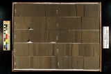
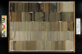
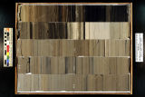
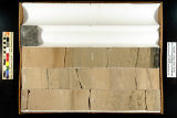
Skyline 16: SW SW sec. 10 11S 25E Uintah County, Utah. Box 10 Depth: 110.0 - 120.0 ft. | 2015-07 | core samples; Skyline 16; box 10; Green River Formation | Core sample photograph by the Utah Geological Survey, University of Utah. Skyline 16: SW SW sec. 10 11S 25E Uintah County, Utah. Box 10 Depth: 110.0 - 120.0 ft. |
| 91 |
 |
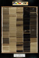
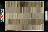
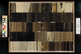
Skyline 16: SW SW sec. 10 11S 25E Uintah County, Utah. Box 11 Depth: 120.0 - 130.0 ft. | 2015-07 | core samples; Skyline 16; box 11; Green River Formation | Core sample photograph by the Utah Geological Survey, University of Utah. Skyline 16: SW SW sec. 10 11S 25E Uintah County, Utah. Box 11 Depth: 120.0 - 130.0 ft. |
| 92 |
 |
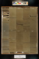
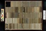
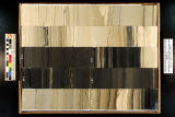
Skyline 16: SW SW sec. 10 11S 25E Uintah County, Utah. Box 12 Depth: 130.0 - 140.0 ft. | 2015-07 | core samples; Skyline 16; box 12; Green River Formation | Core sample photograph by the Utah Geological Survey, University of Utah. Skyline 16: SW SW sec. 10 11S 25E Uintah County, Utah. Box 12 Depth: 130.0 - 140.0 ft. |
| 93 |
 |
Skyline 16: SW SW sec. 10 11S 25E Uintah County, Utah. Box 13 Depth: 140.0 - 150.0 ft. | 2015-07 | core samples; Skyline 16; box 13; Green River Formation | Core sample photograph by the Utah Geological Survey, University of Utah. Skyline 16: SW SW sec. 10 11S 25E Uintah County, Utah. Box 13 Depth: 140.0 - 150.0 ft. |
| 94 |
 |
Skyline 16: SW SW sec. 10 11S 25E Uintah County, Utah. Box 14 Depth: 150.0 - 160.0 ft. | 2015-07 | core samples; Skyline 16; box 14; Green River Formation | Core sample photograph by the Utah Geological Survey, University of Utah. Skyline 16: SW SW sec. 10 11S 25E Uintah County, Utah. Box 14 Depth: 150.0 - 160.0 ft. |
| 95 |
 |
Skyline 16: SW SW sec. 10 11S 25E Uintah County, Utah. Box 15 Depth: 160.0 - 170.0 ft. | 2015-07 | core samples; Skyline 16; box 15; Green River Formation | Core sample photograph by the Utah Geological Survey, University of Utah. Skyline 16: SW SW sec. 10 11S 25E Uintah County, Utah. Box 15 Depth: 160.0 - 170.0 ft. |
| 96 |
 |
Skyline 16: SW SW sec. 10 11S 25E Uintah County, Utah. Box 16 Depth: 170.0 - 180.0 ft. | 2015-07 | core samples; Skyline 16; box 16; Green River Formation | Core sample photograph by the Utah Geological Survey, University of Utah. Skyline 16: SW SW sec. 10 11S 25E Uintah County, Utah. Box 16 Depth: 170.0 - 180.0 ft. |
| 97 |
 |
Skyline 16: SW SW sec. 10 11S 25E Uintah County, Utah. Box 17 Depth: 180.0 - 190.0 ft. | 2015-07 | core samples; Skyline 16; box 17; Green River Formation | Core sample photograph by the Utah Geological Survey, University of Utah. Skyline 16: SW SW sec. 10 11S 25E Uintah County, Utah. Box 17 Depth: 180.0 - 190.0 ft. |
| 98 |
 |
Skyline 16: SW SW sec. 10 11S 25E Uintah County, Utah. Box 18 Depth: 190.0 - 200.0 ft. | 2015-07 | core samples; Skyline 16; box 18; Green River Formation | Core sample photograph by the Utah Geological Survey, University of Utah. Skyline 16: SW SW sec. 10 11S 25E Uintah County, Utah. Box 18 Depth: 190.0 - 200.0 ft. |
| 99 |
 |
Skyline 16: SW SW sec. 10 11S 25E Uintah County, Utah. Box 19 Depth: 200.0 - 210.0 ft. | 2015-07 | core samples; Skyline 16; box 19; Green River Formation | Core sample photograph by the Utah Geological Survey, University of Utah. Skyline 16: SW SW sec. 10 11S 25E Uintah County, Utah. Box 19 Depth: 200.0 - 210.0 ft. |
| 100 |
 |
Skyline 16: SW SW sec. 10 11S 25E Uintah County, Utah. Box 2 Depth: 30.0 - 40.0 ft. | 2015-07 | core samples; Skyline 16; box 2; Green River Formation | Core sample photograph by the Utah Geological Survey, University of Utah. Skyline 16, SW SW sec. 10 11S 25E Uintah Country, Utah. Box 2 Depth: 30.0 - 40.0 ft. |
| 101 |
 |
Skyline 16: SW SW sec. 10 11S 25E Uintah County, Utah. Box 20 Depth: 210.0 - 220.0 ft. | 2015-07 | core samples; Skyline 16; box 20; Green River Formation | Core sample photograph by the Utah Geological Survey, University of Utah. Skyline 16: SW SW sec. 10 11S 25E Uintah County, Utah. Box 20 Depth: 210.0 - 220.0 ft. |
| 102 |
 |
Skyline 16: SW SW sec. 10 11S 25E Uintah County, Utah. Box 21 Depth: 220.0 - 230.0 ft. | 2015-07 | core samples; Skyline 16; box 21; Green River Formation | Core sample photograph by the Utah Geological Survey at the University of Utah and the Utah Core Research Center. Skyline 16: SW SW sec. 10 11S 25E Uintah County, Utah. Box 21 Depth: 220.0 - 230.0 ft. |
| 103 |
 |
Skyline 16: SW SW sec. 10 11S 25E Uintah County, Utah. Box 22 Depth: 230.0 - 240.0 ft. | 2015-07 | core samples; Skyline 16; box 22; Green River Formation | Core sample photograph by the Utah Geological Survey at the University of Utah, and the Utah Core Research Center. Skyline 16: SW SW sec. 10 11S 25E Uintah County, Utah. Box 22 Depth: 230.0 - 240.0 ft. |
| 104 |
 |
Skyline 16: SW SW sec. 10 11S 25E Uintah County, Utah. Box 23 Depth: 240.0 - 250.0 ft. | 2015-07 | core samples; Skyline 16; box 23; Green River Formation | Core sample photograph by the Utah Geological Survey at the University of Utah, and the Utah Core Research Center. Skyline 16: SW SW sec. 10 11S 25E Uintah County, Utah. Box 23 Depth: 240.0 - 250.0 ft. |
| 105 |
 |
Skyline 16: SW SW sec. 10 11S 25E Uintah County, Utah. Box 24 Depth: 250.0 - 260.0 ft. | 2015-07 | core samples; Skyline 16; box 24; Green River Formation | Core sample photograph by the Utah Geological Survey at the University of Utah, and the Utah Core Research Center. Skyline 16: SW SW sec. 10 11S 25E Uintah County, Utah. Box 24 Depth: 250.0 - 260.0 ft. |
| 106 |
 |
Skyline 16: SW SW sec. 10 11S 25E Uintah County, Utah. Box 25 Depth: 260.0 - 270.0 ft. | 2015-07 | core samples; Skyline 16; box 25; Green River Formation | Core sample photograph by the Utah Geological Survey and the University of Utah, and the Utah Core Research Center. Skyline 16: SW SW sec. 10 11S 25E Uintah County, Utah. Box 25 Depth: 260.0 - 270.0 ft. |
| 107 |
 |
Skyline 16: SW SW sec. 10 11S 25E Uintah County, Utah. Box 26 Depth: 270.0 - 280.0 ft. | 2015-07 | core samples; Skyline 16; box 26; Green River Formation | Core sample photograph by the Utah Geological Survey at the University of Utah, and the Utah Core Research Center. Skyline 16: SW SW sec. 10 11S 25E Uintah County, Utah. Box 26 Depth: 270.0 - 280.0 ft. |
| 108 |
 |
Skyline 16: SW SW sec. 10 11S 25E Uintah County, Utah. Box 27 Depth: 280.0 - 290.0 ft. | 2015-07 | core samples; Skyline 16; box 27; Green River Formation | Core sample photograph by the Utah Geological Survey at the University of Utah, and the Utah Core Research Center. Skyline 16: SW SW sec. 10 11S 25E Uintah County, Utah. Box 27 Depth: 280.0 - 290.0 ft. |
| 109 |
 |
Skyline 16: SW SW sec. 10 11S 25E Uintah County, Utah. Box 28 Depth: 290.0 - 300.0 ft. | 2015-07 | core samples; Skyline 16; box 28; Green River Formation | Core sample photograph by the Utah Geological Survey at the University of Utah, and the Utah Core Research Center. Skyline 16: SW SW sec. 10 11S 25E Uintah County, Utah. Box 28 Depth: 290.0 - 300.0 ft. |
| 110 |
 |
Skyline 16: SW SW sec. 10 11S 25E Uintah County, Utah. Box 29 Depth: 300.0 - 310.0 ft. | 2015-07 | core samples; Skyline 16; box 29; Green River Formation | Core sample photograph by the Utah Geological Survey at the University of Utah, and the Utah Core Research Center. Skyline 16: SW SW sec. 10 11S 25E Uintah County, Utah. Box 29 Depth: 300.0 - 310.0 ft. |
| 111 |
 |
Skyline 16: SW SW sec. 10 11S 25E Uintah County, Utah. Box 3 Depth: 40.0 - 50.0 ft. | 2015-07 | core samples; Skyline 16; box 3; Green River Formation | Core sample photograph by the Utah Geological Survey, University of Utah. Skyline 16: SW SW sec. 10 11S 25E Uintah County, Utah. Box 3 Depth: 40.0 - 50.0 ft. |
| 112 |
 |
Skyline 16: SW SW sec. 10 11S 25E Uintah County, Utah. Box 30 Depth: 310.0 - 320.0 ft. | 2015-07 | core samples; Skyline 16; box 30; Green River Formation | Core sample photograph by the Utah Geological Survey at the University of Utah, and the Utah Core Research Center. Skyline 16: SW SW sec. 10 11S 25E Uintah County, Utah. Box 30 Depth: 310.0 - 320.0 ft. |
| 113 |
 |
Skyline 16: SW SW sec. 10 11S 25E Uintah County, Utah. Box 31 Depth: 320.0 - 330.0 ft. | 2015-07 | core samples; Skyline 16; box 31; Green River Formation | Core sample photograph by the Utah Geological Survey at the University of Utah, and the Utah Core Research Center. Skyline 16: SW SW sec. 10 11S 25E Uintah County, Utah. Box 31 Depth: 320.0 - 330.0 ft. |
| 114 |
 |
Skyline 16: SW SW sec. 10 11S 25E Uintah County, Utah. Box 32 Depth: 330.0 - 340.0 ft. | 2015-07 | core samples; Skyline 16; box 32; Green River Formation | Core sample photograph by the Utah Geological Survey at the University of Utah, and the Utah Core Research Center. Skyline 16: SW SW sec. 10 11S 25E Uintah County, Utah. Box 32 Depth: 330.0 - 340.0 ft. |
| 115 |
 |
Skyline 16: SW SW sec. 10 11S 25E Uintah County, Utah. Box 33 Depth: 340.0 - 350.0 ft. | 2015-07 | core samples; Skyline 16; box 33; Green River Formation | Core sample photograph by the Utah Geological Survey at the University of Utah, and the Utah Core Research Center. Skyline 16: SW SW sec. 10 11S 25E Uintah County, Utah. Box 33 Depth: 340.0 - 350.0 ft. |
| 116 |
 |
Skyline 16: SW SW sec. 10 11S 25E Uintah County, Utah. Box 34 Depth: 350.0 - 360.0 ft. | 2015-07 | core samples; Skyline 16; box 34; Green River Formation | Core sample photograph by the Utah Geological Survey at the University of Utah, and the Utah Core Research Center. Skyline 16: SW SW sec. 10 11S 25E Uintah County, Utah. Box 34 Depth: 350.0 - 360.0 ft. |
| 117 |
 |
Skyline 16: SW SW sec. 10 11S 25E Uintah County, Utah. Box 35 Depth: 360.0 - 370.0 ft. | 2015-07 | core samples; Skyline 16; box 35; Green River Formation | Core sample photograph by the Utah Geological Survey at the University of Utah, and the Utah Core Research Center. Skyline 16: SW SW sec. 10 11S 25E Uintah County, Utah. Box 35 Depth: 360.0 - 370.0 ft. |
| 118 |
 |
Skyline 16: SW SW sec. 10 11S 25E Uintah County, Utah. Box 36 Depth: 370.0 - 380.0 ft. | 2015-07 | core samples; Skyline 16; box 36; Green River Formation | Core sample photograph by the Utah Geological Survey at the University of Utah, and the Utah Core Research Center. Skyline 16: SW SW sec. 10 11S 25E Uintah County, Utah. Box 36 Depth: 370.0 - 380.0 ft. |
| 119 |
 |
Skyline 16: SW SW sec. 10 11S 25E Uintah County, Utah. Box 37 Depth: 380.0 - 390.0 ft. | 2015-07 | core samples; Skyline 16; box 37; Green River Formation | Core sample photograph by the Utah Geological Survey at the University of Utah, and the Utah Core Research Center. Skyline 16: SW SW sec. 10 11S 25E Uintah County, Utah. Box 37 Depth: 380.0 - 390.0 ft. |
| 120 |
 |
Skyline 16: SW SW sec. 10 11S 25E Uintah County, Utah. Box 38 Depth: 390.0 - 400.0 ft. | 2015-07 | core samples; Skyline 16; box 38; Green River Formation | Core sample photograph by the Utah Geological Survey at the University of Utah, and the Utah Core Research Center. Skyline 16: SW SW sec. 10 11S 25E Uintah County, Utah. Box 38 Depth: 390.0 - 400.0 ft. |
| 121 |
 |
Skyline 16: SW SW sec. 10 11S 25E Uintah County, Utah. Box 39 Depth: 400.0 - 410.0 ft. | 2015-07 | core samples; Skyline 16; box 39; Green River Formation | Core sample photograph by the Utah Geological Survey at the University of Utah, and the Utah Core Research Center. Skyline 16: SW SW sec. 10 11S 25E Uintah County, Utah. Box 39 Depth: 400.0 - 410.0 ft. |
| 122 |
 |
Skyline 16: SW SW sec. 10 11S 25E Uintah County, Utah. Box 4 Depth: 50.0 - 60.0 ft. | 2015-07 | core samples; Skyline 16; box 4; Green River Formation | Core sample photograph by the Utah Geological Survey, University of Utah. Skyline 16: SW SW sec. 10 11S 25E Uintah County, Utah. Box 4 Depth: 50.0 - 60.0 ft. |
| 123 |
 |
Skyline 16: SW SW sec. 10 11S 25E Uintah County, Utah. Box 40 Depth: 410.0 - 420.0 ft. | 2015-07 | core samples; Skyline 16; box 40; Green River Formation | Core sample photograph by the Utah Geological Survey at the University of Utah, and the Utah Core Research Center. Skyline 16: SW SW sec. 10 11S 25E Uintah County, Utah. Box 40 Depth: 410.0 - 420.0 ft. |
| 124 |
 |
Skyline 16: SW SW sec. 10 11S 25E Uintah County, Utah. Box 41 Depth: 420.0 - 430.0 ft. | 2015-07 | core samples; Skyline 16; box 41; Green River Formation | Core sample photograph by the Utah Geological Survey at the University of Utah, and the Utah Core Research Center. Skyline 16: SW SW sec. 10 11S 25E Uintah County, Utah. Box 41 Depth: 420.0 - 430.0 ft. |
| 125 |
 |
Skyline 16: SW SW sec. 10 11S 25E Uintah County, Utah. Box 42 Depth: 430.0 - 440.0 ft. | 2015-07 | core samples; Skyline 16; box 42; Green River Formation | Core sample photograph by the Utah Geological Survey at the University of Utah, and the Utah Core Research Center. Skyline 16: SW SW sec. 10 11S 25E Uintah County, Utah. Box 42 Depth: 430.0 - 440.0 ft. |
| 126 |
 |
Skyline 16: SW SW sec. 10 11S 25E Uintah County, Utah. Box 43 Depth: 440.0 - 450.0 ft. | 2015-07 | core samples; Skyline 16; box 43; Green River Formation | Core sample photograph by the Utah Geological Survey at the University of Utah, and the Utah Core Research Center. Skyline 16: SW SW sec. 10 11S 25E Uintah County, Utah. Box 43 Depth: 440.0 - 450.0 ft. |
| 127 |
 |
Skyline 16: SW SW sec. 10 11S 25E Uintah County, Utah. Box 44 Depth: 450.0 - 460.0 ft. | 2015-07 | core samples; Skyline 16; box 44; Green River Formation | Core sample photograph by the Utah Geological Survey at the University of Utah, and the Utah Core Research Center. Skyline 16: SW SW sec. 10 11S 25E Uintah County, Utah. Box 44 Depth: 450.0 - 460.0 ft. |
| 128 |
 |
Skyline 16: SW SW sec. 10 11S 25E Uintah County, Utah. Box 45 Depth: 460.0 - 470.0 ft. | 2015-07 | core samples; Skyline 16; box 45; Green River Formation | Core sample photograph by the Utah Geological Survey at the University of Utah, and the Utah Core Research Center. Skyline 16: SW SW sec. 10 11S 25E Uintah County, Utah. Box 45 Depth: 460.0 - 470.0 ft. |
| 129 |
 |
Skyline 16: SW SW sec. 10 11S 25E Uintah County, Utah. Box 46 Depth: 470.0 - 480.0 ft. | 2015-07 | core samples; Skyline 16; box 46; Green River Formation | Core sample photograph by the Utah Geological Survey at the University of Utah, and the Utah Core Research Center. |
| 130 |
 |
Skyline 16: SW SW sec. 10 11S 25E Uintah County, Utah. Box 47 Depth: 480.0 - 490.0 ft. | 2015-07 | core samples; Skyline 16; box 47; Green River Formation | Core sample photograph by the Utah Geological Survey at the University of Utah, and the Utah Core Research Center. Skyline 16: SW SW sec. 10 11S 25E Uintah County, Utah. Box 47 Depth: 480.0 - 490.0 ft. |
| 131 |
 |
Skyline 16: SW SW sec. 10 11S 25E Uintah County, Utah. Box 48 Depth: 490.0 - 500.0 ft. | 2015-07 | core samples; Skyline 16; box 48; Green River Formation | Core sample photograph by the Utah Geological Survey at the University of Utah, and the Utah Core Research Center. Skyline 16: SW SW sec. 10 11S 25E Uintah County, Utah. Box 48 Depth: 490.0 - 500.0 ft. |
| 132 |
 |
Skyline 16: SW SW sec. 10 11S 25E Uintah County, Utah. Box 49 Depth: 500.0 - 510.0 ft. | 2015-07 | core samples; Skyline 16; box 49; Green River Formation | Core sample photograph by the Utah Geological Survey at the University of Utah, and the Utah Core Research Center. Skyline 16: SW SW sec. 10 11S 25E Uintah County, Utah. Box 49 Depth: 500.0 - 510.0 ft. |
| 133 |
 |
Skyline 16: SW SW sec. 10 11S 25E Uintah County, Utah. Box 5 Depth: 60.0 - 70.0 ft. | 2015-07 | core samples; Skyline 16; box 5; Green River Formation | Core sample photograph by the Utah Geological Survey, University of Utah. Skyline 16: SW SW sec. 10 11S 25E Uintah County, Utah. Box 5 Depth: 60.0 - 70.0 ft. |
| 134 |
 |
Skyline 16: SW SW sec. 10 11S 25E Uintah County, Utah. Box 50 Depth: 510.0 - 520.0 ft. | 2015-07 | core samples; Skyline 16; box 50; Green River Formation | Core sample photograph by the Utah Geological Survey at the University of Utah, and the Utah Core Research Center. Skyline 16: SW SW sec. 10 11S 25E Uintah County, Utah. Box 50 Depth: 510.0 - 520.0 ft. |
| 135 |
 |
Skyline 16: SW SW sec. 10 11S 25E Uintah County, Utah. Box 51 Depth: 520.0 - 530.0 ft. | 2015-07 | core samples; Skyline 16; box 51; Green River Formation | Core sample photograph by the Utah Geological Survey at the University of Utah, and the Utah Core Research Center. Skyline 16: SW SW sec. 10 11S 25E Uintah County, Utah. Box 51 Depth: 520.0 - 530.0 ft. |
| 136 |
 |
Skyline 16: SW SW sec. 10 11S 25E Uintah County, Utah. Box 52 Depth: 530.0 - 540.0 ft. | 2015-07 | core samples; Skyline 16; box 52; Green River Formation | Core sample photograph by the Utah Geological Survey at the University of Utah, and the Utah Core Research Center. Skyline 16: SW SW sec. 10 11S 25E Uintah County, Utah. Box 52 Depth: 530.0 - 540.0 ft. |
| 137 |
 |
Skyline 16: SW SW sec. 10 11S 25E Uintah County, Utah. Box 53 Depth: 540.0 - 550.0 ft. | 2015-07 | core samples; Skyline 16; box 53; Green River Formation | Core sample photograph by the Utah Geological Survey at the University of Utah, and the Utah Core Research Center. Skyline 16: SW SW sec. 10 11S 25E Uintah County, Utah. Box 53 Depth: 540.0 - 550.0 ft. |
| 138 |
 |
Skyline 16: SW SW sec. 10 11S 25E Uintah County, Utah. Box 54 Depth: 550.0 - 560.0 ft. | 2015-07 | core samples; Skyline 16; box 54; Green River Formation | Core sample photograph by the Utah Geological Survey at the University of Utah, and the Utah Core Research Center. Skyline 16: SW SW sec. 10 11S 25E Uintah County, Utah. Box 54 Depth: 550.0 - 560.0 ft. |
| 139 |
 |
Skyline 16: SW SW sec. 10 11S 25E Uintah County, Utah. Box 55 Depth: 560.0 - 570.0 ft. | 2015-07 | core samples; Skyline 16; box 55; Green River Formation | Core sample photograph by the Utah Geological Survey at the University of Utah, and the Utah Core Research Center. Skyline 16: SW SW sec. 10 11S 25E Uintah County, Utah. Box 55 Depth: 560.0 - 570.0 ft. |
| 140 |
 |
Skyline 16: SW SW sec. 10 11S 25E Uintah County, Utah. Box 56 Depth: 570.0 - 580.0 ft. | 2015-07 | core samples; Skyline 16; box 56; Green River Formation | Core sample photograph by the Utah Geological Survey at the University of Utah, and the Utah Core Research Center. Skyline 16: SW SW sec. 10 11S 25E Uintah County, Utah. Box 56 Depth: 570.0 - 580.0 ft. |
| 141 |
 |
Skyline 16: SW SW sec. 10 11S 25E Uintah County, Utah. Box 57 Depth: 580.0 - 590.0 ft. | 2015-07 | core samples; Skyline 16; box 57; Green River Formation | Core sample photograph by the Utah Geological Survey at the University of Utah, and the Utah Core Research Center. Skyline 16: SW SW sec. 10 11S 25E Uintah County, Utah. Box 57 Depth: 580.0 - 590.0 ft. |
| 142 |
 |
Skyline 16: SW SW sec. 10 11S 25E Uintah County, Utah. Box 58 Depth: 590.0 - 600.0 ft. | 2015-07 | core samples; Skyline 16; box 58; Green River Formation | Core sample photograph by the Utah Geological Survey at the University of Utah, and the Utah Core Research Center. Skyline 16: SW SW sec. 10 11S 25E Uintah County, Utah. Box 58 Depth: 590.0 - 600.0 ft. |
| 143 |
 |
Skyline 16: SW SW sec. 10 11S 25E Uintah County, Utah. Box 59 Depth: 600.0 - 610.0 ft. | 2015-07 | core samples; Skyline 16; box 59; Green River Formation | Core sample photograph by the Utah Geological Survey at the University of Utah, and the Utah Core Research Center. |
| 144 |
 |
Skyline 16: SW SW sec. 10 11S 25E Uintah County, Utah. Box 6 Depth: 70.0 - 80.0 ft. | 2015-07 | core samples; Skyline 16; box 6; Green River Formation | Core sample photograph by the Utah Geological Survey, University of Utah. Skyline 16: SW SW sec. 10 11S 25E Uintah County, Utah. Box 6 Depth: 70.0 - 80.0 ft. |
| 145 |
 |
Skyline 16: SW SW sec. 10 11S 25E Uintah County, Utah. Box 60 Depth: 610.0 - 620.0 ft. | 2015-07 | core samples; Skyline 16; box 60; Green River Formation | Core sample photograph by the Utah Geological Survey at the University of Utah, and the Utah Core Research Center. Skyline 16: SW SW sec. 10 11S 25E Uintah County, Utah. Box 60 Depth: 610.0 - 620.0 ft. |
| 146 |
 |
Skyline 16: SW SW sec. 10 11S 25E Uintah County, Utah. Box 61 Depth: 620.0 - 630.0 ft. | 2015-07 | core samples; Skyline 16; box 61; Green River Formation | Core sample photograph by the Utah Geological Survey at the University of Utah, and the Utah Core Research Center. Skyline 16: SW SW sec. 10 11S 25E Uintah County, Utah. Box 61 Depth: 620.0 - 630.0 ft. |
| 147 |
 |
Skyline 16: SW SW sec. 10 11S 25E Uintah County, Utah. Box 62 Depth: 630.0 - 640.0 ft. | 2015-07 | core samples; Skyline 16; box 62; Green River Formation | Core sample photograph by the Utah Geological Survey at the University of Utah, and the Utah Core Research Center. Skyline 16: SW SW sec. 10 11S 25E Uintah County, Utah. Box 62 Depth: 630.0 - 640.0 ft. |
| 148 |
 |
Skyline 16: SW SW sec. 10 11S 25E Uintah County, Utah. Box 63 Depth: 640.0 - 650.0 ft. | 2015-07 | core samples; Skyline 16; box 63; Green River Formation | Core sample photograph by the Utah Geological Survey at the University of Utah, and the Utah Core Research Center. Skyline 16: SW SW sec. 10 11S 25E Uintah County, Utah. Box 63 Depth: 640.0 - 650.0 ft. |
| 149 |
 |
Skyline 16: SW SW sec. 10 11S 25E Uintah County, Utah. Box 64 Depth: 650.0 - 660.0 ft. | 2015-07 | core samples; Skyline 16; box 64; Green River Formation | Core sample photograph by the Utah Geological Survey at the University of Utah, and the Utah Core Research Center. Skyline 16: SW SW sec. 10 11S 25E Uintah County, Utah. Box 64 Depth: 650.0 - 660.0 ft. |
| 150 |
 |
Skyline 16: SW SW sec. 10 11S 25E Uintah County, Utah. Box 65 Depth: 660.0 - 670.0 ft. | 2015-07 | core samples; Skyline 16; box 65; Green River Formation | Core sample photograph by the Utah Geological Survey at the University of Utah, and the Utah Core Research Center. Skyline 16: SW SW sec. 10 11S 25E Uintah County, Utah. Box 65 Depth: 660.0 - 670.0 ft. |
| 151 |
 |
Skyline 16: SW SW sec. 10 11S 25E Uintah County, Utah. Box 66 Depth: 670.0 - 680.0 ft. | 2015-07 | core samples; Skyline 16; box 66; Green River Formation | Core sample photograph by the Utah Geological Survey at the University of Utah, and the Utah Core Research Center. Skyline 16: SW SW sec. 10 11S 25E Uintah County, Utah. Box 66 Depth: 670.0 - 680.0 ft. |
| 152 |
 |
Skyline 16: SW SW sec. 10 11S 25E Uintah County, Utah. Box 67 Depth: 680.0 - 690.0 ft. | 2015-07 | core samples; Skyline 16; box 67; Green River Formation | Core sample photograph by the Utah Geological Survey at the University of Utah, and Utah Core Research Center. Skyline 16: SW SW sec. 10 11S 25E Uintah County, Utah. Box 67 Depth: 680.0 - 690.0 ft. |
| 153 |
 |
Skyline 16: SW SW sec. 10 11S 25E Uintah County, Utah. Box 68 Depth: 690.0 - 700.0 ft. | 2015-07 | core samples; Skyline 16; box 68; Green River Formation | Core sample photograph by the Utah Geological Survey at the University of Utah, and the Utah Core Research Center. Skyline 16: SW SW sec. 10 11S 25E Uintah County, Utah. Box 68 Depth: 690.0 - 700.0 ft. |
| 154 |
 |
Skyline 16: SW SW sec. 10 11S 25E Uintah County, Utah. Box 69 Depth: 700.0 - 710.0 ft. | 2015-07 | core samples; Skyline 16; box 69; Green River Formation | Core sample photograph by the Utah Geological Survey at the University of Utah, and the Utah Core Research Center. Skyline 16: SW SW sec. 10 11S 25E Uintah County, Utah. Box 69 Depth: 700.0 - 710.0 ft. |
| 155 |
 |
Skyline 16: SW SW sec. 10 11S 25E Uintah County, Utah. Box 7 Depth: 80.0 - 90.0 ft. | 2015-07 | core samples; Skyline 16; box 7; Green River Formation | Core sample photograph by the Utah Geological Survey, University of Utah. Skyline 16: SW SW sec. 10 11S 25E Uintah County, Utah. Box 7 Depth: 80.0 - 90.0 ft. |
| 156 |
 |
Skyline 16: SW SW sec. 10 11S 25E Uintah County, Utah. Box 70 Depth: 710.0 - 720.0 ft. | 2015-07 | core samples; Skyline 16; box 70; Green River Formation | Core sample photograph by the Utah Geological Survey at the University of Utah, and the Utah Core Research Center. Skyline 16: SW SW sec. 10 11S 25E Uintah County, Utah. Box 70 Depth: 710.0 - 720.0 ft. |
| 157 |
 |
Skyline 16: SW SW sec. 10 11S 25E Uintah County, Utah. Box 71 Depth: 720.0 - 730.0 ft. | 2015-07 | core samples; Skyline 16; box 71; Green River Formation | Core sample photograph by the Utah Geological Survey at the University of Utah, and the Utah Core Research Center. Skyline 16: SW SW sec. 10 11S 25E Uintah County, Utah. Box 71 Depth: 720.0 - 730.0 ft. |
| 158 |
 |
Skyline 16: SW SW sec. 10 11S 25E Uintah County, Utah. Box 72 Depth: 730.0 - 740.0 ft. | 2015-07 | core samples; Skyline 16; box 72; Green River Formation | Core sample photograph by the Utah Geological Survey at the University of Utah, and the Utah Core Research Center. Skyline 16: SW SW sec. 10 11S 25E Uintah County, Utah. Box 72 Depth: 730.0 - 740.0 ft. |
| 159 |
 |
Skyline 16: SW SW sec. 10 11S 25E Uintah County, Utah. Box 73 Depth: 740.0 - 750.0 ft. | 2015-07 | core samples; Skyline 16; box 73; Green River Formation | Core sample photograph by the Utah Geological Survey at the University of Utah, and the Utah Core Research Center. Skyline 16: SW SW sec. 10 11S 25E Uintah County, Utah. Box 73 Depth: 740.0 - 750.0 ft. |
| 160 |
 |
Skyline 16: SW SW sec. 10 11S 25E Uintah County, Utah. Box 74 Depth: 750.0 - 760.0 ft. | 2015-07 | core samples; Skyline 16; box 74; Green River Formation | Core sample photograph by the Utah Geological Survey at the University of Utah, and the Utah Core Research Center. Skyline 16: SW SW sec. 10 11S 25E Uintah County, Utah. Box 74 Depth: 750.0 - 760.0 ft. |
| 161 |
 |
Skyline 16: SW SW sec. 10 11S 25E Uintah County, Utah. Box 75 Depth: 760.0 - 770.0 ft. | 2015-07 | core samples; Skyline 16; box 75; Green River Formation | Core sample photograph by the Utah Geological Survey at the University of Utah, and the Utah Core Research Center. Skyline 16: SW SW sec. 10 11S 25E Uintah County, Utah. Box 75 Depth: 760.0 - 770.0 ft. |
| 162 |
 |
Skyline 16: SW SW sec. 10 11S 25E Uintah County, Utah. Box 76 Depth: 770.0 - 780.0 ft. | 2015-07 | core samples; Skyline 16; box 76; Green River Formation | Core sample photograph by the Utah Geological Survey at the University of Utah, and the Utah Core Research Center. Skyline 16: SW SW sec. 10 11S 25E Uintah County, Utah. Box 76 Depth: 770.0 - 780.0 ft. |
| 163 |
 |
Skyline 16: SW SW sec. 10 11S 25E Uintah County, Utah. Box 77 Depth: 780.0 - 790.0 ft. | 2015-07 | core samples; Skyline 16; box 77; Green River Formation | Core sample photograph by the Utah Geological Survey at the University of Utah, and the Utah Core Research Center. Skyline 16: SW SW sec. 10 11S 25E Uintah County, Utah. Box 77 Depth: 780.0 - 790.0 ft. |
| 164 |
 |
Skyline 16: SW SW sec. 10 11S 25E Uintah County, Utah. Box 78 Depth: 790.0 - 800.0 ft. | 2015-07 | core samples; Skyline 16; box 78; Green River Formation | Core sample photograph by the Utah Geological Survey at the University of Utah, and the Utah Core Research Center. Skyline 16: SW SW sec. 10 11S 25E Uintah County, Utah. Box 78 Depth: 790.0 - 800.0 ft. |
| 165 |
 |
Skyline 16: SW SW sec. 10 11S 25E Uintah County, Utah. Box 79 Depth: 800.0 - 810.0 ft. | 2015-07 | core samples; Skyline 16; box 79; Green River Formation | Core sample photograph by the Utah Geological Survey at the University of Utah, and the Utah Core Research Center. Skyline 16: SW SW sec. 10 11S 25E Uintah County, Utah. Box 79 Depth: 800.0 - 810.0 ft. |
| 166 |
 |
Skyline 16: SW SW sec. 10 11S 25E Uintah County, Utah. Box 8 Depth: 90.0 - 100.0 ft. | 2015-07 | core samples; Skyline 16; box 8; Green River Formation | Core sample photograph by the Utah Geological Survey, University of Utah. Skyline 16: SW SW sec. 10 11S 25E Uintah County, Utah. Box 8 Depth: 90.0 - 100.0 ft. |
| 167 |
 |
Skyline 16: SW SW sec. 10 11S 25E Uintah County, Utah. Box 80 Depth: 810.0 - 820.0 ft. | 2015-07 | core samples; Skyline 16; box 80; Green River Formation | Core sample photograph by the Utah Geological Survey at the University of Utah, and the Utah Core Research Center. Skyline 16: SW SW sec. 10 11S 25E Uintah County, Utah. Box 80 Depth: 810.0 - 820.0 ft. |
| 168 |
 |
Skyline 16: SW SW sec. 10 11S 25E Uintah County, Utah. Box 81 Depth: 820.0 - 830.0 ft. | 2015-07 | core samples; Skyline 16; box 81; Green River Formation | Core sample photograph by the University of Utah, and the Utah Core Research Center. Skyline 16: SW SW sec. 10 11S 25E Uintah County, Utah. Box 81 Depth: 820.0 - 830.0 ft. |
| 169 |
 |
Skyline 16: SW SW sec. 10 11S 25E Uintah County, Utah. Box 82 Depth: 830.0 - 840.0 ft. | 2015-07 | core samples; Skyline 16; box 82; Green River Formation | Core sample photograph by the University of Utah, and the Utah Core Research Center. Skyline 16: SW SW sec. 10 11S 25E Uintah County, Utah. Box 82 Depth: 830.0 - 840.0 ft. |
| 170 |
 |
Skyline 16: SW SW sec. 10 11S 25E Uintah County, Utah. Box 83 Depth: 840.0 - 850.0 ft. | 2015-07 | core sample; Skyline 16; box 83; Green River Formation | Core sample photograph by the Utah Geological Survey at the University of Utah, and the Utah Core Research Center. Skyline 16: SW SW sec. 10 11S 25E Uintah County, Utah. Box 83 Depth: 840.0 - 850.0 ft. |
| 171 |
 |
Skyline 16: SW SW sec. 10 11S 25E Uintah County, Utah. Box 84 Depth: 850.0 - 860.0 ft. | 2015-07 | core sample; Skyline 16; box 84; Green River Formation | Core sample photograph by the Utah Geological Survey at the University of Utah, and the Utah Core Research Center. Skyline 16: SW SW sec. 10 11S 25E Uintah County, Utah. Box 84 Depth: 850.0 - 860.0 ft. |
| 172 |
 |
Skyline 16: SW SW sec. 10 11S 25E Uintah County, Utah. Box 85 Depth: 860.0 - 870.0 ft. | 2015-07 | core sample; Skyline 16; box 85; Green River Formation | Core sample photograph by the Utah Geological Survey at the University of Utah, and the Utah Core Research Center. Skyline 16: SW SW sec. 10 11S 25E Uintah County, Utah. Box 85 Depth: 860.0 - 870.0 ft. |
| 173 |
 |
Skyline 16: SW SW sec. 10 11S 25E Uintah County, Utah. Box 86 Depth: 870.0 - 880.0 ft. | 2015-07 | core sample; Skyline 16; box 86; Green River Formation | Core sample photograph by the Utah Geological Survey at the University of Utah, and the Utah Core Research Center. Skyline 16: SW SW sec. 10 11S 25E Uintah County, Utah. Box 86 Depth: 870.0 - 880.0 ft. |
| 174 |
 |
Skyline 16: SW SW sec. 10 11S 25E Uintah County, Utah. Box 87 Depth: 880.0 - 890.0 ft. | 2015-07 | core sample; Skyline 16; box 87; Green River Formation | Core sample photograph by the Utah Geological Survey at the University of Utah, and the Utah Core Research Center. Skyline 16: SW SW sec. 10 11S 25E Uintah County, Utah. Box 87 Depth: 880.0 - 890.0 ft. |
| 175 |
 |
Skyline 16: SW SW sec. 10 11S 25E Uintah County, Utah. Box 88 Depth: 890.0 - 900.0 ft. | 2015-07 | core sample; Skyline 16; box 88; Green River Formation | Core sample photograph by the Utah Geological Survey at the University of Utah, and the Utah Core Research Center. Skyline 16: SW SW sec. 10 11S 25E Uintah County, Utah. Box 88 Depth: 890.0 - 900.0 ft. |
| 176 |
 |
Skyline 16: SW SW sec. 10 11S 25E Uintah County, Utah. Box 89 Depth: 900.0 - 910.0 ft. | 2015-07 | core sample; Skyline 16; box 89; Green River Formation | Core sample photograph by the Utah Geological Survey at the University of Utah, and the Utah Core Research Center. Skyline 16: SW SW sec. 10 11S 25E Uintah County, Utah. Box 89 Depth: 900.0 - 910.0 ft. |
| 177 |
 |
Skyline 16: SW SW sec. 10 11S 25E Uintah County, Utah. Box 9 Depth: 100.0 - 110.0 ft. | 2015-07 | core samples; Skyline 16; box 9; Green River Formation | Core sample photograph by the Utah Geological Survey, University of Utah. Skyline 16: SW SW sec. 10 11S 25E Uintah County, Utah. Box 9 Depth: 100.0 - 110.0 ft. |
| 178 |
 |
Skyline 16: SW SW sec. 10 11S 25E Uintah County, Utah. Box 90 Depth: 910.0 - 920.0 ft. | 2015-07 | core sample; Skyline 16; box 90; Green River Formation | Core sample photograph by the Utah Geological Survey at the University of Utah, and the Utah Core Research Center. Skyline 16: SW SW sec. 10 11S 25E Uintah County, Utah. Box 90 Depth: 910.0 - 920.0 ft. |
| 179 |
 |
Skyline 16: SW SW sec. 10 11S 25E Uintah County, Utah. Box 91 Depth: 920.0 - 930.0 ft. | 2015-07 | core sample; Skyline 16; box 91; Green River Formation | Core sample photograph by the Utah Geological Survey at the University of Utah, and the Utah Core Research Center. Skyline 16: SW SW sec. 10 11S 25E Uintah County, Utah. Box 91 Depth: 920.0 - 930.0 ft. |
| 180 |
 |
Skyline 16: SW SW sec. 10 11S 25E Uintah County, Utah. Box 92 Depth: 930.0 - 940.0 ft. | 2015-07 | core sample; Skyline 16; box 92; Green River Formation | Core sample photograph by the Utah Geological Survey at the University of Utah, and the Utah Core Research Center. Skyline 16: SW SW sec. 10 11S 25E Uintah County, Utah. Box 92 Depth: 930.0 - 940.0 ft. |
| 181 |
 |
Skyline 16: SW SW sec. 10 11S 25E Uintah County, Utah. Box 93 Depth: 940.0 - 950.0 ft. | 2015-07 | core sample; Skyline 16; box 93; Green River Formation | Core sample photograph by the Utah Geological Survey at the University of Utah, and the Utah Core Research Center. Skyline 16: SW SW sec. 10 11S 25E Uintah County, Utah. Box 93 Depth: 940.0 - 950.0 ft. |
| 182 |
 |
Skyline 16: SW SW sec. 10 11S 25E Uintah County, Utah. Box 94 Depth: 950.0 - 960.0 ft. | 2015-07 | core sample; Skyline 16; box 94; Green River Formation | Core sample photograph by the Utah Geological Survey at the University of Utah, and the Utah Core Research Center. Skyline 16: SW SW sec. 10 11S 25E Uintah County, Utah. Box 94 Depth: 950.0 - 960.0 ft. |
| 183 |
 |
Skyline 16: SW SW sec. 10 11S 25E Uintah County, Utah. Box 95 Depth: 960.0 - 970.0 ft. | 2015-07 | core sample; Skyline 16; box 95; Green River Formation | Core sample photograph by the Utah Geological Survey at the University of Utah, and the Utah Core Research Center. Skyline 16: SW SW sec. 10 11S 25E Uintah County, Utah. Box 95 Depth: 960.0 - 970.0 ft. |
| 184 |
 |
Skyline 16: SW SW sec. 10 11S 25E Uintah County, Utah. Box 96 Depth: 970.0 - 980.0 ft. | 2015-07 | core sample; Skyline 16; box 96; Green River Formation | Core sample photograph by the Utah Geological Survey at the University of Utah, and the Utah Core Research Center. Skyline 16: SW SW sec. 10 11S 25E Uintah County, Utah. Box 96 Depth: 970.0 - 980.0 ft. |
| 185 |
 |
Skyline 16: SW SW sec. 10 11S 25E Uintah County, Utah. Box 97 Depth: 980.0 - 990.0 ft. | 2015-07 | core sample; Skyline 16; box 97; Green River Formation | Core sample photograph by the Utah Geological Survey at the University of Utah, and the Utah Core Research Center. Skyline 16: SW SW sec. 10 11S 25E Uintah County, Utah. Box 97 Depth: 980.0 - 990.0 ft. |
| 186 |
 |
Skyline 16: SW SW sec. 10 11S 25E Uintah County, Utah. Box 98 Depth: 990.0 - 1000.0 ft. | 2015-07 | core sample; Skyline 16; box 98; Green River Formation | Core sample photograph by the Utah Geological Survey at the University of Utah, and the Utah Core Research Center. Skyline 16: SW SW sec. 10 11S 25E Uintah County, Utah. Box 98 Depth: 990.0 - 1000.0 ft. |
| 187 |
 |
Skyline 16: SW SW sec. 10 11S 25E Uintah County, Utah. Box 99 Depth: 1000.0 - 1006.25 ft. | 2015-07 | core sample; Skyline 16; Green River Formation; box 99 | Core sample photograph by the Utah Geological Survey at the University of Utah, and the Utah Core Research Center. Skyline 16: SW SW sec. 10 11S 25E Uintah County, Utah. Box 99 Depth: 1000.0 - 1006.25 ft. |
| 188 |
 |
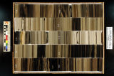
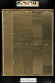
South Uinta Basin 12 core log - Plate 10 | 2014 | plate 10; well log; core log; Green River Formation | |
| 189 |
 |
Staff Council Annual Report 2013-2014 (University of Utah Staff Advisory Committee) | 2014 | Annual report | University of Utah Staff Advisory Committee (UUSAC) annual report for fiscal year 2013-2014. Contents include Committee Highlights, Development Committee, Legislative Committee, EVents Committee, Communications & Selections Committee and Executive Board & Committee Chairs. |
| 190 |
 |
Staff Council Applications 2013 (UUSAC) | 2013; 2014 | Staff applications; Employment | Applications for positions on the Staff Council |
| 191 |
 |
Staff council votes (University of Utah Staff Advisory Committee (UUSAC)) | 2014 | Votes; Staff council | Votes for individuals to serve on the staff council. |
| 192 |
 |
Stay safe this Halloween | 2020-10-23 | COVID-19; Halloween | How to stay safe this Halloween |
| 193 |
 |
Student council for exceptional children, University of Utah | 2014-10-22 | CEC; Exceptional children; Special and gifted education | Council for Exceptional Children is the international nonprofit organization dedicated to improving the educational success of individuals with disabilities and/or gifts and talents. |
| 194 |
 |
SUB 12 XRF depth plots | 2014 | depth plots; South Uina Basin; SUB 12; Green River Formation | |
| 195 |
 |
Survey Plat Skyline 16 | 2015-07 | survey plat; Skyline 16; well survey | Survey plat of Skyline 16 well. |
| 196 |
 |
Texas progress in flaring - 6 years of emissions data 2015 through 2020 | 2020 | Following nearly a decade of flare performance inquiry, modeling, and testing in the early 2000s, new United States Environmental Protection Agency (USEPA) flare regulations have been enacted for the petroleum refinery sector in 2012 and 2015. The stated objective of these new regulations was th... | |
| 197 |
 |
U campus remains in Orange status | 2020-09-03 | COVID-19; Fall semester; 2020 | Covid 19 status communication to University community from Ruth Watkins, University President, and Senior Vice Presidents' Mike Good and Dan Reed |
| 198 |
 |
Underground coal thermal treatment - Task 6 topical report, Utah Clean Coal Program | 2015-01 | transformational energy production; insitu thermal treatment of a coal seam; coal reserves; underground coal thermal treatment; Utah Clean Coal Program; coal resources | The long-term objective of this task is to develop a transformational energy production technology by in situ thermal treatment of a coal seam for the production of substitute natural gas and/or liquid transportation fuels while leaving much of the coal's carbon in the ground. This process converts ... |
| 199 |
 |
University of Utah and Utah Geological Survey Green River coring project summary | 2015-07 | Green River coring project; Skyline 16; oil shale deposits; Green River Formation | The University of Utah's Institute for Clean and Secure Energy and the Utah Geological Survey teamed up to drill 1000 feet of 4-inch diameter core in the upper Green River Formation oil shale deposits in the eastern Uinta Basin, Utah. The purpose was to recover nearly the entire oil shale zone (Para... |
| 200 |
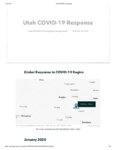 |
Utah COVID-19 response (storymap) | 2020-10-30 | COVID-19; transmission | Snapshot of Oct. 30, 2020 arcgis storyboard of Utah's COVID-19 response. |