TO
Filters: Collection: "ir_eua"
| Title | Date | Subject | Description | ||
|---|---|---|---|---|---|
| 176 |
 |
AK_Libraries, Museums & Other Resources | |||
| 177 |
 |
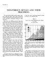
Capitol Reef-Miners Mountain oil-impregnated rock occurrences | 1967 | The Capitol Reef bituminous sandstone area occurs mainly on the northern and northeastern portions of the area known as Miners Mountain. This is a dome structure of the Teasdale anticline, the axis of which parallels the Teasdale fault system. | |
| 178 |
 |
Libraries, Museums & Other Resources | |||
| 179 |
 |
Domestic tar sands and potential recovery methods--a review | 1969-12 | The purpose of this paper is to review and evaluate present knowledge of United States tar sands including physical properties, occurrence, reserves, and recovery methods. Tar sands are oil, bitumen, asphalt, tar, or petroleum-impregnated rock from which little hydrocarbon material is recoverable by... | |
| 180 |
 |
Properties of Utah tar sands--South Seep Ridge area, P. R. Spring deposit | 1975 | Seep Ridge area; P. R. Spring tar sand deposit; tar sand zones | The Bureau of Mines analyzed three cores from the south Seep Ridge area of the P. R. Spring tar sand deposit of northeastern Utah. Four tar sand zones are indicated in the area. The zones range in average thickness from 13 to 24 ft. The total net thickness of the tar sand in the three coreholes rang... |
| 181 |
 |
AK_Academic Resources | |||
| 182 |
 |
Libraries, Museums & Other Resources | Libraries; Museums; Higher education resources; University of Utah | The libraries, museum and other resources connected with the University of Utah. | |
| 183 |
 |
Chapter 8 Part 1 | |||
| 184 |
 |
Historic Fort Douglas at the University of Utah | Fort Douglas; Utah | The majority of the fort was designated a National Historic Landmark in 1970. The University of Utah Fort Douglas Heritage Commons is also an Official Project of Save America's Treasures, a public-private partnership between the White House Millennium Council and the National Trust for Historic Pres... | |
| 185 |
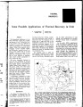 |
Some possible applications of thermal recovery in Utah | 1965-11 | thermal recovery; applications of thermal recovery; oil reserves; bituminous sandstones; thermal project; bituminous oil sand | The bituminous sandstones of the Rocky Mountain region have significant reserves of oil. Production costs of the reserves must be reduced to be equal to or lower than the cost of crude oil produced by conventional methods. Three Utah deposits alone, Sunny side, Vernal (Asphalt Ridge) and Whiterocks ... |
| 186 |
 |
California production statistics-1999: Production by company | 1999 | 1999 Annual Report | |
| 187 |
 |
A proposal to evaluate oil-impregnated sandstone in the Uinta Basin, northeast Utah; made to the Energy Research and Development Administration by Utah Geological and Mineral Survey | 1976-06-15 | Petroleum; Utah; Uinta Basin; Oil; Bitumen; Ore waste radiation; Oil-impregnated sandstone; Deposits | Most of the known petroleum resources in the form of oil-impregnated in the United States occur in Utah. It is estimated that over ten billion barrels of petroleum occur in such deposits in the Uinta Basin alone (Ritzma, 1973; Campbell, 1975). Four deposits among the twenty identified in the Uinta ... |
| 188 |
 |
Proceedings of the first annual oil shale/tar sand contractors meeting | 1985-07 | Tar sand deposits; oil; energy demands; wastewaters; treated waters | Tar sand deposits in the United States, estimated to represent over 50 billion barrels of oil, could help meet future national energy demands. The recovery of this resource, however, is partially dependent upon satisfactorily addressing a variety of concerns regarding air, land, and water contaminat... |
| 189 |
 |
Assessment of research needs for oil recovery from heavy-oil sources and tar sands | 1982-03 | The Fossil Energy Research Working Group (FERWG), at the request of J. W. Mares (Assistant Secretary for Fossil Energy) and A. W. Trivelpiece (Director, Office of Energy Research), has reviewed and evaluated the U.S. programs on oil recovery from heavy oil sources and tar sands. These studies were p... | |
| 190 |
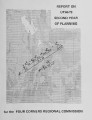 |
Report on Utah's second year of planning for the four corners regional commission | 1970-09 | scope of work contained in Article I set forth five specific program elements on which services were to be rendered. These were: 1. Continue to develop and refine criteria and evaluation procedures for assigning priorities to projects submitted for funding by the Four Corners Regional Commission.... | |
| 191 |
 |
Chapter 13 Part 1 | |||
| 192 |
 |
Chemistry and mineralogy of natural bitumens and heavy oils and their reservoir rocks from the United States, Canada, Trinidad and Tobago, and Venezuela | 1989-12-21 | Twenty-one samples from natural bitumen and heavy oil deposits in seven States of the United States and six samples from outside the United States form the basis of this initial study. This Circular gives the mineral content of the reservoir rock, the trace-element distribution in the reservoir rock... | |
| 193 |
 |
Areawide and local effects of tar sands development at the Sunnyside site in Utah: A socioeconomic analysis | 1984-04 | The Combined Hydrocarbon Leasing Act of 1982 (Public Law 97-78) provides guidelines for converting federal oil and gas leases to combined hydrocarbon leases in Special Tar Sands Areas (STSAs). The STSAs are designated by the U.S. Department of the Interior as areas that contain substantial deposits ... | |
| 194 |
 |
Lands with wilderness characteristics, Resource Management Plan constraints, and land exchanges: Cross-jurisdictional management and impacts on unconventional fuel development in Utah's Uinta Basin | 2012-03 | Utah oil shale; oil sands; unconventional fuel resources; land exchanges; land rights | Utah is rich in oil shale and oil sands resources. Chief among the challenges facing prospective unconventional fuel developers is the ability to access these resources. Access is heavily dependent upon land ownership and applicable management requirements. Understanding constraints on resource acce... |
| 195 |
 |
Towanta Lineament, Northern Utah | 1974-06 | Towanta Lineament; geologic mapping; mineralization; relation to ground water | A lineament, herein called the Towanta Lineament, was first noticed on a composite raised relief map of Utah and has been traced on aerial and satellite photograph)' and topographic maps for about 220 miles (350 kms.). Parrs of the eastern half have been examined in the field. The lineament extends ... |
| 196 |
 |
1888-89 General Catalog | 1888 | University of Utah catalogue; (Catalog) | Annual of the University of Deseret, 1888-89 |
| 197 |
 |
Diagenetic and burial history of the Lower Permian White Rim Sandstone in the Tar Sand Triangle, Paradox Basin, southeastern Utah | 1995 | Subsurface petrologic study and burial history reconstruction of the Lower Permian White Rim Sandstone in the Tar Sand triangle on the western edge of the Paradox Basin in southeastern Utah suggest that oil migrated into White Rim reservoirs after significant burial during the early Tertiary. Primar... | |
| 198 |
 |
Dilution centrifuging of bitumen froth from the hot water process for tar sand | 1983-05-17 | Patent; Dilution centrifuging; Bitumen froth; Tar sand; Naphtha-diluted bitumen froth | In the known operation wherein naphtha-diluted bitumen froth is pumped from a scroll-type centrifugal separator to a disc-type centrifugal separator, an improved pumping system is provided. The system comprises at least two centrifugal pumps in series, each operating preferably at an impellor tip sp... |
| 199 |
 |
Geology and genesis of the coast range province of California and its hydrocarbon deposits | 1987 | hydrocarbon deposits; tar sand; oil shale | California is along the western borderland of North America where sedimentary deposits accumulated along the eastern Pacific margin. During that time, subduction diastrophism prevailed in the late Mesozoic-early Cenozoic era, and right-lateral strike-slip shear diastrophism prevailed in the middle a... |
| 200 |
 |
Geologic evaluation and reservoir properties of the PR Spring tar sand deposit, Uintah and Grand counties, Utah | 1985-01 | reservoir properties; PR Spring tar sand deposit; tar sand | In 1980, the Laramie Energy Technology Center completed a seven corehole drilling program at the PR Spring tar sand deposit, southeastern Uinta Basin, Utah. The data from this project were integrated with other resource information to complete lithologic correlations, to evaluate general reservoir p... |