TO
Filters: Collection: "ir_eua"
| Title | Date | Subject | Description | ||
|---|---|---|---|---|---|
| 126 |
 |
The oil resources in tar sand deposits in the United States | 1982 | oil resources; tar sand deposits; tar sand oil recovery processes | This report summarizes the data available at the Laramie Energy Technology Center. An effort was made to catalogue U.S. tar sand resources, identify U.S. and state maps showing tar sand deposits, and attempt to compare tar sand oil recovery processes. A review of the available data indicated there w... |
| 127 |
 |
Major tar sand deposits of Utah, United States: Recent field investigations | 1986-07-10 | tar sand deposits; field investigations; tar sand resource; resource evaluation | The results of field investigations at three major Utah tar sand deposits are presented along with representative core sections. A resource evaluation of the PR Spring deposit in the southeastern Uinta Basin includes stratigraphic cross sections and isopleth maps of significant reservoir engineering... |
| 128 |
 |
Fischer Assay Data, Utah Geological Survey Well Number U087 | 2008 | This dataset contains the results of Fischer assay analyses obtained and published by the Utah Geological Survey for well U087. | |
| 129 |
 |
Reconnaissance study of bituminous sandstone deposits, Trans*Dirty Devil, Wayne and Garfield Counties, Utah | 1966-11 | bitumous sandstone deposits; Elaterite Basin; Teapot Rock | This report is the result of preliminary and reconnaissance investigations of the Elaterite Basin and Teapot Rock bituminous sandstone occurrences. Six samples were analyzed for their bitumen content and seven sections were measured in the Teapot Rock area. Up to 200 feet of varying degrees of satur... |
| 130 |
 |
Chemistry and resources of heavy oil and natural bitumen deposits | 1989 | chemistry of heavy oil; chemistry of natural bitumen deposits; heavy oil resources; natural bitumen deposits; heavy oil; unconventional oil deposits; natural bitumen | Supplies of conventional crude oil are diminishing; therefore, it is important to understand the reservoir characteristics of unconventional oil deposits. Reservoirs of unconventional deposits contain oils heavier than 20° gravity API and natural bitumens (tar sands and oil sands) are more viscous ... |
| 131 |
 |
Properties of Utah tar sands--Asphalt Wash area, P. R. Spring deposit | 1975 | Asphalt Wash Area; P. R. Spring tar sand deposit; tar sand zones; oil; tar sand evaluation | This Bureau of Mines report presents the analysis of three cores from the Asphalt Wash area of the P.R. Spring tar sand deposit of northeastern Utah. Two tar sand zones are indicated in the Asphalt Wash Area. Total net thickness of the tar sand ranges from 23 to 39 ft, with occurrences between 56 an... |
| 132 |
 |
Information | General information about the University of Utah | ||
| 133 |
 |
Bituminous sands and viscous crude oils | 1964-10-10 | Bituminous sands; Viscous crude oils; Rocky Mountain region; Low gravity; high viscosity; Heavy crude oil; Quiet Revolution; Thermal recovery; Utah; Bituminous sandstone deposits | Bituminous sandstones of the Rocky Mountain region contain large reserves of low gravity, highly viscous oil that can be recovered at costs equal to or less than the cost of finding and producing oil from conventional methods. Heavy crude oil is defined as "oil which cannot be produce through the no... |
| 134 |
 |
Oil sands leasing opportunities on federal land | 2009-02-27 | oil sands; leasing opportunities; federal oil sands leases and lands; BLM management plans | Overview of the process for obtaining federal oil sands leases and lands available for leasing under current BLM management plans, presented at the 2009 Western U.S. Oil Sands Conference by James Kohler, former Branch Chief of Solid Minerals, U.S. Bureau of Land Management. |
| 135 |
 |
Depositional setting and preliminary oil-shale resource potential, southwestern Uinta Basin, Utah | 1982 | Oil shale; Uinta Basin; Utah; Green River; Oil yield; Lake Uinta; Mohogany zone; Kerogen; Sheep Pass; Elko Basins; Nevada; Strawberry Structure; Strawberry Reservoir | This report characterizes the potential oil-shale resources underlying those lands west of the Green River in the southwestern Uinta Basin, Utah. The principal evaluation technique has been the calculation of oil yield from oil-well sonic and density log data available in this area. Subsurface corre... |
| 136 |
 |
A brief history of early mineral exploitation in the Uinta Basin | 1964 | Uinta Basin; Mining; Uintah Valley; Indian Reservation; Meeker; Utah; History of early mineral exploitation; Uintah Reservation; Gilsonite; Coal; Copper; Iron; Oil shale; Ozocerite; Wurtzilite; Oil; Asphalt; Ashley Creek; Hatchtown; Vernal; Fort Duchesne; Ouray Subagency | Early mining activities in the Uinta Basin can be summarized by saying that they included mining for gilsonite, coal, copper, iron, oil shale, ozocerite, wurtzilite, and oil and asphalt (under the placer mining laws). Of these minerals only coal and gilsonite were produced in commercially significan... |
| 137 |
 |
Composition and origin of the Uinta Basin bitumens | 1963-01 | The names of the three formations of interest, from oldest to youngest, the Wasatch, Green River, and Uinta, have been used largely as facies terms to differentiate sediments which were believed to be of different age but actually were deposited simultaneously. The Wasatch is predominantly fluviatil... | |
| 138 |
 |
Geologic summary report of the Sunnyside Tar Sands project, Carbon County, Utah | 1981-02-04 | geologic summary report; Sunnyside Tar Sands project; tar sands | The project area is located in the southwest portion of the Uinta Basin, near the northeast portion of the San Rafael Swell and localized within a small delta complex that formed in Lake Uinta during early Tertiary. The delta complex encompasses dimensions approximately 4-6 miles parallel to the anc... |
| 139 |
 |
Geologic summary report of the 1981 exploration program, Sunnyside Tar Sands project, Carbon County, Utah | 1982-02-19 | Geologic summary; exploration project; Sunnyside Tar Sands project; delta complex. | The 1981 Sunnyside exploration program consisted of: (1) diamond drilling of sixteen drill holes and logging of the core, and (2) initial geologic mapping in the northern area to better define the limits of the tar sands associated with the Sunnyside delta complex. In order to comprehend the geometr... |
| 140 |
 |
Sunnyside Special Tar Sand Area site specific analysis Sunnyside no. 12 tract: Moab District, Price River Resource Area | 1983-03 | Sunnyside special tar sand area; site specific analysis; Sunnyside no. 12 tract; tar sand extraction; STSA | The Sunnyside No. 12 Tract is in the north-central part of the Sunnyside Special Tar Sand Area (STSA) in Carbon County, Utah. The tract is located about 33 miles east of Price, Utah (See Maps 1 and 2 in Appendix I). The legal description and ownership are shown in Table 1. |
| 141 |
 |
Preliminary mineral resource study of the Uintah and Ouray reservation, Utah | 1975 | mineral resources; production of oil and gas; oil shale industry development; coal resources | Development of known mineral resources on the Uintah and Ouray Indian Reservation probably will be confined to expanded production of oil and gas by conventional methods and to extraction of modest amounts of sand and gravel. Oil shale may have some development potential provided exploration can pro... |
| 142 |
 |
Palynology and petrography of some solid bitumens of the Uinta Basin, Utah | 1976-07 | bitumen; petrologic character; palyonogic content; plant material found in bitumen | Several solid bitumens and bituminous substances of the Uinta Basin found in veins, brecciated fissures, cracks, joints, and porous rocks have been examined for petrologic character and palynologic content. Some samples of solid ozocerite, a native wax, intercalated in the matrix of brecciated zones... |
| 143 |
 |
Sunnyside Special Tar Sand Area site specific analysis Sunnyside no. 2 tract: Moab District, Price River Resource Area | 1983-03 | Sunnyside Special Tar Sand Area; tar sand; site specific analysis; Sunnyside no. 2 tract; STSA; tar sand extraction | The Sunnyside No. 2 Tract is in the central part of the Sunnyside Special Tar Sand Area (STSA) in Carbon County, Utah. The tract is located about 25 miles northeast of Price, Utah (See Maps 1 and 2 in Appendix I). The legal description and ownership are shown in Table 1. |
| 144 |
 |
A report to Idaho National Engineering Laboratory | 1987 | Three Texas lignites (Jewett, Big Brown, and Bastrap), weathered and fresh tar sand, weathered and fresh Gilsonite and weathered oil shale have been studied using Py-MS (pyrolysis mass spectrometry) and further analyzed using the SIGMA program. | |
| 145 |
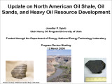 |
Update on North American oil shale, oil sands, and heavy oil resource development | 2008-03-12 | Unconventional fuel resources; U.S.; Canada; RH&D; Oil shale; Oil sands | Large unconventional fuel resources exist in the U.S. & Canada -Processing technologies for oil sands are well-developed in Canada, but those processes cannot be directly applied to U.S. resources; oil shale processing technologies have yet to be commercialized -RH&D leases are a roadmap for future ... |
| 146 |
 |
Sunnyside Special Tar Sand Area site specific analysis Sunnyside no. 11 tract: Moab District, Price River Resource Area | 1983-03 | Sunnyside special tar sand area; site specific analysis; Sunnyside no. 11 tract; tar sand extraction; drilling | The Sunnyside No. 11 Tract is in the central part of the Sunnyside Special Tar Sand Area (STSA) in Carbon County, Utah. The tract is located about 26 miles east-northeast of Price, Utah (See Maps 1 and 2 in Appendix I). The legal description and ownership are shown in Table 1. |
| 147 |
 |
Geology and resources of the Tar Sand Triangle, southeastern Utah | 1984-05 | Tar Sand Triangle; geology and resources; Dirty Devil; Colorado River; wells | Dirty Devil and Colorado Rivers and covers an area of about 200 square miles. The geology of the area consists of gently northwest dipping strata exposed in-the box canyons and slopes of the canyonlands morphology. Strata in the area range in age from Jurassic to Permian. The majority of tar sand sa... |
| 148 |
 |
Properties of Utah tar sands--Flat Rock Mesa area, Hill Creek deposit | 1976-04-01 | Flat Rock Mesa Area; Hill Creek tar sand deposit; tar sand zone | This report presents the results of analyses of three cores from the Flat Rock Mesa area in the Hill Creek tar sand deposit in northeastern Utah. Two major tar sand zones exist in the Flat Rock Mesa area and have net thicknesses ranging from 55 to 81 ft. The overall tar sand section has good porosit... |
| 149 |
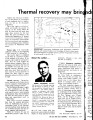 |
Thermal recovery may bring industry's "quiet revolution" | 1964-11-23 | thermal recovery; oil revolution; quiet revolution; low-gravity, viscous crude oils; crude oils; bituminous sandstones | Today the American oil industry is in the process of a revolution of such magnitude that its implications are yet to be thoroughly understood. This is the "quiet revolution" which will double the proved oil reserves of the world within the next 10 years and will more than triple those reserves by th... |
| 150 |
 |
Transportation system map portfolio | 1969-12 |