TO
Filters: Collection: "ir_eua"
| Title | Date | Subject | Description | ||
|---|---|---|---|---|---|
| 2101 |
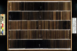 |
Skyline 16: SW SW sec. 10 11S 25E Uintah County, Utah. Box 40 Depth: 410.0 - 420.0 ft. | 2015-07 | core samples; Skyline 16; box 40; Green River Formation | Core sample photograph by the Utah Geological Survey at the University of Utah, and the Utah Core Research Center. Skyline 16: SW SW sec. 10 11S 25E Uintah County, Utah. Box 40 Depth: 410.0 - 420.0 ft. |
| 2102 |
 |
Skyline 16: SW SW sec. 10 11S 25E Uintah County, Utah. Box 41 Depth: 420.0 - 430.0 ft. | 2015-07 | core samples; Skyline 16; box 41; Green River Formation | Core sample photograph by the Utah Geological Survey at the University of Utah, and the Utah Core Research Center. Skyline 16: SW SW sec. 10 11S 25E Uintah County, Utah. Box 41 Depth: 420.0 - 430.0 ft. |
| 2103 |
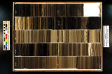 |
Skyline 16: SW SW sec. 10 11S 25E Uintah County, Utah. Box 42 Depth: 430.0 - 440.0 ft. | 2015-07 | core samples; Skyline 16; box 42; Green River Formation | Core sample photograph by the Utah Geological Survey at the University of Utah, and the Utah Core Research Center. Skyline 16: SW SW sec. 10 11S 25E Uintah County, Utah. Box 42 Depth: 430.0 - 440.0 ft. |
| 2104 |
 |
Skyline 16: SW SW sec. 10 11S 25E Uintah County, Utah. Box 43 Depth: 440.0 - 450.0 ft. | 2015-07 | core samples; Skyline 16; box 43; Green River Formation | Core sample photograph by the Utah Geological Survey at the University of Utah, and the Utah Core Research Center. Skyline 16: SW SW sec. 10 11S 25E Uintah County, Utah. Box 43 Depth: 440.0 - 450.0 ft. |
| 2105 |
 |
Skyline 16: SW SW sec. 10 11S 25E Uintah County, Utah. Box 44 Depth: 450.0 - 460.0 ft. | 2015-07 | core samples; Skyline 16; box 44; Green River Formation | Core sample photograph by the Utah Geological Survey at the University of Utah, and the Utah Core Research Center. Skyline 16: SW SW sec. 10 11S 25E Uintah County, Utah. Box 44 Depth: 450.0 - 460.0 ft. |
| 2106 |
 |
Skyline 16: SW SW sec. 10 11S 25E Uintah County, Utah. Box 45 Depth: 460.0 - 470.0 ft. | 2015-07 | core samples; Skyline 16; box 45; Green River Formation | Core sample photograph by the Utah Geological Survey at the University of Utah, and the Utah Core Research Center. Skyline 16: SW SW sec. 10 11S 25E Uintah County, Utah. Box 45 Depth: 460.0 - 470.0 ft. |
| 2107 |
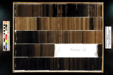 |
Skyline 16: SW SW sec. 10 11S 25E Uintah County, Utah. Box 46 Depth: 470.0 - 480.0 ft. | 2015-07 | core samples; Skyline 16; box 46; Green River Formation | Core sample photograph by the Utah Geological Survey at the University of Utah, and the Utah Core Research Center. |
| 2108 |
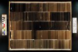 |
Skyline 16: SW SW sec. 10 11S 25E Uintah County, Utah. Box 47 Depth: 480.0 - 490.0 ft. | 2015-07 | core samples; Skyline 16; box 47; Green River Formation | Core sample photograph by the Utah Geological Survey at the University of Utah, and the Utah Core Research Center. Skyline 16: SW SW sec. 10 11S 25E Uintah County, Utah. Box 47 Depth: 480.0 - 490.0 ft. |
| 2109 |
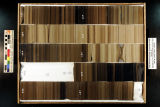 |
Skyline 16: SW SW sec. 10 11S 25E Uintah County, Utah. Box 48 Depth: 490.0 - 500.0 ft. | 2015-07 | core samples; Skyline 16; box 48; Green River Formation | Core sample photograph by the Utah Geological Survey at the University of Utah, and the Utah Core Research Center. Skyline 16: SW SW sec. 10 11S 25E Uintah County, Utah. Box 48 Depth: 490.0 - 500.0 ft. |
| 2110 |
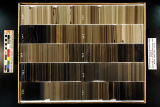 |
Skyline 16: SW SW sec. 10 11S 25E Uintah County, Utah. Box 49 Depth: 500.0 - 510.0 ft. | 2015-07 | core samples; Skyline 16; box 49; Green River Formation | Core sample photograph by the Utah Geological Survey at the University of Utah, and the Utah Core Research Center. Skyline 16: SW SW sec. 10 11S 25E Uintah County, Utah. Box 49 Depth: 500.0 - 510.0 ft. |
| 2111 |
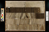 |
Skyline 16: SW SW sec. 10 11S 25E Uintah County, Utah. Box 5 Depth: 60.0 - 70.0 ft. | 2015-07 | core samples; Skyline 16; box 5; Green River Formation | Core sample photograph by the Utah Geological Survey, University of Utah. Skyline 16: SW SW sec. 10 11S 25E Uintah County, Utah. Box 5 Depth: 60.0 - 70.0 ft. |
| 2112 |
 |
Skyline 16: SW SW sec. 10 11S 25E Uintah County, Utah. Box 50 Depth: 510.0 - 520.0 ft. | 2015-07 | core samples; Skyline 16; box 50; Green River Formation | Core sample photograph by the Utah Geological Survey at the University of Utah, and the Utah Core Research Center. Skyline 16: SW SW sec. 10 11S 25E Uintah County, Utah. Box 50 Depth: 510.0 - 520.0 ft. |
| 2113 |
 |
Skyline 16: SW SW sec. 10 11S 25E Uintah County, Utah. Box 51 Depth: 520.0 - 530.0 ft. | 2015-07 | core samples; Skyline 16; box 51; Green River Formation | Core sample photograph by the Utah Geological Survey at the University of Utah, and the Utah Core Research Center. Skyline 16: SW SW sec. 10 11S 25E Uintah County, Utah. Box 51 Depth: 520.0 - 530.0 ft. |
| 2114 |
 |
Skyline 16: SW SW sec. 10 11S 25E Uintah County, Utah. Box 52 Depth: 530.0 - 540.0 ft. | 2015-07 | core samples; Skyline 16; box 52; Green River Formation | Core sample photograph by the Utah Geological Survey at the University of Utah, and the Utah Core Research Center. Skyline 16: SW SW sec. 10 11S 25E Uintah County, Utah. Box 52 Depth: 530.0 - 540.0 ft. |
| 2115 |
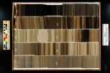 |
Skyline 16: SW SW sec. 10 11S 25E Uintah County, Utah. Box 53 Depth: 540.0 - 550.0 ft. | 2015-07 | core samples; Skyline 16; box 53; Green River Formation | Core sample photograph by the Utah Geological Survey at the University of Utah, and the Utah Core Research Center. Skyline 16: SW SW sec. 10 11S 25E Uintah County, Utah. Box 53 Depth: 540.0 - 550.0 ft. |
| 2116 |
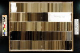 |
Skyline 16: SW SW sec. 10 11S 25E Uintah County, Utah. Box 54 Depth: 550.0 - 560.0 ft. | 2015-07 | core samples; Skyline 16; box 54; Green River Formation | Core sample photograph by the Utah Geological Survey at the University of Utah, and the Utah Core Research Center. Skyline 16: SW SW sec. 10 11S 25E Uintah County, Utah. Box 54 Depth: 550.0 - 560.0 ft. |
| 2117 |
 |
Skyline 16: SW SW sec. 10 11S 25E Uintah County, Utah. Box 55 Depth: 560.0 - 570.0 ft. | 2015-07 | core samples; Skyline 16; box 55; Green River Formation | Core sample photograph by the Utah Geological Survey at the University of Utah, and the Utah Core Research Center. Skyline 16: SW SW sec. 10 11S 25E Uintah County, Utah. Box 55 Depth: 560.0 - 570.0 ft. |
| 2118 |
 |
Skyline 16: SW SW sec. 10 11S 25E Uintah County, Utah. Box 56 Depth: 570.0 - 580.0 ft. | 2015-07 | core samples; Skyline 16; box 56; Green River Formation | Core sample photograph by the Utah Geological Survey at the University of Utah, and the Utah Core Research Center. Skyline 16: SW SW sec. 10 11S 25E Uintah County, Utah. Box 56 Depth: 570.0 - 580.0 ft. |
| 2119 |
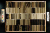 |
Skyline 16: SW SW sec. 10 11S 25E Uintah County, Utah. Box 57 Depth: 580.0 - 590.0 ft. | 2015-07 | core samples; Skyline 16; box 57; Green River Formation | Core sample photograph by the Utah Geological Survey at the University of Utah, and the Utah Core Research Center. Skyline 16: SW SW sec. 10 11S 25E Uintah County, Utah. Box 57 Depth: 580.0 - 590.0 ft. |
| 2120 |
 |
Skyline 16: SW SW sec. 10 11S 25E Uintah County, Utah. Box 58 Depth: 590.0 - 600.0 ft. | 2015-07 | core samples; Skyline 16; box 58; Green River Formation | Core sample photograph by the Utah Geological Survey at the University of Utah, and the Utah Core Research Center. Skyline 16: SW SW sec. 10 11S 25E Uintah County, Utah. Box 58 Depth: 590.0 - 600.0 ft. |
| 2121 |
 |
Skyline 16: SW SW sec. 10 11S 25E Uintah County, Utah. Box 59 Depth: 600.0 - 610.0 ft. | 2015-07 | core samples; Skyline 16; box 59; Green River Formation | Core sample photograph by the Utah Geological Survey at the University of Utah, and the Utah Core Research Center. |
| 2122 |
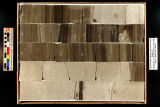 |
Skyline 16: SW SW sec. 10 11S 25E Uintah County, Utah. Box 6 Depth: 70.0 - 80.0 ft. | 2015-07 | core samples; Skyline 16; box 6; Green River Formation | Core sample photograph by the Utah Geological Survey, University of Utah. Skyline 16: SW SW sec. 10 11S 25E Uintah County, Utah. Box 6 Depth: 70.0 - 80.0 ft. |
| 2123 |
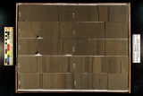 |
Skyline 16: SW SW sec. 10 11S 25E Uintah County, Utah. Box 60 Depth: 610.0 - 620.0 ft. | 2015-07 | core samples; Skyline 16; box 60; Green River Formation | Core sample photograph by the Utah Geological Survey at the University of Utah, and the Utah Core Research Center. Skyline 16: SW SW sec. 10 11S 25E Uintah County, Utah. Box 60 Depth: 610.0 - 620.0 ft. |
| 2124 |
 |
Skyline 16: SW SW sec. 10 11S 25E Uintah County, Utah. Box 61 Depth: 620.0 - 630.0 ft. | 2015-07 | core samples; Skyline 16; box 61; Green River Formation | Core sample photograph by the Utah Geological Survey at the University of Utah, and the Utah Core Research Center. Skyline 16: SW SW sec. 10 11S 25E Uintah County, Utah. Box 61 Depth: 620.0 - 630.0 ft. |
| 2125 |
 |
Skyline 16: SW SW sec. 10 11S 25E Uintah County, Utah. Box 62 Depth: 630.0 - 640.0 ft. | 2015-07 | core samples; Skyline 16; box 62; Green River Formation | Core sample photograph by the Utah Geological Survey at the University of Utah, and the Utah Core Research Center. Skyline 16: SW SW sec. 10 11S 25E Uintah County, Utah. Box 62 Depth: 630.0 - 640.0 ft. |
| 2126 |
 |
Skyline 16: SW SW sec. 10 11S 25E Uintah County, Utah. Box 63 Depth: 640.0 - 650.0 ft. | 2015-07 | core samples; Skyline 16; box 63; Green River Formation | Core sample photograph by the Utah Geological Survey at the University of Utah, and the Utah Core Research Center. Skyline 16: SW SW sec. 10 11S 25E Uintah County, Utah. Box 63 Depth: 640.0 - 650.0 ft. |
| 2127 |
 |
Skyline 16: SW SW sec. 10 11S 25E Uintah County, Utah. Box 64 Depth: 650.0 - 660.0 ft. | 2015-07 | core samples; Skyline 16; box 64; Green River Formation | Core sample photograph by the Utah Geological Survey at the University of Utah, and the Utah Core Research Center. Skyline 16: SW SW sec. 10 11S 25E Uintah County, Utah. Box 64 Depth: 650.0 - 660.0 ft. |
| 2128 |
 |
Skyline 16: SW SW sec. 10 11S 25E Uintah County, Utah. Box 65 Depth: 660.0 - 670.0 ft. | 2015-07 | core samples; Skyline 16; box 65; Green River Formation | Core sample photograph by the Utah Geological Survey at the University of Utah, and the Utah Core Research Center. Skyline 16: SW SW sec. 10 11S 25E Uintah County, Utah. Box 65 Depth: 660.0 - 670.0 ft. |
| 2129 |
 |
Skyline 16: SW SW sec. 10 11S 25E Uintah County, Utah. Box 66 Depth: 670.0 - 680.0 ft. | 2015-07 | core samples; Skyline 16; box 66; Green River Formation | Core sample photograph by the Utah Geological Survey at the University of Utah, and the Utah Core Research Center. Skyline 16: SW SW sec. 10 11S 25E Uintah County, Utah. Box 66 Depth: 670.0 - 680.0 ft. |
| 2130 |
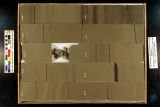 |
Skyline 16: SW SW sec. 10 11S 25E Uintah County, Utah. Box 67 Depth: 680.0 - 690.0 ft. | 2015-07 | core samples; Skyline 16; box 67; Green River Formation | Core sample photograph by the Utah Geological Survey at the University of Utah, and Utah Core Research Center. Skyline 16: SW SW sec. 10 11S 25E Uintah County, Utah. Box 67 Depth: 680.0 - 690.0 ft. |
| 2131 |
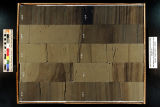 |
Skyline 16: SW SW sec. 10 11S 25E Uintah County, Utah. Box 68 Depth: 690.0 - 700.0 ft. | 2015-07 | core samples; Skyline 16; box 68; Green River Formation | Core sample photograph by the Utah Geological Survey at the University of Utah, and the Utah Core Research Center. Skyline 16: SW SW sec. 10 11S 25E Uintah County, Utah. Box 68 Depth: 690.0 - 700.0 ft. |
| 2132 |
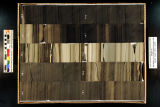 |
Skyline 16: SW SW sec. 10 11S 25E Uintah County, Utah. Box 69 Depth: 700.0 - 710.0 ft. | 2015-07 | core samples; Skyline 16; box 69; Green River Formation | Core sample photograph by the Utah Geological Survey at the University of Utah, and the Utah Core Research Center. Skyline 16: SW SW sec. 10 11S 25E Uintah County, Utah. Box 69 Depth: 700.0 - 710.0 ft. |
| 2133 |
 |
Skyline 16: SW SW sec. 10 11S 25E Uintah County, Utah. Box 7 Depth: 80.0 - 90.0 ft. | 2015-07 | core samples; Skyline 16; box 7; Green River Formation | Core sample photograph by the Utah Geological Survey, University of Utah. Skyline 16: SW SW sec. 10 11S 25E Uintah County, Utah. Box 7 Depth: 80.0 - 90.0 ft. |
| 2134 |
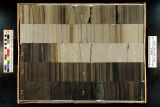 |
Skyline 16: SW SW sec. 10 11S 25E Uintah County, Utah. Box 70 Depth: 710.0 - 720.0 ft. | 2015-07 | core samples; Skyline 16; box 70; Green River Formation | Core sample photograph by the Utah Geological Survey at the University of Utah, and the Utah Core Research Center. Skyline 16: SW SW sec. 10 11S 25E Uintah County, Utah. Box 70 Depth: 710.0 - 720.0 ft. |
| 2135 |
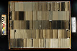 |
Skyline 16: SW SW sec. 10 11S 25E Uintah County, Utah. Box 71 Depth: 720.0 - 730.0 ft. | 2015-07 | core samples; Skyline 16; box 71; Green River Formation | Core sample photograph by the Utah Geological Survey at the University of Utah, and the Utah Core Research Center. Skyline 16: SW SW sec. 10 11S 25E Uintah County, Utah. Box 71 Depth: 720.0 - 730.0 ft. |
| 2136 |
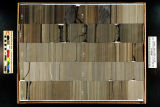 |
Skyline 16: SW SW sec. 10 11S 25E Uintah County, Utah. Box 72 Depth: 730.0 - 740.0 ft. | 2015-07 | core samples; Skyline 16; box 72; Green River Formation | Core sample photograph by the Utah Geological Survey at the University of Utah, and the Utah Core Research Center. Skyline 16: SW SW sec. 10 11S 25E Uintah County, Utah. Box 72 Depth: 730.0 - 740.0 ft. |
| 2137 |
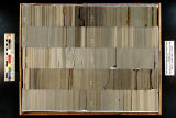 |
Skyline 16: SW SW sec. 10 11S 25E Uintah County, Utah. Box 73 Depth: 740.0 - 750.0 ft. | 2015-07 | core samples; Skyline 16; box 73; Green River Formation | Core sample photograph by the Utah Geological Survey at the University of Utah, and the Utah Core Research Center. Skyline 16: SW SW sec. 10 11S 25E Uintah County, Utah. Box 73 Depth: 740.0 - 750.0 ft. |
| 2138 |
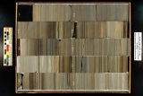 |
Skyline 16: SW SW sec. 10 11S 25E Uintah County, Utah. Box 74 Depth: 750.0 - 760.0 ft. | 2015-07 | core samples; Skyline 16; box 74; Green River Formation | Core sample photograph by the Utah Geological Survey at the University of Utah, and the Utah Core Research Center. Skyline 16: SW SW sec. 10 11S 25E Uintah County, Utah. Box 74 Depth: 750.0 - 760.0 ft. |
| 2139 |
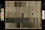 |
Skyline 16: SW SW sec. 10 11S 25E Uintah County, Utah. Box 75 Depth: 760.0 - 770.0 ft. | 2015-07 | core samples; Skyline 16; box 75; Green River Formation | Core sample photograph by the Utah Geological Survey at the University of Utah, and the Utah Core Research Center. Skyline 16: SW SW sec. 10 11S 25E Uintah County, Utah. Box 75 Depth: 760.0 - 770.0 ft. |
| 2140 |
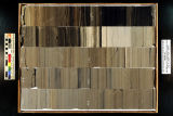 |
Skyline 16: SW SW sec. 10 11S 25E Uintah County, Utah. Box 76 Depth: 770.0 - 780.0 ft. | 2015-07 | core samples; Skyline 16; box 76; Green River Formation | Core sample photograph by the Utah Geological Survey at the University of Utah, and the Utah Core Research Center. Skyline 16: SW SW sec. 10 11S 25E Uintah County, Utah. Box 76 Depth: 770.0 - 780.0 ft. |
| 2141 |
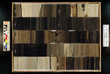 |
Skyline 16: SW SW sec. 10 11S 25E Uintah County, Utah. Box 77 Depth: 780.0 - 790.0 ft. | 2015-07 | core samples; Skyline 16; box 77; Green River Formation | Core sample photograph by the Utah Geological Survey at the University of Utah, and the Utah Core Research Center. Skyline 16: SW SW sec. 10 11S 25E Uintah County, Utah. Box 77 Depth: 780.0 - 790.0 ft. |
| 2142 |
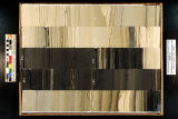 |
Skyline 16: SW SW sec. 10 11S 25E Uintah County, Utah. Box 78 Depth: 790.0 - 800.0 ft. | 2015-07 | core samples; Skyline 16; box 78; Green River Formation | Core sample photograph by the Utah Geological Survey at the University of Utah, and the Utah Core Research Center. Skyline 16: SW SW sec. 10 11S 25E Uintah County, Utah. Box 78 Depth: 790.0 - 800.0 ft. |
| 2143 |
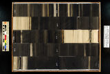 |
Skyline 16: SW SW sec. 10 11S 25E Uintah County, Utah. Box 79 Depth: 800.0 - 810.0 ft. | 2015-07 | core samples; Skyline 16; box 79; Green River Formation | Core sample photograph by the Utah Geological Survey at the University of Utah, and the Utah Core Research Center. Skyline 16: SW SW sec. 10 11S 25E Uintah County, Utah. Box 79 Depth: 800.0 - 810.0 ft. |
| 2144 |
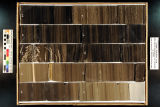 |
Skyline 16: SW SW sec. 10 11S 25E Uintah County, Utah. Box 8 Depth: 90.0 - 100.0 ft. | 2015-07 | core samples; Skyline 16; box 8; Green River Formation | Core sample photograph by the Utah Geological Survey, University of Utah. Skyline 16: SW SW sec. 10 11S 25E Uintah County, Utah. Box 8 Depth: 90.0 - 100.0 ft. |
| 2145 |
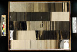 |
Skyline 16: SW SW sec. 10 11S 25E Uintah County, Utah. Box 80 Depth: 810.0 - 820.0 ft. | 2015-07 | core samples; Skyline 16; box 80; Green River Formation | Core sample photograph by the Utah Geological Survey at the University of Utah, and the Utah Core Research Center. Skyline 16: SW SW sec. 10 11S 25E Uintah County, Utah. Box 80 Depth: 810.0 - 820.0 ft. |
| 2146 |
 |
Skyline 16: SW SW sec. 10 11S 25E Uintah County, Utah. Box 81 Depth: 820.0 - 830.0 ft. | 2015-07 | core samples; Skyline 16; box 81; Green River Formation | Core sample photograph by the University of Utah, and the Utah Core Research Center. Skyline 16: SW SW sec. 10 11S 25E Uintah County, Utah. Box 81 Depth: 820.0 - 830.0 ft. |
| 2147 |
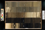 |
Skyline 16: SW SW sec. 10 11S 25E Uintah County, Utah. Box 82 Depth: 830.0 - 840.0 ft. | 2015-07 | core samples; Skyline 16; box 82; Green River Formation | Core sample photograph by the University of Utah, and the Utah Core Research Center. Skyline 16: SW SW sec. 10 11S 25E Uintah County, Utah. Box 82 Depth: 830.0 - 840.0 ft. |
| 2148 |
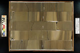 |
Skyline 16: SW SW sec. 10 11S 25E Uintah County, Utah. Box 83 Depth: 840.0 - 850.0 ft. | 2015-07 | core sample; Skyline 16; box 83; Green River Formation | Core sample photograph by the Utah Geological Survey at the University of Utah, and the Utah Core Research Center. Skyline 16: SW SW sec. 10 11S 25E Uintah County, Utah. Box 83 Depth: 840.0 - 850.0 ft. |
| 2149 |
 |
Skyline 16: SW SW sec. 10 11S 25E Uintah County, Utah. Box 84 Depth: 850.0 - 860.0 ft. | 2015-07 | core sample; Skyline 16; box 84; Green River Formation | Core sample photograph by the Utah Geological Survey at the University of Utah, and the Utah Core Research Center. Skyline 16: SW SW sec. 10 11S 25E Uintah County, Utah. Box 84 Depth: 850.0 - 860.0 ft. |
| 2150 |
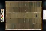 |
Skyline 16: SW SW sec. 10 11S 25E Uintah County, Utah. Box 85 Depth: 860.0 - 870.0 ft. | 2015-07 | core sample; Skyline 16; box 85; Green River Formation | Core sample photograph by the Utah Geological Survey at the University of Utah, and the Utah Core Research Center. Skyline 16: SW SW sec. 10 11S 25E Uintah County, Utah. Box 85 Depth: 860.0 - 870.0 ft. |
| 2151 |
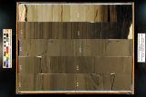 |
Skyline 16: SW SW sec. 10 11S 25E Uintah County, Utah. Box 86 Depth: 870.0 - 880.0 ft. | 2015-07 | core sample; Skyline 16; box 86; Green River Formation | Core sample photograph by the Utah Geological Survey at the University of Utah, and the Utah Core Research Center. Skyline 16: SW SW sec. 10 11S 25E Uintah County, Utah. Box 86 Depth: 870.0 - 880.0 ft. |
| 2152 |
 |
Skyline 16: SW SW sec. 10 11S 25E Uintah County, Utah. Box 87 Depth: 880.0 - 890.0 ft. | 2015-07 | core sample; Skyline 16; box 87; Green River Formation | Core sample photograph by the Utah Geological Survey at the University of Utah, and the Utah Core Research Center. Skyline 16: SW SW sec. 10 11S 25E Uintah County, Utah. Box 87 Depth: 880.0 - 890.0 ft. |
| 2153 |
 |
Skyline 16: SW SW sec. 10 11S 25E Uintah County, Utah. Box 88 Depth: 890.0 - 900.0 ft. | 2015-07 | core sample; Skyline 16; box 88; Green River Formation | Core sample photograph by the Utah Geological Survey at the University of Utah, and the Utah Core Research Center. Skyline 16: SW SW sec. 10 11S 25E Uintah County, Utah. Box 88 Depth: 890.0 - 900.0 ft. |
| 2154 |
 |
Skyline 16: SW SW sec. 10 11S 25E Uintah County, Utah. Box 89 Depth: 900.0 - 910.0 ft. | 2015-07 | core sample; Skyline 16; box 89; Green River Formation | Core sample photograph by the Utah Geological Survey at the University of Utah, and the Utah Core Research Center. Skyline 16: SW SW sec. 10 11S 25E Uintah County, Utah. Box 89 Depth: 900.0 - 910.0 ft. |
| 2155 |
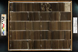 |
Skyline 16: SW SW sec. 10 11S 25E Uintah County, Utah. Box 9 Depth: 100.0 - 110.0 ft. | 2015-07 | core samples; Skyline 16; box 9; Green River Formation | Core sample photograph by the Utah Geological Survey, University of Utah. Skyline 16: SW SW sec. 10 11S 25E Uintah County, Utah. Box 9 Depth: 100.0 - 110.0 ft. |
| 2156 |
 |
Skyline 16: SW SW sec. 10 11S 25E Uintah County, Utah. Box 90 Depth: 910.0 - 920.0 ft. | 2015-07 | core sample; Skyline 16; box 90; Green River Formation | Core sample photograph by the Utah Geological Survey at the University of Utah, and the Utah Core Research Center. Skyline 16: SW SW sec. 10 11S 25E Uintah County, Utah. Box 90 Depth: 910.0 - 920.0 ft. |
| 2157 |
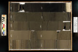 |
Skyline 16: SW SW sec. 10 11S 25E Uintah County, Utah. Box 91 Depth: 920.0 - 930.0 ft. | 2015-07 | core sample; Skyline 16; box 91; Green River Formation | Core sample photograph by the Utah Geological Survey at the University of Utah, and the Utah Core Research Center. Skyline 16: SW SW sec. 10 11S 25E Uintah County, Utah. Box 91 Depth: 920.0 - 930.0 ft. |
| 2158 |
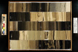 |
Skyline 16: SW SW sec. 10 11S 25E Uintah County, Utah. Box 92 Depth: 930.0 - 940.0 ft. | 2015-07 | core sample; Skyline 16; box 92; Green River Formation | Core sample photograph by the Utah Geological Survey at the University of Utah, and the Utah Core Research Center. Skyline 16: SW SW sec. 10 11S 25E Uintah County, Utah. Box 92 Depth: 930.0 - 940.0 ft. |
| 2159 |
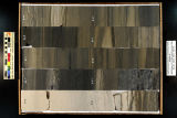 |
Skyline 16: SW SW sec. 10 11S 25E Uintah County, Utah. Box 93 Depth: 940.0 - 950.0 ft. | 2015-07 | core sample; Skyline 16; box 93; Green River Formation | Core sample photograph by the Utah Geological Survey at the University of Utah, and the Utah Core Research Center. Skyline 16: SW SW sec. 10 11S 25E Uintah County, Utah. Box 93 Depth: 940.0 - 950.0 ft. |
| 2160 |
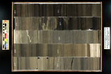 |
Skyline 16: SW SW sec. 10 11S 25E Uintah County, Utah. Box 94 Depth: 950.0 - 960.0 ft. | 2015-07 | core sample; Skyline 16; box 94; Green River Formation | Core sample photograph by the Utah Geological Survey at the University of Utah, and the Utah Core Research Center. Skyline 16: SW SW sec. 10 11S 25E Uintah County, Utah. Box 94 Depth: 950.0 - 960.0 ft. |
| 2161 |
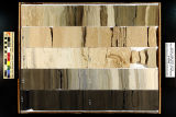 |
Skyline 16: SW SW sec. 10 11S 25E Uintah County, Utah. Box 95 Depth: 960.0 - 970.0 ft. | 2015-07 | core sample; Skyline 16; box 95; Green River Formation | Core sample photograph by the Utah Geological Survey at the University of Utah, and the Utah Core Research Center. Skyline 16: SW SW sec. 10 11S 25E Uintah County, Utah. Box 95 Depth: 960.0 - 970.0 ft. |
| 2162 |
 |
Skyline 16: SW SW sec. 10 11S 25E Uintah County, Utah. Box 96 Depth: 970.0 - 980.0 ft. | 2015-07 | core sample; Skyline 16; box 96; Green River Formation | Core sample photograph by the Utah Geological Survey at the University of Utah, and the Utah Core Research Center. Skyline 16: SW SW sec. 10 11S 25E Uintah County, Utah. Box 96 Depth: 970.0 - 980.0 ft. |
| 2163 |
 |
Skyline 16: SW SW sec. 10 11S 25E Uintah County, Utah. Box 97 Depth: 980.0 - 990.0 ft. | 2015-07 | core sample; Skyline 16; box 97; Green River Formation | Core sample photograph by the Utah Geological Survey at the University of Utah, and the Utah Core Research Center. Skyline 16: SW SW sec. 10 11S 25E Uintah County, Utah. Box 97 Depth: 980.0 - 990.0 ft. |
| 2164 |
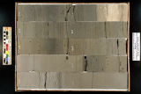 |
Skyline 16: SW SW sec. 10 11S 25E Uintah County, Utah. Box 98 Depth: 990.0 - 1000.0 ft. | 2015-07 | core sample; Skyline 16; box 98; Green River Formation | Core sample photograph by the Utah Geological Survey at the University of Utah, and the Utah Core Research Center. Skyline 16: SW SW sec. 10 11S 25E Uintah County, Utah. Box 98 Depth: 990.0 - 1000.0 ft. |
| 2165 |
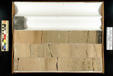 |
Skyline 16: SW SW sec. 10 11S 25E Uintah County, Utah. Box 99 Depth: 1000.0 - 1006.25 ft. | 2015-07 | core sample; Skyline 16; Green River Formation; box 99 | Core sample photograph by the Utah Geological Survey at the University of Utah, and the Utah Core Research Center. Skyline 16: SW SW sec. 10 11S 25E Uintah County, Utah. Box 99 Depth: 1000.0 - 1006.25 ft. |
| 2166 |
 |
Slow radio-frequency processing of large oil shale volumes to produce petroleum-like shale oil | 2003-08-20 | slow radio-frequency processing; large oil shale volumes; petroleum-like shale oil; oil shale | A process is proposed to convert oil shale by radio frequency heating over a period of months to years to create a product similar to natural petroleum. Electrodes would be placed in drill holes, either vertical or horizontal, and a radio frequency chosen so that the penetration depth of the radio w... |
| 2167 |
 |
SO2 emissions from the oxidation of retorted oil shale | 1981-11 | SO2 emissions; retorted oil shale; oil shale oxidization; S02 capture; burned char; carbonate decomposition | The purpose of this study is to measure the efficiency of S02 capture reactions when char and associated iron sulfides are burned in such a way that little carbonate decomposition occurs. The data described below show that char combustion can be performed in such a way that little carbonate decompos... |
| 2168 |
 |
SO3 formation during oxy-coal combustion | 2010-06-10 | oxy-coal combustion; SO3 formation; formation of sulfur compounds; sulfur | In oxy-coal combustion, an oxygen and carbon dioxide mixture, rather than air, is used to burn the coal. Many studies to date have focused on the formation of NOx under oxy-coal combustion conditions; however, the formation of sulfur species, particularly sulfur trioxide, is currently not a well und... |
| 2169 |
 |
SO3 formation during oxy-coal combustion - Presentation | 2010-06-10 | SO3; oxy-coal combustion; controlled condensation method; sulfur combustion; pilot-scale combustor | In oxy-coal combustion, an oxygen and carbon dioxide mixture, rather than air, is used to burn the coal. Many studies to date have focused on the formation of NOx under oxy-coal combustion conditions; however, the formation of sulfur species, particularly sulfur trioxide, is currently not a wellunde... |
| 2170 |
 |
Soil stabilization using oil shale solid wastes: Laboratory evaluation of engineering properties | 1991-01 | soil stabilization; oil shale solid wastes; engineering properties; using oil shale solid waste for subgrade soil stabilization | Oil shale solid wastes were evaluated for possible use as soil stabilizers . A laboratory study was conducted and consisted of the following tests on compacted samples of soil treated with water and spent oil shale: unconfined compressive strength, moisture-density relationships, wet-dry and freeze-... |
| 2171 |
 |
Solar Parking Project | 2011 | Solar Energy; Parking; University of Utah | Feasibility study to install photo voltaic structures at the University of Utah. |
| 2172 |
 |
Solvent extraction of tar sand | 1979-02-13 | solvent extraction process; tar sand; bitumen recovery | An extraction process for recovering bitumens from tar sands in which the tar sand is mixed with a hot hydrocarbon solvent, for example, toluene, in order to evaporate substantially all the water contained in the tar sands. The tar sands-solvent mixture is then separated into two phases of fine and ... |
| 2173 |
 |
Solvent extraction process for recovering bitumen from tar sand | 1987-06-30 | solvent extraction process; bitumen recovery; tar sand; patent; direct solvent extraction; solvent bitumen recovery; residual bitumen | Bitumen recovered from tar sand by direct solvent extraction followed by washing of the sand tailings with countercurrent solvent flow and a solvent/aqueous phase separation step to recover solvent and residual bitumen. |
| 2174 |
 |
Some possible applications of thermal recovery in Utah | 1965-11 | thermal recovery; applications of thermal recovery; oil reserves; bituminous sandstones; thermal project; bituminous oil sand | The bituminous sandstones of the Rocky Mountain region have significant reserves of oil. Production costs of the reserves must be reduced to be equal to or lower than the cost of crude oil produced by conventional methods. Three Utah deposits alone, Sunny side, Vernal (Asphalt Ridge) and Whiterocks ... |
| 2175 |
 |
Sources and deposition of organic matter in the Monterey Formation, South-Central Coastal basins of California | 1987-11-02 | organic matter; Monterey Formation; Californial ; marine algal debris | The abundant organic matter in the Monterey Formation is commonly considered to be derived from marine algal debris rapidly deposited in anoxic bottom water during a period of high surface plankton productivity. However, many aspects of the distribution of organic matter in the Monterey of the south... |
| 2176 |
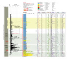 |
South Uinta Basin 12 core log - Plate 10 | 2014 | plate 10; well log; core log; Green River Formation | |
| 2177 |
 |
Special Academic Programs | College Programs; University of Utah | ||
| 2178 |
 |
Spent shale grouting of abandoned in-situ oil shale retorts | 1980-03 | spent shale grouting; in-situ oil shale retorts; abandoned oil shale retorts; vertical modified in-situ oil shale retorting; VMIS; retort abandonment | In vertical modified in-situ (VMIS) oil shale retorting, the resource is processed in the ground. Large chambers of rubblized oil shale are formed by mining out about 20 to 40 percent of the in-place shale and blasting the balance into the created void. The mined-out material is brought to the surfa... |
| 2179 |
 |
Spint modify instructions | The spint modity programs allow the used the modity a spint matrix. It, also, copies information at the beginning and endot a file which allows it to process inpact files, etc. | ||
| 2180 |
 |
Spontaneous potential-focused electric log | 1982-07-29 | electric log | |
| 2181 |
 |
Spring 2012 applications (UUSAC) | 2012 | University scholarships | Applications for a scholarship |
| 2182 |
 |
Staff Council Annual Report 2013-2014 (University of Utah Staff Advisory Committee) | 2014 | Annual report | University of Utah Staff Advisory Committee (UUSAC) annual report for fiscal year 2013-2014. Contents include Committee Highlights, Development Committee, Legislative Committee, EVents Committee, Communications & Selections Committee and Executive Board & Committee Chairs. |
| 2183 |
 |
Staff Council applications (UUSAC) | 2012 | University of Utah staff | Applications of individuals from areas across the University of Utah campus that are interested in becoming members of the University of Utah Staff Council. |
| 2184 |
 |
Staff Council Applications 2013 (UUSAC) | 2013; 2014 | Staff applications; Employment | Applications for positions on the Staff Council |
| 2185 |
 |
Staff Council award templates 2010-2014 (UUSAC) | 2010 | Member service; University of Utah employees | Template for service awards to members of the University of Utah Staff Council. |
| 2186 |
 |
Staff Council committee member award template 2009-2013 (UUSAC) | 2009 | Member service; University of Utah employees | Template for service awards to members of the University of Utah Staff Council. |
| 2187 |
 |
Staff council votes (University of Utah Staff Advisory Committee (UUSAC)) | 2014 | Votes; Staff council | Votes for individuals to serve on the staff council. |
| 2188 |
 |
STAR-CCM+ simulations of in-situ thermal treatment of oil shale | 2013-03 | in-situ thermal treatment; oil shale; shale oil/gas; oil shale formations | Presentation given at the STAR Global Conference on March 13, 2013. |
| 2189 |
 |
State and regional control of geological carbon sequestration | 2010-12-31 | geological carbon sequestration; geologic sequestration; carbon capture | The United States has economically recoverable coal reserves of about 261 billion tons, which is in excess of a 250-year supply based on 2009 consumption rates. However, in the near future the use of coal may be legally restricted because of concerns over the effects of its combustion on atmospheric... |
| 2190 |
 |
State and regional control of geological carbon sequestration (Part I) | 2011-05 | state and regional control; geological carbon sequestration; hydrocarbon fuel; carbon capture; geologic sequestration | In the near future the use of coal may be legally restricted due to concerns over the effects of its combustion on atmospheric carbon dioxide concentrations. Carbon capture and geologic sequestration offer one method to reduce carbon emissions from coal and other hydrocarbon fuel. While the federal ... |
| 2191 |
 |
State and Regional Control of Geological Carbon Sequestration Topical Report - Reporting Period July 1, 2008 to September 30 2010 | 2011-03 | control of geological carbon sequestration; IOGCC; Interstate Oil and Gas Compact Commission; CO2 emissions | The United States has economically recoverable coal reserves of about 261 billion tons, which is in excess of a 250‐year supply based on 2009 consumption rates. However, in the near future the use of coal may be legally restricted because of concerns over the effects of its combustion on atmospher... |
| 2192 |
 |
State of Utah demographic and economic projection model system | 1995-05 | This document was prepared with multiple objectives and various audiences in mind. Its structure reflects this multiplicity. The differing levels of coverage of the various components of the model system are intentional. We consider this document to be an electronic filing cabinet which will be expa... | |
| 2193 |
 |
State of Utah economic & demographic projections 1988 | 1988-04 | This is the updated projection of "baseline" or the "most likely" economic and demographic conditions through the year 2010 for the State of Utah, its counties, and its multi-county planning districts (MCD's) Rapidly changing economic and demographic circumstances in recent years have exacerbated th... | |
| 2194 |
 |
State of Utah economic & demographic projections 1990 | 1989-12 | This is the updated projection of "baseline" or the "most likely" economic and demographic conditions through the year 2010 for the State of Utah, its multi-county planning districts (MCDs) and its counties. Rapidly changing economic and demographic circumstances in recent years have exacerbated the... | |
| 2195 |
 |
State of Utah economic & demographic projections 1992 | 1992-05 | This report includes the updated projection of "baseline" economic and demographic conditions through the year 2020 for the State of Utah, its multi-county planning districts (MCDs) and its counties. Rapidly changing economic and demographic circumstances in recent years have exacerbated the usual d... | |
| 2196 |
 |
State of Utah economic & demographic projections 1994 | 1994-09 | This biennial Economic and Demographic Projections Report presents population and employment projections reflecting baseline economic and demographic conditions to the year 2020 for the State of Utah, its multi-county planning districts (MCDs) and counties. The primary purpose of this report is to a... | |
| 2197 |
 |
State of Utah economic & demographic projections 1994: highlights | 1994-10 | This document reviews and examines the major conclusions from the larger, more detailed report, State of Utah Economic and Demographic Projections 1994. The Governor's Office of Planning and Budget (GOPB) publishes these long-term projections biennially. The primary purpose of the projections is to ... | |
| 2198 |
 |
State of Utah economic and demographic projection: UPED scoping process and workplan | 2001-04 | Utah is one of the few states in the entire nation where all of the state agencies and local governments coordinate to use the same source of information for planning purposes. The data that they use is generated from the UPED model system. This consistency allows private and public sector entities... | |
| 2199 |
 |
State of Utah economic and demographic projections for counties, multi-country districts, and the State, 2000-2030 Volume 1 | 2000-01 | ||
| 2200 |
 |
State of Utah economic and demographic projections: 2000-2030, 2000 baseline highlights | 2001-01 |
