TO
Filters: Collection: "ir_eua"
| Title | Date | Subject | Description | ||
|---|---|---|---|---|---|
| 2001 |
 |
Research investigations in oil shale, tar sand, coal research, advanced exploratory process technology, and advanced fuels research: Volume 2--jointly sponsored research program | 1994-09 | oil shale; tar sand; coal research; advanced exporatory process technology; advanced fuels research; JSRP; Contained Recovery of Oily Wastes | This report summarizes the major research investigations conducted by the Western Research Institute (WRI) under Cooperative Agreement DE-FC21-86MCll076 with the U.S. Department of Energy (DOE) over the period October 1986 through September 1993. In 1989 a Jointly Sponsored Research Program (JSRP) w... |
| 2002 |
 |
Resolution on scholarly communication | 2007 | Scholarly communication; publishing; open access | Resolution presented to the Academic Senate at The University of Utah by Mary Youngkin on March 5, 2007. |
| 2003 |
 |
Resource evaluation of selected tar-sand deposits in southern Oklahoma | 1987-11-02 | resource evaluation; tar-sand deposits; southern Oklahoma; sulphur deposit; bitumen content | The cooperative program between the Oklahoma Geological Survey and the U.S. Department of Energy has permitted evaluation of specific tar-sand deposits in Carter and Murray counties, Oklahoma. The Sulphur deposit was evaluated by a combination of industry and DOE-OGS boreholes. Bitumen content of th... |
| 2004 |
 |
Resource potential of Utah oil sands | 2008-02-22 | Utah tar sand resources; tar sand resources; tar sand | Overview of Utah tar sand resources given by John Baza, Director of Utah Division of Oil, Gas & Mining. |
| 2005 |
 |
Results of mathematical modeling of an oil shale retort having a fluidized-bed pyrolyzer and a lift-pipe combustor | 1988-10 | Mathematical modeling; oil shale retort; fluidized-bed pyrolyzer; lift-pipe combustor; computer model | A commercial-size, hot-solids recycle retorting process, consisting of a staged fluidized-bed pyrolyzer and a lift-pipe combustor, was simulated using a previously developed mathematical model. The focus of this work at Lawrence Livermore National Laboratory (LLNL) is to show the effects of varying ... |
| 2006 |
 |
Results of mathematical modeling of an oil shale retort having a fluidized-bed pyrolyzer and a lift-pipe combustor | 1988-01 | mathematical modeling; oil shale retort; fluidezed-bed pyrolyzer; lift-pipe combustior; varying key process parameters | Many aboveground processes have been proposed for retorting oil shale. The common objective is to heat oil shale particles to 450-600°C to pyrolyze the kerogen in the shale and form oil. Either hot gas or hot solid particles may be used to supply heat to the shale. Hot-solids processes heat the coo... |
| 2007 |
 |
Retorting and combustion processes in surface oil-shale retorts | 1981-03 | batch oil-shale retorting process; surface oil-shale retorts; oil shale | Lawrence Livermore National Laboratory's mathematical model for a batch oil-shale retorting process has proved useful in understanding in situ retorting in a bed of oil-shale rubble. This model is based on an improved understanding of the physical and chemical processes involved in retorting. It has... |
| 2008 |
 |
Retorting kinetics for oil shale from fluidized-bed pyrolysis | 1981-12 | retorting kinetics; oil shale; fluidized-bed pyrolysis; aboveground oil shale retorting; developing diagnostic techniques | A quartz isothermal fluidized-bed reactor has been constructed in order to measure kinetics and oil properties relevant to surface processing of oil shale. The rate of volatile hydrocarbon evolution is measured with a flameionization detector. Oil yield and composition is determined via subsequent a... |
| 2009 |
 |
Retreat notes (UUSAC) | 2013 | University of Utah staff | The year in review, communication and selection. |
| 2010 |
 |
Retreat notes: 2014 (UUSAC) | 2014 | University of Utah staff | Communication and selection. |
| 2011 |
 |
Return to Campus: Keys to success for students | 2020-08-20 | COVID-19; Fall Semester; 2020 | Announcement following the fifth Return to Campus webinar |
| 2012 |
 |
Review of the world's major oil sand deposits | 1974 | oil sand deposits; major oil sand deposits; oil reserves; non-conventional oil; oil sands; oil shale; coal; syncrude production; review; types of oil deposits | The solution of today's energy equation lies in crash programmes for the development of alternative fuels to supplement dwindling conventional oil reserves. Conse quently, sources of non-conventional oil such as oil sands, oil-shale and coal are being given greater consid eration. The production of ... |
| 2013 |
 |
Revised Utah population estimates for the 1990s | 2001-05 | Every 10 years, the U.S. Bureau of the Census conducts a population count. In the intervening years the Utah Population Es timates Committee (UPEC) annually prepares total resident population estimates for each of the 29 counties in the state. These estimates are based on methods that ut i l i z e s... | |
| 2014 |
 |
Road log no. 2 | 1963 | road log; geology of southwestern Utah | Road Log NO. 2 1.1 St. George, Utah, To Cedar City, Utah, Via Zion National Park and Cedar Breaks National Monument (216.9 Miles). |
| 2015 |
 |
The role of gas bubbles in bitumen recovery from tar sands in hot-water processing | 1994-05 | gas bubbles in bitumen recovery; bitumen recovery; hot water process | Complete bitumen disengagement and displacement from tar sand during digestion is a determining but not sufficient condition for satisfactory bitumen recovery in the hot water process. The density of most bitumens is close to that of the aqueous phase, and fine, mineral particles reside in the bitum... |
| 2016 |
 |
Role of simulation in carbon management | 2013-05-07 | ICSE; Unconventional fuels; Carbon; CCS; Simulation | Presentation given at the University of Utah Unconventional Fuels Conference, Salt Lake City, Utah, May 7, 2013. |
| 2017 |
 |
Sabbatical report (July 2015 - December 2015) | 2015-12 | Sabbitical; Oxford university; St. Stephen's House; Pusey House | Report of sabbatical leave for Peter Kraus, Marriott Library, University of Utah |
| 2018 |
 |
Safety compliance under orange | COVID-19; guidelines | Executive summary | |
| 2019 |
 |
Salient features of the bituminous sandstone occurrence near Sunnyside, Carbon County, Utah | 1963 | bituminous sandstone; Sunnyside | |
| 2020 |
 |
Salt Lake area transportation study: volume I current travel inventory | 1963-11 | A major element of this study was the review of current travel patterns generated by the 394,000 residents of the Salt Lake area as determined from a 1960 comprehensive origin-destination survey which was conducted by the Department of Highways. Supplemental studies covered commercial vehicle m... | |
| 2021 |
 |
Salt Lake City census 2000 atlas | 2011-03 | Demographics; Salt Lake City; Utah; Census | This volume presents the basic demographic characteristics of residents of Salt Lake City as recorded in the 2000 Census of Population and Housing. Every ten years these federal governm ent counts of people are the basis of congressional apportionment and political redistricting. Data in this volume... |
| 2022 |
 |
Salt Lake City census 2010 atlas | 2013-02 | Demographics; Salt Lake City; Utah; Census | This volume presents and analyzes results from the 2010 Census of Population and Housing. This mandatory enumeration is conducted by the federal government and is used to determine reapportionment and redistricting. This is the most complete record of population, households, and housing units that i... |
| 2023 |
 |
Salt Lake County's distinctive demographics: implications for the aging population | 2006-12 | Salt Lake County; Projections; Estimates; Aging population; Baby boom; Utah; Salt Lake Aging Services; Kennecott Land | Salt Lake County is the economic, political, and cultural center of Utah. The county is currently home to nearly 40 percent of Utah residents and generates about half of all jobs in the state. It remains the most populous county, with a million of the state's 2.6 million residents,1 and its daytime ... |
| 2024 |
 |
Salt Lake County's distinctive demographics: implications for the future | 2006-11 | Salt Lake County is the economic, political, and cultural center of Utah. The county is currently home to nearly 40% of Utah residents and generates about half of all jobs in the state. It remains the most populous county, with a million of the state's 2.6 million residents,2 and its daytime populat... | |
| 2025 |
 |
Salt Lake County: demographic and economic overview | 2006-12 | Salt Lake County; Utah; Demographics; Aging; Dependency ratio; Foreign born; Immigrants; Age structure; Age waves; Occupation; Labor force participation; Sex ratio; Educational attainment; commuting | Salt Lake County is the economic, political, and cultural center of Utah. The county is currently home to nearly 40 percent of Utah residents and generates about half of all jobs in the state. It remains the most populous county, with a million of the state's 2.6 million residents,1 and its daytime ... |
| 2026 |
 |
SAM model operations | 1981-08-20 | In conjunction with UU/CC mandated upgrades of all BEBR software, some additional changes have been made to component programs of the Sam model. These changes will simplify future program maintenance, file management and runstream preparation. | |
| 2027 |
 |
The San Rafael oil fields; where the oil runs out of the rocks | 1975-09 | San Rafael oil fields; oil; oil field | The following article has been prepared and written with the object of furnishing accurate and dependable information of what is, perhaps, as little known a region as exists in this Twentieth Century. It is a country of wonderful possibilities and the writer after years of careful observation and ex... |
| 2028 |
 |
Saturated hydrocarbon distributions in bitumens and in oils recovered by thermal processes | 1986-07 | saturated hydrocarbon distribution; bitumen; oil recovered by thermal process; thermal process; in-situ thermal processing; tar sand bitumen; oil recovery | The effect of processing conditions on oil recovery from tar sand has been studied recently by using a linear, adiabatic tube reactor. Laboratory experiments have been conducted to evaluate the potential of combustion and hot-gas injection for the thermal recovery of oil from the Asphalt Ridge and t... |
| 2029 |
 |
Schematic of Utah process employment-demographic model | |||
| 2030 |
 |
Scientific drilling: Directional drilling in coal | 2011-03-21 | scientific drilling; directional drilling in coal; drilling; UCG training course; UCG | UCG Training Course, March 21-22, 2011, Deloitte, London |
| 2031 |
 |
The search for a source rock for the giant Tar Sand Triangle accumulation, southeastern Utah | 1999-03 | source rock; giant Tar Sand Triangle; southeastern Utah; oil resource; heavy oil and tar; oil; Tar Sand Triangle accumulation; thermal modeling | A large proportion (about 36%) of the world's oil resource is contained in accumulations of heavy oil or tar. In these large deposits of degraded oil, the oil in place represents only a fraction of what was present at the time of accumulation. In many of these deposits, the source of the oil is unkn... |
| 2032 |
 |
Secure fuels from domestic resources: The continuing evolution of America's oil shale and tar sands industries | 2007-06 | secure fuels; domestic fuel; energy security; foreign imports; oil; oil conservation; fuel conservation; domestic fuel; bio-fuels. | Energy security is essential to preserve America's economic strength and national security. Reducing our dependence on foreign imports of oil and refined products is essential to achieving the energy security objective. Import reductions can be achieved in two fundamental ways--reducing our demand f... |
| 2033 |
 |
Sedimentology of oil-impregnated, lacustrine and fluvial sandstone, P.R. Spring area, southeast Uinta Basin, Utah | 1970-08 | sedimentology; lacustrine and fluvial sandstone; P. R. Spring area; Oil-impregnated lacustrine and fluvial sandstone | Oil-impregnated intervals, up to 75 feet thick within a stratigraphic interval of about 250 feet in the Garden Gulch and Parachute Creek Members of the Green River Formation (Eocene), are exposed in beds that dip gently northward in the P. R. Spring area. Reserve estimates indicate that there may be... |
| 2034 |
 |
Separation and cost analysis of recovering crude oils from bituminous sandstones near Roosevelt, Utah | 1967-10 | crude oil recovery; bitumous sandstones; separation analysis; cost analysis; shallow oil sand deposits; hot water flotation process | The recovery of crude oil from shallow oil sand deposits by means of hot water flotation process is now a reality, with possible production costs competitive with crude from oil wells, depending on the oil content of the sand. Consistent recovery of 95 to 97$ of the contained crude oils, with the po... |
| 2035 |
 |
Separation and utilization studies of bitumens from bituminous sandstones of the Vernal and Sunnyside, Utah, deposits | 1952-05 | separation studies; utilization studies; bituminous sandstones; Vernal, Utah deposit; Sunnyside, Utah deposit; bitumen separation techniques; bitumen separation | In the search for possible future sources of petroleum products, the recovery and utilization of bitumens from the large outcropping deposits of bituminous sandstones in the United States have been under study by the Bureau of Mines for the past several years. The results of laboratory research in t... |
| 2036 |
 |
Separation of bitumen from dry tar sands | 1978-10-17 | bitumen separation; bitumen recovery; dry tar sands | A process for the separation and recovery of bitumen from dry tar sands or sands with negligible quantities of connate water. The process includes comminuting the tar sands to an average particle size of approximately one centimeter in diameter and digesting the comminuted tar sand in a hot, aqueous... |
| 2037 |
 |
Separation of solids from tar sands extract | 1978-06-13 | separations of solids; tar sands; tar sands extract; liquid promoter; patent | Solids are separated from a tar sands extract by gravity settling or centrifugation in the presence of a liquid promoter which promotes and enhances the separation of the solid material. The liquid promoter has a characterization factor of at least 9.75, a 5 volume percent distillation temperature o... |
| 2038 |
 |
Shale oil recovery systems incorporating ore beneficiation | 1982-10 | shale oil; shale oil recovery systems; ore beneficiation; potential attractiveness of new large-scale systems; oil recovery | This study analyzed the recovery of oil from oil shale by use of proposed systems which incorporate beneficiation of the shale ore (that is, concentration of the kerogen) before the oil-recovery step. The objective was to identify systems which could be more attractive than conventional surface reto... |
| 2039 |
 |
Shale oil value enhancement research - Qarterly report: July 1 - September 30, 1994 | 1994 | shale oil; value enhancement; process sequence alternatives | Activities during this quarter focused on using the phase-l results to define process sequence alternatives for phase-ll. Two process alternatives have been devised while obtaining the desired marketable product slate. The status of required process units has been evaluated. While there are some uni... |
| 2040 |
 |
Shale oil value enhancement research - Quarterly report: April 1 - June 30, 1995 | 1995 | shale oil; value enhancement | A review of the marketing, compositional analysis, and process data has pointed to a simplification of the process scheme envisaged for the phase-II continuous process work. This translates into a higher probability of success, both for the R&D and the likelihood of securing an industrial partner fo... |
| 2041 |
 |
Shale oil value enhancement research - Quarterly report: December 1, 1994 - February 28, 1995 | 1995 | shale oil; value enhancement | The quarter's efforts were aimed towards completing phase-l. We expect to complete phase-l in the next quarter. The final in phase-l will produce the new economic estimates to use as guidelines for phase-l I activities. Progress on phase-ll has been initiated with the focus being on completing fabri... |
| 2042 |
 |
Shale oil value enhancement research - Quarterly report: January 1 - March 31, 1996 | 1996 | shale oil; value enhancement; compound type analysis | Activities during this quarter focused on (a) compound type analysis of shale oil and its extraction products, (b) thermal hydrodealkylation of the > 290°C polar fraction, and (c) economic analysis of the SPX project. At the end of this quarter, Mr. Jerry Wiser - the chief process engineer of JWBA,... |
| 2043 |
 |
Shale oil value enhancement research - Quarterly report: June 1 - August 31, 1993 | 1993 | shale oil; value enhancement; shale oil-derived products | All tasks are on schedule, or ahead of schedule. Particular progress has been made in identifying industrial entities, commodities and specialty products of target interest for shale oil-derived products. There is clearly a major emphasis worldwide on new chemicals and shale oil-derived structures a... |
| 2044 |
 |
Shale oil value enhancement research - Quarterly report: June 1 - August 31, 1996 | 1996 | shale oil; value enhancement; compound type analysis; kerogen derived products | The quarter's efforts were concentrated on (a) THDA and reaction of alkylpyridines at elevated conditions, (b) compound type analysis of kerogen oil and its derived products, (b) thermal hydrodealkylation of the >290 °C polar fraction, (c) secondary reactions of pyridinic type compounds to form mar... |
| 2045 |
 |
Shale oil value enhancement research - Quarterly report: March 1 - May 31, 1994 | 1994 | shale oil; value enhancement; identification of molecular types in shale oil; molecular composition | Activities during this quarter focused on integrating the various tasks and elements. During Phase-I, substantial effort was placed on designing and automating the identification of molecular types present in shale oil. The ability to know the molecular composition and to track a given "target" spec... |
| 2046 |
 |
Shale oil value enhancement research - Quarterly report: March 1 - May 31, 1996 | 1996 | shale oil; value enhancement; compound type analysis of shale oil | The quarter's efforts were concentrated on (a) compound type analysis of shale oil and its extraction products, (b) thermal hydrodealkylation of the >290 °C polar fraction, (c) reaction of pyridinic type compounds to form secondary products, (d) updating SPX economic analysis, and (e) preparation o... |
| 2047 |
 |
Shale oil value enhancement research - Quarterly report: October 1 - December 31, 1993 | 1993 | Shale oil; value enhancement; molecular types of shale oil | The first year of this effort was focussed on the following broad objectives: -Analyze the molecular types present in shale oil (as a function of molecular weight distribution ); - Determine the behavior of these molecular types in liquid-liquid extraction; -Develop the analytical tools needed to sy... |
| 2048 |
 |
Shale oil value enhancement research - Quarterly report: October 1 - December 31, 1993 | 1993 | shale oil; value enhancement; raw shale oil; market shale oil project | A major push was made to identify the hydrocarbon and heteroatom types present in raw shale oil. A comprehensive, qualitative picture of the <400°C material has been obtained. In addition to the expected types, e.g., pyridines, pyrroles, indoles and phenols, the presence of aliphatic carboxylic aci... |
| 2049 |
 |
Shale oil value enhancement research - Quarterly report: October 1- December 31, 1996 | 1996 | shale oil; value enhancement; flow THDA reactor system; KPX product slate | Concurrent activities are ongoing in all key area, namely, (a) construction and startup of a flow THDA reactor system, (b) development of KPX product slate, and (c) conducting industrial liaison for assembly of the KPX consortium. Excellent progress is being made in all cases. Our market analysis an... |
| 2050 |
 |
Shale oil value enhancement research - Quarterly report: September 1 - November 30, 1995 | 1995 | Shale oil; value enhancement; shale oil extraction products; extraction process | Activities during this quarter focused on compound type analysis of shale oil extraction products and improvement of the continuous extraction process. We have installed a walk-in fume hood to improve the ventilation of our working environment while handling of larger amounts of shale oil and volati... |
| 2051 |
 |
Shale oil value enhancement research - Quarterly report: September 1, - November 30, 1994 | 1994 | shale oil; value enhancement; polars processing scheme | The focus of the phase-l research effort is now on exploratory level verification of the candidate process schemes. We are quite confident of the basic strategy, namely, division of the barrel by polarity and separate processing of the polar and non-polar streams. Processing of the non-polar stream ... |
| 2052 |
 |
Shovel ready...can you dig it? | 2010-04-28 | Earth Energy; Ophus Process; oil and sand leases. | "Earth Energy is a Calgary-based private company with a patent-pending oil sands processing technology, the ‘Ophus Process', which it intends to initially deploy on the company's oil sand leases in the State of Utah..." |
| 2053 |
 |
Signal oil and gas company summary: Test data, horizontal test wells #101, #102, #103, Sunnyside Area, Sec. 4, Twp. 14 S., R. 14 E., Carbon County, Utah | 1967-04 | gas company summary; test wells; horizontal test wells; tar sands | The objective of this project was to drill horizontal test wells into the Wasatch "tar sands" and test produce oil by application of steam. Complete records were to be maintained for an engineering evaluation of this test pilot operation. This project followed the drilling of a 1450 ft. core hole (v... |
| 2054 |
 |
Similitude studies in three-phase ebullieted bed reactors | 1993-05 | similitude studies; three-phase ebullieted bed reactors; reactors; processing heavy oils, bitumen, and bitumen derived liquids | The length of a commercial reactor, in three-phase ebullieted bed processes with pelleted catalysts, for the processing of heavy oils, bitumen and bitumen-derived liquids are long due to the requirement of low space velocities. The reactor length, for laboratory scale studies of such processes, can ... |
| 2055 |
 |
Simplified analysis and practical mitigation techniques for induestrial boiler thermoacoustic vibration | 2019 | Industrial boiler systems are prone to mechanical vibration which can lead to premature component failures, emission non-compliance, and greatly increased ambient noise generation. Driving mechanisms, thermoacoustic phenomena, and system geometrical interactions are complex. General methods for accu... | |
| 2056 |
 |
Simulation of in situ processes in reservoir modeling: Fracturing and permeability development of oil shale | 2013-05-07 | ICSE; Unconventional fuels; Oil shale; Reservoir modeling | Presentation given at the University of Utah Unconventional Fuels Conference, Salt Lake City, Utah, May 7, 2013. |
| 2057 |
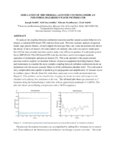 |
Simulation of the thermal-acoustic coupling inside an industrial hazardous waste incinerator | To analyze the coupling between combustion reactions and the natural acoustic behavior of a reactor, a transient LES based CFD code has been used. Previous transient analysis of ignition inside large process heaters, of multi-tipped elevated gas flares and waste incinerators has shown the ability of... | ||
| 2058 |
 |
Simultaneous upgrading of tar sand bitumen and coal by corefining | 1988-08-16 | tar sands derived bitumen and coal liquification process; patent; tar sands | An improved tar sands derived bitumen and coal liquification process is disclosed wherein substantial percentages of subdivided coal particles and tar sands derived bitumen liquids are mixed and then corefined with hydrogen under hydrocracking conditions, but in the absence of a separate catalyst, a... |
| 2059 |
 |
Site Evaluation for UCG Prospects | 2011-03-21 | UCG; site evaluation; JMC; UCG prospects; deep mine planing | UCG Training Course, March 21-22, 2011, Deloitte, London |
| 2060 |
 |
Size-range analysis of diesel soot with ultra-small angle X-ray scattering | 2005 | desiel soot; ultra-small angle X-ray scattering; Carbonaceous soot; diesel fuel; soot powders; soot | Carbonaceous soot produced in a small diesel engine test facility was investigated with ultra-small-angle X-ray scattering. Three soot samples produced using a reference diesel fuel and the reference fuel plus two oxygenate additives were investigated. The presence of objects at three typical size r... |
| 2061 |
 |
Skyline 12 Fisher Assay Data | 2015-07 | Skyline 12; Fisher Assay; Drill hole | Fisher Assay drill hole info on Skyline 12. |
| 2062 |
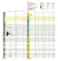 |
Skyline 16 - Plate 7 | 2014 | well log; core log; Skyline 16; plate 7; Green River Formation | |
| 2063 |
 |
Skyline 16 information | 2015-07 | Skyline 16; preliminary stratigraphy of Skyline 16; Green River Formation; Protecore samples | |
| 2064 |
 |
Skyline 16 sampling | 2015-07 | Skyline 16; sampling summary | Skyline 16 sampling summary. |
| 2065 |
 |
Skyline 16 Stratigraphic Column | 2015-07 | Skyline 16; stratigraphic column; well core; core log | Well log of Skyline 16. |
| 2066 |
 |
Skyline 16 XRF | 2015-07 | Skyline 16; Skyline 16 samples | |
| 2067 |
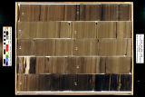 |
Skyline 16: SW SW sec. 10 11S 25E Uintah County, Utah. Box 1 Depth: 20.0 - 30.0 ft. | 2015-07 | core samples; Skyline 16; box 1; Green River Formation | Core sample photograph by the Utah Geological Survey, University of Utah. Skyline 16, SW SW sec. 10 11S 25E Uintah Country, Utah. Box 1 Depth: 20.0 - 30.0 ft. |
| 2068 |
 |
Skyline 16: SW SW sec. 10 11S 25E Uintah County, Utah. Box 10 Depth: 110.0 - 120.0 ft. | 2015-07 | core samples; Skyline 16; box 10; Green River Formation | Core sample photograph by the Utah Geological Survey, University of Utah. Skyline 16: SW SW sec. 10 11S 25E Uintah County, Utah. Box 10 Depth: 110.0 - 120.0 ft. |
| 2069 |
 |
Skyline 16: SW SW sec. 10 11S 25E Uintah County, Utah. Box 11 Depth: 120.0 - 130.0 ft. | 2015-07 | core samples; Skyline 16; box 11; Green River Formation | Core sample photograph by the Utah Geological Survey, University of Utah. Skyline 16: SW SW sec. 10 11S 25E Uintah County, Utah. Box 11 Depth: 120.0 - 130.0 ft. |
| 2070 |
 |
Skyline 16: SW SW sec. 10 11S 25E Uintah County, Utah. Box 12 Depth: 130.0 - 140.0 ft. | 2015-07 | core samples; Skyline 16; box 12; Green River Formation | Core sample photograph by the Utah Geological Survey, University of Utah. Skyline 16: SW SW sec. 10 11S 25E Uintah County, Utah. Box 12 Depth: 130.0 - 140.0 ft. |
| 2071 |
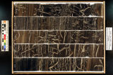 |
Skyline 16: SW SW sec. 10 11S 25E Uintah County, Utah. Box 13 Depth: 140.0 - 150.0 ft. | 2015-07 | core samples; Skyline 16; box 13; Green River Formation | Core sample photograph by the Utah Geological Survey, University of Utah. Skyline 16: SW SW sec. 10 11S 25E Uintah County, Utah. Box 13 Depth: 140.0 - 150.0 ft. |
| 2072 |
 |
Skyline 16: SW SW sec. 10 11S 25E Uintah County, Utah. Box 14 Depth: 150.0 - 160.0 ft. | 2015-07 | core samples; Skyline 16; box 14; Green River Formation | Core sample photograph by the Utah Geological Survey, University of Utah. Skyline 16: SW SW sec. 10 11S 25E Uintah County, Utah. Box 14 Depth: 150.0 - 160.0 ft. |
| 2073 |
 |
Skyline 16: SW SW sec. 10 11S 25E Uintah County, Utah. Box 15 Depth: 160.0 - 170.0 ft. | 2015-07 | core samples; Skyline 16; box 15; Green River Formation | Core sample photograph by the Utah Geological Survey, University of Utah. Skyline 16: SW SW sec. 10 11S 25E Uintah County, Utah. Box 15 Depth: 160.0 - 170.0 ft. |
| 2074 |
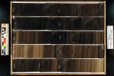 |
Skyline 16: SW SW sec. 10 11S 25E Uintah County, Utah. Box 16 Depth: 170.0 - 180.0 ft. | 2015-07 | core samples; Skyline 16; box 16; Green River Formation | Core sample photograph by the Utah Geological Survey, University of Utah. Skyline 16: SW SW sec. 10 11S 25E Uintah County, Utah. Box 16 Depth: 170.0 - 180.0 ft. |
| 2075 |
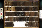 |
Skyline 16: SW SW sec. 10 11S 25E Uintah County, Utah. Box 17 Depth: 180.0 - 190.0 ft. | 2015-07 | core samples; Skyline 16; box 17; Green River Formation | Core sample photograph by the Utah Geological Survey, University of Utah. Skyline 16: SW SW sec. 10 11S 25E Uintah County, Utah. Box 17 Depth: 180.0 - 190.0 ft. |
| 2076 |
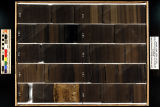 |
Skyline 16: SW SW sec. 10 11S 25E Uintah County, Utah. Box 18 Depth: 190.0 - 200.0 ft. | 2015-07 | core samples; Skyline 16; box 18; Green River Formation | Core sample photograph by the Utah Geological Survey, University of Utah. Skyline 16: SW SW sec. 10 11S 25E Uintah County, Utah. Box 18 Depth: 190.0 - 200.0 ft. |
| 2077 |
 |
Skyline 16: SW SW sec. 10 11S 25E Uintah County, Utah. Box 19 Depth: 200.0 - 210.0 ft. | 2015-07 | core samples; Skyline 16; box 19; Green River Formation | Core sample photograph by the Utah Geological Survey, University of Utah. Skyline 16: SW SW sec. 10 11S 25E Uintah County, Utah. Box 19 Depth: 200.0 - 210.0 ft. |
| 2078 |
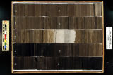 |
Skyline 16: SW SW sec. 10 11S 25E Uintah County, Utah. Box 2 Depth: 30.0 - 40.0 ft. | 2015-07 | core samples; Skyline 16; box 2; Green River Formation | Core sample photograph by the Utah Geological Survey, University of Utah. Skyline 16, SW SW sec. 10 11S 25E Uintah Country, Utah. Box 2 Depth: 30.0 - 40.0 ft. |
| 2079 |
 |
Skyline 16: SW SW sec. 10 11S 25E Uintah County, Utah. Box 20 Depth: 210.0 - 220.0 ft. | 2015-07 | core samples; Skyline 16; box 20; Green River Formation | Core sample photograph by the Utah Geological Survey, University of Utah. Skyline 16: SW SW sec. 10 11S 25E Uintah County, Utah. Box 20 Depth: 210.0 - 220.0 ft. |
| 2080 |
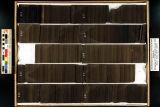 |
Skyline 16: SW SW sec. 10 11S 25E Uintah County, Utah. Box 21 Depth: 220.0 - 230.0 ft. | 2015-07 | core samples; Skyline 16; box 21; Green River Formation | Core sample photograph by the Utah Geological Survey at the University of Utah and the Utah Core Research Center. Skyline 16: SW SW sec. 10 11S 25E Uintah County, Utah. Box 21 Depth: 220.0 - 230.0 ft. |
| 2081 |
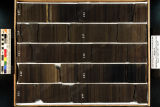 |
Skyline 16: SW SW sec. 10 11S 25E Uintah County, Utah. Box 22 Depth: 230.0 - 240.0 ft. | 2015-07 | core samples; Skyline 16; box 22; Green River Formation | Core sample photograph by the Utah Geological Survey at the University of Utah, and the Utah Core Research Center. Skyline 16: SW SW sec. 10 11S 25E Uintah County, Utah. Box 22 Depth: 230.0 - 240.0 ft. |
| 2082 |
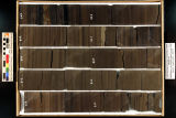 |
Skyline 16: SW SW sec. 10 11S 25E Uintah County, Utah. Box 23 Depth: 240.0 - 250.0 ft. | 2015-07 | core samples; Skyline 16; box 23; Green River Formation | Core sample photograph by the Utah Geological Survey at the University of Utah, and the Utah Core Research Center. Skyline 16: SW SW sec. 10 11S 25E Uintah County, Utah. Box 23 Depth: 240.0 - 250.0 ft. |
| 2083 |
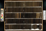 |
Skyline 16: SW SW sec. 10 11S 25E Uintah County, Utah. Box 24 Depth: 250.0 - 260.0 ft. | 2015-07 | core samples; Skyline 16; box 24; Green River Formation | Core sample photograph by the Utah Geological Survey at the University of Utah, and the Utah Core Research Center. Skyline 16: SW SW sec. 10 11S 25E Uintah County, Utah. Box 24 Depth: 250.0 - 260.0 ft. |
| 2084 |
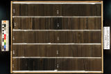 |
Skyline 16: SW SW sec. 10 11S 25E Uintah County, Utah. Box 25 Depth: 260.0 - 270.0 ft. | 2015-07 | core samples; Skyline 16; box 25; Green River Formation | Core sample photograph by the Utah Geological Survey and the University of Utah, and the Utah Core Research Center. Skyline 16: SW SW sec. 10 11S 25E Uintah County, Utah. Box 25 Depth: 260.0 - 270.0 ft. |
| 2085 |
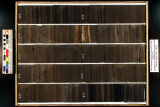 |
Skyline 16: SW SW sec. 10 11S 25E Uintah County, Utah. Box 26 Depth: 270.0 - 280.0 ft. | 2015-07 | core samples; Skyline 16; box 26; Green River Formation | Core sample photograph by the Utah Geological Survey at the University of Utah, and the Utah Core Research Center. Skyline 16: SW SW sec. 10 11S 25E Uintah County, Utah. Box 26 Depth: 270.0 - 280.0 ft. |
| 2086 |
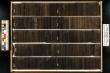 |
Skyline 16: SW SW sec. 10 11S 25E Uintah County, Utah. Box 27 Depth: 280.0 - 290.0 ft. | 2015-07 | core samples; Skyline 16; box 27; Green River Formation | Core sample photograph by the Utah Geological Survey at the University of Utah, and the Utah Core Research Center. Skyline 16: SW SW sec. 10 11S 25E Uintah County, Utah. Box 27 Depth: 280.0 - 290.0 ft. |
| 2087 |
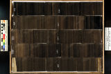 |
Skyline 16: SW SW sec. 10 11S 25E Uintah County, Utah. Box 28 Depth: 290.0 - 300.0 ft. | 2015-07 | core samples; Skyline 16; box 28; Green River Formation | Core sample photograph by the Utah Geological Survey at the University of Utah, and the Utah Core Research Center. Skyline 16: SW SW sec. 10 11S 25E Uintah County, Utah. Box 28 Depth: 290.0 - 300.0 ft. |
| 2088 |
 |
Skyline 16: SW SW sec. 10 11S 25E Uintah County, Utah. Box 29 Depth: 300.0 - 310.0 ft. | 2015-07 | core samples; Skyline 16; box 29; Green River Formation | Core sample photograph by the Utah Geological Survey at the University of Utah, and the Utah Core Research Center. Skyline 16: SW SW sec. 10 11S 25E Uintah County, Utah. Box 29 Depth: 300.0 - 310.0 ft. |
| 2089 |
 |
Skyline 16: SW SW sec. 10 11S 25E Uintah County, Utah. Box 3 Depth: 40.0 - 50.0 ft. | 2015-07 | core samples; Skyline 16; box 3; Green River Formation | Core sample photograph by the Utah Geological Survey, University of Utah. Skyline 16: SW SW sec. 10 11S 25E Uintah County, Utah. Box 3 Depth: 40.0 - 50.0 ft. |
| 2090 |
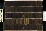 |
Skyline 16: SW SW sec. 10 11S 25E Uintah County, Utah. Box 30 Depth: 310.0 - 320.0 ft. | 2015-07 | core samples; Skyline 16; box 30; Green River Formation | Core sample photograph by the Utah Geological Survey at the University of Utah, and the Utah Core Research Center. Skyline 16: SW SW sec. 10 11S 25E Uintah County, Utah. Box 30 Depth: 310.0 - 320.0 ft. |
| 2091 |
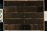 |
Skyline 16: SW SW sec. 10 11S 25E Uintah County, Utah. Box 31 Depth: 320.0 - 330.0 ft. | 2015-07 | core samples; Skyline 16; box 31; Green River Formation | Core sample photograph by the Utah Geological Survey at the University of Utah, and the Utah Core Research Center. Skyline 16: SW SW sec. 10 11S 25E Uintah County, Utah. Box 31 Depth: 320.0 - 330.0 ft. |
| 2092 |
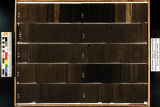 |
Skyline 16: SW SW sec. 10 11S 25E Uintah County, Utah. Box 32 Depth: 330.0 - 340.0 ft. | 2015-07 | core samples; Skyline 16; box 32; Green River Formation | Core sample photograph by the Utah Geological Survey at the University of Utah, and the Utah Core Research Center. Skyline 16: SW SW sec. 10 11S 25E Uintah County, Utah. Box 32 Depth: 330.0 - 340.0 ft. |
| 2093 |
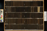 |
Skyline 16: SW SW sec. 10 11S 25E Uintah County, Utah. Box 33 Depth: 340.0 - 350.0 ft. | 2015-07 | core samples; Skyline 16; box 33; Green River Formation | Core sample photograph by the Utah Geological Survey at the University of Utah, and the Utah Core Research Center. Skyline 16: SW SW sec. 10 11S 25E Uintah County, Utah. Box 33 Depth: 340.0 - 350.0 ft. |
| 2094 |
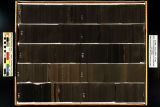 |
Skyline 16: SW SW sec. 10 11S 25E Uintah County, Utah. Box 34 Depth: 350.0 - 360.0 ft. | 2015-07 | core samples; Skyline 16; box 34; Green River Formation | Core sample photograph by the Utah Geological Survey at the University of Utah, and the Utah Core Research Center. Skyline 16: SW SW sec. 10 11S 25E Uintah County, Utah. Box 34 Depth: 350.0 - 360.0 ft. |
| 2095 |
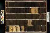 |
Skyline 16: SW SW sec. 10 11S 25E Uintah County, Utah. Box 35 Depth: 360.0 - 370.0 ft. | 2015-07 | core samples; Skyline 16; box 35; Green River Formation | Core sample photograph by the Utah Geological Survey at the University of Utah, and the Utah Core Research Center. Skyline 16: SW SW sec. 10 11S 25E Uintah County, Utah. Box 35 Depth: 360.0 - 370.0 ft. |
| 2096 |
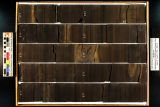 |
Skyline 16: SW SW sec. 10 11S 25E Uintah County, Utah. Box 36 Depth: 370.0 - 380.0 ft. | 2015-07 | core samples; Skyline 16; box 36; Green River Formation | Core sample photograph by the Utah Geological Survey at the University of Utah, and the Utah Core Research Center. Skyline 16: SW SW sec. 10 11S 25E Uintah County, Utah. Box 36 Depth: 370.0 - 380.0 ft. |
| 2097 |
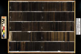 |
Skyline 16: SW SW sec. 10 11S 25E Uintah County, Utah. Box 37 Depth: 380.0 - 390.0 ft. | 2015-07 | core samples; Skyline 16; box 37; Green River Formation | Core sample photograph by the Utah Geological Survey at the University of Utah, and the Utah Core Research Center. Skyline 16: SW SW sec. 10 11S 25E Uintah County, Utah. Box 37 Depth: 380.0 - 390.0 ft. |
| 2098 |
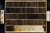 |
Skyline 16: SW SW sec. 10 11S 25E Uintah County, Utah. Box 38 Depth: 390.0 - 400.0 ft. | 2015-07 | core samples; Skyline 16; box 38; Green River Formation | Core sample photograph by the Utah Geological Survey at the University of Utah, and the Utah Core Research Center. Skyline 16: SW SW sec. 10 11S 25E Uintah County, Utah. Box 38 Depth: 390.0 - 400.0 ft. |
| 2099 |
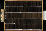 |
Skyline 16: SW SW sec. 10 11S 25E Uintah County, Utah. Box 39 Depth: 400.0 - 410.0 ft. | 2015-07 | core samples; Skyline 16; box 39; Green River Formation | Core sample photograph by the Utah Geological Survey at the University of Utah, and the Utah Core Research Center. Skyline 16: SW SW sec. 10 11S 25E Uintah County, Utah. Box 39 Depth: 400.0 - 410.0 ft. |
| 2100 |
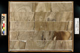 |
Skyline 16: SW SW sec. 10 11S 25E Uintah County, Utah. Box 4 Depth: 50.0 - 60.0 ft. | 2015-07 | core samples; Skyline 16; box 4; Green River Formation | Core sample photograph by the Utah Geological Survey, University of Utah. Skyline 16: SW SW sec. 10 11S 25E Uintah County, Utah. Box 4 Depth: 50.0 - 60.0 ft. |
