TO
Filters: Collection: "ir_eua"
| Title | Date | Subject | Description | ||
|---|---|---|---|---|---|
| 26 |
 |
Geologic summary report of the 1986 exploration program, Sunnyside tar sands project, Carbon County, Utah--volume 1 | 1987-07-19 | geologic summary report; exploration program; Sunnyside tar sands project; hydrocarbon leases; tar sand. | The 1986 exploration program focused on detailed geological and geophysical field work in outlying areas of hydrocarbon leases east of Mt. Bartles. Field work was also completed in the Whitmore Canyon area. The field program extended from June 16 through September 19. During this time geological and... |
| 27 |
 |
Determination of the major elements and trace metals present in bitumen from several tar sand deposits | 1985-01 | The results of the analyses of 14 tar sand samples for the concentration of major elements and trace metals are presented. Ten samples were obtained from the Uinta Basin of Utah, three from the southeastern part of Utah, and one from New Mexico. In general, the major element composition of the bitum... | |
| 28 |
 |
Oil-impregnated rock deposits of Utah | 1974-07 | ||
| 29 |
 |
Mineral management plan: Glen Canyon National Recreation Area--Arizona and Utah | 1980-03 | A General Management Plan (GMP) for Glen Canyon National Recreation Area was prepared during the period 1973 - 1979 and was approved on November 21, 1979, after it and an accompanying final environmental statement (FES 79-23) had been released to the public. That Plan called for the preparation of a... | |
| 30 |
 |
Road log no. 2 | 1963 | road log; geology of southwestern Utah | Road Log NO. 2 1.1 St. George, Utah, To Cedar City, Utah, Via Zion National Park and Cedar Breaks National Monument (216.9 Miles). |
| 31 |
 |
Analyses of oil extracted from oil-impregnated sandstone deposits in Utah | 1972-01 | This study, in progress from 1967 to 1970, is part of a systematic effort to find, map and sample Utah's oil-impregnated rock deposits. Samples were collected by ten individuals in field parties who examined oil-impregnated rock occurrences throughout the state. Samples 68-3A and 68-4A are from aban... | |
| 32 |
|
The determination of the major elements and trace metals present in bitumen from several tar sand deposits | 1985-01 | trace metals in bitumen; tar sand deposits; tar sand; bitumen extraction | The results of the analyses of 14 tar sand samples for the concentration of major elements and trace metals are presented. Ten samples were obtained from the Uinta Basin of Utah, three from the southeastern part of Utah, and one from New Mexico. In general, the major element composition of the bitum... |
| 33 |
 |
Properties of Utah tar sands--Three Mile Canyon area, P. R. Spring deposit | 1974 | Threemile Canyon area; P. R. Spring tar sand deposit; oil zone; oil extraction; tar sands | Results of detailed analyses of four cores from the Threemile Canyon area in the P. R. Spring tar sand deposit in Utah are reported by the Bureau of Mines. The cores were obtained by the Utah Geological and Mineralogical Survey as part of a 17-corehole evaluation program in the P. R. Spring, Hill Cr... |
| 34 |
 |
Analysis of lacustrine deltaic sedimentation in the Green River Formation, southern Uinta Basin, Utah | 1991 | lacustrine deltaic sedimentation; Green River Formation; southern Uinta Basin; sedimentation analysis | Detailed lithofacies analysis of over 4,500 m of measured sections of most of the Eocene portion of the fluvial and lacustrine Green River Formation in the south-central Uinta Basin documents twelve lithofacies: Sa (nonsinuous trunk streams), Sb (meandering delta distributary channels), Sc (amalgama... |
| 35 |
 |
A reconnaissance evaluation of heavy hydrocarbons in the Tar Sand Triangle | 1985-08 | Utah; Tar Sand Triangle; Permian White Rim Sandstone; Moenkopi Formation; Cedar Mesa Sandstone; Chinle Formation; Oil; Oil-impregnated sandstone deposit; In-situ; Heavy hydrocarbons; Triassic; Jurassic Navajo Sandstone | The Tar Sand Triangle encompasses about 200 square miles in southeastern Utah. The area consists of rough, mountainous terrain, with a climate that varies from semiarid to arid. Sedimentary rocks exposed in the area range from Permian Cedar Mesa Sandstone to the Triassic(?)-Jurassic Navajo Sandstone... |
| 36 |
 |
Evaluation of the Utah oil sand resource | 1976-08 | oil sand deposits; Utah oil sand; oil sand resource; Tar Sand Triangle; P. R. Spring; Sunnyside deposits; hydrocarbons; surface mining of oil sands | The three largest oil sand deposits in Utah, namely, the Tar Sand Triangle, the P.R. Spring, and the Sunnyside deposits, have been studied to contribute data relative to the surface and insitu mining of these deposits and to recommend research that should be conducted to develop the Utah oil sand re... |
| 37 |
 |
Environmental concerns for oil sands development in Utah--serious unanswered questions | 2008-02-22 | tar sands development; tar sand; Southern Utah Wilderness Association; BLM; PEIS; EIA; tar sand recovery | Overview of environmental issues and concerns associated with potential tar sands development in Utah presented by Stephen Bloch, Conservation Director of the Southern Utah Wilderness Association. |
| 38 |
 |
Geologic summary report of the 1989 exploration program, Sunnyside tar sands project, Carbon County, Utah | 1990-07-30 | geologic summary report; exploration program; Sunnyside tar sands project; tar sand. | This report includes the 1989 data and represents a summary of previous exploration reports. Eight photographs included in Volume I are used to highlight aspects of the Sunnyside. Tar Sands project. Volume II contains five maps and five cross sections. Volume III contains twenty-six strip logs. Both... |
| 39 |
 |
Geologic summary report of the 1987 exploration program, Sunnyside Tar Sands project, Carbon County, Utah--volume 1 | 1988-06-01 | geologic summary report; 1987 exploration program; Sunnyside Tar Sands project; tar sand distribution; tar sands; bituminous sandstones | 1. The distribution of tar sands in the Sunnyside deposit is related to both structure and lithology. The structural control is associated with a northwest trending flexure that segments a large monocline which slopes gently into the Uinta Basin. The lithologic control is determined by porous and pe... |
| 40 |
 |
Oil-impregnated sandstones in Utah and Wayne Counties, Utah | 1972 | Thistle; Utah County; Jurassic sandstone; Thousand Lake Mountain; Wayne County; Oil-impregnated sediments; Asphalt-bearing Tertiary beds | Two little known occurrences of oil-impregnated sediments are discussed briefly. One is a fairly extensive area of asphalt-bearing Tertiary beds in the vicinity of Thistle, Utah County. The other is a very limited exposure of Jurassic sandstone permeated with dead oil on Thousand Lake Mountain in Wa... |
| 41 |
 |
Investigation of tar sand and heavy oil deposits of Utah for underground coal gasification applications | 1985-12 | tar sand; heavy oil deposits; underground coal gasification; UCG applications | A literature review was conducted to determine spatial and geological relationships between Utah's tar sand or heavy oil deposits and coal deposits and to evaluate these relationships in terms of suitability for underground coal gasification (UCG) applications. The investigation was undertaken as pa... |
| 42 |
 |
Surface and shallow oil-impregnated rocks and shallow oil fields in the United States | 1965 | oil-impregnated rocks; shallow oil fields; petroleum-impregnated outcrops; tar sands | Petroleum-impregnated outcrops are widespread throughout eastern Utah and less so in the west and southwest. Within and around the periphery of the Uinta Basin, in the northeast are grouped some the best known "tar sands" in the United States, including the Sunnyside, Asphalt Ridge, and Whiterock de... |
| 43 |
 |
Draft environmental impact statement on conversion of oil and gas leases to combined hydrocarbon leases, Tar Sand Triangle, Utah | 1984-07-16 | The Draft Environmental Impact Statement will provide the Regional Director, National Park Service, and State Director, Bureau of Land Management, with the necessary information to make a decision on whether existing oil and gas leases in Glen Canyon National Recreation Area and on adjacent BLM land... | |
| 44 |
 |
Notes on localities examined in survey for oil-impregnated sandstones, Hill Creek deposit, Uintah County | 1969 | Oil-impregnated sandstones; Hill Creek Deposit; Uintah County; Localitites | |
| 45 |
 |
Geologic summary report of the 1988 exploration program, Sunnyside Tar Sands project, Carbon County, Utah--volume 1 | 1989-06-01 | geologic summary report; exploration program; Sunnyside tar sands project; tar sand | The 1988 field program focused on completion and logging of twelve core drill holes and three measured sections. Five marker beds were established within the Parachute Creek Member and include the Wavy Bedded Tuff, Mahogany oil shale, R-5 oil shale, lower tuff and Blue Marker containing the R-2 oil ... |
| 46 |
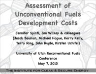 |
Assessment of unconventional fuels development costs | 2013-05-07 | ICSE; Unconventional fuels; Development cost; Oil Shale; In situ; Ex situ; Oil Sands; Utah; Uinta Basin | Presentation given at the University of Utah Unconventional Fuels Conference, Salt Lake City, Utah, May 7, 2013. |
| 47 |
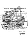 |
Mono Power Company: Sunnyside tar sands project--1983 geologic evaluation | 1984-03 | Mono Power; Sunnyside, Utah; Range Creek; Bruin Point; Whitmore Canyon; Uinta Basin; Wasatch Formation; Green River Formation; Mono Power's Sunnyside tar sand leases | This report presents the results of the 1983 geologic evaluation which M-K performed on Mono Power's tar sand leases near Sunnyside, Utah. The project's scope of work involved: - P. R. Spring Drilling - Sunnyside Drilling - Logging and Sampling - Assaying and Testing - Surveying - Aerial Photography... |
| 48 |
 |
Geologic summary report of the 1982 exploration program, Sunnyside Tar Sands project, Carbon County, Utah | 1983-06-30 | geologic summary report; exploration program; Sunnyside Tar Sands project; tar sands; bituminous sandstone deposits | The Sunnyside tar sands are located within the southwest portion of the Uinta Basin and localized within a small delta complex that formed in Lake Uinta during early Tertiary time. The essence of the Sunnyside tar sands deposit is a sequence of laterally continuous sheet sands or stacked bituminous ... |
| 49 |
 |
Oil impregnated sandstone study near Bruin Point and Range Creek--Sunnyside Quadrangle | 1972-06 | Book Cliffs; Sunnyside, Utah; Oil impregnated sandstons; Bruin Point; Range Creek; Dry Creek; Carbon County; Lower Green River | An investigation into the oil sandstones in the Book Cliffs area northest of Sunnyside, Utah, showed an eastward continuation of the oil impregnated sandstones (oiss) previously mapped (USGS, OM 86, 1948). The survey was conducted from June 19 through 21, 1972 by Sam Quigley and D. Craig Mann. The a... |
| 50 |
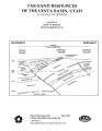 |
Tar-sand resources of the Uinta Basin, Utah: A catalog of deposits | 1996-05 | tar sand; oil-impregnated sandstone; tar sand resources; solid hydrocarbon deposits; bitumous sandstone | Tar-sand, or oil-impregnated sandstone, deposits and occurrences of the Uinta Basin, Utah are summarized and presented. Twenty five tar-sand deposits/occurrences are reviewed with respect to geology, locations of bitumen saturated outcrops, land ownership, physiography, bitumen-analyses, development... |