TO
Filters: Collection: "ir_eua"
| Title | Date | Subject | Description | ||
|---|---|---|---|---|---|
| 1 |
 |
Reactivation of an idle lease to increase heavy oil recovery through application of conventional steam drive technology in a low dip slope and basin reservoir in the midway-sunset field, San Joaquin Basin, California | 2002-02 | heavy oil recovery; conventional steam drive technology; Midway-Sunset field | A previously idle portion of the Midway-Sunset field, Aera Energy's Pru Fee property, has been brought back into commercial production through tight integration of geologic characterization, geostatistical modeling, reservoir simulation, and petroleum engineering. This property, shut-in over a decad... |
| 2 |
 |
Petroleum geology of the greater Red Wash Area, Uintah County, Utah | 1965-07 | oil and gas field; sandstone; petroleum geology | The Greater Red Wash area is the largest oil and gas field in the Uinta Basin. The Douglas Creek and Garden Gulch Members of the Green River Formation form a lacustrine delta in the area and yield hydrocarbons from a complex network of discrete sandstones. Each individual sandstone body forms its ow... |
| 3 |
 |
Green River Formation at Raven Ridge, Uintah County, Utah | 1965-07 | Green River formation; Raven Ridge; sandstone beds; shale; limestone; marlstone; oil-bearing strata | Along Raven Ridge in Uintah County, Utah, exposures of the Green River Formation contain a complex sequence of intertonguing beds of sandstone, shale, limestone, and marlstone. These strata are considered to represent deposition in an orderly sequence of environments from the flood plain through the... |
| 4 |
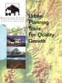 |
Urban planning tools for quality growth | 2000 | Formed in January of 1997, Envision Utah is a public/private community partnership dedicated to studying the effects of long-term growth in the Greater Wasatch Area of northern Utah. Sponsored by the Coalition for Utah's Future, Envision Utah and its partners - with extensive input from the public -... | |
| 5 |
 |
Model codes and analysis tools for quality growth | The following ordinance is designed as an OVERLAY zone for sensitive areas. It depends on a map, adopted as a zoning overlay map, that identifies the approximate areas where the sensitive lands will be located. The areas are described in this workbook. For the methods and sources of data that may be... | ||
| 6 |
 |
Stratigraphy and origin of the Moenkopi Formation (Triassic) of southeastern Utah | 1973-01 | Moenkopi Formation; stratigraphy; regional stratigraphy of southeastern Utah | In southeastern Utah, the Triassic Moenkopi Formation is composed mainly of red and yellowish-gray siltstone, sandstone, mudstone, and limestone. Continuity of individual units is one of the characteristics of this formation and provides a basic for regional correlation. For the purpose of this stud... |
| 7 |
 |
Heavy oil production operations in Potiguar Basin, Brazil | 1987 | heavy oil production operations; heavy oil; Portiguar Basin; oil fields; oil | The Potiguar basin is located on the northeastern Brazilian coast and comprises an onshore portion with 21,500 km2 (8300 mi2) and its offshore extension (Fig. 1). In the last 4 years, many oil fields have been discovered in the onshore portion, where today's production reaches 20,000 bbl/d. The oil ... |
| 8 |
 |
Geologic summary report of the 1990 exploration program, Sunnyside Tar Sands project, Carbon County, Utah--volume 1 | 1991-02-28 | geologic summary; exploration program; Sunnyside tar sands project; tar sand; regional, engineering geology. | This 1990 report is a supplement to the extensive 1989 report. This 1990 report concentrates on results of the following four categories: (1) regional geology and engineering geology needed to investigate the feasibility of conveyor routes that will bring the tar sand ore down from the Roan Cliffs t... |
| 9 |
 |
Determination of oil shale potential Green River Formation, Uinta Basin northeast Utah | 1967-11-03 | ||
| 10 |
 |
Hypotheses of oil-shale genesis, Green River Formation, northeast Utah, northwest Colorado, and southwest Wyoming | 1985 | oil shale; Green River Formation; tar sandstone | In the six decades or so of oil-shale studies on the Green River Formation (Paleocene/Eocene) in northeast Utah, northwest Colorado, and southwest Wyoming, two alternative hypotheses for the paleoenvironment have dominated the literature: (1) a stratified lake in which anaerobic conditions in the hy... |
| 11 |
 |
Preliminary report of oil impregnated sediments of the San Rafael Swell | 1970-06 | San Rafael Swell; oil impregnated sediments; petroleum deposits | The deposits are given the following geographic names: 1. Black Dragon Deposit 2. Jackass Bench Deposit 3. Cottonwood Draw Deposit 4. Red Canyon Deposit , 5. Family Butte Deposit The relationships (stratigraphic and horizontal) of the above deposits are uncertain. Deposits 2 and 3 occupy the same st... |
| 12 |
 |
Geologic summary report of the 1984 exploration program, Sunnyside Tar Sands project, Carbon County, Utah--volume 1 | 1985-06 | geologic summary; exploration program; tar sands; Sunnyside tar sand deposit. | The 1984 Sunnyside exploration program consisted of: (1) diamond drilling of fifteen drill holes, (2) logging of all core and (3) additional geological mapping in the north area to better define the limits of the tar sands associated with the Sunnyside delta complex. Both regional and detailed geolo... |
| 13 |
 |
Quantitative methods for reservoir characterization and improved recovery: Application to heavy oil sands | 2001-10-30 | interwell reservoir heterogeneity; heavy oil sands; analytical property-distribution methods; reservoir simulation | Improved prediction of interwell reservoir heterogeneity is needed to increase productivity and to reduce recovery cost for California's heavy oil sands, which contain approximately 2.3 billion barrels of remaining reserves in the Temblor Formation and in other formations of the San Joaquin Valley. ... |
| 14 |
 |
Tongues of the Green River and Uinta Formations in the Piceane Creek Basin | 1982 | Green River formations; Uinta formations; oil shale; thick zones | Lake Uinta achieved its maximum extent durinq the deposition of the Mahogany bed, the richest oilshale unit in the Mahogany zone. Filling of the lake with stream-borne debris began immediately after deposition of the Mahogany bed. The lake gradually constricted from about 20,000 square miles in area... |
| 15 |
 |
Courses | |||
| 16 |
 |
Quantitative methods for reservoir characterization and improved recovery: Application to heavy oil sands | 2002-10-30 | interwell reservoir heterogeneity; heavy oil sands; advanced analytical property-distribution methods; reservoir characterization | Improved prediction of interwell reservoir heterogeneity has the potential to increase productivity and to reduce recovery cost for California's heavy oil sands, which contain approximately 2.3 billion barrels of remaining reserves in the Temblor Formation and in other formations of the San Joaquin ... |
| 17 |
 |
A heavy-oil case study on a single well in Venezuela, MFM-7s, using cores and logs | 1987 | heavy-oil case study; Venezuela well; MFM-7s; well cores; well logs; heavy-oil reservoirs | Planning for optimum production from heavy-oil reservoirs requires a deep understanding of their geological and petrophysical characteristics, synthesized from intermittent core and continuous log data. In this paper the study developed for the MFM-7S well, operated by S. A. Meneven in the Faja Petr... |
| 18 |
 |
Geologic summary report of the 1987 exploration program, Sunnyside Tar Sands project, Carbon County, Utah--volume 1 | 1988-06-01 | geologic summary report; 1987 exploration program; Sunnyside Tar Sands project; tar sand distribution; tar sands; bituminous sandstones | 1. The distribution of tar sands in the Sunnyside deposit is related to both structure and lithology. The structural control is associated with a northwest trending flexure that segments a large monocline which slopes gently into the Uinta Basin. The lithologic control is determined by porous and pe... |
| 19 |
 |
Oil-impregnated sandstone deposits Circle Cliffs Uplift, Utah | 1981-04 | oil-impregnated sandstone; Utah deposits; Circle Cliffs Uplift; Triassic Moenkopi Formation; oil-impregnated sandstone resource | One of the major oil-impregnated sandstone deposits in the United States is present on the Circle Cliffs uplift in an unnamed sandstone unit in the middle portion of the Triassic Moenkopi Formation. The deposit occurs on the west and east flanks of the uplift and is separated by an irregular barren ... |
| 20 |
 |
Geologic summary report of the Sunnyside Tar Sands project, Carbon County, Utah | 1981-02-04 | geologic summary report; Sunnyside Tar Sands project; tar sands | The project area is located in the southwest portion of the Uinta Basin, near the northeast portion of the San Rafael Swell and localized within a small delta complex that formed in Lake Uinta during early Tertiary. The delta complex encompasses dimensions approximately 4-6 miles parallel to the anc... |
| 21 |
 |
Uinta Basin tar sand deposits | 1990 | Uinta Basin; Tar sand deposits; Utah | This report addresses an important need to the State of Utah; to define, tabulate, and document an economic resource which has aroused the interest of industry and academia and which is vastly undeveloped and little understood as to its potential. The need for this report has grown since the last ta... |
| 22 |
 |
The Whiterocks tar sand deposit | 1985 | Whiterocks tar sand deposit; tar sand; bitumen; tar-bearing Navajo Sandstone | The Whiterocks tar sand deposit is located near the mouth of Whiterocks Canyon, an important south drainage of the Uinta Mountains. This deposit is probably the least known and most unique of the major bitumen accumulations in the Uinta Basin. Historically, it is near the purported oldest white sett... |
| 23 |
 |
Bituminous sandstone deposits Asphalt Ridge | 1966-12 | Asphalt Ridge probably is the second largest bituminous sandstone deposit in northeastern Utah's Uinta Basin. Discontinuous concentrations of bitumen occur in the Rim Rock Sandstone of the Mesaverde Group of Cretaceous age, in the overlying Uinta Formation of Eocene age and the Duchesne River Format... | |
| 24 |
 |
Instrumental analysis of tars and their correlations in oil-impregnated sandstone beds, Uintah and Grand Counties, Utah | 1971-10 | tar analysis; oil-impregnated sandstone beds; sandstone. | The Wasatch, Green River and Uinta formations, in ascending order make up the normal sequence of exposed Eocene rocks in the southeast Uinta Basin, Uintah and Grand counties, Utah. They dip northward towards the center of the basin, relatively undisturbed by faulting, and exhibit a system of promine... |
| 25 |
 |
Geology and resources of the Tar Sand Triangle, southeastern Utah | 1984-05 | Tar Sand Triangle; geology and resources; Dirty Devil; Colorado River; wells | Dirty Devil and Colorado Rivers and covers an area of about 200 square miles. The geology of the area consists of gently northwest dipping strata exposed in-the box canyons and slopes of the canyonlands morphology. Strata in the area range in age from Jurassic to Permian. The majority of tar sand sa... |