TO
Filters: Collection: "ir_eua" Type: "Text"
| Title | Date | Subject | Description | ||
|---|---|---|---|---|---|
| 1 |
 |
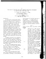
P.R. Spring and Hill Creek Tar Sand Areas: A resource assessment (in progress) | 2008-02-22 | P. R. Spring; Hill Creek Tar Sand Areas; Uinta Basin; Green River; resource assessment | The P.R. Spring-Hill Creek Tar Sand Area is located at the southern flank of the Uinta Basin. The area is generally bounded by T. 12 S. in Uintah County, extending southward to T. 17 S. and the Roan Cliffs in Grand County. It is further bounded by the Green River on the west and the Utah-Colorado st... |
| 2 |
 |
Energy resources map of Utah (no. 68) | 1983-05 | Map 68; Utah; Energy Resources map; Gilsonite; Oil shale; Oil-impregnated rock; Geology; Oil and natural gas | |
| 3 |
 |
Determination of oil shale potential Green River Formation, Uinta Basin northeast Utah | 1967-11-03 | ||
| 4 |
 |
Assessment of unconventional fuels development costs | 2013-05-07 | ICSE; Unconventional fuels; Development cost; Oil Shale; In situ; Ex situ; Oil Sands; Utah; Uinta Basin | Presentation given at the University of Utah Unconventional Fuels Conference, Salt Lake City, Utah, May 7, 2013. |
| 5 |
 |
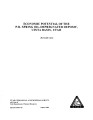
Depositional environments of oil shale in the Green River Formation, Douglas Creek Arch, Colorado and Utah | 1985 | depositional environments; oil shale; Green River Formation; Douglas Creek Arch; stratigraphy | Douglas Creek arch in western Colorado and eastern Utah separates the Uinta and Piceance Creek basins. During deposition of the lower part of the Eocene Green River Formation, the arch provided a physical barrier dividing ancient Lake Uinta into two segments. As the lake expanded, the arch became a ... |
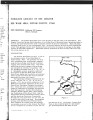
| 6 |
 |
Utah's oil-sand resources | 2006-09-21 | tar sands; tar sand; recoverable heavy oil; natural bitumen recovery; world wide tar sand resources. | Tar sands--a look around the world. Recovery factors and technically recoverable heavy oils and natural bitumens from around the globe. |
| 7 |
 |
Geologic summary report of the Sunnyside Tar Sands project, Carbon County, Utah | 1981-02-04 | geologic summary report; Sunnyside Tar Sands project; tar sands | The project area is located in the southwest portion of the Uinta Basin, near the northeast portion of the San Rafael Swell and localized within a small delta complex that formed in Lake Uinta during early Tertiary. The delta complex encompasses dimensions approximately 4-6 miles parallel to the anc... |
| 8 |
 |
Geologic summary report of the 1984 exploration program, Sunnyside Tar Sands project, Carbon County, Utah--volume 1 | 1985-06 | geologic summary; exploration program; tar sands; Sunnyside tar sand deposit. | The 1984 Sunnyside exploration program consisted of: (1) diamond drilling of fifteen drill holes, (2) logging of all core and (3) additional geological mapping in the north area to better define the limits of the tar sands associated with the Sunnyside delta complex. Both regional and detailed geolo... |
| 9 |
 |
Constructing a basin-scale geologic model | 2013-05-07 | Unconventional fuels; Green River Formation; Uinta Basin; Geologic model; Workflow; Reservoir; Basin-scale model | Presentation given at the University of Utah Unconventional Fuels Conference, Salt Lake City, Utah, May 7, 2013. |
| 10 |
 |
Hypotheses of oil-shale genesis, Green River Formation, northeast Utah, northwest Colorado, and southwest Wyoming | 1985 | oil shale; Green River Formation; tar sandstone | In the six decades or so of oil-shale studies on the Green River Formation (Paleocene/Eocene) in northeast Utah, northwest Colorado, and southwest Wyoming, two alternative hypotheses for the paleoenvironment have dominated the literature: (1) a stratified lake in which anaerobic conditions in the hy... |
| 11 |
 |
Geologic summary report of the 1981 exploration program, Sunnyside Tar Sands project, Carbon County, Utah | 1982-02-19 | Geologic summary; exploration project; Sunnyside Tar Sands project; delta complex. | The 1981 Sunnyside exploration program consisted of: (1) diamond drilling of sixteen drill holes and logging of the core, and (2) initial geologic mapping in the northern area to better define the limits of the tar sands associated with the Sunnyside delta complex. In order to comprehend the geometr... |
| 12 |
 |
Geologic summary report of the 1982 exploration program, Sunnyside Tar Sands project, Carbon County, Utah | 1983-06-30 | geologic summary report; exploration program; Sunnyside Tar Sands project; tar sands; bituminous sandstone deposits | The Sunnyside tar sands are located within the southwest portion of the Uinta Basin and localized within a small delta complex that formed in Lake Uinta during early Tertiary time. The essence of the Sunnyside tar sands deposit is a sequence of laterally continuous sheet sands or stacked bituminous ... |
| 13 |
 |
P. R. spring oil-impregnated sandstone deposit Uintah and Grand Counties, Utah | 1970-02 | oil-impregnated sandstone beds; oil impregnation; oil shale; lenticular sandstones; siltstones | Oil-impregnated sandstone beds underlie at least 214 square miles in the southeastern Uinta Basin and may extend northward beneath cover. One to as many as five principal saturated zones, 3 to 75 feet thick, occur in a 250-foot interval that dips gently northward. The northernmost outcrops are overl... |
| 14 |
 |
Oil-impregnated sandstones of Raven Ridge, Vernal, Utah | 1972 | Oil-impregnated sandstone; Raven Ridge; Vernal, Utah; Uinta Basin; Utah; Colorado; Wasatch Formation; Green River Formation; Uinta Formation | The area of this report is in the northeastern part of the Uinta Basin of northeastern Utah and northwestern Colorado. The area covers approximately 52 square miles of what is regionally called Raven Ridge. Raven Ridge, a series of hogback ridges, trends northwest-southeast, and includes three Eocen... |
| 15 |
 |
Field guide to lacustrine and related nonmarine depositional environments in tertiary rocks, Uinta Basin, Utah | 1976-11 | lacustrine environments; nonmarine depositional environments; tertiary rocks | The lower part of the Tertiary System in the Uinta Basin of northeastern Utah and northwestern Colorado (fig. 1) reflects a series of very complex and variable forms of continental sedimentation in a basin of internal drainage. These complex forms represent the disruption of the Cretaceous depositio... |
| 16 |
 |
Analyses of oil extracted from oil-impregnated sandstone deposits in Utah | 1972-01 | This study, in progress from 1967 to 1970, is part of a systematic effort to find, map and sample Utah's oil-impregnated rock deposits. Samples were collected by ten individuals in field parties who examined oil-impregnated rock occurrences throughout the state. Samples 68-3A and 68-4A are from aban... | |
| 17 |
 |
Geologic summary report of the 1989 exploration program, Sunnyside tar sands project, Carbon County, Utah | 1990-07-30 | geologic summary report; exploration program; Sunnyside tar sands project; tar sand. | This report includes the 1989 data and represents a summary of previous exploration reports. Eight photographs included in Volume I are used to highlight aspects of the Sunnyside. Tar Sands project. Volume II contains five maps and five cross sections. Volume III contains twenty-six strip logs. Both... |
| 18 |
 |
Economic potential of the P.R. Spring oil-impregnated deposit, Uinta Basin, Utah | 1984-08 | The P.R. Spring oil-impregnated sandstone (tar sand) deposit is located in the southeastern portion of the Uinta Basin, approximately 50 miles northwest of Grand Junction, Colorado. These oil impregnated sandstones are in the Eocene Green River Formation and five zones have been identified. These zo... | |
| 19 |
 |
Petroleum geology of the greater Red Wash Area, Uintah County, Utah | 1965-07 | oil and gas field; sandstone; petroleum geology | The Greater Red Wash area is the largest oil and gas field in the Uinta Basin. The Douglas Creek and Garden Gulch Members of the Green River Formation form a lacustrine delta in the area and yield hydrocarbons from a complex network of discrete sandstones. Each individual sandstone body forms its ow... |
| 20 |
 |
Geologic summary report of the 1990 exploration program, Sunnyside Tar Sands project, Carbon County, Utah--volume 1 | 1991-02-28 | geologic summary; exploration program; Sunnyside tar sands project; tar sand; regional, engineering geology. | This 1990 report is a supplement to the extensive 1989 report. This 1990 report concentrates on results of the following four categories: (1) regional geology and engineering geology needed to investigate the feasibility of conveyor routes that will bring the tar sand ore down from the Roan Cliffs t... |
| 21 |
 |
Characterization and beneficiation of bitumen-free domestic tar sands | 1982-09 | The Federal Bureau of Mines conducted a study to determine if residues from fractional distillation represent a potential source of mineral values. Aliterature review and discussions with tar sand specialists failed to disclose the mineralogical nature of residues remaining after bitumen extraction.... | |
| 22 |
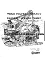 |
Mono Power Company: Sunnyside tar sands project--1983 geologic evaluation | 1984-03 | Mono Power; Sunnyside, Utah; Range Creek; Bruin Point; Whitmore Canyon; Uinta Basin; Wasatch Formation; Green River Formation; Mono Power's Sunnyside tar sand leases | This report presents the results of the 1983 geologic evaluation which M-K performed on Mono Power's tar sand leases near Sunnyside, Utah. The project's scope of work involved: - P. R. Spring Drilling - Sunnyside Drilling - Logging and Sampling - Assaying and Testing - Surveying - Aerial Photography... |
| 23 |
 |
Geologic summary report of the 1988 exploration program, Sunnyside Tar Sands project, Carbon County, Utah--volume 1 | 1989-06-01 | geologic summary report; exploration program; Sunnyside tar sands project; tar sand | The 1988 field program focused on completion and logging of twelve core drill holes and three measured sections. Five marker beds were established within the Parachute Creek Member and include the Wavy Bedded Tuff, Mahogany oil shale, R-5 oil shale, lower tuff and Blue Marker containing the R-2 oil ... |
| 24 |
 |
Geologic summary report of the 1987 exploration program, Sunnyside Tar Sands project, Carbon County, Utah--volume 1 | 1988-06-01 | geologic summary report; 1987 exploration program; Sunnyside Tar Sands project; tar sand distribution; tar sands; bituminous sandstones | 1. The distribution of tar sands in the Sunnyside deposit is related to both structure and lithology. The structural control is associated with a northwest trending flexure that segments a large monocline which slopes gently into the Uinta Basin. The lithologic control is determined by porous and pe... |
| 25 |
 |
Investigation of tar sand and heavy oil deposits of Utah for underground coal gasification applications | 1985-12 | tar sand; heavy oil deposits; underground coal gasification; UCG applications | A literature review was conducted to determine spatial and geological relationships between Utah's tar sand or heavy oil deposits and coal deposits and to evaluate these relationships in terms of suitability for underground coal gasification (UCG) applications. The investigation was undertaken as pa... |