TO
Filters: Collection: "ir_eua" Subject: "Utah"
1 - 25 of 23
| Title | Date | Subject | Description | ||
|---|---|---|---|---|---|
| 1 |
 |
Energy resources map of Utah (no. 68) | 1983-05 | Map 68; Utah; Energy Resources map; Gilsonite; Oil shale; Oil-impregnated rock; Geology; Oil and natural gas | |
| 2 |
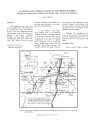 |
Oil impregnated carbonate rocks of the Timpoweap Member Moenkopi Formation, Hurricane Cliffs area, Utah and Arizona | 1979 | Oil impregnated rocks; Hurricane Cliffs; Utah; Arizona; Timpoweap Member; Triassic Moenkopi Formation; Timpoweap Canyon; Hurricane, Utah | Oil impregnated rocks crop out at several localities near the Hurricane Cliffs in southwestern Utah and adjacent Arizona. The most significant petroliferous deposits occur in the Timpoweap Member of the Triassic Moenkopi Formation in Timpoweap Canyon and the Hurricane Cliffs south of Hurricane, Utah... |
| 3 |
 |
A reconnaissance evaluation of heavy hydrocarbons in the Tar Sand Triangle | 1985-08 | Utah; Tar Sand Triangle; Permian White Rim Sandstone; Moenkopi Formation; Cedar Mesa Sandstone; Chinle Formation; Oil; Oil-impregnated sandstone deposit; In-situ; Heavy hydrocarbons; Triassic; Jurassic Navajo Sandstone | The Tar Sand Triangle encompasses about 200 square miles in southeastern Utah. The area consists of rough, mountainous terrain, with a climate that varies from semiarid to arid. Sedimentary rocks exposed in the area range from Permian Cedar Mesa Sandstone to the Triassic(?)-Jurassic Navajo Sandstone... |
| 4 |
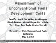 |
Assessment of unconventional fuels development costs | 2013-05-07 | ICSE; Unconventional fuels; Development cost; Oil Shale; In situ; Ex situ; Oil Sands; Utah; Uinta Basin | Presentation given at the University of Utah Unconventional Fuels Conference, Salt Lake City, Utah, May 7, 2013. |
| 5 |
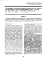 |
A comparison of biomakers in gilsonite, oil shale, tar sand and petroleum from Threemile Canyon and adjacent areas in the Uinta Basin, Utah | 1992 | Gilsonite; Oil shale; Tar sand; Petroleum; Threemile Canyon; Uinta Basin; Utah; Green River; Hopane; Sterane; Carotenoid biomarkers; Alginite; GC/MS; Ion fragmentograms; Biodegradation; Maturation; Oil shale outcrops; Bluebell-Altamont; Red Wash field; Bitumen; Pyrolysis; Py-GC/MS; Curie-point pyrol... | Relationships between gilsonite, oil shale and petroleum were investigated by comparison of hopane, sterane and carotenoid biomarkers. Samples examined were alginite, gilsonite, oil shale, tar sand and petroleum. Comparison of peak distributions in specific GC/MS ion fragmentograms of the above hydr... |
| 6 |
 |
Uinta Basin tar sand deposits | 1990 | Uinta Basin; Tar sand deposits; Utah | This report addresses an important need to the State of Utah; to define, tabulate, and document an economic resource which has aroused the interest of industry and academia and which is vastly undeveloped and little understood as to its potential. The need for this report has grown since the last ta... |
| 7 |
 |
Overburden map and thickness determinations, Sunnyside oil-impregnated sandstone deposit, Carbon and Duchesne Counties, Utah | 1986 | Oil-impregnated sandstone; Sunnyside deposits; Carbon County; Duchesne County; Utah | This investigation into the overburden and oil-impregnated sandstone thicknesses within the Sunnyside deposits, Carbon and Duchesne Counties, Utah is done under Contract No. YA-553-CT0-1059 between the Utah Geological and Mineral Survey and the U.S. Bureau of Land Management. |
| 8 |
 |
Demographic and socioeconomic characteristics of Salt Lake County: sub-county analysis | 2006-12 | Salt Lake County; Projections; Estimates; Aging population; Baby boom; Utah; Salt Lake Aging Services; Kennecott Land | This paper is an examination of the shifting geographic distribution of the population within Salt Lake County over time as well as an analysis of the spatial distribution of its demographic and socioeconomic characteristics. It builds on the county-level analysis included in a separate section of t... |
| 9 |
 |
Bituminous sands and viscous crude oils | 1964-10-10 | Bituminous sands; Viscous crude oils; Rocky Mountain region; Low gravity; high viscosity; Heavy crude oil; Quiet Revolution; Thermal recovery; Utah; Bituminous sandstone deposits | Bituminous sandstones of the Rocky Mountain region contain large reserves of low gravity, highly viscous oil that can be recovered at costs equal to or less than the cost of finding and producing oil from conventional methods. Heavy crude oil is defined as "oil which cannot be produce through the no... |
| 10 |
 |
Depositional setting and preliminary oil-shale resource potential, southwestern Uinta Basin, Utah | 1982 | Oil shale; Uinta Basin; Utah; Green River; Oil yield; Lake Uinta; Mohogany zone; Kerogen; Sheep Pass; Elko Basins; Nevada; Strawberry Structure; Strawberry Reservoir | This report characterizes the potential oil-shale resources underlying those lands west of the Green River in the southwestern Uinta Basin, Utah. The principal evaluation technique has been the calculation of oil yield from oil-well sonic and density log data available in this area. Subsurface corre... |
| 11 |
 |
A brief history of early mineral exploitation in the Uinta Basin | 1964 | Uinta Basin; Mining; Uintah Valley; Indian Reservation; Meeker; Utah; History of early mineral exploitation; Uintah Reservation; Gilsonite; Coal; Copper; Iron; Oil shale; Ozocerite; Wurtzilite; Oil; Asphalt; Ashley Creek; Hatchtown; Vernal; Fort Duchesne; Ouray Subagency | Early mining activities in the Uinta Basin can be summarized by saying that they included mining for gilsonite, coal, copper, iron, oil shale, ozocerite, wurtzilite, and oil and asphalt (under the placer mining laws). Of these minerals only coal and gilsonite were produced in commercially significan... |
| 12 |
 |
Basin-wide evaluation of the uppermost Green River Formation's oil-shale resource, Uinta Basin, Utah and Colorado | 2008 | Green River; Uinta Basin; Utah; Colorado; Crude oil; Green River Formation; Oil; Gas; Oil yield; Oil shale; Oil-shale thickness; Mahogany zone; R-7; Parachute Creek Member; Richness grade; Uintah County; Salt Lake Base Line and Meridian; BLM; U.S. Bureau of Land Management | Due to the recent increase in crude oil prices and concerns over diminishing conventional reserves, the Utah Geological Survey has reexamined the Uinta Basin's oil-shale resource, primarily in the Mahogany zone of the Green River Formation. Past assessments, the first conducted in 1964 and subsequen... |
| 13 |
 |
Historic Fort Douglas at the University of Utah | Fort Douglas; Utah | The majority of the fort was designated a National Historic Landmark in 1970. The University of Utah Fort Douglas Heritage Commons is also an Official Project of Save America's Treasures, a public-private partnership between the White House Millennium Council and the National Trust for Historic Pres... | |
| 14 |
 |
A proposal to evaluate oil-impregnated sandstone in the Uinta Basin, northeast Utah; made to the Energy Research and Development Administration by Utah Geological and Mineral Survey | 1976-06-15 | Petroleum; Utah; Uinta Basin; Oil; Bitumen; Ore waste radiation; Oil-impregnated sandstone; Deposits | Most of the known petroleum resources in the form of oil-impregnated in the United States occur in Utah. It is estimated that over ten billion barrels of petroleum occur in such deposits in the Uinta Basin alone (Ritzma, 1973; Campbell, 1975). Four deposits among the twenty identified in the Uinta ... |
| 15 |
 |
An assessment of oil shale and tar sand development in the state of Utah: Phase 1 | 1980-05 | Oil shale; Tar sand; Utah; Synthetic fuels; Tar sand development; Tar sand deposits | This assessment is the result of an interest and commitment by the State of Utah to both promote development of its vast energy resources and to manage the impacts associated with such development. As the development of Utah oil shale and tar sands became more imminent a specific proposal to study t... |
| 16 |
 |
Lithologic logs and correlation of coreholes P. R. Spring and Hill Creek oil-impregnated standstone deposits Uintah County, Utah | 1975-08 | lithologic logs; correlation of coreholes; P. R. Spring; Hill Creek; oil-impregnated sandstone deposits; Utah | This report of investigation presents the lithologic logs and correlation of 16 coreholes drilled in 1973 in the P. R. Spring and Hill Creek oil-impregnated sandstone deposits, southeast Uintah County, Utah. The program was conducted under Grant No. GO 122094 from the U. S. Department of the Interio... |
| 17 |
 |
APPENDIX B - Depositional heterogeneity and fluid flow modeling of the oil shale interval of the upper Green River Formation, eastern Uinta Basin, Utah - Final Project Report - Reporting period: June 21, 2006 to October 21, 2009 | 2009-10 | Green River Formation; Uinta Basin; Utah; Uintah County; Oil shale; Deposition | In this project, a detailed geological analysis was performed followed by a reservoir modeling exercise. For the geological analysis, ~300 m of cores were correlated to gamma and density logs in well P4 in the lower to middle Eocene (49.5-48.0 million years ago (Ma)), upper Green River Formation of ... |
| 18 |
 |
Core-based integrated sedimentologic, stratigraphic, and geochemical analysis of the oil shale bearing Green River Formation, Uinta Basin, Utah | 2011-04 | Utah; Green River Formation; Lake Uinta; Mahogany zone; Lake evolution; Oil shale development; Uinta Basin | An integrated detailed sedimentologic, stratigraphic, and geochemical study of Utah's Green River Formation has found that Lake Uinta evolved in three phases 1) a freshwater rising lake phase below the Mahogany zone, 2) an anoxic deep lake phase above the base of the Mahogany zone and 3) a hypersali... |
| 19 |
 |
Salt Lake County's distinctive demographics: implications for the aging population | 2006-12 | Salt Lake County; Projections; Estimates; Aging population; Baby boom; Utah; Salt Lake Aging Services; Kennecott Land | Salt Lake County is the economic, political, and cultural center of Utah. The county is currently home to nearly 40 percent of Utah residents and generates about half of all jobs in the state. It remains the most populous county, with a million of the state's 2.6 million residents,1 and its daytime ... |
| 20 |
 |
A model of hydrocarbon generation from type 1 kerogen: Application to the Uinta Basin, Utah | 1986-12-18 | Pyrolysis; Green River shale; Petroleum; Utah; Uinta Basin; Kerogen; Oil; Eocene; Type I kerogen; Hydrocarbon generation; Oil generation; Gas generation; Kinetics | The Uinta Basin in northeastern Utah provides an ideal setting to study the evolution of kerogen to petroleum. Oil shale rocks of the Eocene-age Green River Formation outcrop extensively at the southern edge of the synclinal basin. The same rocks are also found at depths of 3650 m in the deepest par... |
| 21 |
 |
Clean and secure energy from domestic oil shale and oil sands resources: Quarterly progress report: April 2013 to June 2013 | 2013 | Quarterly Progress Report; April 2013 to June 2013; DE-FE0001243; Oil Shale; Oil Sands; CO2 management; Uinta Basin; Greenhouse gas; GHG emissions; oxyfiring; Utah; WTP; Ex situ; In situ | The Clean and Secure Energy from Domestic Oil Shale and Oil Sands Resources program, part of the research agenda of the Institute for Clean and Secure Energy (ICSE) at the University of Utah, is focused on engineering, scientific, and legal research surrounding the development of these resources in ... |
| 22 |
 |
Salt Lake City census 2010 atlas | 2013-02 | Demographics; Salt Lake City; Utah; Census | This volume presents and analyzes results from the 2010 Census of Population and Housing. This mandatory enumeration is conducted by the federal government and is used to determine reapportionment and redistricting. This is the most complete record of population, households, and housing units that i... |
| 23 |
 |
Salt Lake City census 2000 atlas | 2011-03 | Demographics; Salt Lake City; Utah; Census | This volume presents the basic demographic characteristics of residents of Salt Lake City as recorded in the 2000 Census of Population and Housing. Every ten years these federal governm ent counts of people are the basis of congressional apportionment and political redistricting. Data in this volume... |
1 - 25 of 23