TO
Filters: School Or College: "University Libraries" Collection: "ir_uspace" Format: "application/zip"
| Creator | Title | Description | Subject | Date | ||
|---|---|---|---|---|---|---|
| 1 |
 | Sorensen, Justin Bruce | Georeferenced Logan, 1900: sheet 07 (.zip file) | This zip file contains a .jgw, .jpg, .jpg.aux.xml and .jpg.ovr representing a single georeferenced sheet overlay from the Sanborn Fire Insurance Maps for Logan, 1900. The downloaded and opened zip file is accessible for viewing in ArcGIS and other GIS software systems. Multiple zip files can be lo... | data modeling; GIS; ArcGIS; Google Earth; historic GIS | |
| 2 |
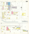 | Sorensen, Justin Bruce; Morrow, Anne | Salt Lake City, 1950: Sheet 164 | This zip file contains a sanborn map as well as associated world files to georeference and analyze in ArcGIS software. | 1950 | |
| 3 |
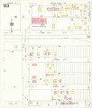 | Sorensen, Justin Bruce; Morrow, Anne | Salt Lake City, 1950: Sheet 163 | This zip file contains a sanborn map as well as associated world files to georeference and analyze in ArcGIS software. | 1950 | |
| 4 |
| Arlitsch, Kenning | Future leaders of research libraries: what are they thinking? | Summarizes the initial findings of survey research conducted with 175 future library leaders. Respondents were asked whether they are satisfied with their organizational culture and management, whether organizational culture limits thier effectiveness, and whether respondents are consideringleaving... | Future leaders | 2009-04-06 |
| 5 |
| Georeferenced Ephraim Sanborn, 1908: sheet 02 (.zip file) | This zip file contains a .jgw, .jpg, .jpg.aux.xml and .jpg.ovr representing a single georeferenced sheet overlay from the Sanborn Fire Insurance Maps for Ephraim Sanborn, 1908. The downloaded and opened zip file is accessible for viewing in ArcGIS and other GIS software systems. Multiple zip files ... | data modeling; GIS; ArcGIS; Google Earth; historic GIS | 2013 | |
| 6 |
| Sorensen, Justin Bruce | Georeferenced Layton Sanborn, 1930: sheet 02 (.zip file) | This zip file contains a .jgw, .jpg, .jpg.aux.xml and .jpg.ovr representing a single georeferenced sheet overlay from the Sanborn Fire Insurance Maps for Layton Sanborn, 1930. The downloaded and opened zip file is accessible for viewing in ArcGIS and other GIS software systems. Multiple zip files c... | data modeling; GIS; ArcGIS; Google Earth; historic GIS | 2013 |
| 7 |
| Sorensen, Justin Bruce | Georeferenced Layton Sanborn, 1930: sheet 01 (.zip file) | This zip file contains a .jgw, .jpg, .jpg.aux.xml and .jpg.ovr representing a single georeferenced sheet overlay from the Sanborn Fire Insurance Maps for Layton Sanborn, 1930. The downloaded and opened zip file is accessible for viewing in ArcGIS and other GIS software systems. Multiple zip files c... | data modeling; GIS; ArcGIS; Google Earth; historic GIS | 2013 |
| 8 |
| Sorensen, Justin Bruce | Georeferenced Layton Sanborn, 1930: sheet 03 (.zip file) | This zip file contains a .jgw, .jpg, .jpg.aux.xml and .jpg.ovr representing a single georeferenced sheet overlay from the Sanborn Fire Insurance Maps for Layton Sanborn, 1930. The downloaded and opened zip file is accessible for viewing in ArcGIS and other GIS software systems. Multiple zip files c... | data modeling; GIS; ArcGIS; Google Earth; historic GIS | 2013 |
| 9 |
| Sorensen, Justin Bruce | Georeferenced Midvale Sanborn, 1911: sheet 08 (.zip file) | This zip file contains a .jgw, .jpg, .jpg.aux.xml and .jpg.ovr representing a single georeferenced sheet overlay from the Sanborn Fire Insurance Maps for Midvale Sanborn, 1911. The downloaded and opened zip file is accessible for viewing in ArcGIS and other GIS software systems. Multiple zip files ... | data modeling; GIS; ArcGIS; Google Earth; historic GIS | 2013 |
| 10 |
| Sorensen, Justin Bruce | Georeferenced Midvale Sanborn, 1911: sheet 05 (.zip file) | This zip file contains a .jgw, .jpg, .jpg.aux.xml and .jpg.ovr representing a single georeferenced sheet overlay from the Sanborn Fire Insurance Maps for Midvale Sanborn, 1911. The downloaded and opened zip file is accessible for viewing in ArcGIS and other GIS software systems. Multiple zip files ... | data modeling; GIS; ArcGIS; Google Earth; historic GIS | 2013 |
| 11 |
| Sorensen, Justin Bruce | Georeferenced Midvale Sanborn, 1911: sheet 03 (.zip file) | This zip file contains a .jgw, .jpg, .jpg.aux.xml and .jpg.ovr representing a single georeferenced sheet overlay from the Sanborn Fire Insurance Maps for Midvale Sanborn, 1911. The downloaded and opened zip file is accessible for viewing in ArcGIS and other GIS software systems. Multiple zip files ... | data modeling; GIS; ArcGIS; Google Earth; historic GIS | 2013 |
| 12 |
| Sorensen, Justin Bruce | Georeferenced Midvale Sanborn, 1911: sheet 07 (.zip file) | This zip file contains a .jgw, .jpg, .jpg.aux.xml and .jpg.ovr representing a single georeferenced sheet overlay from the Sanborn Fire Insurance Maps for Midvale Sanborn, 1911. The downloaded and opened zip file is accessible for viewing in ArcGIS and other GIS software systems. Multiple zip files ... | data modeling; GIS; ArcGIS; Google Earth; historic GIS | 2013 |
| 13 |
| Sorensen, Justin Bruce | Georeferenced Midvale Sanborn, 1911: sheet 01 (.zip file) | This zip file contains a .jgw, .jpg, .jpg.aux.xml and .jpg.ovr representing a single georeferenced sheet overlay from the Sanborn Fire Insurance Maps for Midvale Sanborn, 1911. The downloaded and opened zip file is accessible for viewing in ArcGIS and other GIS software systems. Multiple zip files ... | data modeling; GIS; ArcGIS; Google Earth; historic GIS | 2013 |
| 14 |
| Sorensen, Justin Bruce | Georeferenced Midvale Sanborn, 1911: sheet 06 (.zip file) | This zip file contains a .jgw, .jpg, .jpg.aux.xml and .jpg.ovr representing a single georeferenced sheet overlay from the Sanborn Fire Insurance Maps for Midvale Sanborn, 1911. The downloaded and opened zip file is accessible for viewing in ArcGIS and other GIS software systems. Multiple zip files ... | data modeling; GIS; ArcGIS; Google Earth; historic GIS | 2013 |
| 15 |
| Sorensen, Justin Bruce | Georeferenced Midvale Sanborn, 1911: sheet 02 (.zip file) | This zip file contains a .jgw, .jpg, .jpg.aux.xml and .jpg.ovr representing a single georeferenced sheet overlay from the Sanborn Fire Insurance Maps for Midvale Sanborn, 1911. The downloaded and opened zip file is accessible for viewing in ArcGIS and other GIS software systems. Multiple zip files ... | data modeling; GIS; ArcGIS; Google Earth; historic GIS | 2013 |
| 16 |
| Sorensen, Justin Bruce | Georeferenced Midvale Sanborn, 1911: sheet 04 (.zip file) | This zip file contains a .jgw, .jpg, .jpg.aux.xml and .jpg.ovr representing a single georeferenced sheet overlay from the Sanborn Fire Insurance Maps for Midvale Sanborn, 1911. The downloaded and opened zip file is accessible for viewing in ArcGIS and other GIS software systems. Multiple zip files ... | data modeling; GIS; ArcGIS; Google Earth; historic GIS | 2013 |
| 17 |
| Sorensen, Justin Bruce | Georeferenced Midvale Sanborn, 1911: sheet 09 (.zip file) | This zip file contains a .jgw, .jpg, .jpg.aux.xml and .jpg.ovr representing a single georeferenced sheet overlay from the Sanborn Fire Insurance Maps for Midvale Sanborn, 1911. The downloaded and opened zip file is accessible for viewing in ArcGIS and other GIS software systems. Multiple zip files ... | data modeling; GIS; ArcGIS; Google Earth; historic GIS | 2013 |
| 18 |
| Sorensen, Justin Bruce | Georeferenced Moab Sanborn, 1924: sheet 01 (.zip file) | This zip file contains a .jgw, .jpg, .jpg.aux.xml and .jpg.ovr representing a single georeferenced sheet overlay from the Sanborn Fire Insurance Maps for Moab Sanborn, 1924. The downloaded and opened zip file is accessible for viewing in ArcGIS and other GIS software systems. Multiple zip files can... | data modeling; GIS; ArcGIS; Google Earth; historic GIS | 2013 |
| 19 |
| Sorensen, Justin Bruce | Georeferenced Columbia Sanborn, 1929: sheet 01 (.zip file) | This zip file contains a .jgw, .jpg, .jpg.aux.xml and .jpg.ovr representing a single georeferenced sheet overlay from the Sanborn Fire Insurance Maps for Colmbia Sanborn, 1929. The downloaded and opened zip file is accessible for viewing in ArcGIS and other GIS software systems. Multiple zip files ... | data modeling; GIS; ArcGIS; Google Earth; historic GIS | 2013 |
| 20 |
| Sorensen, Justin Bruce | Georeferenced Lewiston Sanborn, 1929: sheet 02 (.zip file) | This zip file contains a .jgw, .jpg, .jpg.aux.xml and .jpg.ovr representing a single georeferenced sheet overlay from the Sanborn Fire Insurance Maps for Lewiston Sanborn, 1929. The downloaded and opened zip file is accessible for viewing in ArcGIS and other GIS software systems. Multiple zip files... | data modeling; GIS; ArcGIS; Google Earth; historic GIS | 2013 |
| 21 |
| Sorensen, Justin Bruce | Georeferenced Lewiston Sanborn, 1929: sheet 01 (.zip file) | This zip file contains a .jgw, .jpg, .jpg.aux.xml and .jpg.ovr representing a single georeferenced sheet overlay from the Sanborn Fire Insurance Maps for Lewiston Sanborn, 1929. The downloaded and opened zip file is accessible for viewing in ArcGIS and other GIS software systems. Multiple zip files... | data modeling; GIS; ArcGIS; Google Earth; historic GIS | 2013 |
| 22 |
| Sorensen, Justin Bruce | Georeferenced Ophir Sanborn, 1917: sheet 01 (.zip file) | This zip file contains a .jgw, .jpg, .jpg.aux.xml and .jpg.ovr representing a single georeferenced sheet overlay from the Sanborn Fire Insurance Maps for Ophir Sanborn, 1917. The downloaded and opened zip file is accessible for viewing in ArcGIS and other GIS software systems. Multiple zip files ca... | data modeling; GIS; ArcGIS; Google Earth; historic GIS | 2013 |
| 23 |
| Sorensen, Justin Bruce | Georeferenced Ophir Sanborn, 1917: sheet 02 (.zip file) | This zip file contains a .jgw, .jpg, .jpg.aux.xml and .jpg.ovr representing a single georeferenced sheet overlay from the Sanborn Fire Insurance Maps for Ophir Sanborn, 1917. The downloaded and opened zip file is accessible for viewing in ArcGIS and other GIS software systems. Multiple zip files ca... | data modeling; GIS; ArcGIS; Google Earth; historic GIS | 2013 |
| 24 |
| Sorensen, Justin Bruce | Georeferenced Salt Lake City Sanborn, 1898: sheet 022 (.zip file) | This zip file contains a .jgw, .jpg, .jpg.aux.xml and .jpg.ovr representing a single georeferenced sheet overlay from the Sanborn Fire Insurance Maps for Salt Lake City Sanborn. The downloaded and opened zip file is accessible for viewing in ArcGIS and other GIS software systems. Multiple zip files... | data modeling; GIS; ArcGIS; Google Earth; historic GIS | 2013 |
| 25 |
| Sorensen, Justin Bruce | Georeferenced Salt Lake City Sanborn, 1898: sheet 018 (.zip file) | This zip file contains a .jgw, .jpg, .jpg.aux.xml and .jpg.ovr representing a single georeferenced sheet overlay from the Sanborn Fire Insurance Maps for Salt Lake City Sanborn. The downloaded and opened zip file is accessible for viewing in ArcGIS and other GIS software systems. Multiple zip files... | data modeling; GIS; ArcGIS; Google Earth; historic GIS | 2013 |