Home
Browse
Ask Us
Chat
Harmful Language Statement
Log in
Institutional Repository
Advanced Search
Year
1951
1952
1953
1954
1955
1956
1957
1958
1959
1960
1961
1962
1963
1964
1965
1966
1967
1968
1969
1970
1971
1972
1973
1974
1975
1976
1977
1978
1979
1980
1981
1982
1983
1984
1985
1986
1987
1988
1989
1990
1991
1992
1993
1994
1995
1996
1997
1998
1999
2000
2001
2002
2003
2004
2005
2006
2007
2008
2009
2010
2011
2012
2013
2014
2015
2016
TO
1951
1952
1953
1954
1955
1956
1957
1958
1959
1960
1961
1962
1963
1964
1965
1966
1967
1968
1969
1970
1971
1972
1973
1974
1975
1976
1977
1978
1979
1980
1981
1982
1983
1984
1985
1986
1987
1988
1989
1990
1991
1992
1993
1994
1995
1996
1997
1998
1999
2000
2001
2002
2003
2004
2005
2006
2007
2008
2009
2010
2011
2012
2013
2014
2015
2016
Type
Text
56
Image
46
Format
application/pdf
58
application/vnd.google-earth.kmz
15
application/zip
14
Collection
Electronic University Archive
1
Theses & Dissertations
80
UScholar Works
6
Filters:
School Or College:
"College of Mines & Earth Sciences"
Subject:
"Utah"
1
-
25
of
87
<
1
2
3
4
>
Gallery view
Number of results to display per page
10
25
50
100
200
Sort by Relevance
Sort by Title A-Z
Sort by Title Z-A
Sort by Date Ascending
Sort by Date Descending
Sort by Last Modified Ascending
Sort by Last Modified Descending
Title
Date
Type
Setname
1
A study of primary sedimentary structures around the Moab anticline, Grand County, Utah (Google Earth map overlay KMZ file)
1965-08
Image
ir_etd
2
A study of primary sedimentary structures around the Moab anticline, Grand County, Utah (Thesis and maps)
1965-08
Text; Image
ir_etd
3
A study of primary sedimentary structures around the Moab anticline, Grand County, Utah: Georeferenced map files
1965-08
Image
ir_etd
4
Ambient resonance of rock arches
2015
Text
ir_etd
5
Areal geology of the Coalville vicinity, Summit County, Utah
1953-06
Text; Image
ir_etd
6
Areal geology of the Coalville vicinity, Summit County, Utah (Google Earth map overlay KMZ file)
1953-06
Image
ir_etd
7
Areal geology of the Coalville vicinity, Summit County, Utah: Georeferenced map files
1953-06
Image
ir_etd
8
Areal geology of the Wanship-Coalville Area
1952-06
Text
ir_etd
9
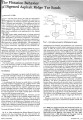
Asphalt ridge tar sands - flotation behavior and process design (Abstract)
1980-12
Text
ir_etd
10
Biostratigraphy of the albertella and glossopleura zones (lower middle cambrian) of Northern Utah and Southern Idaho
1974
Text
ir_etd
11
Carbonate petrology of the Green River Formation (Eocene), Uinta Basin, Utah and Colorado
1972-08
Text
ir_etd
12
Clastic laramide sediments of the Wasatch Hinterland, Northeastern Utah (Thesis and maps)
1974
Text; Image
ir_etd
13
Clastic laramide sediments of the Wasatch Hinterland, Northeastern Utah: Georeferenced map files
1974
Image
ir_etd
14
Correlation of tuff layers in the Green River Formation, Utah, using biotite compositions
1974
Text
ir_etd
15
Dynamic displacement analysis of a shallow landslide in Norwood Tuff
2011-05
Text
ir_etd
16
Effect of feed source in the hot water processing of Utah tar sand
1980
Text
ir_uspace
17
The effect of feed source in the hot water processing of Utah tar sand
1979-02
ir_eua
18
Exceptionally preserved jellyfishes from the Middle Cambrian
2007-10-31
Text
ir_uspace
19
Exhumation of the central Wasatch Mountains, Utah: 1, Patterns and timing of exhumation deduced from low-temperature thermochronology data
2002
Text
ir_uspace
20
Exhumation of the central Wasatch Mountains, Utah: 2, thermokinematic model of exhumation, erosion, and thermochronometer interpretation
2002
Text
ir_uspace
21
Flotation behavior of digested Asphalt Ridge tar sand
1981
Text
ir_uspace
22
Fluvial stratigraphic architecture of the John Henry member of the Straight Cliffs Formation, Kaiparowits Plateau, Utah USA
2010
Text
ir_etd
23
Fracture analysis, hydrodynamic properties and mineral abundance in altered igneous wall rocks of the Mayflower Mine, Park City District, Utah
1975
Text
ir_etd
24
Fractures and surface lineaments in northeastern Utah
1975-12
Text
ir_etd
25
Geological and geophysical studies of the Gilson Mountains and vicinity, Juab County, Utah
1970-06
Text
ir_etd
1
-
25
of
87
<
1
2
3
4
>