Home
Browse
Ask Us
Chat
Harmful Language Statement
Log in
Electronic University Archive
Advanced Search
Year
2006
2007
2008
2009
2010
2011
2012
2013
2014
2015
TO
2006
2007
2008
2009
2010
2011
2012
2013
2014
2015
Type
Text
29
Image
1
Format
application/pdf
98
image/jpeg
79
application/vnd.ms-excel
4
application/vnd.ms-powerpoint
3
application/zip
1
Collection
Electronic University Archive
185
Filters:
Research Institute:
"Institute for Clean and Secure Energy (ICSE)"
School Or College:
"University of Utah"
101
-
125
of
185
<
1
2
3
4
5
6
7
8
>
Gallery view
Number of results to display per page
10
25
50
100
200
Sort by Relevance
Sort by Title A-Z
Sort by Title Z-A
Sort by Date Ascending
Sort by Date Descending
Sort by Last Modified Ascending
Sort by Last Modified Descending
Title
Date
Type
101
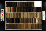
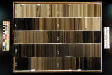
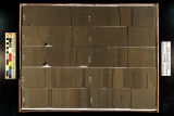
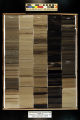
Skyline 16: SW SW sec. 10 11S 25E Uintah County, Utah. Box 41 Depth: 420.0 - 430.0 ft.
2015-07
102
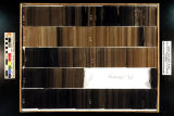
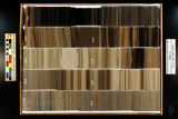
Skyline 16: SW SW sec. 10 11S 25E Uintah County, Utah. Box 42 Depth: 430.0 - 440.0 ft.
2015-07
103
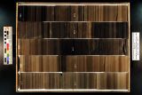
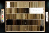
Skyline 16: SW SW sec. 10 11S 25E Uintah County, Utah. Box 43 Depth: 440.0 - 450.0 ft.
2015-07
104
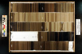
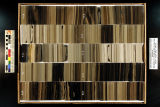
Skyline 16: SW SW sec. 10 11S 25E Uintah County, Utah. Box 44 Depth: 450.0 - 460.0 ft.
2015-07
105
Skyline 16: SW SW sec. 10 11S 25E Uintah County, Utah. Box 45 Depth: 460.0 - 470.0 ft.
2015-07
106
Skyline 16: SW SW sec. 10 11S 25E Uintah County, Utah. Box 46 Depth: 470.0 - 480.0 ft.
2015-07
107
Skyline 16: SW SW sec. 10 11S 25E Uintah County, Utah. Box 47 Depth: 480.0 - 490.0 ft.
2015-07
108
Skyline 16: SW SW sec. 10 11S 25E Uintah County, Utah. Box 48 Depth: 490.0 - 500.0 ft.
2015-07
109
Skyline 16: SW SW sec. 10 11S 25E Uintah County, Utah. Box 49 Depth: 500.0 - 510.0 ft.
2015-07
110
Skyline 16: SW SW sec. 10 11S 25E Uintah County, Utah. Box 50 Depth: 510.0 - 520.0 ft.
2015-07
111
Skyline 16: SW SW sec. 10 11S 25E Uintah County, Utah. Box 51 Depth: 520.0 - 530.0 ft.
2015-07
112
Skyline 16: SW SW sec. 10 11S 25E Uintah County, Utah. Box 52 Depth: 530.0 - 540.0 ft.
2015-07
113
Skyline 16: SW SW sec. 10 11S 25E Uintah County, Utah. Box 53 Depth: 540.0 - 550.0 ft.
2015-07
114
Skyline 16: SW SW sec. 10 11S 25E Uintah County, Utah. Box 54 Depth: 550.0 - 560.0 ft.
2015-07
115
Skyline 16: SW SW sec. 10 11S 25E Uintah County, Utah. Box 55 Depth: 560.0 - 570.0 ft.
2015-07
116
Skyline 16: SW SW sec. 10 11S 25E Uintah County, Utah. Box 56 Depth: 570.0 - 580.0 ft.
2015-07
117
Skyline 16: SW SW sec. 10 11S 25E Uintah County, Utah. Box 57 Depth: 580.0 - 590.0 ft.
2015-07
118
Skyline 16: SW SW sec. 10 11S 25E Uintah County, Utah. Box 58 Depth: 590.0 - 600.0 ft.
2015-07
119
Skyline 16: SW SW sec. 10 11S 25E Uintah County, Utah. Box 59 Depth: 600.0 - 610.0 ft.
2015-07
120
Skyline 16: SW SW sec. 10 11S 25E Uintah County, Utah. Box 60 Depth: 610.0 - 620.0 ft.
2015-07
121
Skyline 16: SW SW sec. 10 11S 25E Uintah County, Utah. Box 61 Depth: 620.0 - 630.0 ft.
2015-07
122
Skyline 16: SW SW sec. 10 11S 25E Uintah County, Utah. Box 62 Depth: 630.0 - 640.0 ft.
2015-07
123
Skyline 16: SW SW sec. 10 11S 25E Uintah County, Utah. Box 63 Depth: 640.0 - 650.0 ft.
2015-07
124
Skyline 16: SW SW sec. 10 11S 25E Uintah County, Utah. Box 64 Depth: 650.0 - 660.0 ft.
2015-07
125
Skyline 16: SW SW sec. 10 11S 25E Uintah County, Utah. Box 65 Depth: 660.0 - 670.0 ft.
2015-07
101
-
125
of
185
<
1
2
3
4
5
6
7
8
>