TO
| Title | Date | Subject | Description | ||
|---|---|---|---|---|---|
| 1 |
 |
Water availability for development of major tar sands areas in Utah | 1979-05 | water availability; major tar sands area; development of tar sands; tar sands deposits; water requirements; water availability | The Sutron Corporation, under contract with Colorado State University, has conducted a study for the Laramie Energy Technology Center (LETC) to determine the availability of water for future extraction of viscous petroleum (bitumen) from the six major tar sands deposits in Utah. Specifically the are... |
| 2 |
 |
Determination of oil shale potential Green River Formation, Uinta Basin northeast Utah | 1967-11-03 | ||
| 3 |
 |
Properties of Utah tar sands--Flat Rock Mesa area, Hill Creek deposit | 1976-04-01 | Flat Rock Mesa Area; Hill Creek tar sand deposit; tar sand zone | This report presents the results of analyses of three cores from the Flat Rock Mesa area in the Hill Creek tar sand deposit in northeastern Utah. Two major tar sand zones exist in the Flat Rock Mesa area and have net thicknesses ranging from 55 to 81 ft. The overall tar sand section has good porosit... |
| 4 |
 |
Tar-sand resources of the Uinta Basin, Utah: A catalog of deposits | 1996-05 | tar sand; oil-impregnated sandstone; tar sand resources; solid hydrocarbon deposits; bitumous sandstone | Tar-sand, or oil-impregnated sandstone, deposits and occurrences of the Uinta Basin, Utah are summarized and presented. Twenty five tar-sand deposits/occurrences are reviewed with respect to geology, locations of bitumen saturated outcrops, land ownership, physiography, bitumen-analyses, development... |
| 5 |
 |
Potential hydrologic impacts of a tar-sand industry in 11 special tar sand areas in eastern Utah | 1983 | crude oil tar-sand deposits; U.S. Bureau of Land Management; Tar Sand Triangle area; hydrolic impact | About 93 percent of the Nation's estimated 30 billion barrels of crude oil in tar-sand deposits is in 11 areas in eastern Utah that were chosen for leasing by the U.S. Bureau of Land Management. The largest deposit, which is in the Tar Sand Triangle area, contains about 15 billion barrels of oil. Th... |
| 6 |
 |
P. R. spring oil-impregnated sandstone deposit Uintah and Grand Counties, Utah | 1970-02 | oil-impregnated sandstone beds; oil impregnation; oil shale; lenticular sandstones; siltstones | Oil-impregnated sandstone beds underlie at least 214 square miles in the southeastern Uinta Basin and may extend northward beneath cover. One to as many as five principal saturated zones, 3 to 75 feet thick, occur in a 250-foot interval that dips gently northward. The northernmost outcrops are overl... |
| 7 |
 |
Economic potential of the P.R. Spring oil-impregnated deposit, Uinta Basin, Utah | 1984-08 | The P.R. Spring oil-impregnated sandstone (tar sand) deposit is located in the southeastern portion of the Uinta Basin, approximately 50 miles northwest of Grand Junction, Colorado. These oil impregnated sandstones are in the Eocene Green River Formation and five zones have been identified. These zo... | |
| 8 |
 |
Investigation of tar sand and heavy oil deposits of Utah for underground coal gasification applications | 1985-12 | tar sand; heavy oil deposits; underground coal gasification; UCG applications | A literature review was conducted to determine spatial and geological relationships between Utah's tar sand or heavy oil deposits and coal deposits and to evaluate these relationships in terms of suitability for underground coal gasification (UCG) applications. The investigation was undertaken as pa... |
| 9 |
 |
Utah geological and mineral survey report of investigation: The Hill Creek oil-impregnated sandstone deposit | 1985-09 | geological and mineral survey; Hill Creek deposit; oil-impregnated sandstone | The Hill Creek oil-impregnated sandstone deposit is located on the rugged, southern flank of the Uinta Basin, in Uintah County, Utah. It lies westward of the P.R. Springs oil-impregnated sandstone deposit, being separated by the Willow Creek drainage system. It also lies eastward of the Sunnyside oi... |
| 10 |
 |
Instrumental analysis of tars and their correlations in oil-impregnated sandstone beds, Uintah and Grand Counties, Utah | 1971-10 | tar analysis; oil-impregnated sandstone beds; sandstone. | The Wasatch, Green River and Uinta formations, in ascending order make up the normal sequence of exposed Eocene rocks in the southeast Uinta Basin, Uintah and Grand counties, Utah. They dip northward towards the center of the basin, relatively undisturbed by faulting, and exhibit a system of promine... |
| 11 |
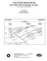
 |
Uinta Basin tar sand deposits | 1990 | Uinta Basin; Tar sand deposits; Utah | This report addresses an important need to the State of Utah; to define, tabulate, and document an economic resource which has aroused the interest of industry and academia and which is vastly undeveloped and little understood as to its potential. The need for this report has grown since the last ta... |
| 12 |
 |
Geology of Circle Cliffs Anticline | 1954 | geology; Circle Cliffs Anticline; stratigraphy; physiography | Circle Cliffs anticline occupies an area, approximately fifteen miles wide, which extends in a northnorthwest direction from Kane County on the south through east-central Garfield County to the Wayne County line. Its axis lies approximately 25 miles east of Boulder, Utah. Hall's Creek, located at th... |
| 13 |
 |
Geologic summary report of the 1981 exploration program, Sunnyside Tar Sands project, Carbon County, Utah | 1982-02-19 | Geologic summary; exploration project; Sunnyside Tar Sands project; delta complex. | The 1981 Sunnyside exploration program consisted of: (1) diamond drilling of sixteen drill holes and logging of the core, and (2) initial geologic mapping in the northern area to better define the limits of the tar sands associated with the Sunnyside delta complex. In order to comprehend the geometr... |
| 14 |
 |
Geologic evaluation and reservoir properties of the PR Spring tar sand deposit, Uintah and Grand counties, Utah | 1985-01 | reservoir properties; PR Spring tar sand deposit; tar sand | In 1980, the Laramie Energy Technology Center completed a seven corehole drilling program at the PR Spring tar sand deposit, southeastern Uinta Basin, Utah. The data from this project were integrated with other resource information to complete lithologic correlations, to evaluate general reservoir p... |
| 15 |
 |
Economic potential of state-owned lands in the Sunnyside Special Tar Sand Area Carbon County, Utah | 1985 | The Sunnyside oil-impregnated (tar sand) deposit is located in the southwestern portion of the Uinta Basin, approximately 25 miles east of Price, Utah (fig. 1). The tar sands are located in the Wasatch Formation and in the Douglas Creek Member of the Green River Formation, with up to 32 individual b... | |
| 16 |
 |
Preliminary mineral resource study of the Uintah and Ouray reservation, Utah | 1975 | mineral resources; production of oil and gas; oil shale industry development; coal resources | Development of known mineral resources on the Uintah and Ouray Indian Reservation probably will be confined to expanded production of oil and gas by conventional methods and to extraction of modest amounts of sand and gravel. Oil shale may have some development potential provided exploration can pro... |
| 17 |
 |
Depositional setting and preliminary oil-shale resource potential, southwestern Uinta Basin, Utah | 1982 | Oil shale; Uinta Basin; Utah; Green River; Oil yield; Lake Uinta; Mohogany zone; Kerogen; Sheep Pass; Elko Basins; Nevada; Strawberry Structure; Strawberry Reservoir | This report characterizes the potential oil-shale resources underlying those lands west of the Green River in the southwestern Uinta Basin, Utah. The principal evaluation technique has been the calculation of oil yield from oil-well sonic and density log data available in this area. Subsurface corre... |
| 18 |
 |
The production of oil from Intermountain West tar sands deposits | 1976-03 | tar sand deposits; oil; tar sands; crude oil; hydrocarbons in tar sands; surface minings | Six tar sand deposits in the Intermountain West, each containing more than one billion barrels of oil in place, are identified. All of these deposits are in eastern Utah and contain a total of twenty-eight billion barrels of oil. The names of the six deposits arranged in descending order of desirabi... |
| 19 |
 |
Bibliography of tar sand deposits in Utah | 1987 | ||
| 20 |
 |
Gilsonite and other bituminous resources of central Uintah County, Utah | 1963-01 | glisonite; bituminous resources; bituminous deposits; oil shale; tar sands; gas; oil; bituminous sandstones | Central Uintah County, located in northeastern Utah, lies in the Uinta Basin and is underlain by relatively undisturbed Tertiary lacustrine and fluviatile sediments. The area (shown in Figure 63) discussed in this chapter contains all of the known gilsonite veins in the western United States and is ... |
| 21 |
 |
A brief history of early mineral exploitation in the Uinta Basin | 1964 | Uinta Basin; Mining; Uintah Valley; Indian Reservation; Meeker; Utah; History of early mineral exploitation; Uintah Reservation; Gilsonite; Coal; Copper; Iron; Oil shale; Ozocerite; Wurtzilite; Oil; Asphalt; Ashley Creek; Hatchtown; Vernal; Fort Duchesne; Ouray Subagency | Early mining activities in the Uinta Basin can be summarized by saying that they included mining for gilsonite, coal, copper, iron, oil shale, ozocerite, wurtzilite, and oil and asphalt (under the placer mining laws). Of these minerals only coal and gilsonite were produced in commercially significan... |
| 22 |
 |
The extraction of bitumen from western oil sands | 1994-03 | bitumen extraction; western oil sands; oil sands; final report; oil sand recovery technologies; environmental impacts; health and safety procedures | The information required for compliance with the National Environmental Protection Act (NEPA) has been documented in this section. This final report has been prepared to reflect the research and development activities performed under the cooperative agreement 89MC26268 between the University of Utah... |
| 23 |
 |
The extraction of bitumen from western oil sands | Oil Sand Research and Development program; oil sand; bitumen; PR Spring oil sand deposit; bitumen extraction | The information required for compliance with the National Environmental Protection Act (NEPA) has been documented in this section. This final report has been prepared to reflect the research and development activities performed under the cooperative agreement 89MC26268 between the University of Utah... | |
| 24 |
 |
Evaluation of the Utah oil sand resource | 1976-08 | oil sand deposits; Utah oil sand; oil sand resource; Tar Sand Triangle; P. R. Spring; Sunnyside deposits; hydrocarbons; surface mining of oil sands | The three largest oil sand deposits in Utah, namely, the Tar Sand Triangle, the P.R. Spring, and the Sunnyside deposits, have been studied to contribute data relative to the surface and insitu mining of these deposits and to recommend research that should be conducted to develop the Utah oil sand re... |
| 25 |
 |
Heavy oil prospect NW Asphalt Ridge Uintah County, Utah | 1975 | heavy oil; heavy oil prospect; NW Asphalt Ridge; thermal recovery project | A 150 million barrel accumulation of heavy oil (14° API) underlies an 1120 acre Tom Brown, Inc. tract located six miles west of Vernal, Utah. A recently completed six-well corehole project provided the data to delineate this major accumulation. The following combination of geological and engineerin... |