Home
Browse
Ask Us
Chat
Harmful Language Statement
Log in
Electronic University Archive
Advanced Search
Year
2008
2009
2010
2011
2012
2013
2014
2015
TO
2008
2009
2010
2011
2012
2013
2014
2015
Publication Type
photograph
104
poster
1
School Or College
University of Utah
79
Program
University of Utah Staff Advisory Committee (UUSAC)
2
Research Institute
Institute for Clean and Secure Energy (ICSE)
99
Filters:
Publication Type:
"photograph"
Collection:
"ir_eua"
1
-
25
of
104
<
1
2
3
4
5
>
Gallery view
Number of results to display per page
10
25
50
100
200
Sort by Relevance
Sort by Title A-Z
Sort by Title Z-A
Sort by Date Ascending
Sort by Date Descending
Sort by Last Modified Ascending
Sort by Last Modified Descending
Title
Setname
Type
1
3-D structure of a local minimum of the Siskin model of oil shale kerogen using the RHF/STO-3G method
ir_eua
2
Komas (UUSAC)
ir_eua
Image
3
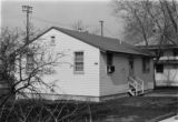
Photograph of the University of Utah Genetics Laboratory
ir_eua
Image
4
Photograph of the University of Utah Genetics Laboratory
ir_eua
Image
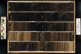
5
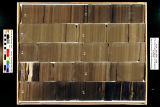
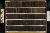
Skyline 16: SW SW sec. 10 11S 25E Uintah County, Utah. Box 1 Depth: 20.0 - 30.0 ft.
ir_eua
6
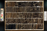
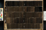
Skyline 16: SW SW sec. 10 11S 25E Uintah County, Utah. Box 10 Depth: 110.0 - 120.0 ft.
ir_eua
7
Skyline 16: SW SW sec. 10 11S 25E Uintah County, Utah. Box 11 Depth: 120.0 - 130.0 ft.
ir_eua
8
Skyline 16: SW SW sec. 10 11S 25E Uintah County, Utah. Box 12 Depth: 130.0 - 140.0 ft.
ir_eua
9
Skyline 16: SW SW sec. 10 11S 25E Uintah County, Utah. Box 13 Depth: 140.0 - 150.0 ft.
ir_eua
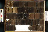
10
Skyline 16: SW SW sec. 10 11S 25E Uintah County, Utah. Box 14 Depth: 150.0 - 160.0 ft.
ir_eua
11
Skyline 16: SW SW sec. 10 11S 25E Uintah County, Utah. Box 15 Depth: 160.0 - 170.0 ft.
ir_eua
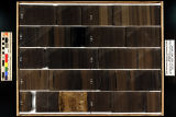
12
Skyline 16: SW SW sec. 10 11S 25E Uintah County, Utah. Box 16 Depth: 170.0 - 180.0 ft.
ir_eua
13
Skyline 16: SW SW sec. 10 11S 25E Uintah County, Utah. Box 17 Depth: 180.0 - 190.0 ft.
ir_eua
14
Skyline 16: SW SW sec. 10 11S 25E Uintah County, Utah. Box 18 Depth: 190.0 - 200.0 ft.
ir_eua
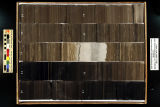
15
Skyline 16: SW SW sec. 10 11S 25E Uintah County, Utah. Box 19 Depth: 200.0 - 210.0 ft.
ir_eua
16
Skyline 16: SW SW sec. 10 11S 25E Uintah County, Utah. Box 2 Depth: 30.0 - 40.0 ft.
ir_eua
17
Skyline 16: SW SW sec. 10 11S 25E Uintah County, Utah. Box 20 Depth: 210.0 - 220.0 ft.
ir_eua
18
Skyline 16: SW SW sec. 10 11S 25E Uintah County, Utah. Box 21 Depth: 220.0 - 230.0 ft.
ir_eua
19
Skyline 16: SW SW sec. 10 11S 25E Uintah County, Utah. Box 22 Depth: 230.0 - 240.0 ft.
ir_eua
20
Skyline 16: SW SW sec. 10 11S 25E Uintah County, Utah. Box 23 Depth: 240.0 - 250.0 ft.
ir_eua
21
Skyline 16: SW SW sec. 10 11S 25E Uintah County, Utah. Box 24 Depth: 250.0 - 260.0 ft.
ir_eua
22
Skyline 16: SW SW sec. 10 11S 25E Uintah County, Utah. Box 25 Depth: 260.0 - 270.0 ft.
ir_eua
23
Skyline 16: SW SW sec. 10 11S 25E Uintah County, Utah. Box 26 Depth: 270.0 - 280.0 ft.
ir_eua
24
Skyline 16: SW SW sec. 10 11S 25E Uintah County, Utah. Box 27 Depth: 280.0 - 290.0 ft.
ir_eua
25
Skyline 16: SW SW sec. 10 11S 25E Uintah County, Utah. Box 28 Depth: 290.0 - 300.0 ft.
ir_eua
1
-
25
of
104
<
1
2
3
4
5
>