In 1853 Richard Hovendon Kern was hired as topographer and artist for a government-sponsored reconnaissance led by Captain John Williams Gunnison. Kern sketched landscape panoramas as the group made its way from St. Louis toward San Francisco. When the expedition reached Sevier Lake, Utah, however, it was attacked by a band of Indians. Seven men, including Kern and Gunnison, were killed, and Kern's drawings were stolen. The sketches were soon recovered and eventually carried to Washington, D.C.
Robert Shlaer, an accomplished daguerreotypist, came across Kern's sketches many years later at the Newberry Library in Chicago. He was inspired to locate the views depicted in the drawings and to photograph them, as nearly as was possible, from the same spot where Kern had stood when he sketched them. This collection juxtaposes Kern's drawings with Shlaer's photographs, presenting 389 illustrations in geographic sequence from east to west
| Title | Alternative Title | ||
|---|---|---|---|
| 1 |
 | Plate 1 | Richard Hovendon Kern |
| 2 |
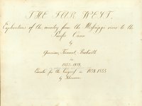 | Plate 2 | The Far West: explorations of the country from the Mississippi River to the Pacific Ocean |
| 3 |
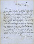 | Plate 3 | Letter from Beckwith to Schumann |
| 4 |
 | Plate 4 | Camp No. 1 near Westport, June 20-53 |
| 5 |
 | Plate 5 | Camp no. 1 |
| 6 |
 | Plate 6 | From 82.0 on Mission and Kansas River, sketch |
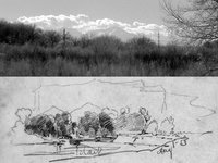
| 7 |
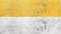
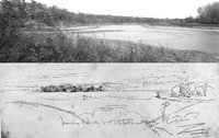
 | Plate 8 | Mission Creek and Kansas River: composite sketch and photograph |
| 8 |
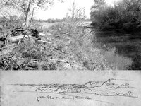
 | Plate 9 | Kansas River |
| 9 |
 | Plate 10 | Uniontown, Kaw River |
| 10 |
 | Plate 11 | Fort Centre or Riley, junction of Smoky Hill and Republican Fork |
| 11 |
 | Plate 13 | Junction of Smoky Hill and Republican Fork, composite of drawing and photograph |
| 12 |
 | Plate 14 | Crossing Saline Creek, July 7th 1853, sketch |
| 13 |
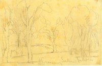 | Plate 15 | Crossing Saline July 7th, 1853, sketch |
| 14 |
 | Plate 16 | Elk Island, Arkansas, July 20th |
| 15 |
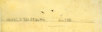 | Plate 17 | Arkansas Plains, sketch |
| 16 |
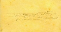
 | Plate 18 | Bent's Fort, sketch |
| 17 |
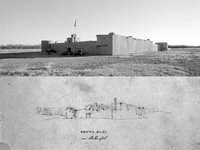 | Plate 20 | Bent's Fort, composite sketch and photograph |
| 18 |
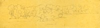
 | Plate 21 | Plains (three sketches) |
| 19 |
 | Plate 22 | Plains and distant mountains, panorama of three sketches |
| 20 |
 | Plate 24 | Plains and distant mountains panorama, composite photograph and three sketches |
| 21 |
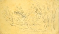
 | Plate 25 | Bluff on Arkansas, Aug 1st, sketch |
| 22 |
 | Plate 27 | Drawing and photograph juxtaposed |
| 23 |
 | Plate 28 | Mouth of Apishpa R. ferry, Arkansas, Aug 1st 1853. Top sketch of two on paper, 13.3 x 19.1 cm. View Plates 28-30: www.Kernsketches.com/plate/28 |
| 24 |
 | Plate 30 | Mouth of Apishpa River at the Arkansas River, composite sketch and photograph |
| 25 |
 | Plate 31 | August 6th, four sketches |