TO
Filters: Format: "image/jpeg" Collection: "ir_eua"
| Title | Date | Subject | Description | ||
|---|---|---|---|---|---|
| 1 |
 |
2014-2015 General Catalog | 2014 | University of Utah catalogue; (Catalog) | Course descriptions, majors & minors, colleges & schools |
| 2 |
 |
2015-2016 General Catalog | 2015 | University of Utah catalogue; (Catalog) | Course descriptions, majors & minors, colleges & schools |
| 3 |
 |
2016-2017 General Catalog | 2016 | University of Utah catalogue; (Catalog) | Course descriptions, majors & minors, colleges & schools |
| 4 |
 |
2017-2018 General Catalog | 2017 | University of Utah catalogue; (Catalog) | Course descriptions, majors & minors, colleges & schools |
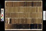
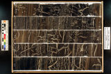
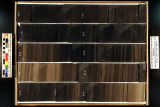
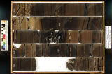
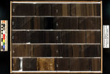
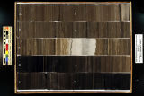
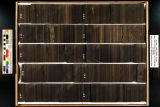
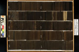
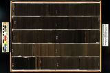
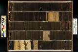
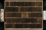
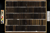
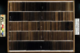
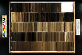
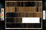
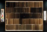
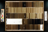
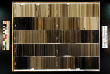
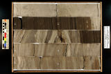
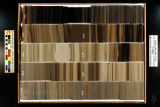
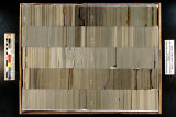
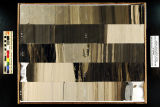
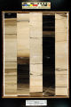
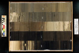
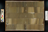
| 5 |
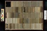
 |
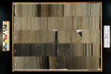
Catalytic and thermal effects in the upgrading of bitumen-derived heavy oils (Abstract only) | 1985 | Heavy oils derived from PR Spring bitumen were hydrotreated in the fixed bed reactor as a function of process variables. The presulfided commercial NiMo/y-alumina (HDN) catalyst, Mo supported on y-alumina (HDM) catalyst and sodium-impregnated HDN catalyst support were used in this study to investiga... | |
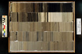
| 6 |
|
Catalytic upgrading of Asphalt Ridge bitumen over hydrodenitrogenation catalysts (Abstract only) | 1997 | The bitumen extracted from Asphalt Ridge oil sands was hydrotreated over three sulfided NiMo/y-Alumina hydrodenitrogenation catalysts in a fixed bed reactor to study the extent of upgrading as a function of process variables and catalyst. The process variables investigated were temperature (619-685 ... | |
| 7 |
|
Fluidization of coked sands and pyrolysis of oil sands in a fluidized bed reactor (Abstract only) | 1995-12 | fluidization of coked sands; pyrolysis of oil sands; fluidized bed reactor; coked sands; oil sands | A 7.62 cm diameter fluidized bed oil sands pyrolysis system was designed, installed, and operated. The studies conducted with this system included coked sands and oil sands feeding using a bin discharge auger feeder, the withdrawal of solids from a fluidized bed using a modified Lvalve, fluidization... |
| 8 |
|
Homogenizer/subsampler for tar sand process streams | |||
| 9 |
|
How Shell attempted to unlock Utah tar sands | |||
| 10 |
|
Hydraulic mining of tar sand bitumen with aggregate material | |||
| 11 |
|
Hydraulic mining technique for recovering bitumen from tar sand deposit | |||
| 12 |
|
Hydrocarbon-induced cancer risks in oil shale processing | |||
| 13 |
|
Hydrotreating the Whiterocks oil sand bitumen and bitumen-derived liquid (Abstract only) | 1992-12 | hydrotreating; Whiterocks oil; oil sand; bitumen; bitumen-derived liquid; bitumen conversion; heteroatom reduction; heteroatom | Conversion of Utah's Uinta Basin bitumens to liquid fuels requires molecular weight reduction of the parent material as well as removal of heteroatoms. Heteroatom reduction of bitumen obtained through solvent extraction of Whiterocks oil sand was investigated. A comparison of the relative processabi... |
| 14 |
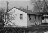 |
Photograph of the University of Utah Genetics Laboratory | University of Utah; Department of Genetics; History | Photograph of one of the earliest locations of the University of Utah Genetics Laboratory. The creation of the Department of Genetics was approved by the Board of Regents in August, 1944. The building itself is probably World War II surplus. | |
| 15 |
|
Photograph of the University of Utah Genetics Laboratory | University of Utah; Department of Genetics; History | Photograph of one of the earliest locations of the University of Utah Genetics Laboratory. The creation of the Department of Genetics was approved by the Board of Regents in August, 1944. The building itself is probably World War II surplus. | |
| 16 |
 |
Skyline 16: SW SW sec. 10 11S 25E Uintah County, Utah. Box 1 Depth: 20.0 - 30.0 ft. | 2015-07 | core samples; Skyline 16; box 1; Green River Formation | Core sample photograph by the Utah Geological Survey, University of Utah. Skyline 16, SW SW sec. 10 11S 25E Uintah Country, Utah. Box 1 Depth: 20.0 - 30.0 ft. |
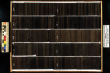
| 17 |
 |
Skyline 16: SW SW sec. 10 11S 25E Uintah County, Utah. Box 10 Depth: 110.0 - 120.0 ft. | 2015-07 | core samples; Skyline 16; box 10; Green River Formation | Core sample photograph by the Utah Geological Survey, University of Utah. Skyline 16: SW SW sec. 10 11S 25E Uintah County, Utah. Box 10 Depth: 110.0 - 120.0 ft. |
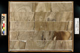
| 18 |
 |
Skyline 16: SW SW sec. 10 11S 25E Uintah County, Utah. Box 11 Depth: 120.0 - 130.0 ft. | 2015-07 | core samples; Skyline 16; box 11; Green River Formation | Core sample photograph by the Utah Geological Survey, University of Utah. Skyline 16: SW SW sec. 10 11S 25E Uintah County, Utah. Box 11 Depth: 120.0 - 130.0 ft. |
| 19 |
 |
Skyline 16: SW SW sec. 10 11S 25E Uintah County, Utah. Box 12 Depth: 130.0 - 140.0 ft. | 2015-07 | core samples; Skyline 16; box 12; Green River Formation | Core sample photograph by the Utah Geological Survey, University of Utah. Skyline 16: SW SW sec. 10 11S 25E Uintah County, Utah. Box 12 Depth: 130.0 - 140.0 ft. |
| 20 |
 |
Skyline 16: SW SW sec. 10 11S 25E Uintah County, Utah. Box 13 Depth: 140.0 - 150.0 ft. | 2015-07 | core samples; Skyline 16; box 13; Green River Formation | Core sample photograph by the Utah Geological Survey, University of Utah. Skyline 16: SW SW sec. 10 11S 25E Uintah County, Utah. Box 13 Depth: 140.0 - 150.0 ft. |
| 21 |
 |
Skyline 16: SW SW sec. 10 11S 25E Uintah County, Utah. Box 14 Depth: 150.0 - 160.0 ft. | 2015-07 | core samples; Skyline 16; box 14; Green River Formation | Core sample photograph by the Utah Geological Survey, University of Utah. Skyline 16: SW SW sec. 10 11S 25E Uintah County, Utah. Box 14 Depth: 150.0 - 160.0 ft. |
| 22 |
 |
Skyline 16: SW SW sec. 10 11S 25E Uintah County, Utah. Box 15 Depth: 160.0 - 170.0 ft. | 2015-07 | core samples; Skyline 16; box 15; Green River Formation | Core sample photograph by the Utah Geological Survey, University of Utah. Skyline 16: SW SW sec. 10 11S 25E Uintah County, Utah. Box 15 Depth: 160.0 - 170.0 ft. |
| 23 |
 |
Skyline 16: SW SW sec. 10 11S 25E Uintah County, Utah. Box 16 Depth: 170.0 - 180.0 ft. | 2015-07 | core samples; Skyline 16; box 16; Green River Formation | Core sample photograph by the Utah Geological Survey, University of Utah. Skyline 16: SW SW sec. 10 11S 25E Uintah County, Utah. Box 16 Depth: 170.0 - 180.0 ft. |
| 24 |
 |
Skyline 16: SW SW sec. 10 11S 25E Uintah County, Utah. Box 17 Depth: 180.0 - 190.0 ft. | 2015-07 | core samples; Skyline 16; box 17; Green River Formation | Core sample photograph by the Utah Geological Survey, University of Utah. Skyline 16: SW SW sec. 10 11S 25E Uintah County, Utah. Box 17 Depth: 180.0 - 190.0 ft. |
| 25 |
 |
Skyline 16: SW SW sec. 10 11S 25E Uintah County, Utah. Box 18 Depth: 190.0 - 200.0 ft. | 2015-07 | core samples; Skyline 16; box 18; Green River Formation | Core sample photograph by the Utah Geological Survey, University of Utah. Skyline 16: SW SW sec. 10 11S 25E Uintah County, Utah. Box 18 Depth: 190.0 - 200.0 ft. |
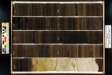
| 26 |
 |
Skyline 16: SW SW sec. 10 11S 25E Uintah County, Utah. Box 19 Depth: 200.0 - 210.0 ft. | 2015-07 | core samples; Skyline 16; box 19; Green River Formation | Core sample photograph by the Utah Geological Survey, University of Utah. Skyline 16: SW SW sec. 10 11S 25E Uintah County, Utah. Box 19 Depth: 200.0 - 210.0 ft. |
| 27 |
 |
Skyline 16: SW SW sec. 10 11S 25E Uintah County, Utah. Box 2 Depth: 30.0 - 40.0 ft. | 2015-07 | core samples; Skyline 16; box 2; Green River Formation | Core sample photograph by the Utah Geological Survey, University of Utah. Skyline 16, SW SW sec. 10 11S 25E Uintah Country, Utah. Box 2 Depth: 30.0 - 40.0 ft. |
| 28 |
 |
Skyline 16: SW SW sec. 10 11S 25E Uintah County, Utah. Box 20 Depth: 210.0 - 220.0 ft. | 2015-07 | core samples; Skyline 16; box 20; Green River Formation | Core sample photograph by the Utah Geological Survey, University of Utah. Skyline 16: SW SW sec. 10 11S 25E Uintah County, Utah. Box 20 Depth: 210.0 - 220.0 ft. |
| 29 |
 |
Skyline 16: SW SW sec. 10 11S 25E Uintah County, Utah. Box 21 Depth: 220.0 - 230.0 ft. | 2015-07 | core samples; Skyline 16; box 21; Green River Formation | Core sample photograph by the Utah Geological Survey at the University of Utah and the Utah Core Research Center. Skyline 16: SW SW sec. 10 11S 25E Uintah County, Utah. Box 21 Depth: 220.0 - 230.0 ft. |
| 30 |
 |
Skyline 16: SW SW sec. 10 11S 25E Uintah County, Utah. Box 22 Depth: 230.0 - 240.0 ft. | 2015-07 | core samples; Skyline 16; box 22; Green River Formation | Core sample photograph by the Utah Geological Survey at the University of Utah, and the Utah Core Research Center. Skyline 16: SW SW sec. 10 11S 25E Uintah County, Utah. Box 22 Depth: 230.0 - 240.0 ft. |
| 31 |
 |
Skyline 16: SW SW sec. 10 11S 25E Uintah County, Utah. Box 23 Depth: 240.0 - 250.0 ft. | 2015-07 | core samples; Skyline 16; box 23; Green River Formation | Core sample photograph by the Utah Geological Survey at the University of Utah, and the Utah Core Research Center. Skyline 16: SW SW sec. 10 11S 25E Uintah County, Utah. Box 23 Depth: 240.0 - 250.0 ft. |
| 32 |
 |
Skyline 16: SW SW sec. 10 11S 25E Uintah County, Utah. Box 24 Depth: 250.0 - 260.0 ft. | 2015-07 | core samples; Skyline 16; box 24; Green River Formation | Core sample photograph by the Utah Geological Survey at the University of Utah, and the Utah Core Research Center. Skyline 16: SW SW sec. 10 11S 25E Uintah County, Utah. Box 24 Depth: 250.0 - 260.0 ft. |
| 33 |
 |
Skyline 16: SW SW sec. 10 11S 25E Uintah County, Utah. Box 25 Depth: 260.0 - 270.0 ft. | 2015-07 | core samples; Skyline 16; box 25; Green River Formation | Core sample photograph by the Utah Geological Survey and the University of Utah, and the Utah Core Research Center. Skyline 16: SW SW sec. 10 11S 25E Uintah County, Utah. Box 25 Depth: 260.0 - 270.0 ft. |
| 34 |
 |
Skyline 16: SW SW sec. 10 11S 25E Uintah County, Utah. Box 26 Depth: 270.0 - 280.0 ft. | 2015-07 | core samples; Skyline 16; box 26; Green River Formation | Core sample photograph by the Utah Geological Survey at the University of Utah, and the Utah Core Research Center. Skyline 16: SW SW sec. 10 11S 25E Uintah County, Utah. Box 26 Depth: 270.0 - 280.0 ft. |
| 35 |
 |
Skyline 16: SW SW sec. 10 11S 25E Uintah County, Utah. Box 27 Depth: 280.0 - 290.0 ft. | 2015-07 | core samples; Skyline 16; box 27; Green River Formation | Core sample photograph by the Utah Geological Survey at the University of Utah, and the Utah Core Research Center. Skyline 16: SW SW sec. 10 11S 25E Uintah County, Utah. Box 27 Depth: 280.0 - 290.0 ft. |
| 36 |
 |
Skyline 16: SW SW sec. 10 11S 25E Uintah County, Utah. Box 28 Depth: 290.0 - 300.0 ft. | 2015-07 | core samples; Skyline 16; box 28; Green River Formation | Core sample photograph by the Utah Geological Survey at the University of Utah, and the Utah Core Research Center. Skyline 16: SW SW sec. 10 11S 25E Uintah County, Utah. Box 28 Depth: 290.0 - 300.0 ft. |
| 37 |
 |
Skyline 16: SW SW sec. 10 11S 25E Uintah County, Utah. Box 29 Depth: 300.0 - 310.0 ft. | 2015-07 | core samples; Skyline 16; box 29; Green River Formation | Core sample photograph by the Utah Geological Survey at the University of Utah, and the Utah Core Research Center. Skyline 16: SW SW sec. 10 11S 25E Uintah County, Utah. Box 29 Depth: 300.0 - 310.0 ft. |
| 38 |
 |
Skyline 16: SW SW sec. 10 11S 25E Uintah County, Utah. Box 3 Depth: 40.0 - 50.0 ft. | 2015-07 | core samples; Skyline 16; box 3; Green River Formation | Core sample photograph by the Utah Geological Survey, University of Utah. Skyline 16: SW SW sec. 10 11S 25E Uintah County, Utah. Box 3 Depth: 40.0 - 50.0 ft. |
| 39 |
 |
Skyline 16: SW SW sec. 10 11S 25E Uintah County, Utah. Box 30 Depth: 310.0 - 320.0 ft. | 2015-07 | core samples; Skyline 16; box 30; Green River Formation | Core sample photograph by the Utah Geological Survey at the University of Utah, and the Utah Core Research Center. Skyline 16: SW SW sec. 10 11S 25E Uintah County, Utah. Box 30 Depth: 310.0 - 320.0 ft. |
| 40 |
 |
Skyline 16: SW SW sec. 10 11S 25E Uintah County, Utah. Box 31 Depth: 320.0 - 330.0 ft. | 2015-07 | core samples; Skyline 16; box 31; Green River Formation | Core sample photograph by the Utah Geological Survey at the University of Utah, and the Utah Core Research Center. Skyline 16: SW SW sec. 10 11S 25E Uintah County, Utah. Box 31 Depth: 320.0 - 330.0 ft. |
| 41 |
 |
Skyline 16: SW SW sec. 10 11S 25E Uintah County, Utah. Box 32 Depth: 330.0 - 340.0 ft. | 2015-07 | core samples; Skyline 16; box 32; Green River Formation | Core sample photograph by the Utah Geological Survey at the University of Utah, and the Utah Core Research Center. Skyline 16: SW SW sec. 10 11S 25E Uintah County, Utah. Box 32 Depth: 330.0 - 340.0 ft. |
| 42 |
 |
Skyline 16: SW SW sec. 10 11S 25E Uintah County, Utah. Box 33 Depth: 340.0 - 350.0 ft. | 2015-07 | core samples; Skyline 16; box 33; Green River Formation | Core sample photograph by the Utah Geological Survey at the University of Utah, and the Utah Core Research Center. Skyline 16: SW SW sec. 10 11S 25E Uintah County, Utah. Box 33 Depth: 340.0 - 350.0 ft. |
| 43 |
 |
Skyline 16: SW SW sec. 10 11S 25E Uintah County, Utah. Box 34 Depth: 350.0 - 360.0 ft. | 2015-07 | core samples; Skyline 16; box 34; Green River Formation | Core sample photograph by the Utah Geological Survey at the University of Utah, and the Utah Core Research Center. Skyline 16: SW SW sec. 10 11S 25E Uintah County, Utah. Box 34 Depth: 350.0 - 360.0 ft. |
| 44 |
 |
Skyline 16: SW SW sec. 10 11S 25E Uintah County, Utah. Box 35 Depth: 360.0 - 370.0 ft. | 2015-07 | core samples; Skyline 16; box 35; Green River Formation | Core sample photograph by the Utah Geological Survey at the University of Utah, and the Utah Core Research Center. Skyline 16: SW SW sec. 10 11S 25E Uintah County, Utah. Box 35 Depth: 360.0 - 370.0 ft. |
| 45 |
 |
Skyline 16: SW SW sec. 10 11S 25E Uintah County, Utah. Box 36 Depth: 370.0 - 380.0 ft. | 2015-07 | core samples; Skyline 16; box 36; Green River Formation | Core sample photograph by the Utah Geological Survey at the University of Utah, and the Utah Core Research Center. Skyline 16: SW SW sec. 10 11S 25E Uintah County, Utah. Box 36 Depth: 370.0 - 380.0 ft. |
| 46 |
 |
Skyline 16: SW SW sec. 10 11S 25E Uintah County, Utah. Box 37 Depth: 380.0 - 390.0 ft. | 2015-07 | core samples; Skyline 16; box 37; Green River Formation | Core sample photograph by the Utah Geological Survey at the University of Utah, and the Utah Core Research Center. Skyline 16: SW SW sec. 10 11S 25E Uintah County, Utah. Box 37 Depth: 380.0 - 390.0 ft. |
| 47 |
 |
Skyline 16: SW SW sec. 10 11S 25E Uintah County, Utah. Box 38 Depth: 390.0 - 400.0 ft. | 2015-07 | core samples; Skyline 16; box 38; Green River Formation | Core sample photograph by the Utah Geological Survey at the University of Utah, and the Utah Core Research Center. Skyline 16: SW SW sec. 10 11S 25E Uintah County, Utah. Box 38 Depth: 390.0 - 400.0 ft. |
| 48 |
 |
Skyline 16: SW SW sec. 10 11S 25E Uintah County, Utah. Box 39 Depth: 400.0 - 410.0 ft. | 2015-07 | core samples; Skyline 16; box 39; Green River Formation | Core sample photograph by the Utah Geological Survey at the University of Utah, and the Utah Core Research Center. Skyline 16: SW SW sec. 10 11S 25E Uintah County, Utah. Box 39 Depth: 400.0 - 410.0 ft. |
| 49 |
 |
Skyline 16: SW SW sec. 10 11S 25E Uintah County, Utah. Box 4 Depth: 50.0 - 60.0 ft. | 2015-07 | core samples; Skyline 16; box 4; Green River Formation | Core sample photograph by the Utah Geological Survey, University of Utah. Skyline 16: SW SW sec. 10 11S 25E Uintah County, Utah. Box 4 Depth: 50.0 - 60.0 ft. |
| 50 |
 |
Skyline 16: SW SW sec. 10 11S 25E Uintah County, Utah. Box 40 Depth: 410.0 - 420.0 ft. | 2015-07 | core samples; Skyline 16; box 40; Green River Formation | Core sample photograph by the Utah Geological Survey at the University of Utah, and the Utah Core Research Center. Skyline 16: SW SW sec. 10 11S 25E Uintah County, Utah. Box 40 Depth: 410.0 - 420.0 ft. |
| 51 |
 |
Skyline 16: SW SW sec. 10 11S 25E Uintah County, Utah. Box 41 Depth: 420.0 - 430.0 ft. | 2015-07 | core samples; Skyline 16; box 41; Green River Formation | Core sample photograph by the Utah Geological Survey at the University of Utah, and the Utah Core Research Center. Skyline 16: SW SW sec. 10 11S 25E Uintah County, Utah. Box 41 Depth: 420.0 - 430.0 ft. |
| 52 |
 |
Skyline 16: SW SW sec. 10 11S 25E Uintah County, Utah. Box 42 Depth: 430.0 - 440.0 ft. | 2015-07 | core samples; Skyline 16; box 42; Green River Formation | Core sample photograph by the Utah Geological Survey at the University of Utah, and the Utah Core Research Center. Skyline 16: SW SW sec. 10 11S 25E Uintah County, Utah. Box 42 Depth: 430.0 - 440.0 ft. |
| 53 |
 |
Skyline 16: SW SW sec. 10 11S 25E Uintah County, Utah. Box 43 Depth: 440.0 - 450.0 ft. | 2015-07 | core samples; Skyline 16; box 43; Green River Formation | Core sample photograph by the Utah Geological Survey at the University of Utah, and the Utah Core Research Center. Skyline 16: SW SW sec. 10 11S 25E Uintah County, Utah. Box 43 Depth: 440.0 - 450.0 ft. |
| 54 |
 |
Skyline 16: SW SW sec. 10 11S 25E Uintah County, Utah. Box 44 Depth: 450.0 - 460.0 ft. | 2015-07 | core samples; Skyline 16; box 44; Green River Formation | Core sample photograph by the Utah Geological Survey at the University of Utah, and the Utah Core Research Center. Skyline 16: SW SW sec. 10 11S 25E Uintah County, Utah. Box 44 Depth: 450.0 - 460.0 ft. |
| 55 |
 |
Skyline 16: SW SW sec. 10 11S 25E Uintah County, Utah. Box 45 Depth: 460.0 - 470.0 ft. | 2015-07 | core samples; Skyline 16; box 45; Green River Formation | Core sample photograph by the Utah Geological Survey at the University of Utah, and the Utah Core Research Center. Skyline 16: SW SW sec. 10 11S 25E Uintah County, Utah. Box 45 Depth: 460.0 - 470.0 ft. |
| 56 |
 |
Skyline 16: SW SW sec. 10 11S 25E Uintah County, Utah. Box 46 Depth: 470.0 - 480.0 ft. | 2015-07 | core samples; Skyline 16; box 46; Green River Formation | Core sample photograph by the Utah Geological Survey at the University of Utah, and the Utah Core Research Center. |
| 57 |
 |
Skyline 16: SW SW sec. 10 11S 25E Uintah County, Utah. Box 47 Depth: 480.0 - 490.0 ft. | 2015-07 | core samples; Skyline 16; box 47; Green River Formation | Core sample photograph by the Utah Geological Survey at the University of Utah, and the Utah Core Research Center. Skyline 16: SW SW sec. 10 11S 25E Uintah County, Utah. Box 47 Depth: 480.0 - 490.0 ft. |
| 58 |
 |
Skyline 16: SW SW sec. 10 11S 25E Uintah County, Utah. Box 48 Depth: 490.0 - 500.0 ft. | 2015-07 | core samples; Skyline 16; box 48; Green River Formation | Core sample photograph by the Utah Geological Survey at the University of Utah, and the Utah Core Research Center. Skyline 16: SW SW sec. 10 11S 25E Uintah County, Utah. Box 48 Depth: 490.0 - 500.0 ft. |
| 59 |
 |
Skyline 16: SW SW sec. 10 11S 25E Uintah County, Utah. Box 49 Depth: 500.0 - 510.0 ft. | 2015-07 | core samples; Skyline 16; box 49; Green River Formation | Core sample photograph by the Utah Geological Survey at the University of Utah, and the Utah Core Research Center. Skyline 16: SW SW sec. 10 11S 25E Uintah County, Utah. Box 49 Depth: 500.0 - 510.0 ft. |
| 60 |
 |
Skyline 16: SW SW sec. 10 11S 25E Uintah County, Utah. Box 5 Depth: 60.0 - 70.0 ft. | 2015-07 | core samples; Skyline 16; box 5; Green River Formation | Core sample photograph by the Utah Geological Survey, University of Utah. Skyline 16: SW SW sec. 10 11S 25E Uintah County, Utah. Box 5 Depth: 60.0 - 70.0 ft. |
| 61 |
 |
Skyline 16: SW SW sec. 10 11S 25E Uintah County, Utah. Box 50 Depth: 510.0 - 520.0 ft. | 2015-07 | core samples; Skyline 16; box 50; Green River Formation | Core sample photograph by the Utah Geological Survey at the University of Utah, and the Utah Core Research Center. Skyline 16: SW SW sec. 10 11S 25E Uintah County, Utah. Box 50 Depth: 510.0 - 520.0 ft. |
| 62 |
 |
Skyline 16: SW SW sec. 10 11S 25E Uintah County, Utah. Box 51 Depth: 520.0 - 530.0 ft. | 2015-07 | core samples; Skyline 16; box 51; Green River Formation | Core sample photograph by the Utah Geological Survey at the University of Utah, and the Utah Core Research Center. Skyline 16: SW SW sec. 10 11S 25E Uintah County, Utah. Box 51 Depth: 520.0 - 530.0 ft. |
| 63 |
 |
Skyline 16: SW SW sec. 10 11S 25E Uintah County, Utah. Box 52 Depth: 530.0 - 540.0 ft. | 2015-07 | core samples; Skyline 16; box 52; Green River Formation | Core sample photograph by the Utah Geological Survey at the University of Utah, and the Utah Core Research Center. Skyline 16: SW SW sec. 10 11S 25E Uintah County, Utah. Box 52 Depth: 530.0 - 540.0 ft. |
| 64 |
 |
Skyline 16: SW SW sec. 10 11S 25E Uintah County, Utah. Box 53 Depth: 540.0 - 550.0 ft. | 2015-07 | core samples; Skyline 16; box 53; Green River Formation | Core sample photograph by the Utah Geological Survey at the University of Utah, and the Utah Core Research Center. Skyline 16: SW SW sec. 10 11S 25E Uintah County, Utah. Box 53 Depth: 540.0 - 550.0 ft. |
| 65 |
 |
Skyline 16: SW SW sec. 10 11S 25E Uintah County, Utah. Box 54 Depth: 550.0 - 560.0 ft. | 2015-07 | core samples; Skyline 16; box 54; Green River Formation | Core sample photograph by the Utah Geological Survey at the University of Utah, and the Utah Core Research Center. Skyline 16: SW SW sec. 10 11S 25E Uintah County, Utah. Box 54 Depth: 550.0 - 560.0 ft. |
| 66 |
 |
Skyline 16: SW SW sec. 10 11S 25E Uintah County, Utah. Box 55 Depth: 560.0 - 570.0 ft. | 2015-07 | core samples; Skyline 16; box 55; Green River Formation | Core sample photograph by the Utah Geological Survey at the University of Utah, and the Utah Core Research Center. Skyline 16: SW SW sec. 10 11S 25E Uintah County, Utah. Box 55 Depth: 560.0 - 570.0 ft. |
| 67 |
 |
Skyline 16: SW SW sec. 10 11S 25E Uintah County, Utah. Box 56 Depth: 570.0 - 580.0 ft. | 2015-07 | core samples; Skyline 16; box 56; Green River Formation | Core sample photograph by the Utah Geological Survey at the University of Utah, and the Utah Core Research Center. Skyline 16: SW SW sec. 10 11S 25E Uintah County, Utah. Box 56 Depth: 570.0 - 580.0 ft. |
| 68 |
 |
Skyline 16: SW SW sec. 10 11S 25E Uintah County, Utah. Box 57 Depth: 580.0 - 590.0 ft. | 2015-07 | core samples; Skyline 16; box 57; Green River Formation | Core sample photograph by the Utah Geological Survey at the University of Utah, and the Utah Core Research Center. Skyline 16: SW SW sec. 10 11S 25E Uintah County, Utah. Box 57 Depth: 580.0 - 590.0 ft. |
| 69 |
 |
Skyline 16: SW SW sec. 10 11S 25E Uintah County, Utah. Box 58 Depth: 590.0 - 600.0 ft. | 2015-07 | core samples; Skyline 16; box 58; Green River Formation | Core sample photograph by the Utah Geological Survey at the University of Utah, and the Utah Core Research Center. Skyline 16: SW SW sec. 10 11S 25E Uintah County, Utah. Box 58 Depth: 590.0 - 600.0 ft. |
| 70 |
 |
Skyline 16: SW SW sec. 10 11S 25E Uintah County, Utah. Box 59 Depth: 600.0 - 610.0 ft. | 2015-07 | core samples; Skyline 16; box 59; Green River Formation | Core sample photograph by the Utah Geological Survey at the University of Utah, and the Utah Core Research Center. |
| 71 |
 |
Skyline 16: SW SW sec. 10 11S 25E Uintah County, Utah. Box 6 Depth: 70.0 - 80.0 ft. | 2015-07 | core samples; Skyline 16; box 6; Green River Formation | Core sample photograph by the Utah Geological Survey, University of Utah. Skyline 16: SW SW sec. 10 11S 25E Uintah County, Utah. Box 6 Depth: 70.0 - 80.0 ft. |
| 72 |
 |
Skyline 16: SW SW sec. 10 11S 25E Uintah County, Utah. Box 60 Depth: 610.0 - 620.0 ft. | 2015-07 | core samples; Skyline 16; box 60; Green River Formation | Core sample photograph by the Utah Geological Survey at the University of Utah, and the Utah Core Research Center. Skyline 16: SW SW sec. 10 11S 25E Uintah County, Utah. Box 60 Depth: 610.0 - 620.0 ft. |
| 73 |
 |
Skyline 16: SW SW sec. 10 11S 25E Uintah County, Utah. Box 61 Depth: 620.0 - 630.0 ft. | 2015-07 | core samples; Skyline 16; box 61; Green River Formation | Core sample photograph by the Utah Geological Survey at the University of Utah, and the Utah Core Research Center. Skyline 16: SW SW sec. 10 11S 25E Uintah County, Utah. Box 61 Depth: 620.0 - 630.0 ft. |
| 74 |
 |
Skyline 16: SW SW sec. 10 11S 25E Uintah County, Utah. Box 62 Depth: 630.0 - 640.0 ft. | 2015-07 | core samples; Skyline 16; box 62; Green River Formation | Core sample photograph by the Utah Geological Survey at the University of Utah, and the Utah Core Research Center. Skyline 16: SW SW sec. 10 11S 25E Uintah County, Utah. Box 62 Depth: 630.0 - 640.0 ft. |
| 75 |
 |
Skyline 16: SW SW sec. 10 11S 25E Uintah County, Utah. Box 63 Depth: 640.0 - 650.0 ft. | 2015-07 | core samples; Skyline 16; box 63; Green River Formation | Core sample photograph by the Utah Geological Survey at the University of Utah, and the Utah Core Research Center. Skyline 16: SW SW sec. 10 11S 25E Uintah County, Utah. Box 63 Depth: 640.0 - 650.0 ft. |
| 76 |
 |
Skyline 16: SW SW sec. 10 11S 25E Uintah County, Utah. Box 64 Depth: 650.0 - 660.0 ft. | 2015-07 | core samples; Skyline 16; box 64; Green River Formation | Core sample photograph by the Utah Geological Survey at the University of Utah, and the Utah Core Research Center. Skyline 16: SW SW sec. 10 11S 25E Uintah County, Utah. Box 64 Depth: 650.0 - 660.0 ft. |
| 77 |
 |
Skyline 16: SW SW sec. 10 11S 25E Uintah County, Utah. Box 65 Depth: 660.0 - 670.0 ft. | 2015-07 | core samples; Skyline 16; box 65; Green River Formation | Core sample photograph by the Utah Geological Survey at the University of Utah, and the Utah Core Research Center. Skyline 16: SW SW sec. 10 11S 25E Uintah County, Utah. Box 65 Depth: 660.0 - 670.0 ft. |
| 78 |
 |
Skyline 16: SW SW sec. 10 11S 25E Uintah County, Utah. Box 66 Depth: 670.0 - 680.0 ft. | 2015-07 | core samples; Skyline 16; box 66; Green River Formation | Core sample photograph by the Utah Geological Survey at the University of Utah, and the Utah Core Research Center. Skyline 16: SW SW sec. 10 11S 25E Uintah County, Utah. Box 66 Depth: 670.0 - 680.0 ft. |
| 79 |
 |
Skyline 16: SW SW sec. 10 11S 25E Uintah County, Utah. Box 67 Depth: 680.0 - 690.0 ft. | 2015-07 | core samples; Skyline 16; box 67; Green River Formation | Core sample photograph by the Utah Geological Survey at the University of Utah, and Utah Core Research Center. Skyline 16: SW SW sec. 10 11S 25E Uintah County, Utah. Box 67 Depth: 680.0 - 690.0 ft. |
| 80 |
 |
Skyline 16: SW SW sec. 10 11S 25E Uintah County, Utah. Box 68 Depth: 690.0 - 700.0 ft. | 2015-07 | core samples; Skyline 16; box 68; Green River Formation | Core sample photograph by the Utah Geological Survey at the University of Utah, and the Utah Core Research Center. Skyline 16: SW SW sec. 10 11S 25E Uintah County, Utah. Box 68 Depth: 690.0 - 700.0 ft. |
| 81 |
 |
Skyline 16: SW SW sec. 10 11S 25E Uintah County, Utah. Box 69 Depth: 700.0 - 710.0 ft. | 2015-07 | core samples; Skyline 16; box 69; Green River Formation | Core sample photograph by the Utah Geological Survey at the University of Utah, and the Utah Core Research Center. Skyline 16: SW SW sec. 10 11S 25E Uintah County, Utah. Box 69 Depth: 700.0 - 710.0 ft. |
| 82 |
 |
Skyline 16: SW SW sec. 10 11S 25E Uintah County, Utah. Box 7 Depth: 80.0 - 90.0 ft. | 2015-07 | core samples; Skyline 16; box 7; Green River Formation | Core sample photograph by the Utah Geological Survey, University of Utah. Skyline 16: SW SW sec. 10 11S 25E Uintah County, Utah. Box 7 Depth: 80.0 - 90.0 ft. |
| 83 |
 |
Skyline 16: SW SW sec. 10 11S 25E Uintah County, Utah. Box 70 Depth: 710.0 - 720.0 ft. | 2015-07 | core samples; Skyline 16; box 70; Green River Formation | Core sample photograph by the Utah Geological Survey at the University of Utah, and the Utah Core Research Center. Skyline 16: SW SW sec. 10 11S 25E Uintah County, Utah. Box 70 Depth: 710.0 - 720.0 ft. |
| 84 |
 |
Skyline 16: SW SW sec. 10 11S 25E Uintah County, Utah. Box 71 Depth: 720.0 - 730.0 ft. | 2015-07 | core samples; Skyline 16; box 71; Green River Formation | Core sample photograph by the Utah Geological Survey at the University of Utah, and the Utah Core Research Center. Skyline 16: SW SW sec. 10 11S 25E Uintah County, Utah. Box 71 Depth: 720.0 - 730.0 ft. |
| 85 |
 |
Skyline 16: SW SW sec. 10 11S 25E Uintah County, Utah. Box 72 Depth: 730.0 - 740.0 ft. | 2015-07 | core samples; Skyline 16; box 72; Green River Formation | Core sample photograph by the Utah Geological Survey at the University of Utah, and the Utah Core Research Center. Skyline 16: SW SW sec. 10 11S 25E Uintah County, Utah. Box 72 Depth: 730.0 - 740.0 ft. |
| 86 |
 |
Skyline 16: SW SW sec. 10 11S 25E Uintah County, Utah. Box 73 Depth: 740.0 - 750.0 ft. | 2015-07 | core samples; Skyline 16; box 73; Green River Formation | Core sample photograph by the Utah Geological Survey at the University of Utah, and the Utah Core Research Center. Skyline 16: SW SW sec. 10 11S 25E Uintah County, Utah. Box 73 Depth: 740.0 - 750.0 ft. |
| 87 |
 |
Skyline 16: SW SW sec. 10 11S 25E Uintah County, Utah. Box 74 Depth: 750.0 - 760.0 ft. | 2015-07 | core samples; Skyline 16; box 74; Green River Formation | Core sample photograph by the Utah Geological Survey at the University of Utah, and the Utah Core Research Center. Skyline 16: SW SW sec. 10 11S 25E Uintah County, Utah. Box 74 Depth: 750.0 - 760.0 ft. |
| 88 |
 |
Skyline 16: SW SW sec. 10 11S 25E Uintah County, Utah. Box 75 Depth: 760.0 - 770.0 ft. | 2015-07 | core samples; Skyline 16; box 75; Green River Formation | Core sample photograph by the Utah Geological Survey at the University of Utah, and the Utah Core Research Center. Skyline 16: SW SW sec. 10 11S 25E Uintah County, Utah. Box 75 Depth: 760.0 - 770.0 ft. |
| 89 |
 |
Skyline 16: SW SW sec. 10 11S 25E Uintah County, Utah. Box 76 Depth: 770.0 - 780.0 ft. | 2015-07 | core samples; Skyline 16; box 76; Green River Formation | Core sample photograph by the Utah Geological Survey at the University of Utah, and the Utah Core Research Center. Skyline 16: SW SW sec. 10 11S 25E Uintah County, Utah. Box 76 Depth: 770.0 - 780.0 ft. |
| 90 |
 |
Skyline 16: SW SW sec. 10 11S 25E Uintah County, Utah. Box 77 Depth: 780.0 - 790.0 ft. | 2015-07 | core samples; Skyline 16; box 77; Green River Formation | Core sample photograph by the Utah Geological Survey at the University of Utah, and the Utah Core Research Center. Skyline 16: SW SW sec. 10 11S 25E Uintah County, Utah. Box 77 Depth: 780.0 - 790.0 ft. |
| 91 |
 |
Skyline 16: SW SW sec. 10 11S 25E Uintah County, Utah. Box 78 Depth: 790.0 - 800.0 ft. | 2015-07 | core samples; Skyline 16; box 78; Green River Formation | Core sample photograph by the Utah Geological Survey at the University of Utah, and the Utah Core Research Center. Skyline 16: SW SW sec. 10 11S 25E Uintah County, Utah. Box 78 Depth: 790.0 - 800.0 ft. |
| 92 |
 |
Skyline 16: SW SW sec. 10 11S 25E Uintah County, Utah. Box 79 Depth: 800.0 - 810.0 ft. | 2015-07 | core samples; Skyline 16; box 79; Green River Formation | Core sample photograph by the Utah Geological Survey at the University of Utah, and the Utah Core Research Center. Skyline 16: SW SW sec. 10 11S 25E Uintah County, Utah. Box 79 Depth: 800.0 - 810.0 ft. |
| 93 |
 |
Skyline 16: SW SW sec. 10 11S 25E Uintah County, Utah. Box 8 Depth: 90.0 - 100.0 ft. | 2015-07 | core samples; Skyline 16; box 8; Green River Formation | Core sample photograph by the Utah Geological Survey, University of Utah. Skyline 16: SW SW sec. 10 11S 25E Uintah County, Utah. Box 8 Depth: 90.0 - 100.0 ft. |
| 94 |
 |
Skyline 16: SW SW sec. 10 11S 25E Uintah County, Utah. Box 80 Depth: 810.0 - 820.0 ft. | 2015-07 | core samples; Skyline 16; box 80; Green River Formation | Core sample photograph by the Utah Geological Survey at the University of Utah, and the Utah Core Research Center. Skyline 16: SW SW sec. 10 11S 25E Uintah County, Utah. Box 80 Depth: 810.0 - 820.0 ft. |
| 95 |
 |
Skyline 16: SW SW sec. 10 11S 25E Uintah County, Utah. Box 81 Depth: 820.0 - 830.0 ft. | 2015-07 | core samples; Skyline 16; box 81; Green River Formation | Core sample photograph by the University of Utah, and the Utah Core Research Center. Skyline 16: SW SW sec. 10 11S 25E Uintah County, Utah. Box 81 Depth: 820.0 - 830.0 ft. |
| 96 |
 |
Skyline 16: SW SW sec. 10 11S 25E Uintah County, Utah. Box 82 Depth: 830.0 - 840.0 ft. | 2015-07 | core samples; Skyline 16; box 82; Green River Formation | Core sample photograph by the University of Utah, and the Utah Core Research Center. Skyline 16: SW SW sec. 10 11S 25E Uintah County, Utah. Box 82 Depth: 830.0 - 840.0 ft. |
| 97 |
 |
Skyline 16: SW SW sec. 10 11S 25E Uintah County, Utah. Box 83 Depth: 840.0 - 850.0 ft. | 2015-07 | core sample; Skyline 16; box 83; Green River Formation | Core sample photograph by the Utah Geological Survey at the University of Utah, and the Utah Core Research Center. Skyline 16: SW SW sec. 10 11S 25E Uintah County, Utah. Box 83 Depth: 840.0 - 850.0 ft. |
| 98 |
 |
Skyline 16: SW SW sec. 10 11S 25E Uintah County, Utah. Box 84 Depth: 850.0 - 860.0 ft. | 2015-07 | core sample; Skyline 16; box 84; Green River Formation | Core sample photograph by the Utah Geological Survey at the University of Utah, and the Utah Core Research Center. Skyline 16: SW SW sec. 10 11S 25E Uintah County, Utah. Box 84 Depth: 850.0 - 860.0 ft. |
| 99 |
 |
Skyline 16: SW SW sec. 10 11S 25E Uintah County, Utah. Box 85 Depth: 860.0 - 870.0 ft. | 2015-07 | core sample; Skyline 16; box 85; Green River Formation | Core sample photograph by the Utah Geological Survey at the University of Utah, and the Utah Core Research Center. Skyline 16: SW SW sec. 10 11S 25E Uintah County, Utah. Box 85 Depth: 860.0 - 870.0 ft. |
| 100 |
 |
Skyline 16: SW SW sec. 10 11S 25E Uintah County, Utah. Box 86 Depth: 870.0 - 880.0 ft. | 2015-07 | core sample; Skyline 16; box 86; Green River Formation | Core sample photograph by the Utah Geological Survey at the University of Utah, and the Utah Core Research Center. Skyline 16: SW SW sec. 10 11S 25E Uintah County, Utah. Box 86 Depth: 870.0 - 880.0 ft. |