The Rare Books Division of Special Collections holds more than 80,000 books, maps and ephemera representing the written record of world history from ancient clay tablet to 21st century artists' books. By actively collecting, preserving and digitizing material of historical and aesthetic importance the Rare Books Division provides reference, research and educational access to local, regional and international communities, strengthening the ability of faculty to teach, students to learn, and communities to find common denominators.
TO
| Title | Date | Type | ||
|---|---|---|---|---|
| 1 |
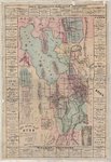 |
New mining map of Utah : showing the location of the mining districts over an extent of territory 150 miles from north to south | 1871 | Image |
| 2 |
 |
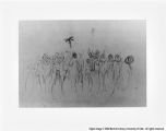
Page 64 | ||
| 3 |
 |
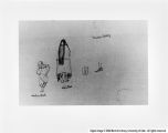
Page 31 | ||
| 4 |
 |
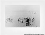
Page 68 | ||
| 5 |
 |
Page 15 | ||
| 6 |
 |
Page 3 | ||
| 7 |
 |
Page 62 | ||
| 8 |
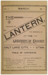 |
The Lantern, 1891-03 | 1891 | Text |
| 9 |
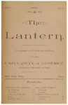 |
The Lantern, 1891-04 | 1891 | Text |
| 10 |
 |
The Lantern, 1891-05 | 1891 | Text |
| 11 |
 |
The Lantern, 1891-06 | 1891 | Text |
| 12 |
 |
The Lantern, 1891-10 | 1891 | Text |
| 13 |
 |
The Lantern, 1891-11 | 1891 | Text |
| 14 |
 |
The Lantern, 1891-12 | 1891 | Text |
| 15 |
 |
The Lantern, 1892-01 | 1892 | Text |
| 16 |
 |
The Lantern, 1892-02 | 1892 | Text |
| 17 |
 |
The Lantern, 1892-04 | 1892 | Text |
| 18 |
 |
The Lantern, 1892-05 | 1892 | Text |
| 19 |
 |
The Lantern, 1892-06 | 1892 | Text |
| 20 |
 |
350 | ||
| 21 |
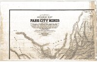 |
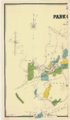
Gorlinski's general map of Park City mines | 1893 | Image |
| 22 |
 |
031 | ||
| 23 |
 |
036 | ||
| 24 |
 |
065 | ||
| 25 |
 |
Gorlinski's general map of Park City and Alta mines, compiled from official surveys in Uintah, Blue Ledge, Snake Creek, Big & Little Cottonwood & American Fork Mining districts, Utah | 1902 | Image |