TO
| Title | Date | Subject | Description | ||
|---|---|---|---|---|---|
| 1 |
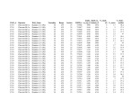 |
Fischer Assay Data, Utah Geological Survey Well Number U330 | 2008 | This dataset contains the results of Fischer assay analyses obtained and published by the Utah Geological Survey for well U330. | |
| 2 |
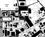 |
Campus Map | |||
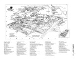
| 3 |
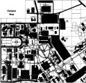 |
Campus Map | |||
| 4 |
 |
Campus Map | |||
| 5 |
 |
Campus Map | |||
| 6 |
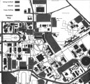 |
Campus Map | |||
| 7 |
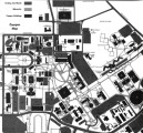 |
Campus Map | |||
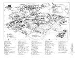
| 8 |
 |
Appendices 1.7: West Side Outreach Efforts | University of Utah 2006 Report to the Northwest Commission on Colleges and Universities, Appendices for Standard 1: Institutional Mission and Goals, Planning and Effectiveness. 1.7: West Side Outreach Efforts | ||
| 9 |
 |
Campus Map | |||
| 10 |
 |
Photos | |||
| 11 |
 |
Abbreviations | |||
| 12 |
 |
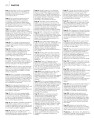
Student Activities | |||
| 13 |
 |
Student Activities | |||
| 14 |
 |
Student Activities | |||
| 15 |
 |
Student Activities | |||
| 16 |
 |
Geology of the Mill Fork Area, Utah | 1972-12 | geology; Mill Fork area; geologic structure; Green River formation | The Mill Fork area comprises about 70 square miles of Cretaceous ( ? ) and Tertiary sediments at the northern end of the Wasatch Plateau in Utah County, Utah. Over 9000 feet of nonmarine sediments are present and belong to the North Horn, Flagstaff, and Green River formations. These sediments record... |
| 17 |
 |
AC_Table of Contents | |||
| 18 |
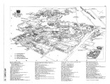 |
AR_Campus Map | |||
| 19 |
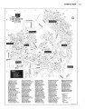 |
Campus Map | |||
| 20 |
 |
Table of Contents | Table of Contents for a report of the University of Utah | ||
| 21 |
 |
Photos | |||
| 22 |
 |
Required Documentation 6.2: Governance and Administration, Organizational Chart | The University of Utah 2006 Self-Study Required Documentation: Standards 6-8. 6.2: Governance and Administration, Organizational Chart | ||
| 23 |
 |
AB_Information | |||
| 24 |
 |
Campus Map | |||
| 25 |
 |
Campus Map |