|
|
Title | Date | Type | Setname |
| 201 |
 |
Geology of the Promontory Range, Box Elder County, Utah | 1960 | Text | ir_etd |
| 202 |
 |
Geology of the Promontory Range, Box Elder County, Utah | 1960-06 | Text | ir_etd |
| 203 |
 |
Geology of the San Arroyo gas Field Grand County, Utah | 1972-08 | Text | ir_etd |
| 204 |
 |
Geology of the Sheeprock Mountains, Tooele and Juab Counties, Utah | 1957-08 | Text; Image | ir_etd |
| 205 |
 |
Geology of the Sheeprock Mountains, Tooele and Juab Counties, Utah: Georeferenced map files | 1957-08 | Image | ir_etd |
| 206 |
 |
Geology of the Smith and Morehouse-Hayden Fork area, Utah | 1952 | Text; Image | ir_etd |
| 207 |
 |
Geology of the Smith and Morehouse-South Fork Area, Utah | 1951 | Text | ir_etd |
| 208 |
 |
Geology of the Smith and Morehouse-South Fork Area, Utah: Georeferenced map files | 1951 | Image | ir_etd |
| 209 |
 |
Geology of the Soapstone Basin and vicinity, Wasatch, Summit, and Duchesne Counties, Utah | 1953-06 | Text | ir_etd |
| 210 |
 |
Geology of the Soldier Summit quadrangle, Utah (Thesis and maps) | 1965-06 | Text; Image | ir_etd |
| 211 |
 |
Geology of the Soldier Summit quadrangle, Utah: Georeferenced map files | 1965-06 | Image | ir_etd |
| 212 |
 |
Geology of the South Fork of the Ogden River area, Weber County, Utah | 1958-06 | Text | ir_etd |
| 213 |
 |
Geology of the Southern Lakeside Mountains, Utah | 1953-08 | Text | ir_etd |
| 214 |
 |
Geology of the Southern Stansbury Range, Tooele County, Utah | 1958-06 | Text | ir_etd |
| 215 |
 |
Geology of the Terrace and Hogup Mountains, Box Elder County, Utah | 1964-06 | Text; Image | ir_etd |
| 216 |
 |
Geology of the Terrace and Hogup Mountains, Box Elder County, Utah (Google Earth map overlay KMZ file) | 1964-06 | Image | ir_etd |
| 217 |
 |
Geology of the Terrace and Hogup Mountains, Box Elder County, Utah (Maps) | 1964-06 | Image | ir_etd |
| 218 |
 |
Geology of the Terrace and Hogup Mountains, Box Elder County, Utah: Georeferenced map files | 1964-06 | Image | ir_etd |
| 219 |
 |
Geology of the upper Ogden Canyon, Weber County, Utah | 1960-06 | Text; Image | ir_etd |
| 220 |
 |
Geology of the upper Ogden Canyon, Weber County, Utah: Georeferenced map files | 1960-06 | Image | ir_etd |
| 221 |
 |
Geology of the Wanship - Park City Region, Utah | 1952-06 | Text | ir_etd |
| 222 |
 |
Geology of the Wanship - Park City Region, Utah: Georeferenced map files | 1952-06 | Image | ir_etd |
| 223 |
 |
Geology of the West Tintic mining district and vicinity, Juab County, Utah | 1954-06 | Text; Image | ir_etd |
| 224 |
 |
Geology of the West Tintic Range and vicinity, Tooele and Juab Counties, Utah | 1959-06 | Text | ir_etd |
| 225 |
 |
Geometry of Pleistocene facies on the Great Barrier Reef outer shelf and upper slope - seismic stratigraphy of sites 819, 820, and 821 | 1993 | Text | ir_uspace |
| 226 |
 |
Geomorphic analysis of a late pleistocene Lake Bonneville spit complex, Deep Creek Mountains, Utah | 2014-08 | Text | ir_etd |
| 227 |
 |
Geomorphic and sedimentologic impacts of Mass movements in Canyon Topography: A case study in Hop Valley, Zion National Park, Utah | 2019 | Text | ir_etd |
| 228 |
 |
Geomorphic and stratigraphic development of Lake Bonneville's intermediate paleoshorelines during the late pleistocene | 2012-12 | Text | ir_etd |
| 229 |
 |
Geophysical properties of oceanic crust at Sites 768 and 770 | 1991 | Text | ir_uspace |
| 230 |
 |
Geophysical signatures of volcano-hosted geothermal systems | 2012-05 | Text | ir_etd |
| 231 |
 |
Geothermal resource assessment of the basin and range province in Western Utah | 2013-12 | Text | ir_etd |
| 232 |
 |
Geothermal resources in Southwestern Utah: gravity and magnetotelluric investigations | 2013-08 | Text | ir_etd |
| 233 |
 |
Geothermics and climate change: 1. Analysis of borehole temperatures with emphasis on resolving power | 1998 | Text | ir_uspace |
| 234 |
 |
Geothermics and climate change: 2. Joint analysis of borehole temperature and meteorological data | 1998 | Text | ir_uspace |
| 235 |
 |
Gilsonite | 1905-04-17 | Text | ir_etd |
| 236 |
 |
Glaciation of the High Uintas Primitive Area, Utah with emphasis on the Northern slope | 1974 | Text | ir_etd |
| 237 |
 |
Global warming - just hot air? | 1998 | Text | ir_uspace |
| 238 |
 |
Gombe group basalts and initiation of pliocene deposition in the Turkana depression, northern Kenya and southern Ethiopia | 2004 | Text | ir_uspace |
| 239 |
 |
Gravity signals at the Geysers geothermal system | 2002 | Text | ir_uspace |
| 240 |
 |
Ground temperature and climate change | 2013-08 | Text | ir_etd |
| 241 |
 |
Ground-water hydrology of Emigration Canyon, Salt Lake County, Utah | 1966 | Text | ir_etd |
| 242 |
 |
Groundwater temperature and flow studies in the Great Basin | 2013-12 | Text | ir_etd |
| 243 |
 |
Gypsum veins in the triassic moenkopi formation, southern utah: diagenetic and tectonic implications and analog relevance to mars | 2016-08 | Text | ir_etd |
| 244 |
 |
Heat flow in the Uinta Basin determined from bottom hole temperature (BHT) data | 1984-04 | Text | ir_uspace |
| 245 |
 |
Heavy mineral study of the intrusive rocks of the Antelope Range, Piute County, Utah | 1950 | Text | ir_etd |
| 246 |
 |
Helium equilibrium between pore water and quartz: application to determine caprock permeability | 2012-05 | Text | ir_etd |
| 247 |
 |
High-resolution geochemical variations at Sites 723, 728, and 731: a comparison of X-ray fluorescence and geochemical logs | 1991 | Text | ir_uspace |
| 248 |
 |
Highly seasonal and perennial fluvial facies: implications for climatic control on the Douglas Creek and Parachute Creek Members, Green River Formation, Southeastern Uinta Basin, Utah | 2017 | Text | ir_etd |
| 249 |
 |
Horizontal sediments of the lower Omo valley: the kibish formation | 1969 | Text | ir_uspace |
| 250 |
 |
Hydrology of a firn aquifer in southeast greenland | 2017 | Text | ir_etd |
| 251 |
 |
Hydrology of middle Canyon, Oquirrh Mountains, Tooele County, Utah | 1960-08 | Text | ir_etd |
| 252 |
 |
Ichnology, mineralogy, and paleoenvironmental implications of the verdine and glaucony facies in sedimentary rocks | 2014-12 | Text | ir_etd |
| 253 |
 |
The Igneous Rocks of Utah | 1912 | Text | ir_etd |
| 254 |
 |
Image focusing and data compression in the solution of geophysical inverse problems | 1999-06-06 | Text | ir_etd |
| 255 |
 |
Imaging the fault ruptures of the Great 2012 Indian Ocean intraplate earthquakes from back-projection of teleseismic p-waves | 2013-12 | Text | ir_etd |
| 256 |
 |
Imaging the mantle structure of the earth and moon from array based observations | 2016 | Text | ir_etd |
| 257 |
 |
Implications of thrust and detachment faulting for the structural geology of the Thermo Hot Springs Known Geothermal Resource Area, Beaver County, Utah | 2012-12 | Text | ir_etd |
| 258 |
 |
In situ characterization of texture and fracture anisotropy in fine grained sedimentary rocks | 2018 | Text | ir_etd |
| 259 |
 |
Induced polarization effect in land and marine CSEM data: applications for hydrocarbon exploration | 2009-08-27 | Text | ir_etd |
| 260 |
 |
Induced polarization effect in time domain: theory, modeling, and applications | 2011-12 | Text | ir_etd |
| 261 |
 |
Influence of Nano-Scale interactions on fifld-scale transport of virus- to protozoa-sized colloids: experiments in environment ally equilibrated weltand media | 2019 | Text | ir_etd |
| 262 |
 |
Infrasound signal characteristics of small earthquakes | 2013-08 | Text | ir_etd |
| 263 |
 |
Integral electric current method in 3-D electromagnetic modeling for large conductivity contrast | 2007-05 | Text | ir_uspace |
| 264 |
 |
Integral equation method for 3D modeling of electromagnetic fields in complex structures with inhomogeneous background conductivity | 2006 | Text | ir_uspace |
| 265 |
 |
Integrated depositional model and hydrocarbon potential of distal Ramp deposits, agrio formation, neuquén Basin, Argentina | 2018 | Text | ir_etd |
| 266 |
 |
Interactions between axial and transverse drainage systems in the late cretaceous Cordilleran Foreland Basin: evidence from detrital zircons in the Straight Cliffs Formation, Southern Utah | 2014-05 | Text | ir_etd |
| 267 |
 |
Interpretation of complex resistivity of rocks using gemtip analysis | 2013-08 | Text | ir_etd |
| 268 |
 |
Interpretation of earthscope magnetotelluric data for Northwestern United States | 2014-12 | Text | ir_etd |
| 269 |
 |
Interpretation of induced polarization and resistivity data | 1977 | Text | ir_etd |
| 270 |
 |
Interpreting sedimentary processes and geomechanical trends in heterogeneous mudstone | 2020 | Text | ir_etd |
| 271 |
 |
Inversion of bottom-hole temperature data: the Pineview field, Utah-Wyoming thrust belt | 1988-05 | Text | ir_uspace |
| 272 |
 |
Inversion of gravity data for depth-to-basement estimate using the volume and surface integral methods: model and case study | 2017 | Text | ir_etd |
| 273 |
 |
Investigating coda envelope derived moment magnitudes for small earthquakes in Utah | 2022 | Text | ir_htoa |
| 274 |
 |
Investigating the source of springs in Northeast Salt Lake valley using environmental tracers and noble gas thermometry | 2019 | Text | ir_etd |
| 275 |
 |
Joint 3D inversion of magnetotelluric and magnetovariational data | 2019 | Text | ir_etd |
| 276 |
 |
Joint analysis of the surface and borehole gravity and gravity gradiometry data for hydrocabrbon (HC) reservoir monitoring and carbon dioxide (CO2) sequestration | 2020 | Text | ir_etd |
| 277 |
 |
Joint inversion of geophysical data using multinary transformation and gramian constraints | 2018 | Text | ir_etd |
| 278 |
 |
Joint inversion of potential field and electromagnetic data using gramian constraints | 2017 | Text | ir_etd |
| 279 |
 |
Jurassic Navajo Sandstone of Coyote Buttes, Utah/Arizona: coloration and diagenetic history, preservation of a dinosaur trample surface, and terrestrial analogs to Mars | 2008-05-19 | Text | ir_etd |
| 280 |
 |
Laminated soil carbonate rinds as a high resolution paleoclimate and paleoecologic proxy record | 2018 | Text | ir_etd |
| 281 |
 |
Landslides in the Coal Hill area, Kane County, Utah (Google Earth map overlay KMZ file) | 1964-06 | Image | ir_etd |
| 282 |
 |
Landslides in the Coal Hill area, Kane County, Utah (Thesis and maps) | 1964-06 | Text; Image | ir_etd |
| 283 |
 |
Landslides in the Coal Hill area, Kane County, Utah: Georeferenced map files | 1964-06 | Image | ir_etd |
| 284 |
 |
Large-scale 3D inversion of marine magnetotelluric data: Case study from the Gemini prospect, Gulf of Mexico | 2011 | Text | ir_uspace |
| 285 |
 |
Large-scale 3D inversion of potential field data | 2011 | Text | ir_uspace |
| 286 |
 |
Late Neogene exhumation patterns in Taranaki Basin (New Zealand): evidence from offset porosity-depth trends | 1998 | Text | ir_uspace |
| 287 |
 |
Late pleistocene and early holocene glacier and climate change in the wasatch mountains of Utah | 2019 | Text | ir_etd |
| 288 |
 |
Least squares datuming and surface waves prediction with interferometry | 2010 | Text | ir_etd |
| 289 |
 |
Life in an ancient sea of sand: trace fossil associations and their paleoecological implications in the Upper Triassic/Lower Jurassic Nugget Sandstone, Northeastern Utah | 2013-12 | Text | ir_etd |
| 290 |
 |
Localized S-inversion of time-domain electromagnetic data | 2002-01-01 | Text | ir_uspace |
| 291 |
 |
Low-angle normal faulting in the basin and range-Colorado plateau transition zone during the January 3, 2011 circleville, UT earthquake sequence | 2013-08 | Text | ir_etd |
| 292 |
 |
The lower Omo basin | 1983 | Text | ir_uspace |
| 293 |
 |
Lowering the detection limit for arsenic: implications for a future practical quantitation limit | 2007 | Text | ir_uspace |
| 294 |
 |
The magnetostratigraphy of ocean drilling program leg 105 sediments | 1989 | Text | ir_uspace |
| 295 |
 |
Magnetostratigraphy of the Koobi Fora Formation, Lake Turkana, Kenya | 1986 | Text | ir_uspace |
| 296 |
 |
Magnetostratigraphy of the shungura and usno formations, lower Omo Valley, Ethiopia | 1976 | Text | ir_uspace |
| 297 |
 |
Magnetostratigraphy of the shungura and usno formations, Southwestern Ethiopia: new data and comprehensive reanalysis | 1978 | Text | ir_uspace |
| 298 |
 |
Map 1 Geologic map and sections of Big Piney Area, Utah (Google Earth map overlay KMZ file) | 1953-06 | Image | ir_etd |
| 299 |
 |
Map 1 Geologic map of the Soldier Summit Quadrangle, Utah (Google Earth map overlay KMZ file) | 1965-06 | Image | ir_etd |
| 300 |
 |
Map 1 Geology of the upper Ogden Canyon, Weber County, Utah (Google Earth map overlay KMZ file) | 1960-06 | Image | ir_etd |
| 301 |
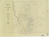 |
Map 1: Geologic map of Antelope intrusive and vicinity | 1950 | Image | ir_etd |
| 302 |
 |
Map 1: Geologic map of Antelope intrusive and vicinity (Google Earth map overlay KMZ file) | 1950 | Image | ir_etd |
| 303 |
 |
Map1 Geologic map and sections of Newfoundland Mountains, Box Elder County, Utah (Google Earth map overlay KMZ file) | 1956-12 | Image | ir_etd |
| 304 |
 |
Map1 Geologic map and sections of Smith and Morehouse-Hayden Fork area, Utah (Google Earth map overlay KMZ file) | 1952 | Image | ir_etd |
| 305 |
 |
Mapping subglacial geomorphology and structure in a collisional orogen: an example from the Malaspina Glacier, Alaska | 2011-12 | Text | ir_etd |
| 306 |
 |
Mass recoveries in nano to microparticle analysis of environmental samples via flow field flow fractionation-inductively-coupled plasma mass spectometry | 2013-08 | Text | ir_etd |
| 307 |
 |
Meta-Analytic approaches to learn about hydroclimatic processes and change from stable isotopes | 2019 | Text | ir_etd |
| 308 |
 |
Metamorphism and fluid-rock interaction in the alta, Utah contact aureole: identification of forsterite reaction pathways, evaluation of reaction overstepping, and trace element characterization | 2015-08 | Text | ir_etd |
| 309 |
 |
Methods of dating | 1992 | Text | ir_uspace |
| 310 |
 |
Methyl mercury hotsports and sources in the Great Salt Lake, Utah, Adjacent freshwater bays and impounded wetlands | 2013-12 | Text | ir_etd |
| 311 |
 |
Microbial-caddisfly bioherm association of the lower cretaceous shinekhudag formation, mongolia | 2017 | Text | ir_etd |
| 312 |
 |
Mid-Latitude (30°-60° N) climatic warming inferred by combining borehole temperatures with surface air temperatures | 2001 | Text | ir_uspace |
| 313 |
 |
Migration and inversion of magnetic and magnetic gradiometry data | 2012-05 | Text | ir_etd |
| 314 |
 |
Migration and tomographic imaging of colluvial wedges and faults over the Washington Fault, Arizona | 2015-12 | Text | ir_etd |
| 315 |
 |
Milankovitch paleoceanographic cycles in geophysical logs from ODP Leg 105, Labrador Sea and Baffin Bay | 1990 | Text | ir_uspace |
| 316 |
 |
Mineral deposits of the Deep Creek Mountains, Tooele and Juab Counties, Utah (Google Earth map overlay KMZ file) | 1970-08 | Image | ir_etd |
| 317 |
 |
Mineral deposits of the Deep Creek Mountains, Tooele and Juab Counties, Utah (Thesis and maps) | 1970-08 | Text; Image | ir_etd |
| 318 |
 |
Mineral deposits of the Deep Creek Mountains, Tooele and Juab Counties, Utah: Georeferenced map files | 1970-08 | Image | ir_etd |
| 319 |
 |
The mineral economics of natural zeolites | 1984 | Text | ir_htca |
| 320 |
 |
Mio-Pliocene geology of the Southern Puna Plateau Margin, Argentina | 2011-08 | Text | ir_etd |
| 321 |
 |
Modeling of Electric and Electromagnetic Data | 1977 | Text | ir_etd |
| 322 |
 |
Monitoring aquifer recharge using repeated high-precision gravity measurements: a pilot study in South Weber, Utah | 2008 | Text | ir_uspace |
| 323 |
 |
Multisource crosstalk reduction and plane-wave least-squares kirchhoff migration | 2014-08 | Text | ir_etd |
| 324 |
 |
Multisource least-squares migration and prism wave reverse time migration | 2012-12 | Text | ir_etd |
| 325 |
 |
Nasutuceratops Titusi, a new basal centrosaurine dinosaur (Ornithischia: Ceratopsidae) from the upper cretaceous Kaiparowits Formation, Southern Utah | 2010-08 | Text | ir_etd |
| 326 |
 |
Near-criticality in dilute binary mixtures: distribution of azulene between coexisting liquid and vapor carbon dioxide | 2002 | Text | ir_uspace |
| 327 |
 |
Near-surface velocity reconstruction using surface wave inversion | 1990-06 | Text | ir_etd |
| 328 |
 |
The Needles Range Formation in Southwestern Utah: paleomagnetism and stratigraphic correlation | 1975-03 | Text | ir_etd |
| 329 |
 |
New approach to interpretation of airborne magnetic and electromagnetic data | 1996-01-01 | Text | ir_uspace |
| 330 |
 |
New Baenid turtles from the cretaceous Kaiparowits formation of Southern Utah: implications for Laramidian biogeography | 2013-08 | Text | ir_etd |
| 331 |
 |
Novel approach to the model appraisal and resolution analysis of regularized geophysical inversion | 2006 | Text | ir_uspace |
| 332 |
 |
Observations on the stratigraphy and rediometric age of the omo beds, lower omo basin, southern Ethiopia | 1969 | Text | ir_uspace |
| 333 |
 |
Oil reserves in the oil shale and coal deposits of Utah | 1905-04-15 | Text | ir_etd |
| 334 |
 |
Origin of seismic reflectors within carbonate-rich sediments from northeastern Australian margin | 1993 | Text | ir_uspace |
| 335 |
 |
Oxygen isotope composition and tourmaline mineral chemistry of the Coso and Darajat geothermal systems | 2016-12 | Text | ir_etd |
| 336 |
 |
Oxygen isotope, cathodoluminescence, and titanium in quartz geothermometry in the Alta Stock, UT: geochemical insights into pluton assembly and early cooling history | 2009-06-15 | Text | ir_etd |
| 337 |
 |
The paleoecology of extinct crocodylomorphs and their resilience to Mass extingctions | 2020 | Text | ir_etd |
| 338 |
 |
Paleoecology of Upper Cambrian carbonate units, house range and South Lakeside Mountains, Utah | 2015-08 | Text | ir_etd |
| 339 |
 |
Paleoenvironment and organic geochemistry of cenomanian-turonian sediments from the central Atlantic Ocean Margins | 2018 | Text | ir_etd |
| 340 |
 |
Paleoenvironment of the Upper Triassic-Lower Jurassic (?) Nugget (?) Sandstone near Heber, Utah | 1975-03 | Text | ir_etd |
| 341 |
 |
Paleontology and Depositional Environments of the Cambrian Wheeler formation drum Mountains, West-Central Utah | 1973 | Text | ir_etd |
| 342 |
 |
Paleoredox conditions and the origin of bedded barites along the Late Devonian North American continental margin | 1994 | Text | ir_uspace |
| 343 |
 |
Paleoredox Conditions, Paleoproductivity, and Depositional Environment of an Eocene Black Shale: Mahogany Zone, Green River Formation, Eastern Uinta Basin, Utah | 2019 | Text | ir_htoa |
| 344 |
 |
Paleozoic-cenozoic evolution of the East Gobi Fault Zone, Southern Mongolia: a protracted record of intracontinental deformation and basin evolution, with implications for tectonics in Eurasia | 2010-08 | Text | ir_etd |
| 345 |
 |
Parameter estimation for 3-D geoelectromagnetic inverse problems | 1999-01-01 | Text | ir_uspace |
| 346 |
 |
Parametric studies of induced polarization spectra | 1979-03 | Text | ir_etd |
| 347 |
 |
Parunuweap formation in the vicinity of Zion National Park, Utah | 1969-06 | Text | ir_etd |
| 348 |
 |
Parunuweap formation in the vicinity of Zion National Park, Utah (Google Earth map overlay KMZ file) | 1969-06 | Image | ir_etd |
| 349 |
 |
Parunuweap formation in the vicinity of Zion National Park, Utah-Maps | 1969-06 | Image | ir_etd |
| 350 |
 |
Parunuweap formation in the vicinity of Zion National Park, Utah: Georeferenced map files | 1969-06 | Image | ir_etd |
| 351 |
 |
Pennsylvanian depositional systems and geology of the Pecos River Canyon, Northern New Mexico | 2007-09-05 | Text | ir_etd |
| 352 |
 |
Petrographic characteristics and provenance of fluvial sandstone, sunnyside oil-impregnated sandstone deposit, Carbon County, Utah | 1981-12 | Text | ir_etd |
| 353 |
 |
Petroleum geochemistry and geology of the Midyan and Al Wajah basins, Northern Red Sea, Saudi Arabia | 2010-01-28 | Text | ir_etd |
| 354 |
 |
Petrology and Chemistry of tuffs from the Shungura Formation, Southwest Ethiopia | 1979 | Text | ir_etd |
| 355 |
 |
Petrology and structure of the little willow series, Wasatch Mountains, Utah | 1962-11 | Text | ir_etd |
| 356 |
 |
Petrology and structure of the little willow series, Wasatch Mountains, Utah (Google Earth map overlay KMZ file) | 1962-11 | Image | ir_etd |
| 357 |
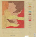 |
Petrology and structure of the Little Willow Series, Wasatch Mountains, Utah-Maps | 1962-11 | Image | ir_etd |
| 358 |
 |
Petrology and structure of the little willow series, Wasatch Mountains, Utah: Georeferenced map files | 1962-11 | Image | ir_etd |
| 359 |
 |
Petrology of bituminous sandstones in the Green River Formation, Southeastern Uinta Basin, Utah | 1967-06 | Text | ir_etd |
| 360 |
 |
Petrology of Lake Bonneville Gravels Salt Lake County, Utah | 1963-05 | Text; Image | ir_etd |
| 361 |
 |
Petrology of Lake Bonneville Gravels Salt Lake County, Utah (Google Earth map overlay KMZ file) | 1963-05 | Image | ir_etd |
| 362 |
 |
Petrology of Lake Bonneville Gravels Salt Lake County, Utah: Georeferenced map files | 1963-05 | Image | ir_etd |
| 363 |
 |
Petrology of the moenkopi formation (Early Triassic), Uinta Mountain Area, Northeastern Utah | 1974-06 | Text | ir_etd |
| 364 |
 |
Petrophysical and diagenetic characteristics of the permian white rim sandstone, southeast utah | 2015-08 | Text | ir_etd |
| 365 |
 |
Plate 1 Fence diagram Moenkopi group (Google Earth map overlay KMZ file) | 1969-06 | Image | ir_etd |
| 366 |
 |
Plate 1 Generalized geologic map of the Laramide orogenic sediments of the Wasatch Hinterland (Google Earth map overlay KMZ file) | 1974 | Image | ir_etd |
| 367 |
 |
Plate 1 Geologic map of Stansbury Island, Tooele County, Utah (Google Earth map overlay KMZ file) | 1969-06 | Image | ir_etd |
| 368 |
 |
Plate 1 Geologic map of the Sheeprock Mountains area, Utah (Google Earth map overlay KMZ file) | 1957-08 | Image | ir_etd |
| 369 |
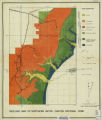 |
Plate 1: Geologic map of Northern Bryce Canyon National Park | 1961-06 | Image | ir_etd |
| 370 |
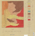 |
Plate 1: Geologic map of the Little Willow Series, Wasatch Mountains, Utah | 1962-11 | Image | ir_etd |
| 371 |
 |
Plate 1: Geologic map of the Lothidok Range, Kenya | 1988-08 | Image | ir_etd |
| 372 |
 |
Plate 1: Geologic map of the Paria NW quadrangle, Kane County, Utah | 1970-08 | Image | ir_etd |
| 373 |
 |
Plate 1: Geologic map of the Southern Grouse Creek Mountains, Box Elder County, Utah (Google Earth map overlay KMZ file) | 1959-06 | Image | ir_etd |
| 374 |
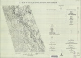 |
Plate 1: Geologic map of the Willard Peak area, North-Central Wasatch Mountains, Utah | 1972-12 | Image | ir_etd |
| 375 |
 |
Plate 1: Geologic map of the Willard Peak area, North-Central Wasatch Mountains, Utah (Google Earth map overlay KMZ file) | 1972-12 | Image | ir_etd |
| 376 |
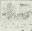 |
Plate 1B: Geologic map of the Central and Southern Silver Island Mountains, Box Elder and Tooele Counties, Utah, and Elko County, Nevada | 1961-06 | Image | ir_etd |
| 377 |
 |
Plate 1B: Geologic map of the Central and Southern Silver Island Mountains, Box Elder and Tooele Counties, Utah, and Elko County, Nevada (Google Earth map overlay KMZ file) | 1961-06 | Image | ir_etd |
| 378 |
 |
Plate 1C: Geologic cross sections of the Central and Southern Silver Island Mountains, Box Elder and Tooele Counties, Utah and Elko County, Nevada | 1961-06 | Image | ir_etd |
| 379 |
 |
Plate 2 Topography, resistivity, and chargeability cross-sections along dipole-dipole line 1 on Fumarole Butte | 1975-08 | Text; Image | ir_etd |
| 380 |
 |
Plate 2: Sections along line A-A' and B-B' | 1962-11 | Image | ir_etd |
| 381 |
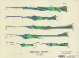 |
Plate 2: Structural sections | 1970-08 | Image | ir_etd |
| 382 |
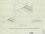 |
Plate 2: Structure sections for geologic map of the Willard Peak area | 1972-12 | Image | ir_etd |
| 383 |
 |
Plate 3 Geologic map of portion of Northwestern Uinta Mountains, Utah (Google Earth map overlay KMZ file) | 1951 | Image | ir_etd |
| 384 |
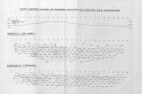 |
Plate 3 Topography, resistivity, and chargeability cross-sections along dipole-dipole line 2 on Fumarole Butte | 1975-08 | Text; Image | ir_etd |
| 385 |
 |
Plate 3: Geologic map and sections of Wanship-Park City region, Utah | 1952-06 | Image | ir_etd |
| 386 |
 |
Plate 3: Geologic map and sections of Wanship-Park City region, Utah (Google Earth map overlay KMZ file) | 1952-06 | Image | ir_etd |
| 387 |
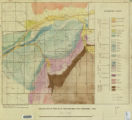 |
Plate 3: Geologic map of portion of Northwestern Uinta Mountains, Utah | 1951 | Image | ir_etd |
| 388 |
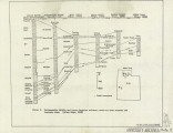 |
Plate 3: Palinspastic middle and upper Cambrian columnar sections from western and northern Utah | 1972-12 | Image | ir_etd |
| 389 |
 |
Plate 3: Structural map of the Little Willow Series, Wasatch Mountains, Utah | 1962-11 | Image | ir_etd |
| 390 |
 |
Plate 3: Structural map of the Paria NW quadrangle, Kane County, Utah | 1970-08 | Image | ir_etd |
| 391 |
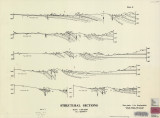 |
Plate 3: Structural sections | 1970-08 | Image | ir_etd |
| 392 |
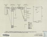 |
Plate 4: Correlation of Precambrian rocks of the lower plate and upper plate of the Willard thrust with the Huntsville and Cottonwood areas | 1972-12 | Image | ir_etd |
| 393 |
 |
Plate 4: Map variations of the Little Willow Series, Wasatch Mountains, Utah | 1962-11 | Image | ir_etd |
| 394 |
 |
Plate 4: Topographic features of the Paria NW quadrangle, Kane County, Utah | 1970-08 | Image | ir_etd |
| 395 |
 |
Plate 5: Geologic map of the Upton region, Summit County, Utah (Google Earth map overlay KMZ file) | 1953-06 | Image | ir_etd |
| 396 |
 |
Plate1 Map of Fumarole Butte showing topography, geology, and locations of dipole-dipole profiles and Schlumberger soundings | 1975-08 | Text; Image | ir_etd |
| 397 |
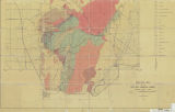 |
Plate1-part1 Geologic map of the Central Mineral Range, Beaver County, Utah | 1957-08 | Image | ir_etd |
| 398 |
 |
Pleistocene rhyolite of the mineral mountains, Utah geothermal and archeological significance | 1978 | Text | ir_uspace |
| 399 |
 |
Pliocene stratigraphy and geology of the Northeastern Ileret Region, Kenya | 2012-12 | Text | ir_etd |
| 400 |
 |
Pliocene/pleistocene formations in the lower omo basin, southern Ethiopia | 1970 | Text | ir_uspace |