Filters: Department: "Geology & Geophysics" Format: "application/pdf" Collection: "ir_uspace" Type: "Text"
1 - 25 of 14
| Creator | Title | Description | Subject | Date | ||
|---|---|---|---|---|---|---|
| 1 |
 |
Brown, Francis Harold | Geological development of the Omo-Turkana Basin during the pliocene and pleistocene epochs | Pliocene and Pleistocene deposits of the Omo-Turkana Basin extend from 6?N latitude to about 2?N latitude (-450 km), and laterally from about 35.5?E to 36.5?E. Sediments are brought to the basin by the Omo River which rises in Ethiopia, and by the Turkwel and Kerio Rivers which rise in Kenya and Uga... | 2004 | |
| 2 |
 |
Zhdanov, Michael | Three-dimensional inversion of large-scale EarthScope magnetotelluric data based on the integral equation method: geoelectrical imaging of the Yellowstone conductive mantle plume | Interpretation of the EarthScope MT (magnetotelluric) data requires the development of a large-scale inversion method which can address two common problems of 3D MT inversion: computational time and memory requirements. We have developed an efficient method of 3D MT inversion based on an IE (integ... | 2011 | |
| 3 |
 |
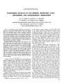
Chapman, David S. | Techniques, analysis, and noise in a Salt Lake Valley 4D gravity experiment | Repeated high-precision gravity measurements using an automated gravimeter and analysis of time series of 1-Hz samples allowed gravity measurements to be made with an accuracy of 5 μGal or better. Nonlinear instrument drift was removed using a new empirical staircase function built from multiple ... | Gravity measurements | 2008 |
| 4 |
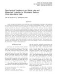 |
Jewell, Paul | Geochemical variations in an alpine lake and watershed underlain by siliciclastic bedrock, Uinta Mountains, Utah | A small watershed which includes several small lakes in the Uinta Mountains of northern Utah is underlain by monolithologic Precambrian siliciclastic rock with extremely limited buffering capacity. In spite of this, s\ stematic spatial and temporal variations in alkalinity, pH, and major elements oc... | 1998-01-01 | |
| 5 |
 |
Brown, Francis Harold | A reappraisal of the geomagnetic polarity time scale to 4 MA using data from the turkana basin, East Africa | Recalibration of the Pliocene and early Pleistocene geomagnetic time scale using the K-Ar dated fluvial sequence of the Turkana Basin in East Africa agrees with calibrations based on astronomical calculations. Ages estimated here are: Olduvai Subchron, 1.78-1.96 Ma; Reunion Subchrons, 2.11-2.15 Ma ... | 2012 | |
| 6 |
 |
Brown, Francis Harold | Pleistocene rhyolite of the mineral mountains, Utah geothermal and archeological significance | 1978 | ||
| 7 |
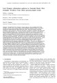 |
Chapman, David S.; Allis, Richard George | Late Neogene exhumation patterns in Taranaki Basin (New Zealand): evidence from offset porosity-depth trends | Taranaki Basin, New Zealand, is located adjacent to the Australian-Pacific Plate boundary where the tectonic regime changes from dominantly subduction-related to the north to transpression-related along the Alpine Fault to the south. During the Neogene, burial and exhumation varied extensively, in ... | Neogene; Uplift; Exhumation; Taranaki Basin; New Zealand | 1998 |
| 8 |
 |
Chapman, David S. | Exhumation of the central Wasatch Mountains, Utah: 1, Patterns and timing of exhumation deduced from low-temperature thermochronology data | The Wasatch Mountains are often cited as an example of normal fault growth and footwall flexure. They represent a tilted footwall at the edge of the Basin and Range extensional province, a major rift basin. Thus understanding the detailed spatial and elevation changes in coupled thermochronometer da... | Uplift; Exhumation; Wasatch Fault; Wasatch Mountains; Utah; Helium dating; Fission track; Tectonophysics; Extensional tectonics; Geothermal observations | 2002 |
| 9 |
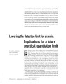 |
Fernandez, Diego P. | Lowering the detection limit for arsenic: implications for a future practical quantitation limit | Exposure to arsenic (As) in drinking water is associated with an increased risk ol bladder, liver, kidney, ,ind skin cancers (Smith et al, 2002; NRG DIEGO P. FERNANDEZ, 2001). To mitigate these risks? the US Environmental Protection Agency AND JANET G. HERING (USEPA) revised the maximum contaminant ... | Practical quantitation limit; Chlorine | 2007 |
| 10 |
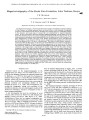 |
Brown, Francis Harold | Magnetostratigraphy of the Koobi Fora Formation, Lake Turkana, Kenya | The Koobi Fora Formation, a Pliocene and Pleistocene sequence of sedimentary deposits northeast of Lake Turkana, has yielded numerous fossils and stone artifacts of early hominids. Stratigraphic correlation of the hominid-bearing deposits throughout the Turkana region was established primarily by th... | 1986 | |
| 11 |
 |
Brown, Francis Harold | A summary of the geology, geochemistry, and geophysics of the Roosevelt Hot Springs thermal area, Utah | 1978 | ||
| 12 |
 |
Solomon, Douglas Kip | Tracer applications of noble gas radionuclides in the geosciences | Noble gas radionuclides, including 81Kr (t1/2 = 229,000 yr), 85Kr (t1/2 = 10.8 yr), and 39Ar (t1/2 = 269 yr), possess nearly ideal chemical and physical properties for studies of earth and environmental processes. Recent advances in Atom Trap Trace Analysis (ATTA), a laser-based atom counting method... | 2014-01-01 | |
| 13 |
 |
Zhdanov, Michael | Discussion and reply: comments on "electromagnetic geophysics: notes from the past and the road ahead" | The direct current and electromagnetic methods have been around for almost 180 years and have been applied successfully in mining, petroleum, geotechnical, engineering, environmental, groundwater, and tectonic studies. Over such a long period of time, it is possible to lose track of who the pioneers... | 2012-01-01 | |
| 14 |
 |
Jewell, Paul | Geochemistry and paleoceanographic setting of Central Nevada bedded barites | The bedded barite deposits of central Nevada are hosted by rocks of the Roberts Mountains allochthon and constitute the largest barite reserves in North America. Detailed geochemical studies of three barite deposits in the Devonian Slaven Chert indicate that rocks surrounding the barite have elevate... | Bedded barites; Roberts Mountains allochthon; Late Devonian | 1991 |
1 - 25 of 14