|
|
Title | Date | Type | Setname |
| 1 |
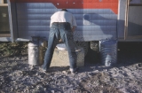 |
A large house trailer, seriously damaged traveling the rough road to the C-LDQ, was the solution to the housing problem the second year (1961) of the University of Utah Cooperative Dinosaur Project (UUCDP). (June 1961) | 1961-06 | Image | uum_map |
| 2 |
 |
An identeification guide to the Mosquitoes of Utah | 1961-06 | Text | ir_uspace |
| 3 |
|
An identification guide to the mosquitoes of Utah | 1961-06 | Text | ir_uspace |
| 4 |
 |
As an expedient and to minimize the necessary handling and preparation time; each bone, as practical, is wrapped, nested in paper excelsior, and boxed for transportation from the field to the laboratory. More fragile bones, regardless of size, require the conventional plaster and burlap packaging. | 1961-06 | Image | uum_map |
| 5 |
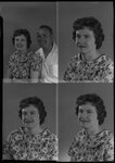 |
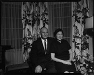
Betty Anderson and husband portraits, 1961 | 1961-06 | | pc_hsm |
| 6 |
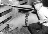 |
Boyd Snow with Hog | 1961-06 | Image/StillImage | ucl_vep |
| 7 |
 |
Correspondence, January - June 1961 | 1961-01; 1961-02; 1961-03; 1961-04; 1961-05; 1961-06 | Text | dha_jbp |
| 8 |
 |
Douglass, Nettie & Fernando-Graves P.1 | 1961-06 | Image | dha_cp |
| 9 |
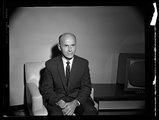 |
Dr. James Orme | 1961-06 | Image/StillImage | dha_sltnc |
| 10 |
 |
Dr. James Orme | 1961-06 | Image/StillImage | dha_sltnc |
| 11 |
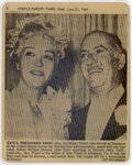 |
Ex-U.S. Treasurer weds | 1961-06 | Image/StillImage | uum_map |
| 12 |
 |
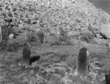
The fossiliferous unit at the C-LDQ, which consists of poorly stratified to blocky, bentonitic shales, is overlain by a dense, hard, siliceous, freshwater limestone. The surface between the two units shows evidence of channeling as seen here. (June 1961) | 1961-06 | Image | uum_map |
| 13 |
 |
Geology and erosional development of Northern Bryce Canyon National Park | 1961-06 | Text | ir_etd |
| 14 |
 |
Geology of a part of Northwestern Uinta County, Wyoming | 1961-06 | Text | ir_etd |
| 15 |
 |
Geology of the Central and Southern Silver Island Mountains Tooele County, Utah and Elko County, Nevada | 1961-06 | Text | ir_etd |
| 16 |
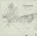 |
Geology of the Central and Southern silver Island Mountains Tooele County, Utah and Elko County, Nevada-Maps | 1961-06 | Image | ir_etd |
| 17 |
 |
Geology of the Central and Southern Silver Island Mountains Tooele County, Utah and Elko County, Nevada: Georeferenced map files | 1961-06 | Image | ir_etd |
| 18 |
 |
Geology of the Cove Creek area Millard County and Beaver County, Utah | 1961-06 | Text; Image | ir_etd |
| 19 |
 |
Gilsonite | 1961-06 | Text | ir_eua |
| 20 |
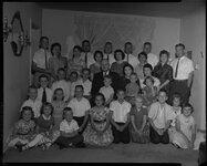 |
H. Clay Cummings family portrait - shot 1, 1961 | 1961-06 | | pc_hsm |
| 21 |
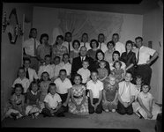 |
H. Clay Cummings family portrait - shot 2, 1961 | 1961-06 | | pc_hsm |
| 22 |
 |
H. Clay Cummings family portrait - shot 3, 1961 | 1961-06 | | pc_hsm |
| 23 |
 |
H. Clay Cummings family portrait - shot 4, 1961 | 1961-06 | | pc_hsm |
| 24 |
 |
H. Clay Cummings family portrait - shot 5, 1961 | 1961-06 | | pc_hsm |
| 25 |
 |
H. Clay Cummings family portrait - shot 6, 1961 | 1961-06 | | pc_hsm |