Home
Browse
Ask Us
Chat
Harmful Language Statement
Log in
Advanced Search
Year
1872
1873
1874
1875
1876
1877
1878
1879
1880
1881
1882
1883
1884
1885
1886
1887
1888
1889
1890
1891
1892
1893
1894
1895
1896
1897
1898
1899
1900
1901
1902
1903
1904
1905
1906
1907
1908
1909
1910
1911
1912
1913
1914
1915
1916
1917
1918
1919
1920
1921
1922
1923
1924
1925
1926
1927
1928
1929
1930
1931
1932
1933
1934
1935
1936
1937
1938
1939
1940
1941
1942
1943
1944
1945
1946
1947
1948
1949
1950
1951
1952
1953
1954
1955
1956
1957
1958
1959
1960
1961
1962
1963
1964
1965
1966
1967
1968
1969
1970
1971
1972
1973
1974
1975
1976
1977
1978
1979
1980
1981
1982
1983
1984
1985
1986
1987
1988
1989
1990
1991
1992
1993
TO
1872
1873
1874
1875
1876
1877
1878
1879
1880
1881
1882
1883
1884
1885
1886
1887
1888
1889
1890
1891
1892
1893
1894
1895
1896
1897
1898
1899
1900
1901
1902
1903
1904
1905
1906
1907
1908
1909
1910
1911
1912
1913
1914
1915
1916
1917
1918
1919
1920
1921
1922
1923
1924
1925
1926
1927
1928
1929
1930
1931
1932
1933
1934
1935
1936
1937
1938
1939
1940
1941
1942
1943
1944
1945
1946
1947
1948
1949
1950
1951
1952
1953
1954
1955
1956
1957
1958
1959
1960
1961
1962
1963
1964
1965
1966
1967
1968
1969
1970
1971
1972
1973
1974
1975
1976
1977
1978
1979
1980
1981
1982
1983
1984
1985
1986
1987
1988
1989
1990
1991
1992
1993
Type
Image
3,521
Image/StillImage
143
Format
image/jpeg
3,594
application/pdf
70
Collection
Photo Archives
3,521
UAIDA Main Collection
143
Filters:
Collection Name:
"Herbert E. Gregory"
826
-
850
of
3,664
<
29
30
31
32
33
34
35
36
37
38
>
Gallery view
Number of results to display per page
10
25
50
100
200
Sort by Relevance
Sort by Title A-Z
Sort by Title Z-A
Sort by Date Ascending
Sort by Date Descending
Sort by Last Modified Ascending
Sort by Last Modified Descending
Title
Date
Type
Setname
826
Contact of Triassic and Permian (beds in wall wrinkled at base). Cherty limestone lower left. Camp Creek. Iron County, UT. 1941
1941
Image
uum_map
827
Contact Wingate and Kayenta formation, branch of Kitchen Canyon east of White Cone, Kane County, Utah, 1938.
1938
Image
uum_map
828
Contact, Carboniferous and Permian, Wolf's Crossing (Photo N-M173)
1913
Image
uum_map
829
Contact, Carmel & Navajo Skutumpah
1936
Image
uum_map
830
Contact, Carmel and Navajo Skutumpah, 1936.
1936
Image
uum_map
831
Contact, McElmo and Dakota, northeast of upper corner of Todilto (Photo G394)
1913
Image
uum_map
832
Contact, McElmo and Mancos, 3 mi. NE of Blue Canyon store, 1914
1914
Image
uum_map
833
Contact, Moencopie-Shinarump, Mouth of Moencopie (Photo G428)
1913
Image
uum_map
834
Contact, Tertiary and McElmo, 2± mi. north of Sunrise Spgs. (Photo N-M166)
1913
Image
uum_map
835
Cook tent, Seven Lakes Oil Field. 1911 (Photo G301)
1911
Image
uum_map
836
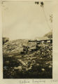
Copra drying
1915
Image
uum_map
837
Corral Knoll volcanic cone, Kanab Valley, Kane County, Carmel limestone covered with lava (foreground), Cretaceous cliffs distance, Kane Co., UT. 1939
1939
Image
uum_map
838
Corredor Hotal Central, Cuzco. Florentin Fluente. Front.
1912
Image
uum_map
839
Cottonwood Canyon, Beef Basin and North Elks, looking west from West Mountain. Abajo Mountains. Utah, San Juan, 1915.
1915
Image
uum_map
840
Cottonwood Pass (Bes-lici-bigiz). Ash cliff on south side of stream. Intrusive diabase on north. 1911 (Photo G-208)
1911
Image
uum_map
841
Cottonwood Pass. Extreme crest, west slope. Mrs. Gregory, photo. 1911 (Photo G209)
1911
Image
uum_map
842
Cottonwood trees buried by sand dunes; trunks reexposed by recent excavations of alluvial valley fill, Short Creek, Mohave County, AZ, 1939
1939
Image
uum_map
843
Cottonwood trees partly buried in drifted sands, Short Creek, Arizona, 1936.
1936
Image
uum_map
844
Cougar Mountain fault. Springdale member of Chinle (lower left) abutting against base of Navajo (lower right), Washington County, UT, 1939
1939
Image
uum_map
845
Cowboy Butte 2 miles north of Fredonia. Moenkopi (Shnabkaib member at base) and Shinarump, Coconino County, AZ. 1939
1939
Image
uum_map
846
Coyote, Ganado 1909
1909
Image
uum_map
847
Crater Lake, Mt. Gambler, South Australia, 1916
1916
Image
uum_map
848
Crater on Kanab Creek, at "the Corrals." Kane County, Utah, 1937.
1936
Image
uum_map
849
Crest of Clay Hills Divide cut in Chinle strata: looking east toward Grand Gulch. San Juan County, UT, 1925
1925
Image
uum_map
850
Crest of Clay Hills Divide cut in Chinle strata: looking east toward Grand Gulch. San Juan County, UT, 1925
1925
Image
uum_map
826
-
850
of
3,664
<
29
30
31
32
33
34
35
36
37
38
>