|
|
Creator | Title | Description | Subject | Date |
| 1 |
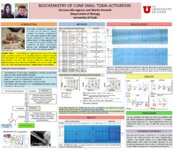 |
Horvath, Martin P. | Biochemistry of Cone Snail toxin activation | Cone snails use venom to capture prey for food and for defense against predators. The venom is composed of over 100 active peptides that target specific receptors in the nervous system. Several of these peptides have the potential to become medicine for treatment of pain, depression, seizures, and n... | biochemistry; horvath; olivera; cone snail; toxin; nmda; elution; buffers; sparse matrix test; protease; protein; purification; neurotoxin; conotoxin | 2013 |
| 2 |
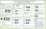 |
Yamaguchi, Ayako | Distinct neural control of vocal phases in frog calls | This poster describes how the connections within the central vocal pathways of African clawed frogs are responsible for coordinating distinct part of their calls. | Vocalizations; Central pattern generators, Motor programs | 2013 |
| 3 |
 |
Berbert, Amanda | The effects of heart failure on the muscle exercise pressor reflex | CONCLUSIONS: HF patients and controls exhibited a similar exercise pressor reflex during both handgrip and knee extensor exercise. However, the rise in MAP was achieved primarily via a rise in SVR in the HF group versus an increase in CO in the control group. This modality-specific adaptation may co... | 2013 Center on Aging poster retreat; Heart Failure; Exercise; 2013 AGS Posters | 2013 |
| 4 |
 |
Sorensen, Justin Bruce | Georeferenced Salt Lake City Sanborn, 1898: sheet 067 (.kmz file) | This .kmz file contains a georeferenced sheet overlay from the Sanborn Fire Insurance Maps for Salt Lake City Sanborn, 1898. The downloaded .kmz file is accessible for viewing in Google Earth and other GIS software systems. Multiple .kmz files can be loaded into a GIS software system in order to vi... | data modeling; GIS; ArcGIS; Google Earth; historic GIS | 2013 |
| 5 |
|
Sorensen, Justin Bruce | Georeferenced American Fork, 1890: sheet 01 (.kmz file) | This .kmz file contains a georeferenced sheet overlay from the Sanborn Fire Insurance Maps for American Fork, 1890. The downloaded .kmz file is accessible for viewing in Google Earth and other GIS software systems. Multiple .kmz files can be loaded into a GIS software system in order to view a cont... | data modeling; GIS; ArcGIS; Google Earth; historic GIS | 2013 |
| 6 |
|
Sorensen, Justin Bruce | Georeferenced American Fork, 1890: sheet 02 (.kmz file) | This .kmz file contains a georeferenced sheet overlay from the Sanborn Fire Insurance Maps for American Fork, 1890. The downloaded .kmz file is accessible for viewing in Google Earth and other GIS software systems. Multiple .kmz files can be loaded into a GIS software system in order to view a cont... | data modeling; GIS; ArcGIS; Google Earth; historic GIS | 2013 |
| 7 |
|
Sorensen, Justin Bruce | Georeferenced American Fork, 1890: sheet 03 (.kmz file) | This .kmz file contains a georeferenced sheet overlay from the Sanborn Fire Insurance Maps for American Fork, 1890. The downloaded .kmz file is accessible for viewing in Google Earth and other GIS software systems. Multiple .kmz files can be loaded into a GIS software system in order to view a cont... | data modeling; GIS; ArcGIS; Google Earth; historic GIS | 2013 |
| 8 |
|
Sorensen, Justin Bruce | Georeferenced American Fork, 1890: sheet 04 (.kmz file) | This .kmz file contains a georeferenced sheet overlay from the Sanborn Fire Insurance Maps for American Fork, 1890. The downloaded .kmz file is accessible for viewing in Google Earth and other GIS software systems. Multiple .kmz files can be loaded into a GIS software system in order to view a cont... | data modeling; GIS; ArcGIS; Google Earth; historic GIS | 2013 |
| 9 |
|
Sorensen, Justin Bruce | Georeferenced American Fork, 1890: sheet 05 (.kmz file) | This .kmz file contains a georeferenced sheet overlay from the Sanborn Fire Insurance Maps for American Fork, 1890. The downloaded .kmz file is accessible for viewing in Google Earth and other GIS software systems. Multiple .kmz files can be loaded into a GIS software system in order to view a cont... | data modeling; GIS; ArcGIS; Google Earth; historic GIS | 2013 |
| 10 |
|
Sorensen, Justin Bruce | Georeferenced American Fork, 1890: sheet 06 (.kmz file) | This .kmz file contains a georeferenced sheet overlay from the Sanborn Fire Insurance Maps for American Fork, 1890. The downloaded .kmz file is accessible for viewing in Google Earth and other GIS software systems. Multiple .kmz files can be loaded into a GIS software system in order to view a cont... | data modeling; GIS; ArcGIS; Google Earth; historic GIS | 2013 |
| 11 |
|
Sorensen, Justin Bruce | Georeferenced American Fork, 1908: sheet 01 (.kmz file) | This .kmz file contains a georeferenced sheet overlay from the Sanborn Fire Insurance Maps for American Fork, 1908. The downloaded .kmz file is accessible for viewing in Google Earth and other GIS software systems. Multiple .kmz files can be loaded into a GIS software system in order to view a cont... | data modeling; GIS; ArcGIS; Google Earth; historic GIS | 2013 |
| 12 |
|
Sorensen, Justin Bruce | Georeferenced American Fork, 1908: sheet 02 (.kmz file) | This .kmz file contains a georeferenced sheet overlay from the Sanborn Fire Insurance Maps for American Fork, 1908. The downloaded .kmz file is accessible for viewing in Google Earth and other GIS software systems. Multiple .kmz files can be loaded into a GIS software system in order to view a cont... | data modeling; GIS; ArcGIS; Google Earth; historic GIS | 2013 |
| 13 |
|
Sorensen, Justin Bruce | Georeferenced American Fork, 1908: sheet 03 (.kmz file) | This .kmz file contains a georeferenced sheet overlay from the Sanborn Fire Insurance Maps for American Fork, 1908. The downloaded .kmz file is accessible for viewing in Google Earth and other GIS software systems. Multiple .kmz files can be loaded into a GIS software system in order to view a cont... | data modeling; GIS; ArcGIS; Google Earth; historic GIS | 2013 |
| 14 |
|
Sorensen, Justin Bruce | Georeferenced American Fork, 1908: sheet 04 (.kmz file) | This .kmz file contains a georeferenced sheet overlay from the Sanborn Fire Insurance Maps for American Fork, 1908. The downloaded .kmz file is accessible for viewing in Google Earth and other GIS software systems. Multiple .kmz files can be loaded into a GIS software system in order to view a cont... | data modeling; GIS; ArcGIS; Google Earth; historic GIS | 2013 |
| 15 |
|
Sorensen, Justin Bruce | Georeferenced American Fork, 1908: sheet 05 (.kmz file) | This .kmz file contains a georeferenced sheet overlay from the Sanborn Fire Insurance Maps for American Fork, 1908. The downloaded .kmz file is accessible for viewing in Google Earth and other GIS software systems. Multiple .kmz files can be loaded into a GIS software system in order to view a cont... | data modeling; GIS; ArcGIS; Google Earth; historic GIS | 2013 |
| 16 |
|
Sorensen, Justin Bruce | Georeferenced American Fork, 1908: sheet 06 (.kmz file) | This .kmz file contains a georeferenced sheet overlay from the Sanborn Fire Insurance Maps for American Fork, 1908. The downloaded .kmz file is accessible for viewing in Google Earth and other GIS software systems. Multiple .kmz files can be loaded into a GIS software system in order to view a cont... | data modeling; GIS; ArcGIS; Google Earth; historic GIS | 2013 |
| 17 |
|
Sorensen, Justin Bruce | Georeferenced American Fork, 1908: sheet 07 (.kmz file) | This .kmz file contains a georeferenced sheet overlay from the Sanborn Fire Insurance Maps for American Fork, 1908. The downloaded .kmz file is accessible for viewing in Google Earth and other GIS software systems. Multiple .kmz files can be loaded into a GIS software system in order to view a cont... | data modeling; GIS; ArcGIS; Google Earth; historic GIS | 2013 |
| 18 |
|
Sorensen, Justin Bruce | Georeferenced American Fork, 1908: sheet 08 (.kmz file) | This .kmz file contains a georeferenced sheet overlay from the Sanborn Fire Insurance Maps for American Fork, 1908. The downloaded .kmz file is accessible for viewing in Google Earth and other GIS software systems. Multiple .kmz files can be loaded into a GIS software system in order to view a cont... | data modeling; GIS; ArcGIS; Google Earth; historic GIS | 2013 |
| 19 |
|
Sorensen, Justin Bruce | Georeferenced Beaver Sanborn, 1917: sheet 01 (.kmz file) | This .kmz file contains a georeferenced sheet overlay from the Sanborn Fire Insurance Maps for Beaver Sanborn, 1917. The downloaded .kmz file is accessible for viewing in Google Earth and other GIS software systems. Multiple .kmz files can be loaded into a GIS software system in order to view a con... | data modeling; GIS; ArcGIS; Google Earth; historic GIS | 2013 |
| 20 |
|
Sorensen, Justin Bruce | Georeferenced Beaver Sanborn, 1917: sheet 02 (.kmz file) | This .kmz file contains a georeferenced sheet overlay from the Sanborn Fire Insurance Maps for Beaver Sanborn, 1917. The downloaded .kmz file is accessible for viewing in Google Earth and other GIS software systems. Multiple .kmz files can be loaded into a GIS software system in order to view a con... | data modeling; GIS; ArcGIS; Google Earth; historic GIS | 2013 |
| 21 |
|
Sorensen, Justin Bruce | Georeferenced Beaver Sanborn, 1917: sheet 03 (.kmz file) | This .kmz file contains a georeferenced sheet overlay from the Sanborn Fire Insurance Maps for Beaver Sanborn, 1917. The downloaded .kmz file is accessible for viewing in Google Earth and other GIS software systems. Multiple .kmz files can be loaded into a GIS software system in order to view a con... | data modeling; GIS; ArcGIS; Google Earth; historic GIS | 2013 |
| 22 |
|
Sorensen, Justin Bruce | Georeferenced Beaver Sanborn, 1917: sheet 04 (.kmz file) | This .kmz file contains a georeferenced sheet overlay from the Sanborn Fire Insurance Maps for Beaver Sanborn, 1917. The downloaded .kmz file is accessible for viewing in Google Earth and other GIS software systems. Multiple .kmz files can be loaded into a GIS software system in order to view a con... | data modeling; GIS; ArcGIS; Google Earth; historic GIS | 2013 |
| 23 |
|
Sorensen, Justin Bruce | Georeferenced Brigham City 1884: sheet 01 (.kmz file) | This .kmz file contains a georeferenced sheet overlay from the Sanborn Fire Insurance Maps for Brigham City, 1884. The downloaded .kmz file is accessible for viewing in Google Earth and other GIS software systems. Multiple .kmz files can be loaded into a GIS software system in order to view a conti... | data modeling; GIS; ArcGIS; Google Earth; historic GIS | 2013 |
| 24 |
|
Sorensen, Justin Bruce | Georeferenced Brigham City, 1884: sheet 02 (.kmz file) | This .kmz file contains a georeferenced sheet overlay from the Sanborn Fire Insurance Maps for Brigham City, 1884. The downloaded .kmz file is accessible for viewing in Google Earth and other GIS software systems. Multiple .kmz files can be loaded into a GIS software system in order to view a conti... | data modeling; GIS; ArcGIS; Google Earth; historic GIS | 2013 |
| 25 |
|
Sorensen, Justin Bruce | Georeferenced Brigham City, 1884: sheet 03 (.kmz file) | This .kmz file contains a georeferenced sheet overlay from the Sanborn Fire Insurance Maps for Brigham City, 1884. The downloaded .kmz file is accessible for viewing in Google Earth and other GIS software systems. Multiple .kmz files can be loaded into a GIS software system in order to view a conti... | data modeling; GIS; ArcGIS; Google Earth; historic GIS | 2013 |