In 1853 Richard Hovendon Kern was hired as topographer and artist for a government-sponsored reconnaissance led by Captain John Williams Gunnison. Kern sketched landscape panoramas as the group made its way from St. Louis toward San Francisco. When the expedition reached Sevier Lake, Utah, however, it was attacked by a band of Indians. Seven men, including Kern and Gunnison, were killed, and Kern's drawings were stolen. The sketches were soon recovered and eventually carried to Washington, D.C.
Robert Shlaer, an accomplished daguerreotypist, came across Kern's sketches many years later at the Newberry Library in Chicago. He was inspired to locate the views depicted in the drawings and to photograph them, as nearly as was possible, from the same spot where Kern had stood when he sketched them. This collection juxtaposes Kern's drawings with Shlaer's photographs, presenting 389 illustrations in geographic sequence from east to west
Filters: Date:"2001" Collection:"uu_rkfws"
| Title | Alternative Title | ||
|---|---|---|---|
| 1 |  | Plate 7 | Photograph of Mission Creek near its confluence with the Kansas River. |
| 2 |  | Plate 12 | Junction of the Smoky Hill and Republican river |
| 3 | 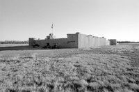 | Plate 19 | Bent's Fort (reconstruction), photograph |
| 4 |  | Plate 23 | Fields and distant mountains, panoramic photograph |
| 5 |  | Plate 26 | Panoramic photograph, Colorado plains with utility poles |
| 6 | 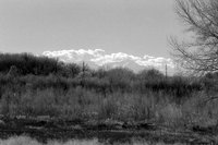 | Plate 29 | Mouth of Apishpa River at the Arkansas River, photograph |
| 7 | 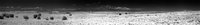 | Plate 33 | Panorama from Mount Mestas to Pikes Peak, photograph |
| 8 |  | Plate 36 | Pikes Peak from distance, photograph |
| 9 | 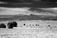 | Plate 39 | Spanish Peaks, photograph |
| 10 | 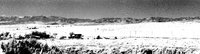 | Plate 45 | First chain of Rocky Mts, eastern base, photograph |
| 11 |  | Plate 50 | Second Huerfano Butte, photograph |
| 12 | 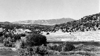 | Plate 55 | Sierra Mohada, photograph |
| 13 |  | Plate 58 | Wet Mountains, photograph |
| 14 |  | Plate 61 | Main chain, Sierra Blanca, eastern slopes, photograph |
| 15 | 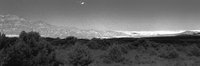 | Plate 64 | View eastward from El Sangre de Cristo Pass, Huerfano_River, photograph |
| 16 |  | Plate 67 | Huerfano River, photograph |
| 17 |  | Plate 70 | Wet Mountains, Huerfano River photograph |
| 18 | 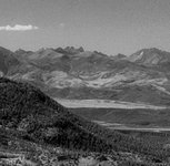 | Plate 73 | Photograph of Les Trois Tetons from higher up |
| 19 | 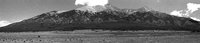 | Plate 103 | Sierra Blanca photograph |
| 20 |  | Plate 106 | San Juan Mountains panoramic photographs |
| 21 |  | Plate 113 | Sierra Blanca, photograph |
| 22 |  | Plate 117 | Panoramic photograph, Sierra Blanca |
| 23 |  | Plate 120 | Photograph of Poncha Pass |
| 24 |  | Plate 124 | Rocky Mountains, panoramic photograph |
| 25 |  | Plate 127 | Entrance to Coochutoke Pass, photograph |