Home
Browse
Ask Us
Chat
Harmful Language Statement
Log in
Institutional Repository
Advanced Search
Year
1905
1906
1907
1908
1909
1910
1911
1912
1913
1914
1915
1916
1917
1918
1919
1920
1921
1922
1923
1924
1925
1926
1927
1928
1929
1930
1931
1932
1933
1934
1935
1936
1937
1938
1939
1940
1941
1942
1943
1944
1945
1946
1947
1948
1949
1950
1951
1952
1953
1954
1955
1956
1957
1958
1959
1960
1961
1962
1963
1964
1965
1966
1967
1968
1969
1970
1971
1972
1973
1974
1975
1976
1977
1978
1979
1980
1981
1982
1983
1984
1985
1986
1987
1988
1989
1990
1991
1992
1993
1994
1995
1996
1997
1998
1999
2000
2001
2002
2003
2004
2005
2006
2007
2008
2009
2010
2011
2012
2013
2014
2015
2016
2017
2018
2019
2020
TO
1905
1906
1907
1908
1909
1910
1911
1912
1913
1914
1915
1916
1917
1918
1919
1920
1921
1922
1923
1924
1925
1926
1927
1928
1929
1930
1931
1932
1933
1934
1935
1936
1937
1938
1939
1940
1941
1942
1943
1944
1945
1946
1947
1948
1949
1950
1951
1952
1953
1954
1955
1956
1957
1958
1959
1960
1961
1962
1963
1964
1965
1966
1967
1968
1969
1970
1971
1972
1973
1974
1975
1976
1977
1978
1979
1980
1981
1982
1983
1984
1985
1986
1987
1988
1989
1990
1991
1992
1993
1994
1995
1996
1997
1998
1999
2000
2001
2002
2003
2004
2005
2006
2007
2008
2009
2010
2011
2012
2013
2014
2015
2016
2017
2018
2019
2020
Type
Text
422
Image
135
Format
application/pdf
447
application/vnd.google-earth.kmz
34
application/zip
34
image/jpeg
7
Collection
Honors Theses Closed Archive
1
Honors Theses Open Access
3
Theses & Dissertations
418
UScholar Works
100
Filters:
Department:
"Geology & Geophysics"
School Or College:
"College of Mines & Earth Sciences"
351
-
375
of
522
<
10
11
12
13
14
15
16
17
18
19
>
Gallery view
Number of results to display per page
10
25
50
100
200
Sort by Relevance
Sort by Title A-Z
Sort by Title Z-A
Sort by Date Ascending
Sort by Date Descending
Sort by Last Modified Ascending
Sort by Last Modified Descending
Title
Date
Type
Setname
351
Petrophysical and diagenetic characteristics of the permian white rim sandstone, southeast utah
2015-08
Text
ir_etd
352
Plate 1 Fence diagram Moenkopi group (Google Earth map overlay KMZ file)
1969-06
Image
ir_etd
353
Plate 1 Generalized geologic map of the Laramide orogenic sediments of the Wasatch Hinterland (Google Earth map overlay KMZ file)
1974
Image
ir_etd
354
Plate 1 Geologic map of Stansbury Island, Tooele County, Utah (Google Earth map overlay KMZ file)
1969-06
Image
ir_etd
355
Plate 1 Geologic map of the Sheeprock Mountains area, Utah (Google Earth map overlay KMZ file)
1957-08
Image
ir_etd
356
Plate 1: Geologic map of Northern Bryce Canyon National Park
1961-06
Image
ir_etd
357
Plate 1: Geologic map of the Little Willow Series, Wasatch Mountains, Utah
1962-11
Image
ir_etd
358
Plate 1: Geologic map of the Lothidok Range, Kenya
1988-08
Image
ir_etd
359
Plate 1: Geologic map of the Paria NW quadrangle, Kane County, Utah
1970-08
Image
ir_etd
360
Plate 1: Geologic map of the Southern Grouse Creek Mountains, Box Elder County, Utah (Google Earth map overlay KMZ file)
1959-06
Image
ir_etd
361
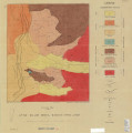
Plate 1: Geologic map of the Willard Peak area, North-Central Wasatch Mountains, Utah
1972-12
Image
ir_etd
362
Plate 1: Geologic map of the Willard Peak area, North-Central Wasatch Mountains, Utah (Google Earth map overlay KMZ file)
1972-12
Image
ir_etd
363
Plate 1B: Geologic map of the Central and Southern Silver Island Mountains, Box Elder and Tooele Counties, Utah, and Elko County, Nevada
1961-06
Image
ir_etd
364
Plate 1B: Geologic map of the Central and Southern Silver Island Mountains, Box Elder and Tooele Counties, Utah, and Elko County, Nevada (Google Earth map overlay KMZ file)
1961-06
Image
ir_etd
365
Plate 1C: Geologic cross sections of the Central and Southern Silver Island Mountains, Box Elder and Tooele Counties, Utah and Elko County, Nevada
1961-06
Image
ir_etd
366
Plate 2 Topography, resistivity, and chargeability cross-sections along dipole-dipole line 1 on Fumarole Butte
1975-08
Text; Image
ir_etd
367
Plate 2: Sections along line A-A' and B-B'
1962-11
Image
ir_etd
368
Plate 2: Structural sections
1970-08
Image
ir_etd
369
Plate 2: Structure sections for geologic map of the Willard Peak area
1972-12
Image
ir_etd
370
Plate 3 Geologic map of portion of Northwestern Uinta Mountains, Utah (Google Earth map overlay KMZ file)
1951
Image
ir_etd
371
Plate 3 Topography, resistivity, and chargeability cross-sections along dipole-dipole line 2 on Fumarole Butte
1975-08
Text; Image
ir_etd
372
Plate 3: Geologic map and sections of Wanship-Park City region, Utah
1952-06
Image
ir_etd
373
Plate 3: Geologic map and sections of Wanship-Park City region, Utah (Google Earth map overlay KMZ file)
1952-06
Image
ir_etd
374
Plate 3: Geologic map of portion of Northwestern Uinta Mountains, Utah
1951
Image
ir_etd
375
Plate 3: Palinspastic middle and upper Cambrian columnar sections from western and northern Utah
1972-12
Image
ir_etd
351
-
375
of
522
<
10
11
12
13
14
15
16
17
18
19
>